
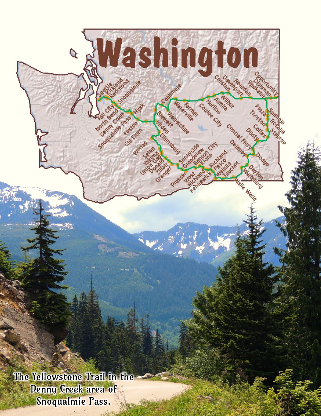
Washington State has two (2) Yellowstone Trail routes:
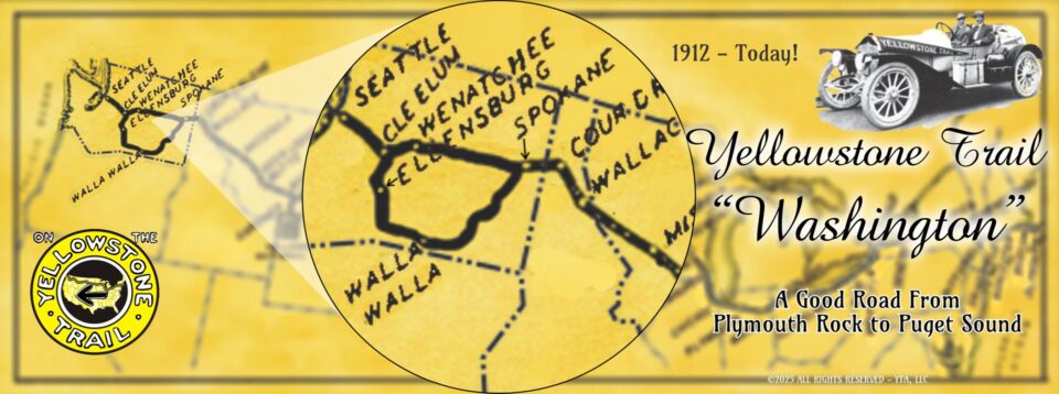
Blewett Pass, west of Wenatchee, and Corbalee-Pine Canyons, near Waterville were impassable by autos in 1915 upon the arrival of the Yellowstone Trail to Washington in the same year.
As a result, from 1915 through 1925, the Yellowstone Trail followed the southern route, through Walla Walla.
This route added many more miles and extra days of travel.
After 10 years, in 1925 the Yellowstone Trail southern route was abandoned as the northern route, through Waterville, Wenatchee, and Blewett Pass was approved in 1925.
Click Here For More Information – Introducing the Yellowstone Trail in Washington
to better understand Parmley’s predicament here.
Scroll down for Washington Travel Guide

 The map’s green circle markers
are modern highway exit numbers used for current location reference.
 The map’s yellow rectangle mile markers show path of YT and distance from state’s west border.
While following the Travel Guide’s details below, click the corresponding text for Google Maps link.
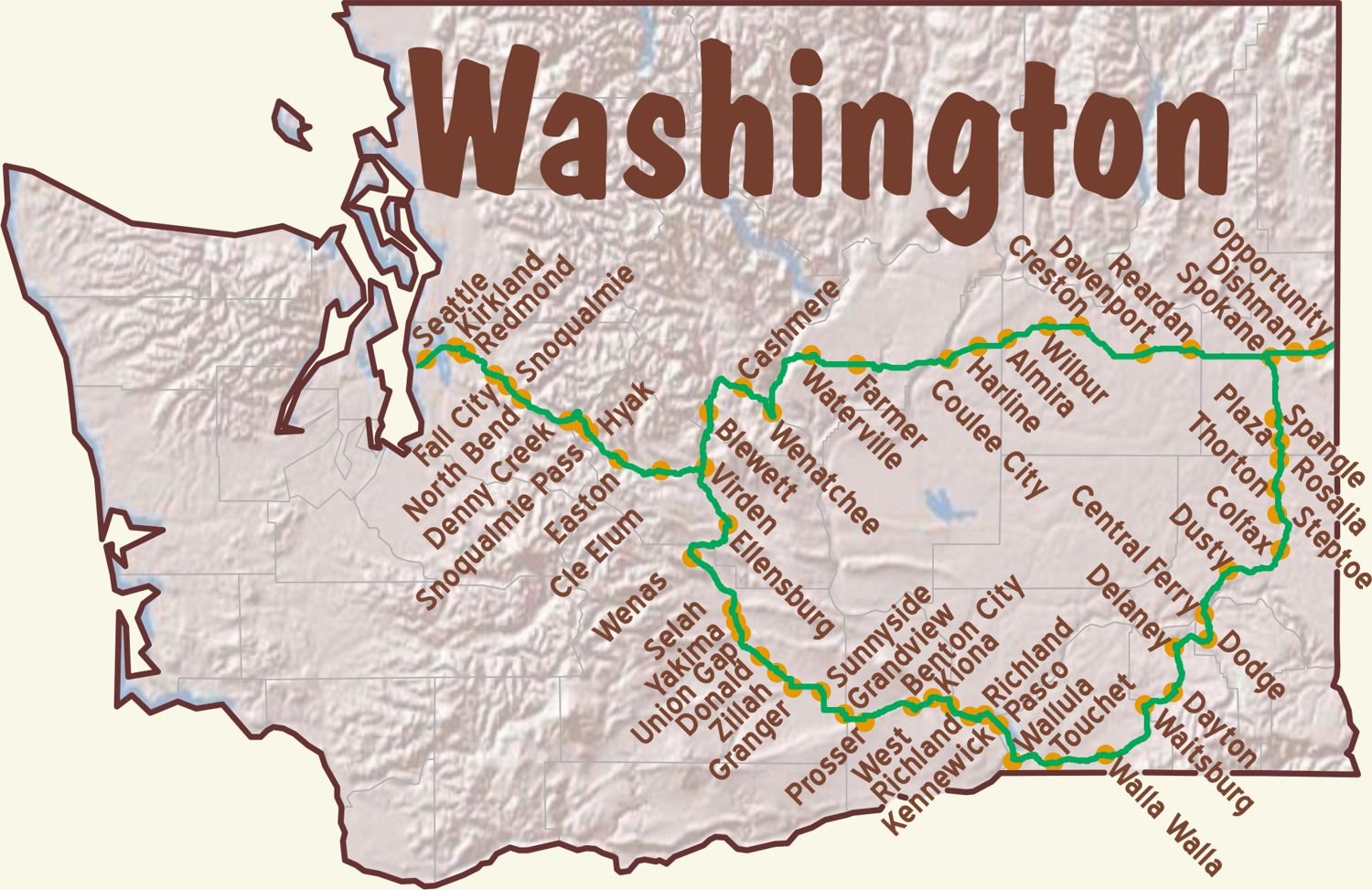
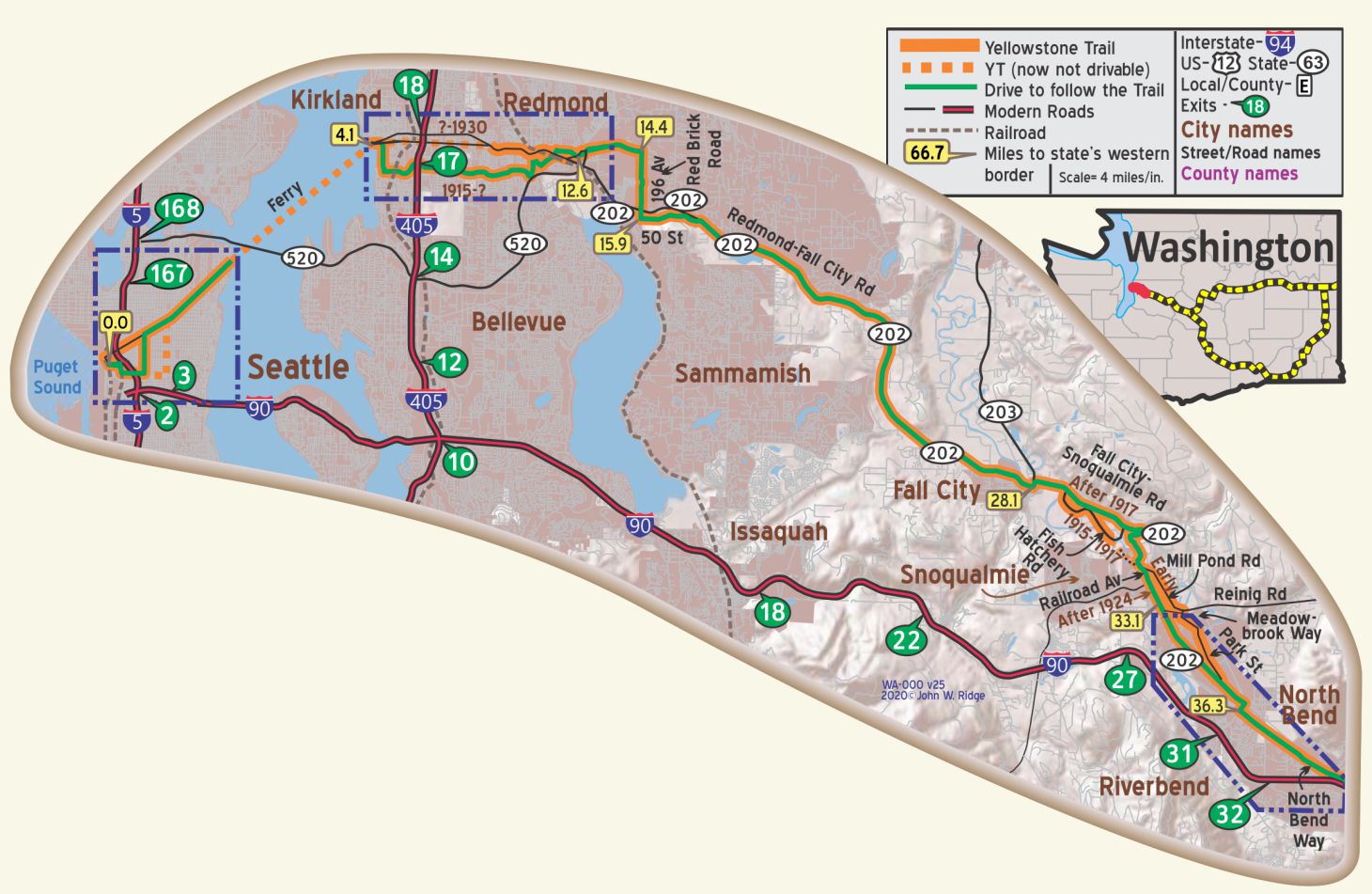
 For Directions, click the red WA State YTA Mile Marker Numbers (below) linking you to a Google map.
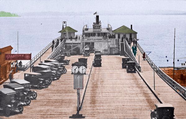
WA-000.0 Seattle
Seattle (pop. 365,000, alt. 36 ft.) is beautifully situated on the east shore of Puget sound, its height affording a magnificent view of the Olympic mountains, the Cascade range and Mount Rainier. BB 1921-9*
It all begins and ends at Pioneer Square in Seattle.
There are many things to do and see here that were available during the time that the very first Trail Travelers would have been here.
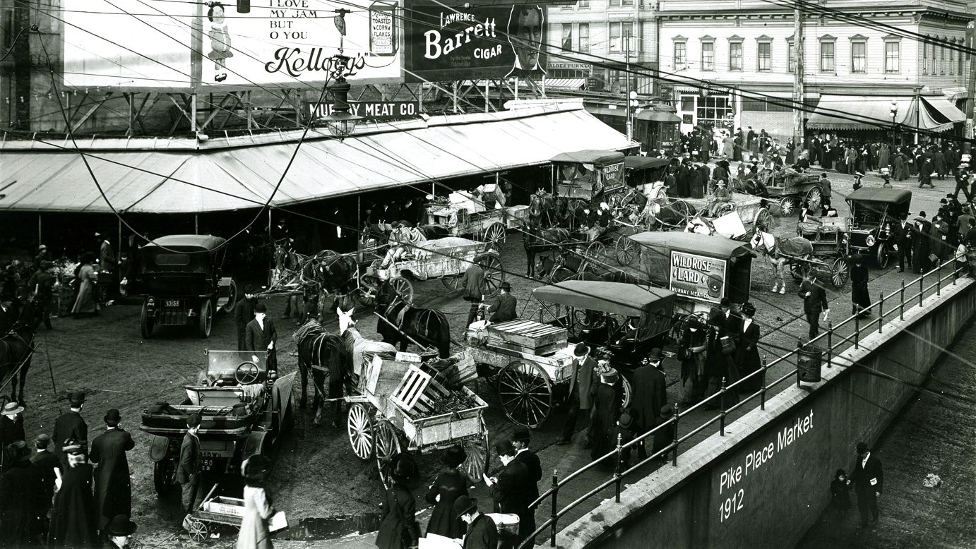
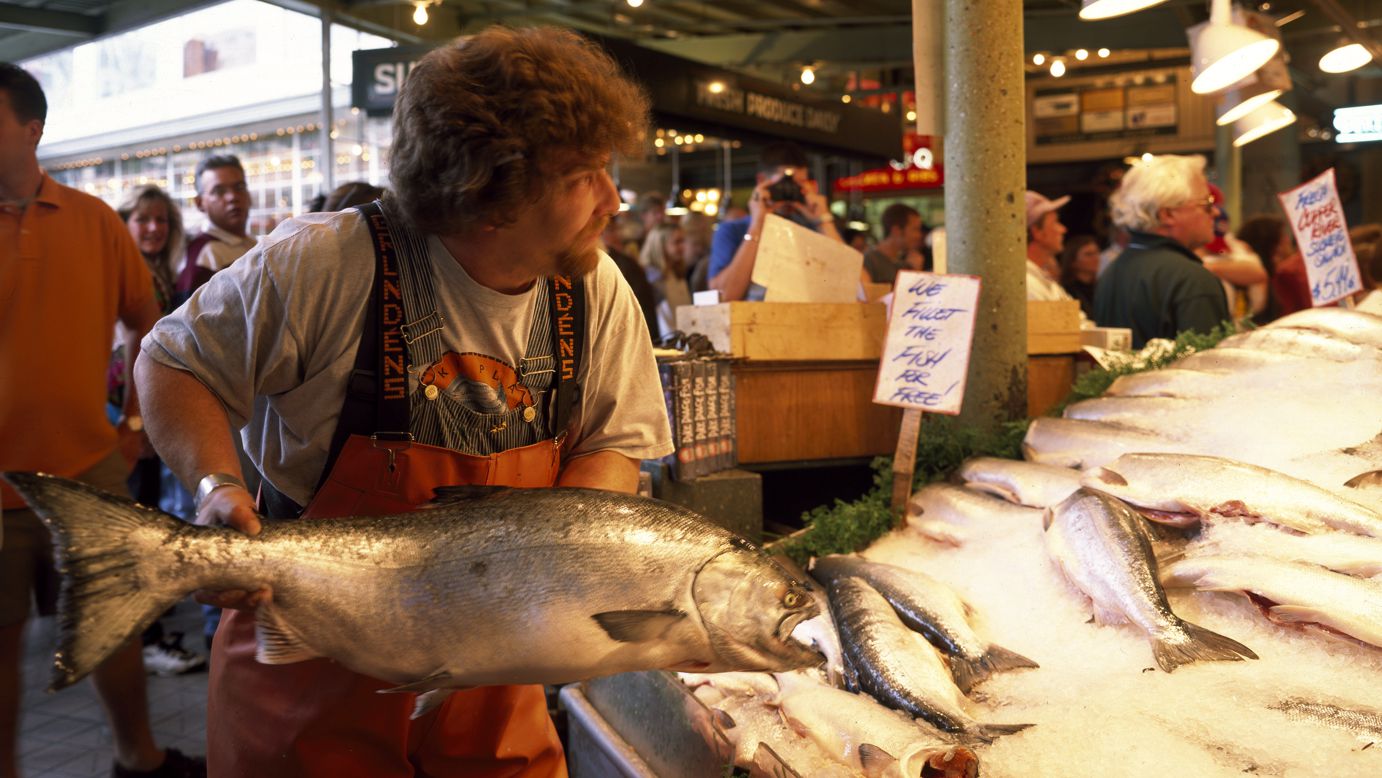
Pike Place Market was a popular place where food vendors gathered depicted in the 1912 photo above.
The Pike Place Market was already well established when Yellowstone Trail travelers arrived and they would certainly have headed there to view food stalls and artisan wares as they do today. It is now the nation’s oldest continuously operating farmers market. And, yes, you must duck as the fishmongers still toss fish about (below).
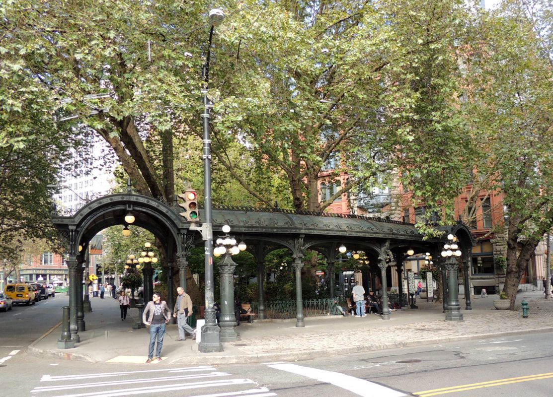
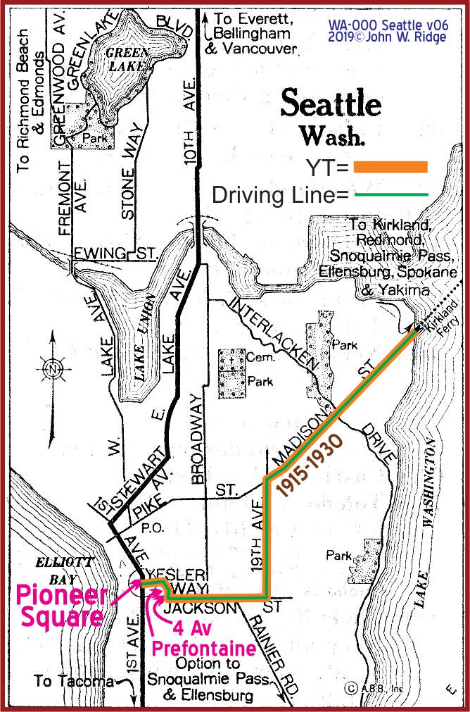 1st Ave. and Yesler Way. Pioneer Square. Pioneer Square was “ground zero,” the western anchor and the beginning of the 3,600 miles of the Yellowstone Trail east to Plymouth Rock. It is an historic and unique area, begun in 1853.
109 Yesler Way. Merchants Café and Saloon. It is the oldest restaurant in Seattle. Built of wood, it was eaten alive by the great 1889 Seattle fire. The building was rebuilt with brick (1890) so that wouldn’t happen again. See History Bits on previous page for a more full story.
506 2nd Ave. (Pioneer Square) Smith Tower. A designated Seattle Landmark, it was built in 1914, the tallest building in the U.S. outside of New York at the time. An elevator goes to the top 42nd floor restaurant for a fee of $19.14. (Get it?)
1st Ave. and Pike St. Established in 1907, the Pike Place Market is an exciting adventure in food (especially fish) and artisan stalls.
1517 Pike Place Athenian Restaurant and Bar inside the Pike Place Market. Athenian Seafood Restaurant and Bar in business since 1909.
Historic Theatre District. The five Seattle Historic Theatres are within 1.3 miles of each other and every day there is an acclaimed show, lecture, dance, concert or theater performance. The district is roughly a triangle of eight city blocks and include the Moore, Paramount, Town Hall, ACT/Eagles and the 5th Avenue Theatre. All are nearly or over 100 years old.
2700 24th Ave. E. Museum of History and Industry at Naval Reserve Armory in South Lake Union Park. The core exhibit provides a chronological history of Seattle and its environs. The 1919 first commercial airplane built by Boeing hangs in the atrium. Be sure to see the SS Virginia V parked behind the building. Built in 1921, she now is available for regular cruises from her dock.
WAYSIDE – 2702 East D St., Tacoma. LeMay’s America’s Car Museum. Directions: Follow I-5 south to E 26th St in Tacoma. Take Exit 133, turn onto E 26th St. Turn at the 2nd cross street onto East D St. Although this 3.5 acre technologically advanced museum is off the Trail, it is still significant in that it tells the tale, through many, many old autos, of U.S. auto transportation and how the auto shaped our society. We’ve been there and spent a day enjoying the history of it all.
Chinatown
The Seattle Chinatown International Historic District, designated by the National Register of Historic Places, is roughly south of Jackson and west of I-5, with Hing Hay Park at its heart.
719 King St. In the East Kong Yick Building (1910) is the Wing Luke Asian Museum. The museum’s galleries contain re-creations of the Gee How Oak Tin Association’s meeting room, kitchens, and apartments that were located inside the hotel. These apartments were occupied by Asian immigrants; the Japanese were removed to internment camps in the 1940s.
The Seattle Waterfront
The Seattle Waterfront – Yellowstone Trail travelers, no doubt, visited a simpler waterfront 100 years ago. Today, the vast Seattle waterfront is not known as just one place, but referred to by several locations.
The one prominent remaining feature is the 1920 Harbor Entrance Pergola, which is listed on the National Register of Historic Places. Originally it functioned as a landing point for boats bringing passengers from ships.
Then again, just wander the waterfront and see what you will find – great restaurants and shops on historic piers, perhaps.
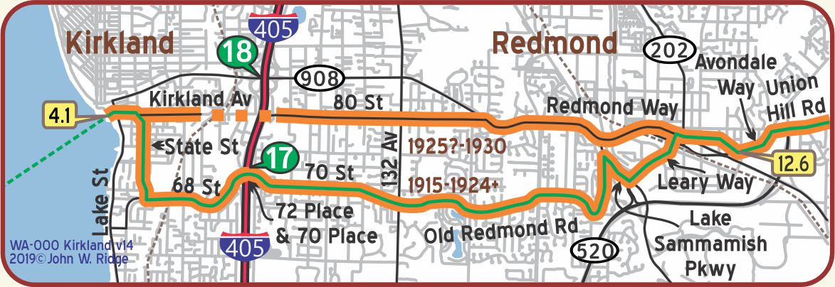 WA-004.1 Kirkland
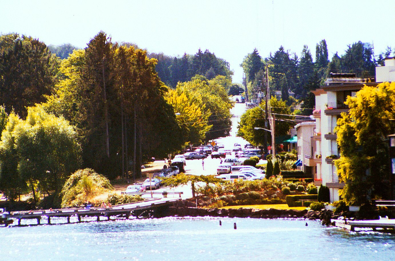
Yellowstone Trail travelers heading east would take a 45-minute ferry ride from Madison St. across Lake Washington, land at Kirkland Landing thence drive along Central Way (Kirkland Ave. today), then 80th St. and on eastward.
The ferry boats MV Kirkland and S.S. Lincoln of Kirkland served Trail customers from 1915 to 1940.
Today there are two substantial floating bridges across the lake, but no ferry.
The docks at Kirkland Ave. It was from this area that ferry boats took westbound Yellowstone Trail travelers across Lake Washington to debark at Madison Ave., the route of the Trail, in Seattle on their way to Pioneer Square and the end point of the transcontinental Trail. One can get a tour boat here today to view 17 historic sites including the Madison St. landing and the hill the old Model Ts had to climb immediately after landing.
620 Market St. Peter Kirk Building. It was first known as the Kirkland Investment Company Building, 1889, on the corner of Market St. and Seventh Ave., Kirkland’s historic commercial core. It is listed on the National Register of Historic Places. Peter Kirk constructed the building as the centerpiece of his planned steel producing city, the “Pittsburgh of the West” he called it. The building was rescued from demolition and restored in the early 1960s as the Kirkland Arts Center which it remains to this day. It is the oldest commercial building on the eastside of Lake Washington.
203 Market St. Kirkland Heritage Society Museum. To promote public involvement, part of their mission, guest speakers appear here often with Kirkland topics.
Traveling to and from Seattle on the Yellowstone Trail required taking a ferry across Lake Washington (see Seattle map above) between Seattle’s Madison Street Ferry Terminal and Kirkland Landing (today Kirkland City Dock), both of which are gone today, but you can drive to their locations.
Click here for directions from Pioneer Square to old Madison St. Ferry Terminal (Madison Park Dock).
You can drive to the exact place where the Kirkland – Seattle Ferry dock on Madison St. was located.
Read magnificent ferry stories below.
Click here for today’s Directions from Seattle’s Madison Park Dock to Kirkland City Dock.
Click here for directions from Kirkland Dock to eastbound YT. This route goes down the Red Brick Road (see below).
WA-012.6 Redmond
A lumbering village in the 1880s, it suffered an economic downturn until World War II brought shipbuilding and upturns. The Evergreen Point Floating Bridge across Lake Washington in 1963 and arrival of technology companies made it the fastest growing city in the state. Among today’s major employers in Redmond are Microsoft, Nintendo, and United Parcel.
There are six Landmark-designated buildings on Leary Way, the Yellowstone Trail:
7805 Leary Way NE Redmond Trading Company. Built in 1908, the Redmond Trading Company was the anchor store along Redmond’s main street for 50 years, and in its first decades it was the town’s largest business in general merchandise. The Trading Company closed in 1955. Some glass windows covering one wall of the original store have been removed, but the front door is still recognizable.
7529 Leary Way NE Justice White House aka. Redmond Hotel now houses an architectural firm. Washington state Supreme Court Justice William Henry White built the 14 bedroom house in 1889 next to railroad tracks to attract travelers. As it became more popular, Hotel Redmond entertained more notable visitors such as Presidents Taft and Teddy Roosevelt, William Jennings Bryan the politician and lawyer, James J. Hill, the railroad magnate, and Percy Rockefeller.
7824 Leary Way NE. Bill Brown Saloon, now Matador Restaurant, built by Redmond Mayor Bill Brown in 1913 morphed into many purposes since its saloon days, but it still looks like it did a century ago.
7841 Leary Way NE Redmond State Bank is now Brad Best Realty. When the first bank in Redmond opened its doors on the corner of Leary and Cleveland in 1911, the handsome brick building looked much the same as it does today. Its dignified facade symbolized stability and security, which bolstered the efforts of early bankers who had to work hard to convince old-timers to deposit their savings, rather than bury money in the ground for safe-keeping.
7875 Leary Way NE Lodge Hall aka. Redmond Hardware 1903, now Edge and Spoke shop. Also a many-purposed building over the decades, but for 45 years it held a hardware shop.
7979 Leary Way NE Odd Fellows Hall, now Redmond Bar & Grill. Like other old 1903 buildings, this one held many businesses over the years. The symbol of the Independent Order of Odd Fellows, three rings, has been restored and returned to the front façade of the latest inhabitant, Redmond Bar & Grill.
16600 NE 80th St., Redmond Historical Society. Guest speakers, activities, and a walking tour are just some of the attractions as the Society collects and explains fascinating facts about this lumbering village that became a booming 21st century town.
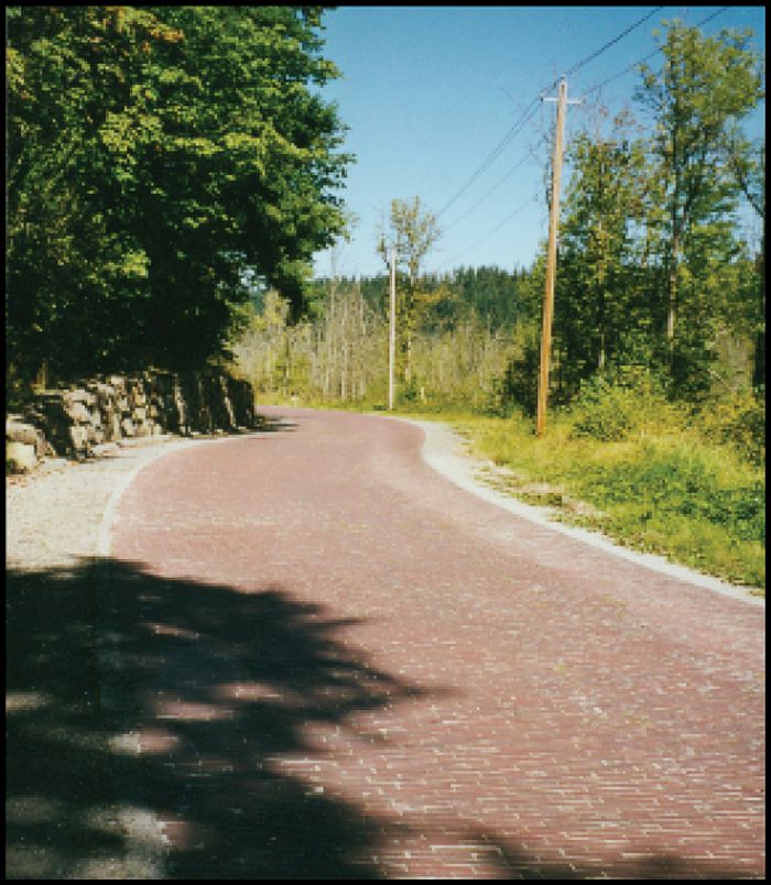 WA-014.4 The Red Brick Road (photo left)
196th Ave. NE between Union Hill Road and Redmond-Fall City Road in the vicinity of Redmond is known as the Red Brick Road, an iconic part of the original Yellowstone Trail laid down in 1913. It was an important part of the route to and from Kirkland’s ferry landing. It is 18 feet wide and 2.3 miles long and is the only unaltered link of the Yellowstone Trail remaining in King County. It is on both the National and State Register of Historic Places.
Suffice it to say that the neighbors are fighting hard to retain this original road’s brick surface and century-old environment against an ever-encroaching culture, but commuters find the speed limit and uneven brick to be inconsistent with their busy lives.
NOTE: The YT at WA-014.4, Red Brick Rd., crossed present day WA 202 near the south end of the Red Brick Rd. Today’s driver must finagle a way to overcome turn restrictions at that intersection. The YT also ran east/west on 50th from Red Brick Rd. to WA 202, today a pleasant drive past the old Grange Hall. The east end, near WA 202, is probably closed.
WA-016.0 Happy Valley Grange
NE 50th St. at 196th Ave. NE (just south of Yellowstone Trail/Fall City/Redmond Road) is Happy Valley Grange, formed here in 1909.
Granges were an important political force through much of rural America from 1867 to around 1950 and were responsible for much of progressive agricultural reforms. Granges actively lobbied state legislatures and Congress for political goals such as the lowering of rates charged by railroads, and acquiring rural free mail delivery (RFD). This Grange is still active.
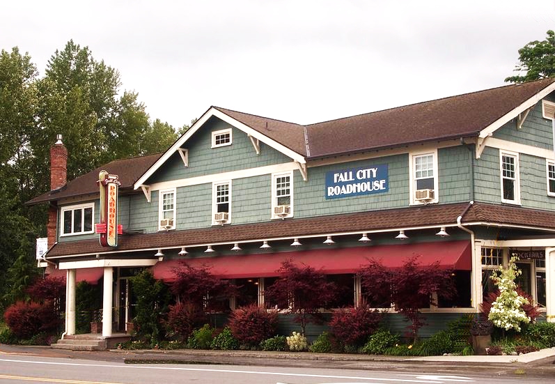
WA-028.1 Fall City
FALL CITY, pop. 300; rooms at Fall City Hotel; Corner Garage leads. Good 50c meals at Riverside Tavern. Mohawk – Hobbs Guide (MH) – 1928
NOTE: “When the first transcontinental highway, the Yellowstone Trail, was planned in 1912, the route from Plymouth Rock, Massachusetts, to Seattle went through Fall City. Today’s Redmond-Fall City Road follows the original route.” (Jack’s History of Fall City by Jack Kelly, 2006).
4200 Preston-Fall City Rd. SE. Roadhouse Inn At the corner of WA 202 (Yellowstone Trail) and WA 203 is Fall City Roadhouse Restaurant & Inn. Built in 1916, exactly 100 years and several owners later, new owners in 2016 made subtle changes and added lots of historical photos to the walls, and the inn rooms were restored with vintage 1920s charm.
33805 SE Redmond. Model Garage. Murphy’s Garage was opened in 1909, then became the Model Garage about 1920 under new owners at a location a little west of its current site. It moved to its current site in 1926 and by 1980 had expanded to the building we see today. This garage is still in business under the same name. Yellowstone Trail travelers would have seen this at either of its locations.
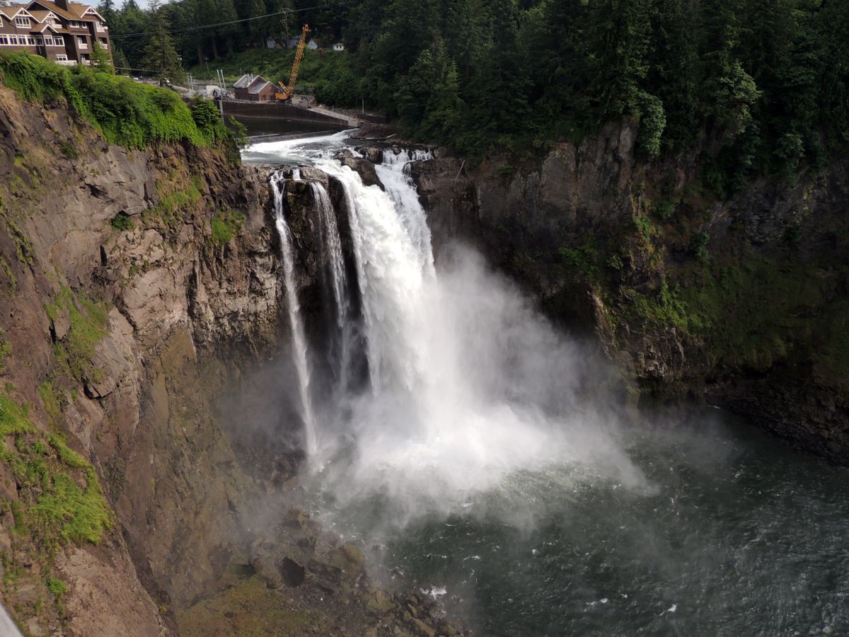 WA-032.0 Snoqualmie Falls
Snoqualmie Falls, 268 ft. high; an imposing sight. A few rooms and $1.50-$2 dinners at The Lodge. MH-1928*
Visit November through March during the rainy and high water time. The falls take on a curtain form, the rushing waters demanding your imagination of why the Native Americans viewed it as a sacred site. The 1899 power generator is unseen, buried deep within the rock beneath the falls. More than 100 years later that equipment is still in use. The thundering falls themselves are on the National Register of Historic Places.
The Salish Lodge & Spa is an elegant hotel looking nothing like its 1919 predecessor. Perched above the falls, the views are stunning.
NOTE: Significance – Construction of the Snoqualmie Falls Hydroelectric Project began in 1898 near the falls of the falls of the Snoqualmie River. It was the first power plant successfully constructed completely underground and one of the first plants in the northwest to transfer power to a distant market. The Snoqualmie Power Company completed the project in 1899 and it has been in continuous operation since then.
38625 SE King St. Northwest Railway Museum. The Northwest Railway Museum is a fairly large railway yard filled with old boxcars, other rail cars, and steam engines with an old Victorian depot. Rail excursions are run from April through October as they were 100 years ago.
You can experience early railway travel on a steam train to North Bend and Mt. Si.
NOTE: WA-033.2 – The route entering Snoqualmie from the northwest is not entirely clear and there may have been variations not recorded on the map. Likewise, the Mill Pond Rd. route was probably used but information about it was hard to find.
Curt Cunningham reports that the route going southeast from Snoqualmie followed today’s 202, turned left onto River St., turned right onto Falls Ave., left onto Newton St., right onto Park St., following it as it turns into Balk Ave. and then merging with Bendigo (or N Bend Blvd.) which it followed into North Bend.
Eric (known only as his online forum name, Sit Properly), using a 1920 Automobile Blue Book, found that the route followed a road no longer existing between the intersection of NW 8th St. and Bendigo Blvd. (WA 202 just NW from North Bend) to W North Bend Way at Snoqualmie River.
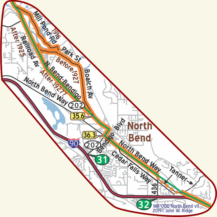
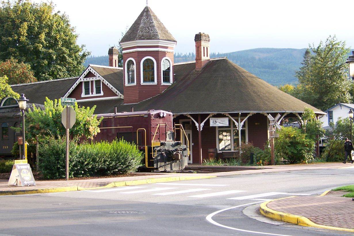
 WA-036.3 North Bend
(in the shadow of 4160’ Mt. Si)
pop. 500; a lumber and logging center. Lies at base of Mt. Si. Cousens Hotel is modern. Camp Mt. Si, many good cottages, $1-$1.50.
HOTEL McGRATH fireproof and best. Sgl.$1.50-$2:dbl.$2,with conn.bath $2.50, bath $3 meals.
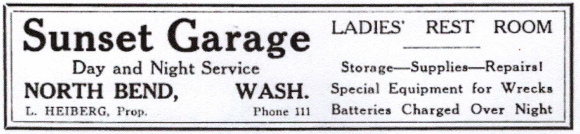
SUNSET GARAGE now leads for complete and good service. Labor $1.50; ph. Call for wrecker any time. MH-1928*
At the busy corner of North Bend Way and Bendigo Blvd. (Yellowstone Trail) stands the landmark Sunset Garage. The first Sunset Garage was built here in 1922. It was replaced by this current concrete garage in 1929, just in time for the Great Depression.
It became a Buick dealership for about three decades, but then stood empty for the past few decades, according to historian Gardiner Vinnedge. In the 1990s, the television show Twin Peaks filmed the jail scenes there. Other businesses then occupied the space. In the fall of 2018 restoration of the building began, “to make it look like its old self” said Craig Glazier, present owner. Present day Trail tourists will rejoice.
320 Bendigo Blvd. S., Snoqualmie Valley Historical Museum (serving Snoqualmie, North Bend, Fall City, Snoqualmie Pass). Native American stories, homesteader, logging and farming stories of the Snoqualmie Valley are all told here.At the tracks see the old North Bend Depot for the historic Puget Sound and Snoqualmie Valley Railroad.
902 SE North Bend Way (Yellowstone Trail). North Bend Ranger Station houses the local headquarters for the U.S. Forest Service. Don’t write this off as a ho-hum stop. These are the folks who frequently repaint the Yellowstone Trail logo near Denny Creek. They also sometimes have hard-to-find information about the historic Snoqualmie Pass.
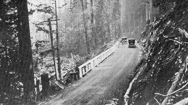
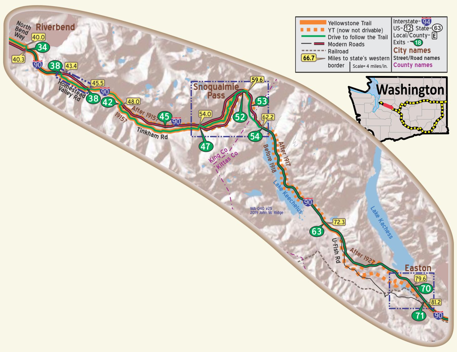
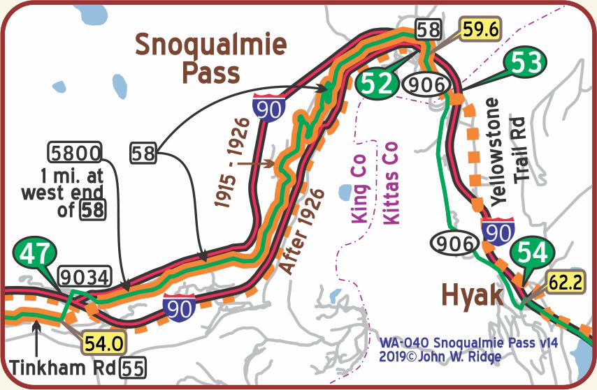
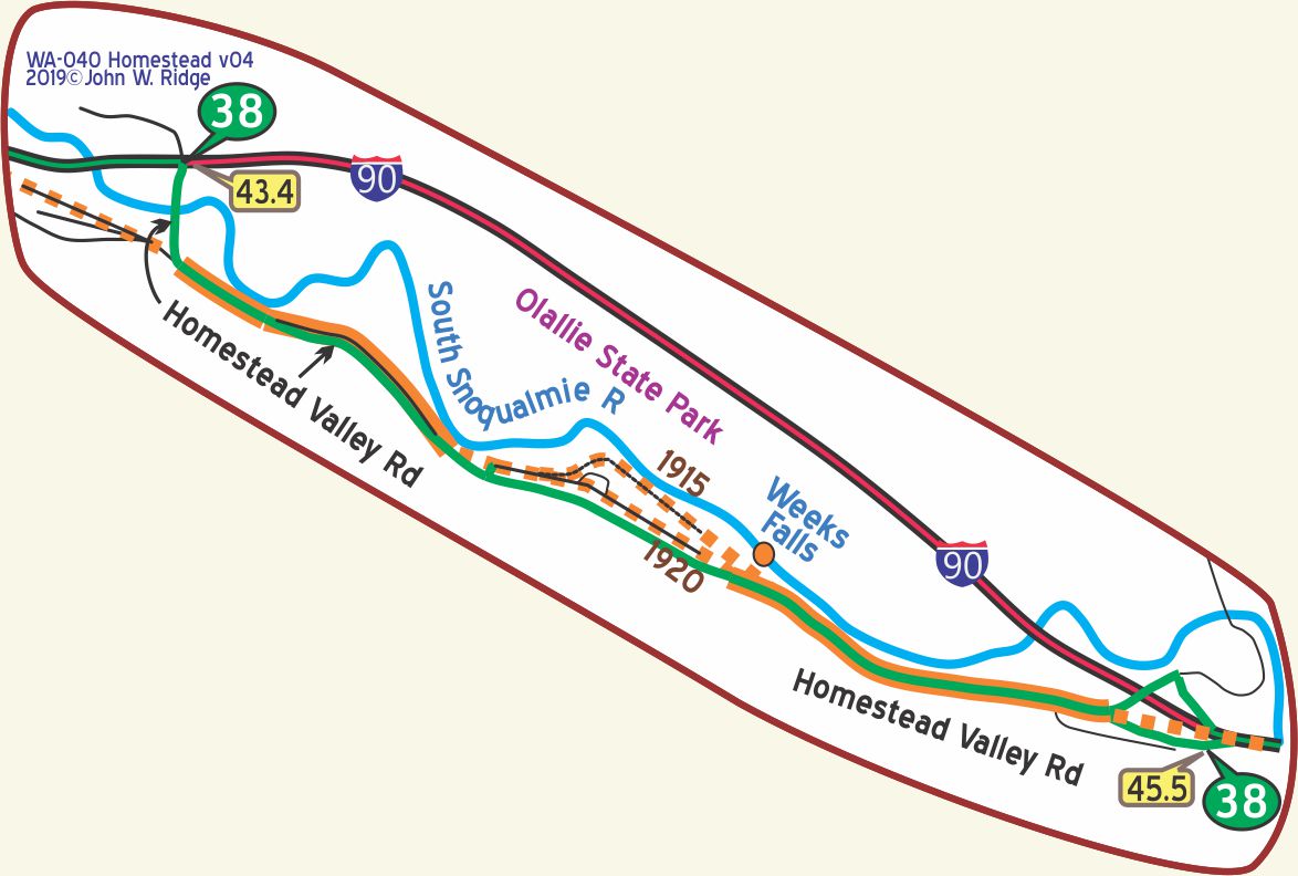 NOTE: Refer to the map on right. Today, there are two exit 38s on I-90, one at WA-043.4 and the other at WA-045.5. Take the first one you reach to follow Homestead Valley Rd., the old road which is a nice respite from I-90. It has side-by-side bridges to explore, one abandoned in 1953 and its replacement. It gives access to Olallie State Park and Weeks Falls. View the falls and hydroelectric plant.
At WA-049.6 on Tinkham Rd. is the Tinkham Campground with outstanding 1920 ambiance.
WA-054.00 Asahel Curtis Nature Trail (off of Forest Road 55/Tinkham Road)
The trail departs from the parking lot.
Asahel Curtis was one of Washington’s most renowned nature photographers and a Vice President of the YTA from
1925 – 1929.
The trail is a half mile loop interpreted nature trail.
It is an easy walk through one of the last remaining stands of old growth forest in the Snoqualmie Valley.
WA-056.4 Old Sunset Highway Bridge
On Forest Road 58 drive on the authentically reconstructed 1916 bridge over the south fork of the River at 47.40627, -121.44347. Visible to the south of the bridge is an original Yellowstone Trail sign painted on a large rock. Over the years it has been cared for by the Forest Service with fresh paint as needed.
WA-056.7 Denny Creek Campground
Situated near the south fork of the Snoqualmie River in Mt. Baker-Snoqualmie National Forest, Denny Creek Campground is a “must see” stop. The original Yellowstone Trail ran on what is now Denny Creek Road through the campground. It was the original Snoqualmie Pass wagon road.
Enjoy the Northern Cascade Range, the scenery, the many hiking trails and the forest smells.
A camping registry was established at the campground by 1918. Maybe Yellowstone Trail campers’ names could still be found?
Nearby, you might see remnants of an old Snoqualmie Pass wagon road where it intersects the Yellowstone Trail. The old wagon road is a good example of the kinds of roads that existed 100 years ago in these mountainous forests. If you hike this Snoqualmie Pass wagon road, you may see old wagon ruts and remnants.
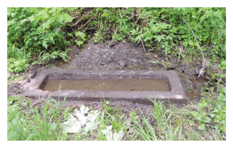 WA-057.8 Old Watering Trough
GPS: 47.4192, -121.4352
Look carefully.
There is an old watering trough at the side of the road.
It is not elevated, but level with the road and possibly shielded by greenery.
Yellowstone Trail researchers Curt Cunningham and Dave Habura told us about the old watering trough and puzzled over its low position, probably too low for horses in harness. Was it placed there for autoists to refill hard-worked Model T radiators?
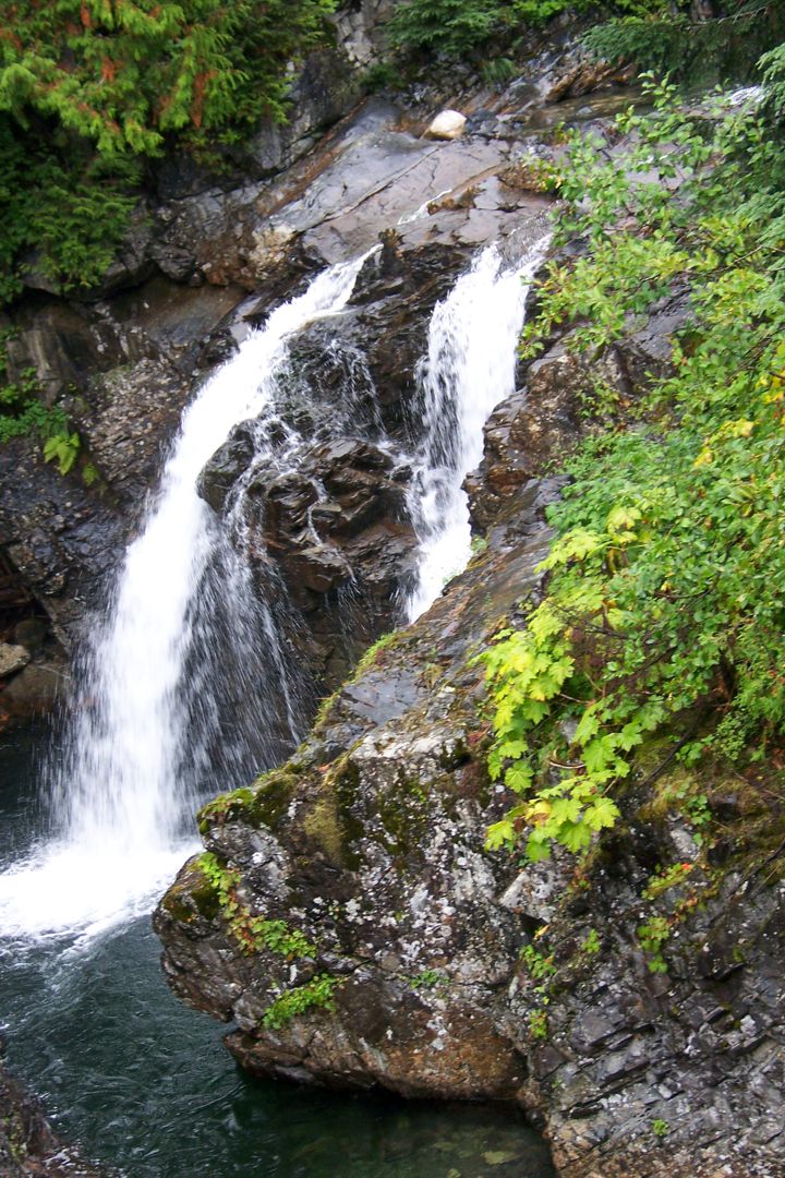
WA-059.2 South Fork Snoqualmie River (photo above)
Stop at the small turnout to see the South Fork of the Snoqualmie River bubbling over a small water falls and rapids.
You’d never know that you were in that half mile space between the lanes of I-90!
All is serene there.
 WA-060.0 Summit of Snoqualmie Pass (elevation 3,022 feet)
Snoqualmie Pass Summit Hotel; rooms, dbl. $1.50, meals 50c, camp and cabins. Good repair shop; wrecker. MH-1928*
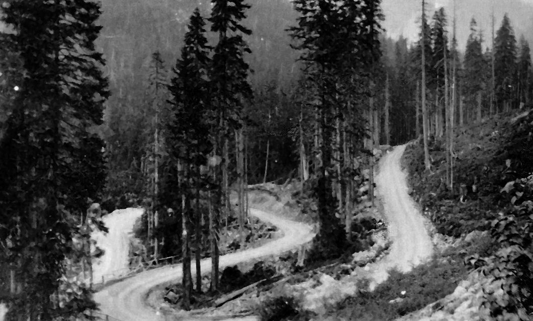
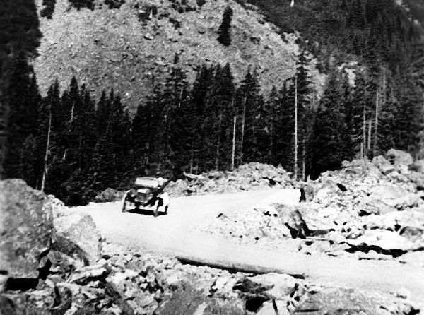
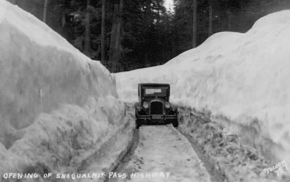
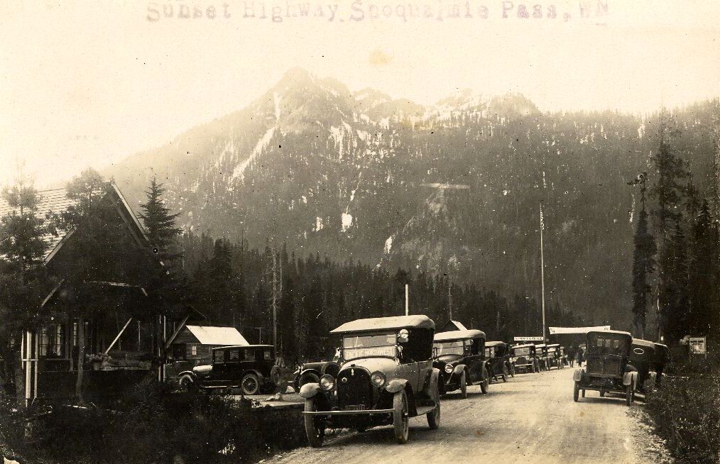
Snoqualmie Pass, christened “Sunset Highway”, was finally graveled and opened to auto and wagon traffic, being officially dedicated July 1, 1915, six months or so after the Yellowstone Trail Association arrived in Washington.
The opening of the Pass enabled the Yellowstone Trail Association to follow the Sunset Highway west to complete its route to Puget Sound, even though it was closed by winter snows regularly.
Because Travelers’ Rest Center at the summit of the Pass was built in 1938, early Yellowstone Trail travelers never had the luxury of stopping and resting there. They did, however, have the original Summit Inn, which is no more. Stop and see the great historical pictures and information on the entry walls of Travelers’ Rest Center.
NOTE: Partial timeline of the history of the Snoqualmie Pass –
1909 – Alaska-Yukon Exposition with race from New York -Seattle was an incentive for King and Kittitas Counties and the state to improve the road; 150 cars went over the Pass then. Toward the end of the 20th century, 13 million+ went over the Pass.
1910-1915 – Nothing much was done to maintain the road because the Milwaukee Road completed its tracks in 1909 and absorbed much of the traffic. People shipped their autos across the summit by train.
1915 – Gov. Lister, to much fanfare, dedicated Snoqualmie Pass Highway part of the Sunset Highway
1929 – Reconstructed into 4 paved lanes
1971 – One could still see stumps and planks of the old wagon road, and bits of the old narrow gauge railroad used by Arthur Denny in mining gold. •
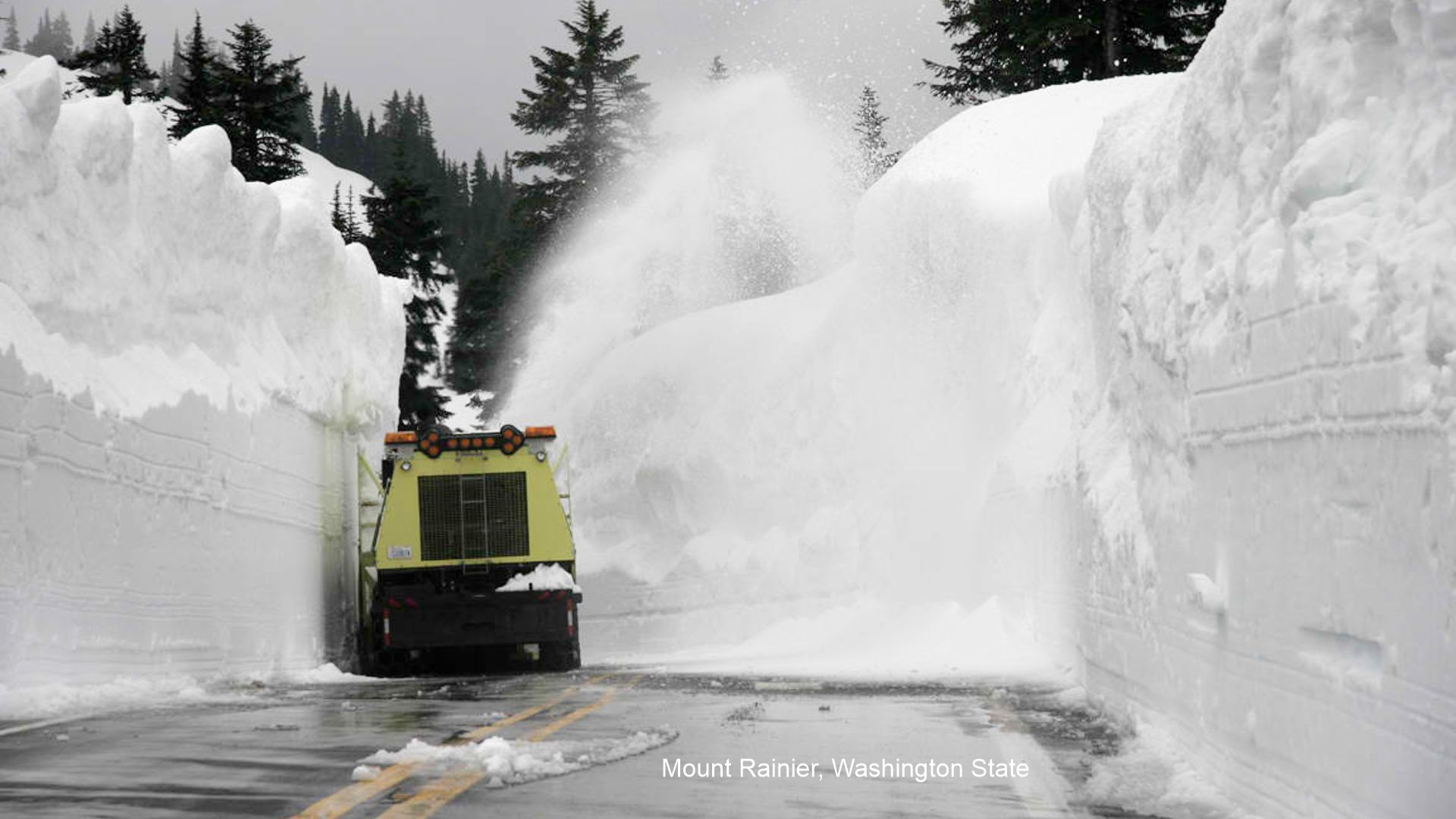 WINTER IN WASHINGTON STATE MOUNTAIN PASSES
Hundred-year-old newspapers announced dates of the spring opening of Snoqualmie Pass to auto traffic as late as July 2 in 1916 and July 3 in 1917!
2025 could be similar! Check out current Pass conditions with the WSDOT website \ live cameras.
Snow was reported by cabin-dwelling neighbors to be 12 feet deep in winter.
Ever changing weather (colder and warmer), snowsheds, improved paving methods, better snow equipment, and improved technology keeps this necessary highway open all winter in modern days.
In recent years, record cold temperatures and deep snow amounts make this task difficult, see photo above.
Even today folks speak of two seasons here – Winter and July, which the Snoqualmie Ski Resort LOVES!
In 1916 they sprinkled charcoal on the snow, hoping that the dark color would absorb the sun’s heat and melt enough snow to open the Pass by May 1.
In 1925 they used dynamite in May. •
WA-062.2 Hyak and Lake Keechelus
HY AK (Indian for hurry), (2,499 alt., 60 pop.), a commercial resort, overhangs the lake bank, at the eastern end of the Chicago, Milwaukee, St. Paul and Pacific Railroad tunnel through the Cascades. At this point the highway swings away from Lake Keechelus. WPA-WA*
AKE KEECHELUS INN, modern; sgl. $2-$3; dbl. $2.50; bath $3.50; dinner $1.50. WPA-WA*
KEECHELUS LAKE (2,475 alt.), is in a basin, whose timbered sides rise abruptly 1,000 feet.
US 10 follows a steep and winding, but safe, grade. During the fishing season anglers line the banks of the Snoqualmie River, which flows close to it for a distance. WPA-WA*
 Snoqualmie Pass Area Recreational Mecca
A lifetime of hiking, biking, exploring, and discovering the Yellowstone Trail in and around the Snoqualmie Pass Summit is waiting for you!
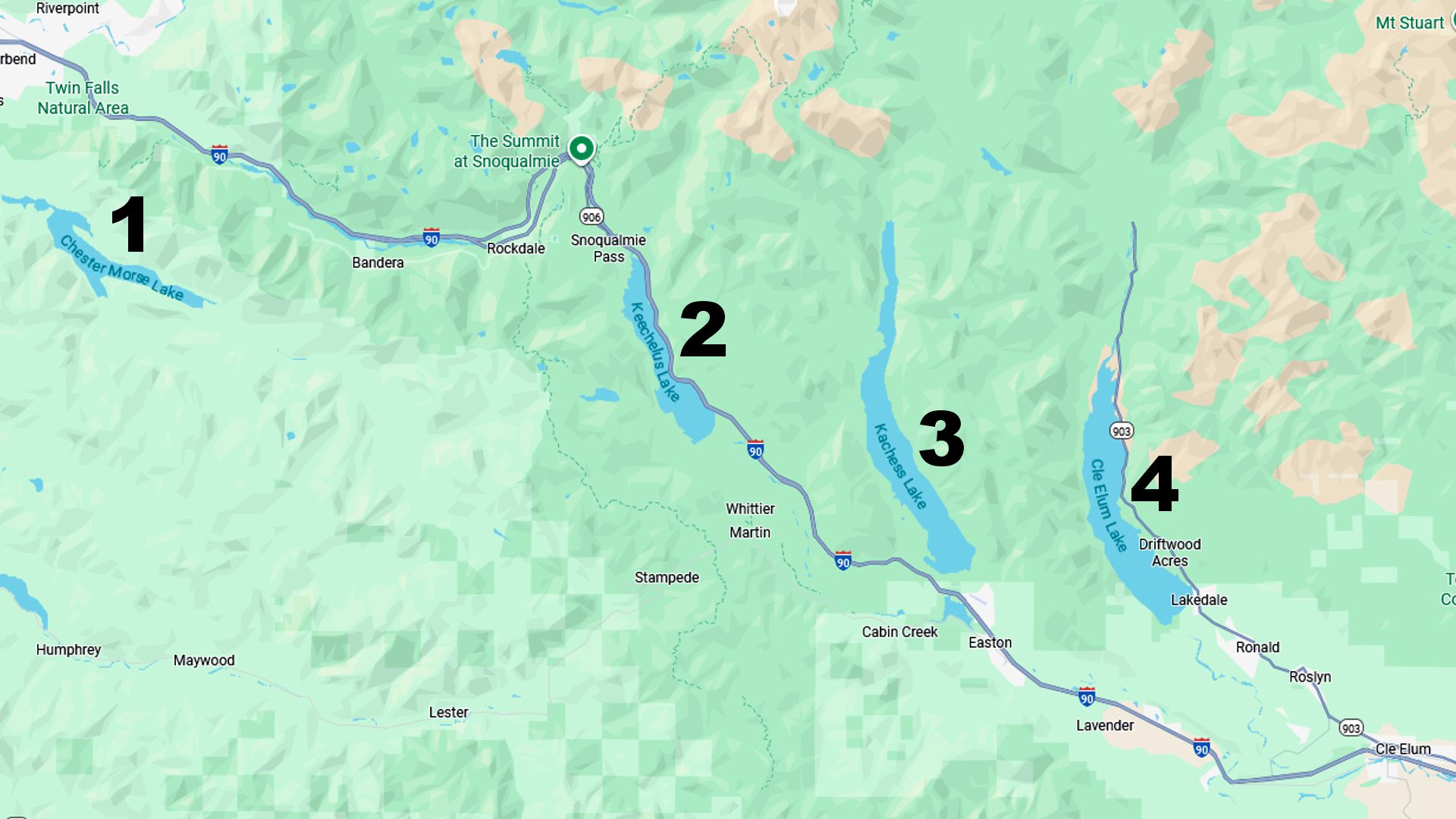
In addition to the YT, there are four (4) large bodies of water well worth visiting while traveling the YT here:
1.) Chester Morse Lake
2.) Keechelus Lake
3.) Kachess Lake
4.) Cle Elum Lake
The Snoqualmie Tunnel, located at the Iron Horse State Park at Hyak, was constructed from 1912–1914 by the Milwaukee Road railroad as part of its line from Chicago to Seattle, and was electrified in 1917. Today the tunnel is part of the Iron Horse State Park rails-to-trails project for hikers and bikers. It is 2.3 miles long and was renovated in 2011. We mention it here because the Trail went through Hyak, following the route of the Milwaukee Road as it usually did, and the tunnel is a relic of the era, the Trail itself having been swallowed by Interstate 90.
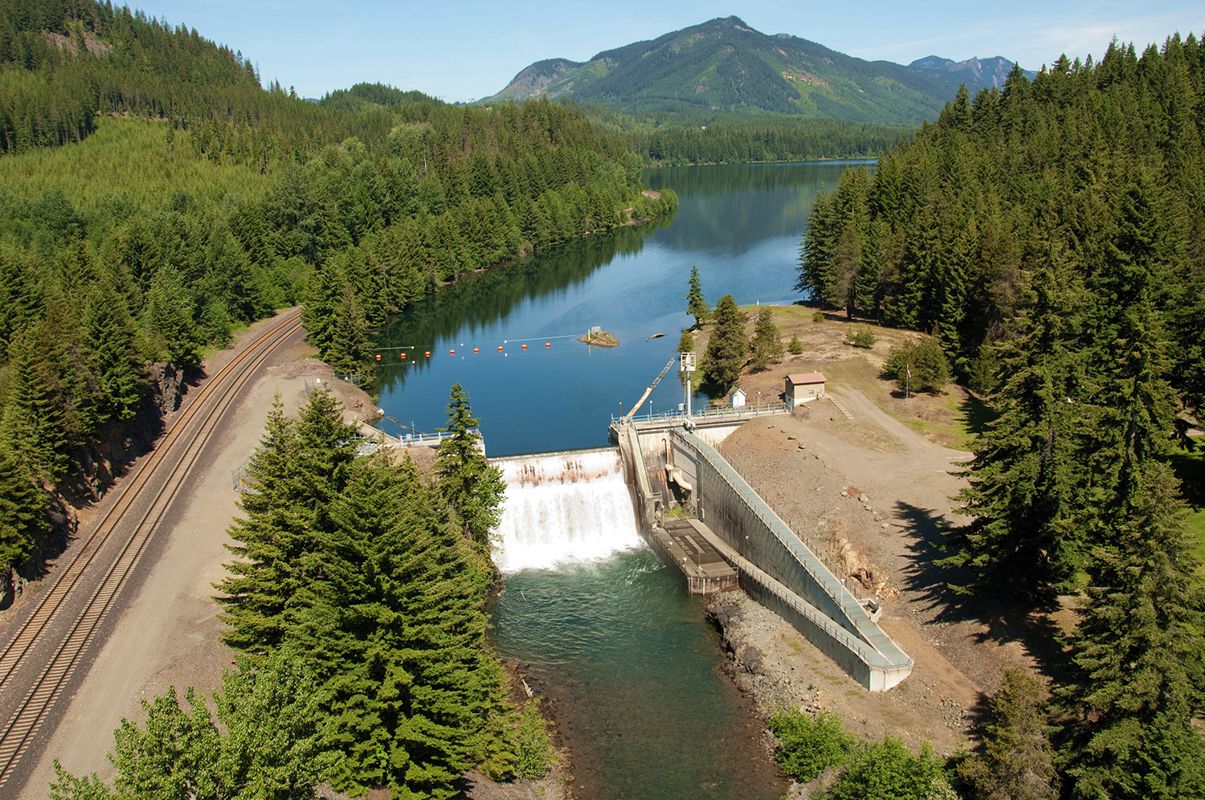
Lake Keechelus.
Although a natural lake, its discharge is controlled by a 1917 dam at the southern end of the lake, giving rise to the Yakima River.
Observe I-90 here, clinging to the east edge of Lake Keechelus.
That modern road probably lies on top of the Yellowstone Trail, Sunset Highway and the National Parks Highway.
Stop just a bit west of Easton to view the eastern, drier side of the Cascades with some picturesque mountain peaks.
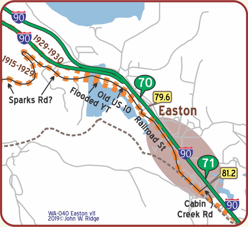 WA-081.2 Easton
pop. 300; two small hotels; the Easton leads. Fine meals at Green Tree Inn. Cottages at Egbert Camp. MH*-1928
The Easton Diversion Dam across the Yakima River was completed in 1929, and thus was possibly visited by late Yellowstone Trail travelers.
It received restorative improvements in the 1980s. The water that it backs up is called Lake Easton and provides the recreation for Easton and Iron Horse State Parks, the latter once a part of the path of the Milwaukee Road railroad.
A draw-down of the lake once revealed the old Yellowstone Trail.
NOTE: WA-062.2 to WA-070.2 Hyak Lake Keechelus: Keechelus Dam (WA-070.2) was constructed at the lower end of a natural lake and on the Yakima River 10 miles northwest of Easton. This earth-fill dam that enlarged the lake was completed in 1917, is 128 feet high and contains 684,000 cubic yards of material. Local researchers might attempt to determine the relationship of U-Fish Rd. and the old YT.
NOTE: The roadway on the eastern side appears to have been cut into the hillside not far above the waterline. When the dam at the lower end was built in 1917, the new highway would, of necessity (in places), have been built higher up the hillside. At the northern end, the lake extended considerably north so that the Keechelus Inn, once at the top of the lake, would be at least a mile and a quarter south of the top.
NOTE: The 1917 National Forest Map is a wildly approximate representation of the route from Easton west to I-90. Curt Cunningham and other maps offered better info. Curt Cunningham and Dave Habura agree this is the best true representation of the old YT.
[Pictures of the YT (Sunset) show the old highway hugging a steep shore line, so at most, the alignment moved up but probably not far east; it didn’t go through a flat now flooded area.]
NOTE: WA-064.5: In 1921 this is the location of Keechelus Inn, and Rocky Run Auto Camp, at what was, before 1917, the top of the lake.
NOTE: Lake Easton and the still existing concrete highway bridge just NW of Easton, were created in 1929. A short section of the replaced pre-1929 YT (and US 10) now lie under the Lake. The YT had traveled Sparks Rd. with its switchback, still visible in Google Maps, going west but after 1929 it followed an alignment which, for the most part, is now under the east-bound lanes of I-90. Much of Sparks road still exists but is essentially unused and is substantially “grown-over”, reported Curt Cunningham.
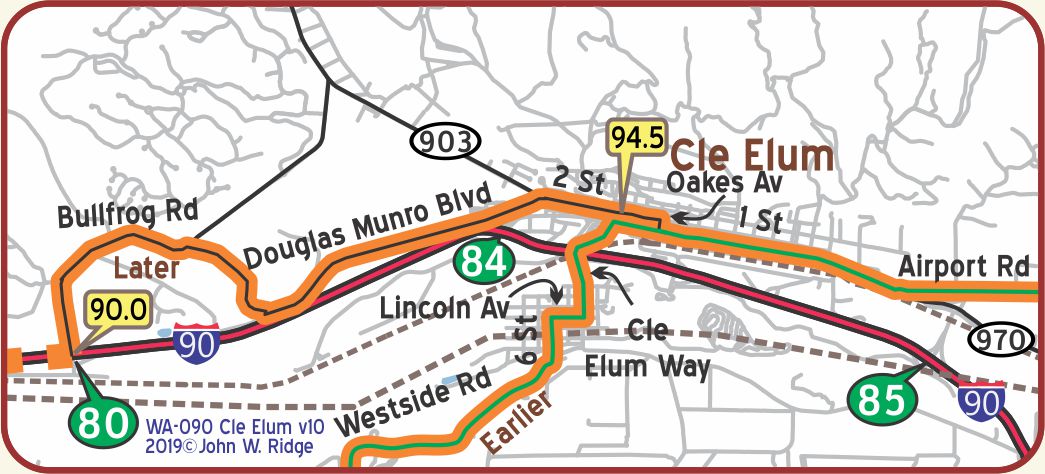 WA-094.5 Cle Elum (it means “swift water”)
Park. City Camp, 50c. Cabins.
HOTEL TRAVELERS modern; outside rooms are best. Rates: sgl. $1.50-$2.50; dbl. $2; bath $3.
RELIABLE AUTO CO., finely equipped and has good name. Labor $1.50; towing $4 hr. Ph. 91. Rest room.
COX MOTORS, Ford, is open until 9 p. m. MH1928*
The market for Cle Elum coal has been reduced, partly because of the development of water power, but mining is still important to the town. Cle Elum also ships lumber and farm and dairy products. HOTHOUSES (visitors welcome), at the end of St. E., grow and ship 100,000 blooms of roses and carnations a year. WPA-WA*
CLE ELUM RANGER STATION, headquarters of the Cle Elum Ranger District of the Wenatchee National Forest.
This district embraces the headwaters of the Yakima, Cle Elum, and Teanaway Rivers and, because of its high mountains and dense forests, conserves an important part of the water supply for irrigation projects in the Kittitas and Yakima valleys. WPA-WA*
221 E 1st St. (the later Yellowstone Trail) Telephone Museum. Displays cover the history of telephone technology from 1901 to 1970. See the 15-foot long switchboard and the crank-style phone. This was the site of the last operator-
assisted switchboard in the Northwest Bell system.
501 E 1st St. Cle Elum Bakery. The Cle Elum Bakery has been in operation since 1906. “We still bake our French Bread in the original brick oven which has never cooled in over 100 years,” they say. Time for a bun break on the Yellowstone Trail just like travelers did back in the day? Get the lemon tart. It was delicious.
302 W 3rd St. Carpenter House Museum & Art Gallery. The 1914 mansion was donated to the Cle Elum Historical Society to “preserve this bit of Cle Elum heritage.” Visitors will see Tiffany lamps, etched light bulbs and original furnishings of the elegant life style of a bank president and his pianist wife.
801 Milwaukee Road Depot. South Cle Elum Rail Yard National Historic District.
There are about 23 sites on view including the 1909 depot, a turntable and a 1919 electric substation to generate the voltage for the Milwaukee Road electric engines used in the mountains.
- Smokey’s Bar B Que in the Depot has replaced the famous “Beanery” restaurant, long the choice of railroad personnel since 1909.
- The Depot was the site of the train operations, crew changes and all telegraphic communication.
- Guides through the rail yards provide a narrative of Cle Elum’s history and the coming of the railroad.
- The rail line is part of Iron Horse State Park. Today the old depot is a joy, saved from decay for its second century of life.
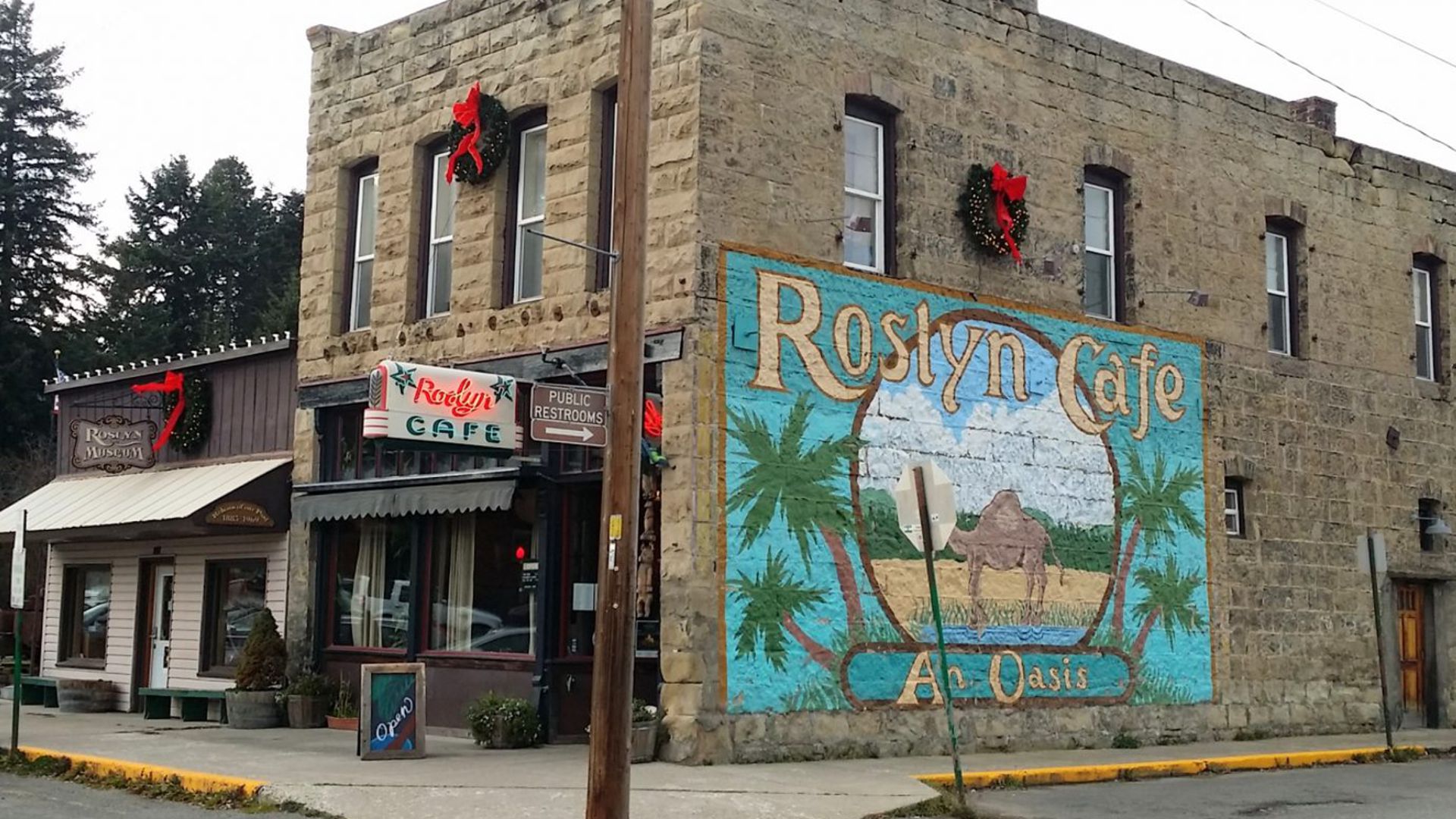 WAYSIDE – About 3 miles NW of Cle Elum on WA 903 is Roslyn, an old 1884 coal mining town and filming site of the popular 1990s television show, Northern Exposure. Readers of a certain age may remember that Roslyn was called Cicely, Alaska, in the comfortable comedy. Look for the famous camel mural outside the Roslyn Café and The Brick Bar and Restaurant in the series and Roslyn Museum, all on Pennsylvania Ave. The Brick claims to be the oldest continuing bar in the state. The last time we were in Roslyn one could still buy tv series memorabilia such as mugs, tee shirts, etc. at the Memory Makers store. Also on that street is the Miners’ Memorial statue, dedicated to the miners who lost their lives while mining coal. From Roslyn, be sure to visit nearby Kachess and Cle Elum Lakes while in the local area as well as Keechelus Lake.
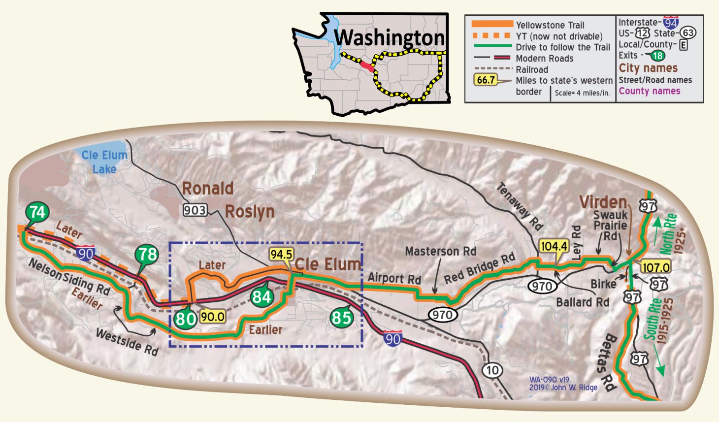
WA-103.3 Red Bridge Road and Red Brick House
Between Cle Elum and Ellensburg, the 1915 Yellowstone Trail followed along what is now the Red Bridge Road, and on it still stands the red brick house which was noted in the 1915 Automobile Blue Book. Not far beyond, the old road turns south toward Ellensburg, says Washington explorer Dave Habura.
WA-104.4: Swauk Teanaway Grange Hall
The Swauk Teanaway Grange Hall might be the restored school shown on the 1924 Automobile Club of Washington map.
This road gives a sense of “authenticity.” Nice drive.
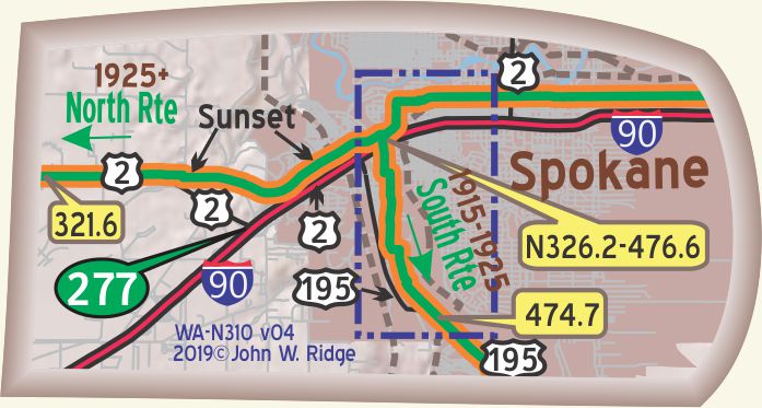
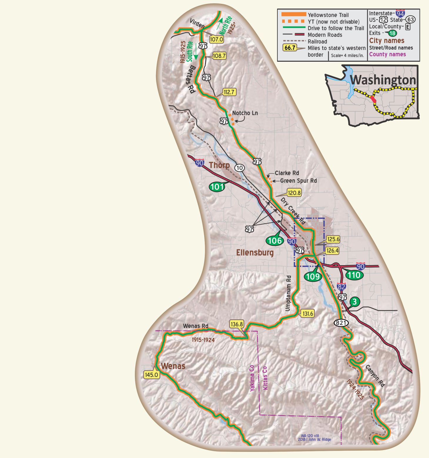
WA-107.0 & WA-N107.0 Decision Point
If you are traveling east, at this point the Trail offers a choice of ways to Spokane.
At decision point, turn south and you will be on the original 1915 “YT South” route of the Yellowstone Trail through
Ellensburg, Yakima, Tri-Cities, Walla Walla and then north through the small towns of the Polouse area.
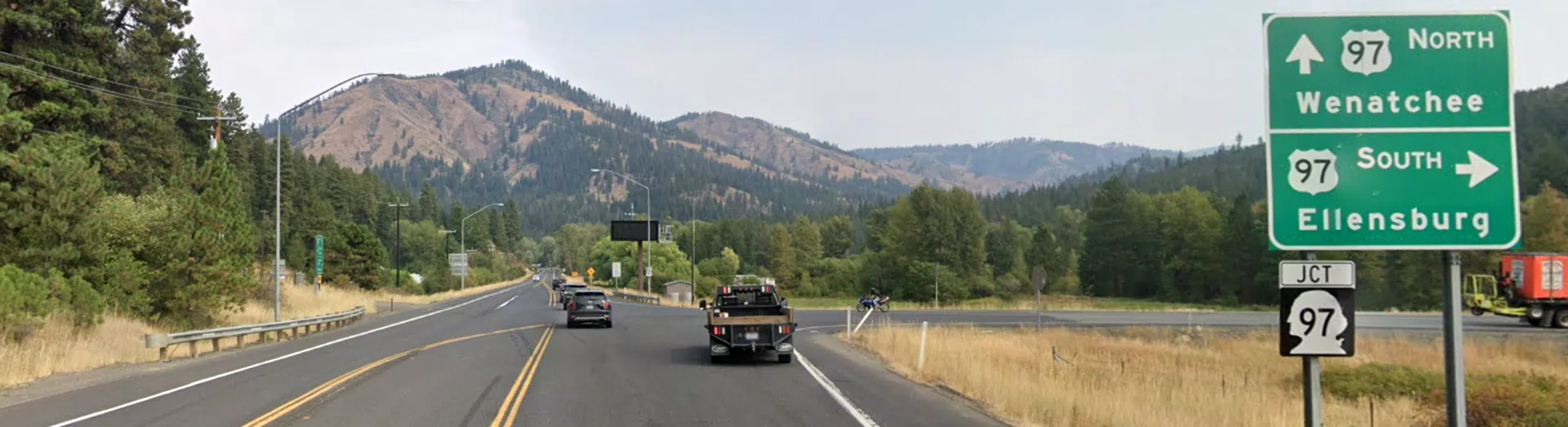
Continue north at decision point and you will be on the “YT North” route through historic Blewett Pass, Wenatchee, Waterville and Davenport,
the 1925 – today’s route of the Yellowstone Trail made possible by the improvement of Blewett Pass.
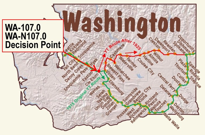
YT NORTH ROUTE TO SPOKANE THROUGH WENATCHEE – 1925
For Directions, click the WA State YTA Mile Marker Numbers (below) linking you to a real-time map.
Continuing North on the 1925 YT from Virden:
(NOTE: North YT Mile Markers begin with letters “WA-N”.)
WA-N107.0 Virden (also known as Lauderdale Junction)
WA-N110.1 Liberty
Along with Virden, Liberty is an old gold mining camp with aged and decaying structures and some occupied homes. A replica of an arrastra is displayed. An arrastra is a primitive tool for grinding down rock to get gold out of it, a rude drag-stone mill for pulverizing ores.
NOTE: The YT apparently ran just north of the present highway from about WA-N115.5 to WA-N116.5 and curved north on to FS 9715. Some of this alignment appears on aerial views.
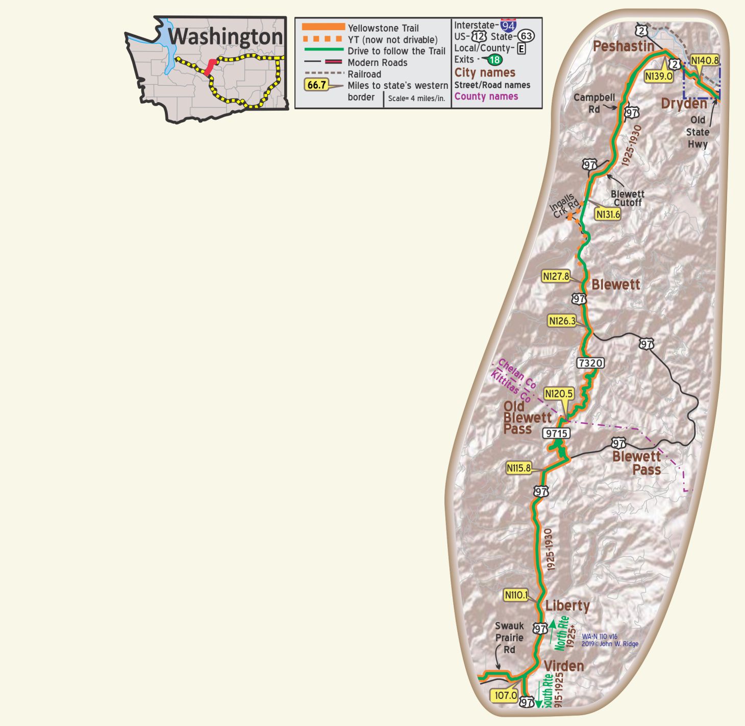
WA-N116.5 (Old) Blewett Pass
WARNING: Road not maintained in the winter months. Mountain forest roads are seasonal. Check conditions before accessing area.
In 2025, the deep snow-pack might not allow access until summer.
Between 116.5 Forest Rd 9715 and 126.3 is the Old Blewett Pass.
US 97 circumvents this great pass which was the route of the old Yellowstone Trail 1925-1930.
Finally, in 1925 the road was passable and the Yellowstone Trail Association moved its signs to this north route from the southern, longer route.
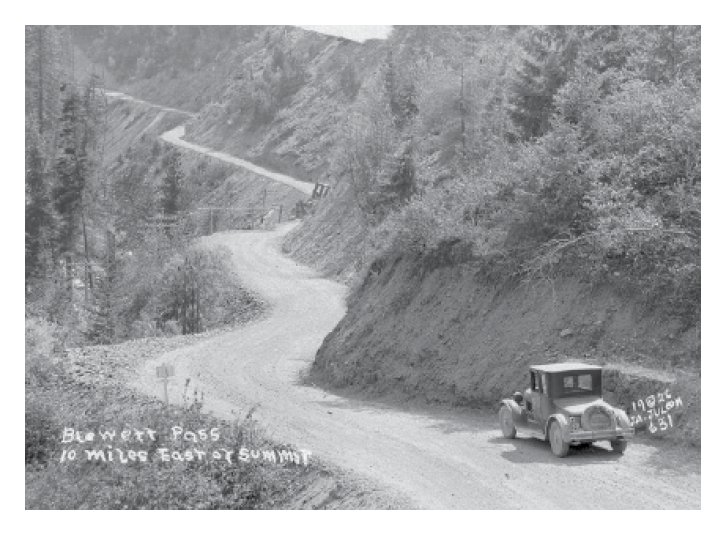
 You really want to drive this old road over Blewett Pass to appreciate the problems of routing a road in the mountains 100 years ago.
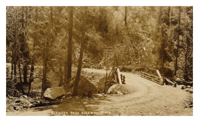
This Old Blewett Pass (1915) is wiggly with switchbacks, but with wonderful scenery and is not nearly as scary as it once was.
The Pass road today is smooth, winding, and very pretty if you’re not in a hurry.
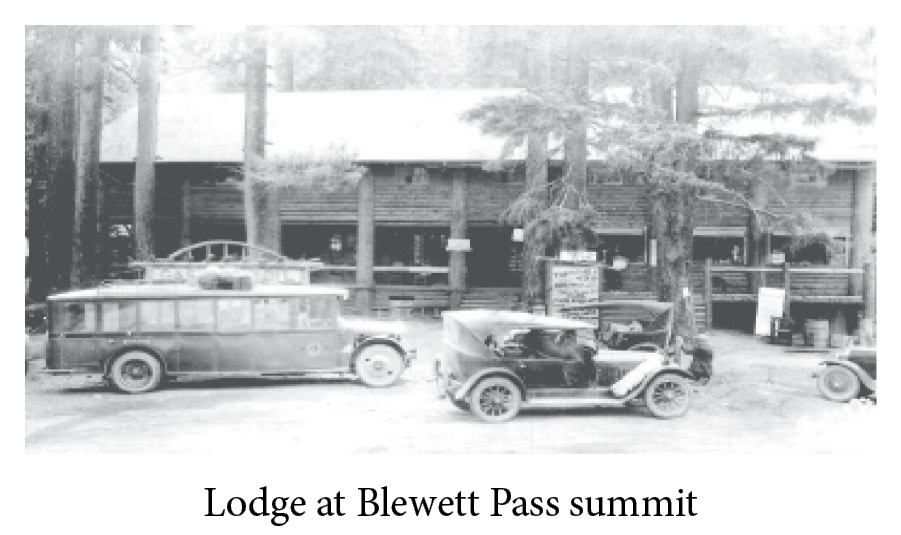
Blewett Pass Summit, at (4.071 alt.), is reached after a twisting climb.
A rustic lodge overlooks the upper reaches of the Yakima Valley (winding descent; drive carefully). The next few miles southwest are dense forest.
The highway passes through the canyon of Swauk Creek, where tunnels and tailing dumps of old mines are still in evidence along the steep sides. This Swauk formation occupies an area of 1,000 square miles, extending from Lake Wenatchee.
Store, gas, phone, two cabins and very fair repair shop. MH-1928*
TOP-O’-THE-HILL TAVERN is good. Modern rooms; good beds. Sgl. $1.50; dbl. $2-$2.50; meals 75c. MH-1928*
NOTE: From WA-N119.3 to WA-N120.1 it is probable that the YT followed Clark Rd. and a spur of Green Canyon Loop to the east in this area but it is not now possible.
 WA-N127.8 Blewett
(2,325 alt., 54 pop.), now only a handful of cabins, Blewett once had a population of more than 250 miners. Prospectors returning from the Caribou and Fraser districts in 1860 wandered into the foothills of the Cascade Mountains and began placer mining on the creeks. Prior to 1879 Blewett was reached only by trail. WPA-WA*
Instead of wagons, saddle horses, and pack mules, today shiny new cars and rattling older models are parked under the pines. Numerous perforations visible in the mountain sides around Blewett are test holes sunk by early prospectors to tap quartz veins. Despite the large-scale development of gold mining, a few prospectors continue their lone search for the scarce yellow metal. WPA-WA*
This mining town, now a ghost town, at the foothills of the Wenatchee Mountains is marked with plaques indicating the spot of gold mines and the old “stamp mill” where several hundred men worked during the 1880s processing gold ore.
The mill ceased operations in 1905. The 1878 arrastra (gold or silver grinder) is on the National Register of Historic Places. Today only ruins of the stamp mill, arrastra, tramway, and mines remain from 1800s Blewett.
NOTE: WA-N129.8 (GPS: 47.46309, -120.67327): Location of landslide that cut old YT (Ingalls Crk. Rd.)
The route of the YT between WA-N139 (Peshastin) and Wenatchee is difficult to document, probably because of many small alignment changes and major bridge constructions over the years. The marked route is an approximation.
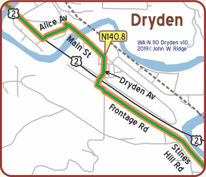 WA-N140.8 Dryden
(938 alt., 250 pop.), a fruit-packing and shipping center, it was named by the Great Northern Railroad in honor of a noted Canadian horticulturist. WPA-WA*
The Dryden Fruit Growers Union was begun in 1909 and it sent out 18 railroad cars of apples. Currently, Dryden is still a supply and shipping point for local farms and orchards.
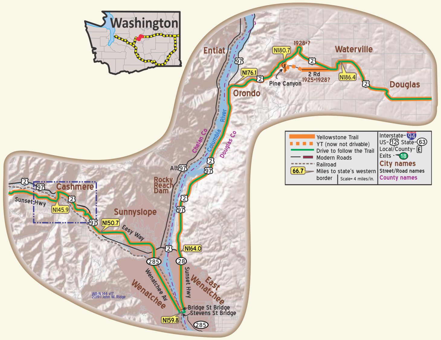
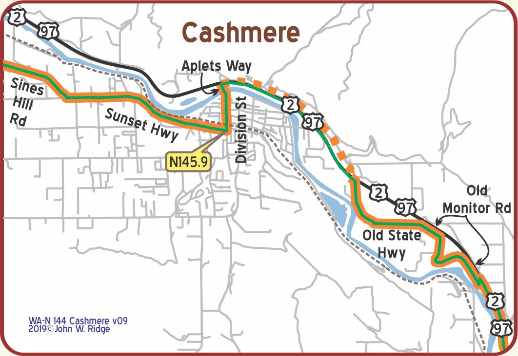
WA-N145.9 Cashmere
(pop. 700, alt. 630 ft.), situated as it is, in the heart of the Wenatchee valley, Cashmere is in the most famous apple district in the world. It has established free camping sites for the use of automobile tourists. The site is situated along the banks of the Wenatchee river. BB1921-9*
This vicinity is said to produce the greatest quantity of apples per acre in the world.
Blewett Garage for towing. American Cafe is best. MH-1928*
HOTEL BLEWETT clean and well furnished; some rooms with bath. Sgl. $1.25-$2; dbl. $1.75, with bath $3. MH-1928
WILSON BROS. GARAGE is far best equipped; owners are master mechanics. Labor $1.50; closed at 6 pm. MH-1928*
Shaded by locust and maple trees, Cashmere is known as the home of Aplets, the confection of the fairies, sugar flavored with apple juice and enriched by walnuts and Spices. Cashmere is known for the shipment of apples, pears, and cherries. Orchards claim every available foot of valley land. WPA-WA*
117 Mission Ave. Aplets and Cotlets Liberty Orchards Country Store. You will be delighted with a stop here, munching on apple and apricot juice candies. Since 1920 they have made fruit candies the same way. You can watch them do it and read their history. Free samples! No doubt Yellowstone Trail travelers were aware of this famous Turkish Delight confection.
600 Cotlets Way. Cashmere Museum & Pioneer Village. The museum has a fine collection of Pioneer and Native American artifacts. The Village has 20 pioneer structures, some original, and a Great Northern Railroad caboose. The waterwheel behind the museum is on the Mission Creek bed and is on the National Register of Historic Places.
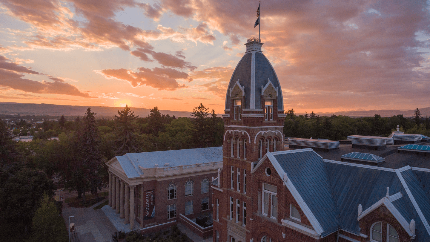
WA-N158.4 Wenatchee (photo right)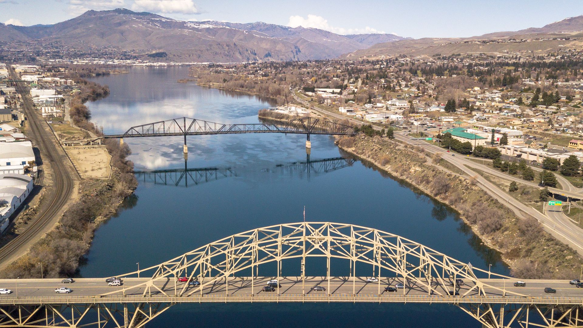
“The Apple Capital of the World” (pop. 4,500, alt. 639 ft.), is situated at the confluence of the Columbia and Wenatchee rivers in a sea of apple orchards with the foothills of the Cascades a few miles away.
Mounts Rainier, Hood and Baker are seen from Saddle Rock.
The Wenatchee district produced 9,000,000 boxes of apples in the fall of 1919, a larger production than any other apple district – in the world. BB1921-9*
If you are lucky enough to arrive in late summer you may see oceans of yellow wheat fields undulating in the breeze. In the spring the apple blossom colors and smell are delightful.
Downtown Wenatchee Historic District is roughly bounded by Columbia, N Mission, 1st, and Kittitas Sts., a stretch of two blocks wide and four blocks long. Most buildings are listed on the National Register of Historic Places.
3 N Worthen St. and Orondo. Pybus Market is in a restored warehouse near Riverfront Park in the Grandview Historic District. The district, encompassing 34 acres, is a collection of commercial, mixed-use, and warehouse buildings located in the central business district of Wenatchee downtown. We mention this site because of the historicity of it. Look at this particular100-year-old warehouse with its high ceiling. Although Trail travelers probably did not visit warehouses, repurposing old buildings is preserving history.
 127 S Mission St. Wenatchee Valley Museum & Cultural Center showcases local and regional history, natural sciences and the arts on four floors. Features offered are field trips, Ice Age Floods information, apple production processes, a miniature railroad and a theater pipe organ.
In 1931 Clyde Pangborn and Hugh Herndon made the first transpacific airplane flight from Japan to the U.S., landing in Wenatchee. Look at a globe. Trace the route from Japan to Alaska to Canada to Wenatchee. The pilots belly-landed, having jettisoned landing gear to conserve fuel. The propeller of the plane is displayed here.
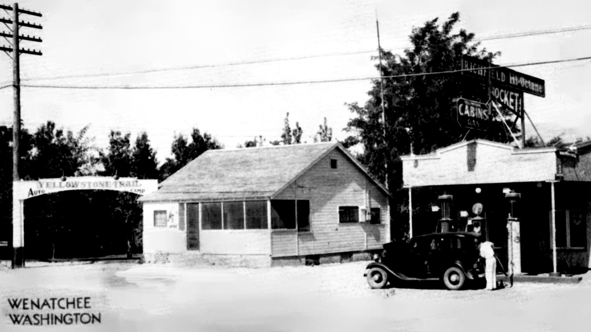
1005 N Wenatchee Ave. (Yellowstone Trail). Note the Gesa Credit Union building. It is standing on the site of the 1928 Yellowstone Trail Auto Camp. The beloved Chieftain Restaurant and Motel grew out of the Yellowstone Trail Auto Camp, then was auctioned off in 1997.
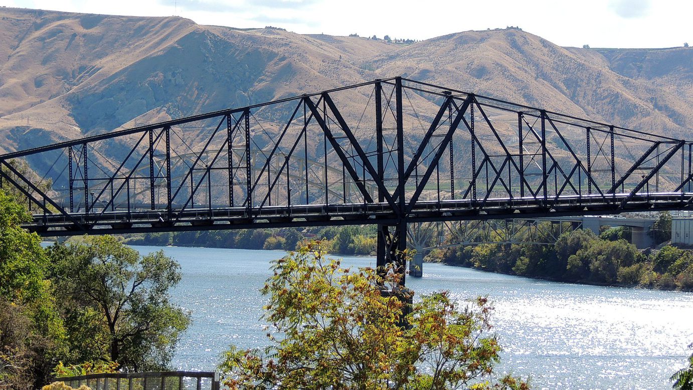
WA-N159.7 Columbia River Bridge (1908)
The Columbia River Bridge, also known as the Old Wenatchee Bridge, was built by the Washington Bridge Company in 1908, primarily as a means to carry irrigation water pipelines across the Columbia River. It was the first road bridge over the Columbia south of Canada. As originally built, the bridge carried a 20.5-foot (6.2 m) wide timber roadway, with additional ability to carry a street railway. Today it is pedestrian only and on the National Register of Historic Places. It is fun to walk in the wake of the Yellowstone Trail.

WA-N176.1 Orondo
The village, on the Columbia River, is at the mouth of Pine Canyon.
Today (2025), Orondo has an Elementary (1-8) School, a gas station, apple packing & storage warehouse, church, mini-mart, and, post office.
Orondo has the first of many mom & pop in-season fruit stands on the YT to Wenatchee which many locals and travelers alike enjoy.
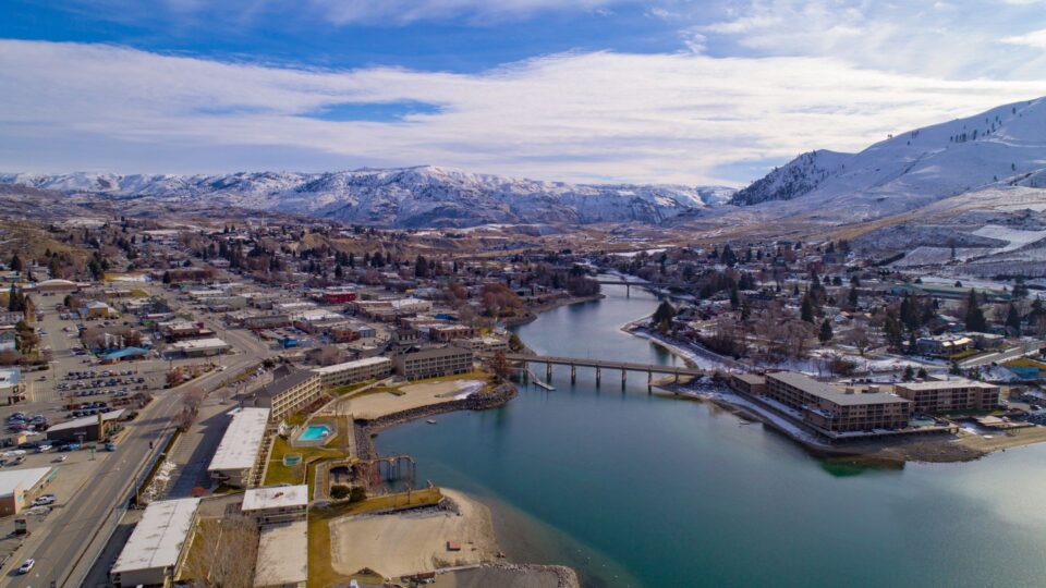
WAYSIDE – Lake Chelan – Twenty-two miles north of Orondo on US 97 is Chelan, the small town at the foot of spectacular Lake Chelan (photo right).
The lake is worth the boat day trip on this third deepest lake in the U.S. “Chelan” is the Wapato word for deep water. They knew. You hardly know that you are on 1,486 feet of water which extends nearly 400 feet below sea level.
You do notice that there is a lot of water, 52 square miles in area, and that there are no roads on either side of your watery highway. Mountains on all sides preclude such construction. The cottages at the few picturesque stops en route are reached only by boat or air. The Chelan dam across the Stehekin River was built in 1927, creating the lake, but latter-day Yellowstone Trail travelers could have detoured to the river or detoured to this larger lake.
Your boat arrives at the north end of the lake at a little, primitive village, Stehekin. Valhalla it is. Enjoy the shore line under the many trees in complete quiet. Or, take a short tour from the visitors’ center to learn of the area’s protected status in the Lake Chelan National Recreation Area. There are a few buildings scattered among the trees. A National Park Service bus is available to Rainbow Falls. There was a forest fire there in 2016. We don’t know the extent of the damage.
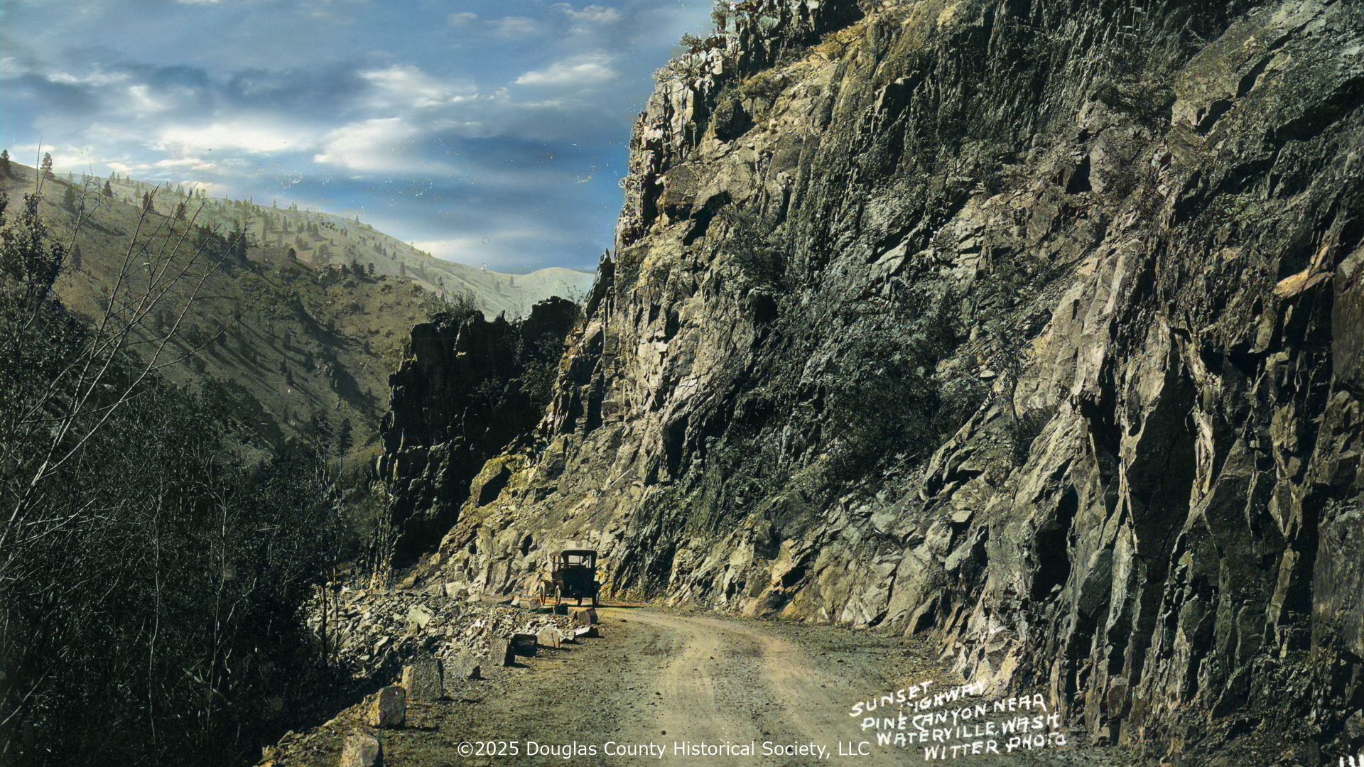
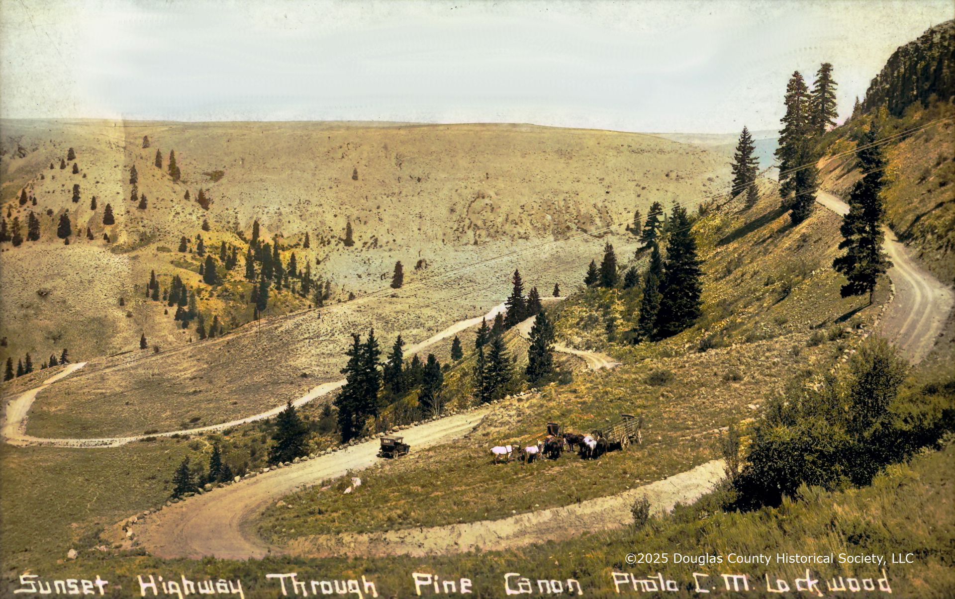
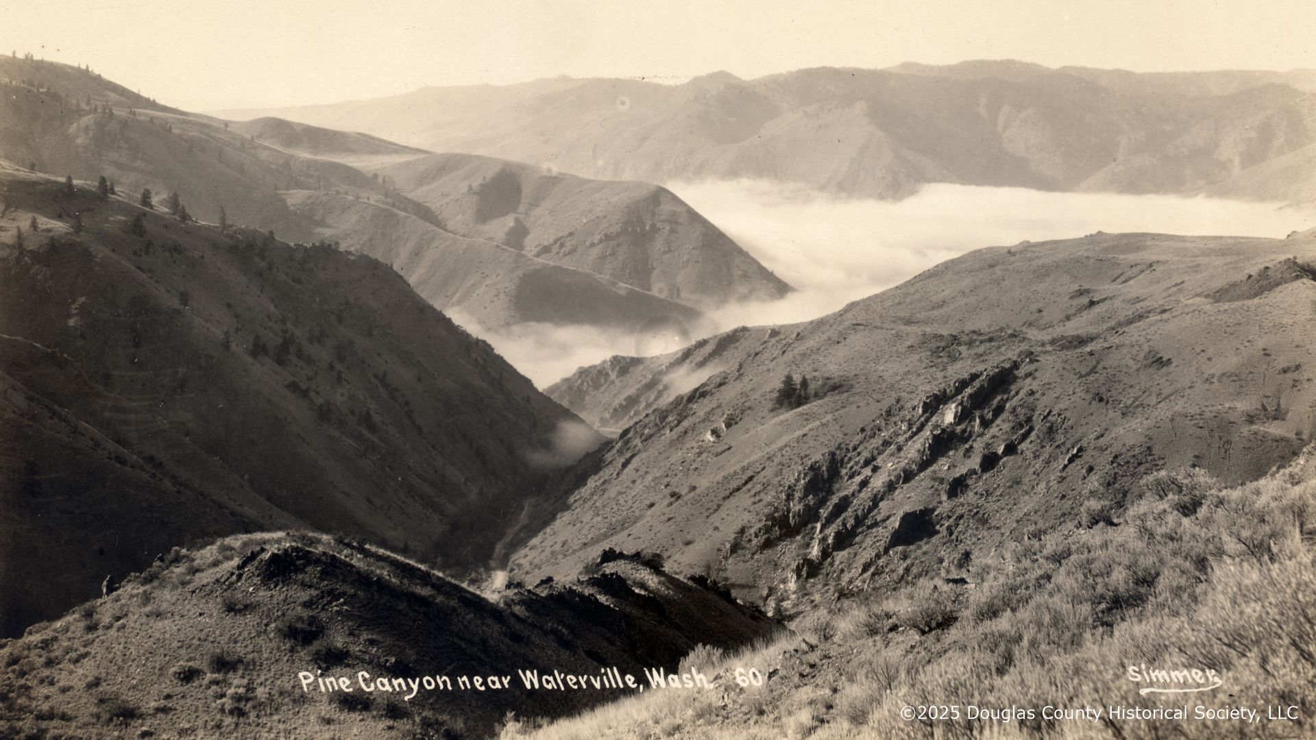
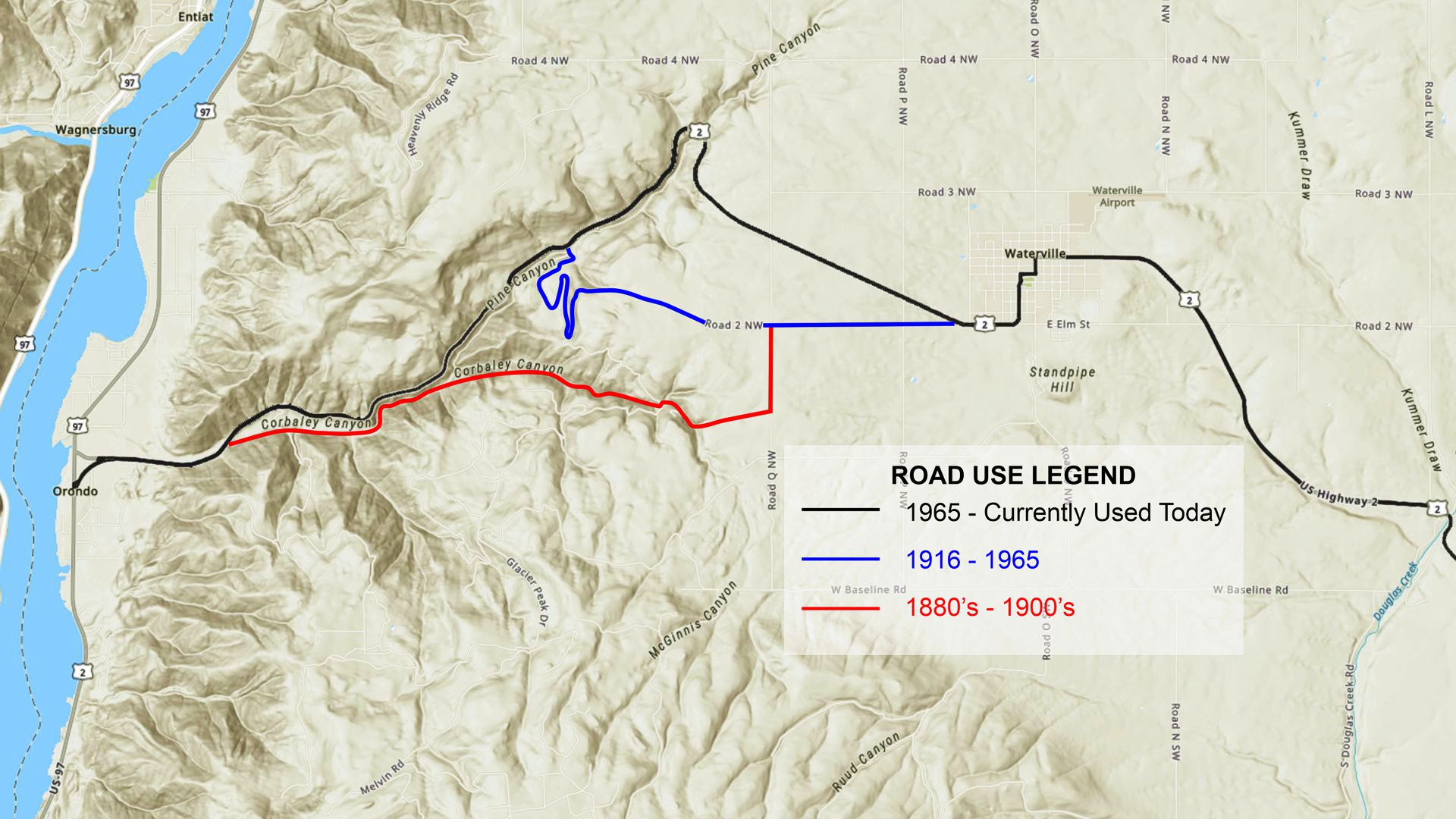 WA-N180 Pine Canyon
Pine Canyon Road carried Yellowstone Trail travelers from the Columbia River to Waterville, a difference of 2,000 feet in altitude. Today Pine Canyon Road is closed to vehicle traffic, but you can still explore on foot from US 2 to appreciate the spectacular scenery of the yellow pines and hairpin turns surrounding the difficult road that climbed that 2,000 foot difference between the upper plateau and the Columbia River from 1915-1950. This map shows the complex route of the old road.

WA-N186.4 Waterville
pop. 1,000; a county seat and a grain center.
HOTEL WATERVILLE, thirty rooms, all outside; five with bath and one-half with running water. Sgl. $l-$2.25; dbl. $1.50, with run. water $2.25, with bath $3.25; meals 50c.
WILSON MOTOR CO. is best equipped; Buick and Chevy dealer. Good mechanics. Labor $1.25, ph. 862 for wrecker until 10 p. m. Ladies’ rest room.
WATERVILLE MOTOR CO., Ford is open until 10
p. m. MH-1928*
Waterville is a gateway between western Washington and the agricultural areas of the Columbia Plateau to the east. The economy is supported mainly by agriculture and forest products. “Waterville maintains its historical feeling as if caught in a wrinkle in time. The patchwork quilt of colorful wheat fields and hidden coulees make memorable subjects for photos,” says a Waterville Historic Hotel brochure. Much of its main street is on the National Register of Historical Places.
102 E Park St. (Yellowstone Trail). Waterville Hotel was a great hotel, representative of good hotels of the past but today is privately owned as a residence. Built in 1903. What can one say about a 118 year old gracious lady and Waterville landmark that hasn’t already been said? Its exterior is little changed, still retaining the Jacobean style architecture.
 124 W Walnut St., Douglas County Historical Museum – This museum is on the Yellowstone Trail and supports the YT History locally. Visit their website at www.Douglas CountyMuseum.com.
As you enter the museum, note the Yellowstone Trail interpretive sign just outside the door. This museum rocks! With real rocks, that is. It has over 4,500 rock and mineral specimens, some glowing under UV light in a dark room. It also has an iron meteorite, the largest in Washington. Unique is the mural and story of moving goods up from and down to the Columbia River by bucket, a 2,000 foot drop!
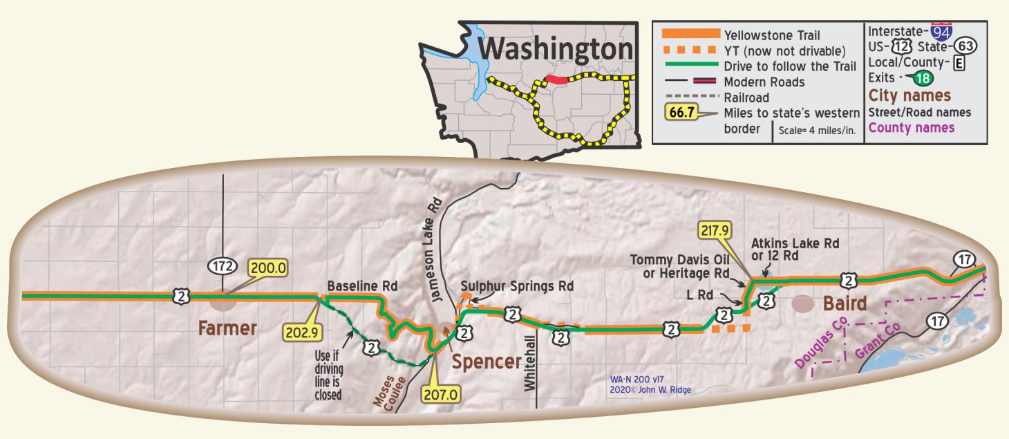
WA-N200.0 Farmer
Going west, the tops of the Cascades can be seen.
WA-N207.8 Spencer (Ghost town)
You won’t find Spencer on any current Washington map or atlas.
The local historical society folks did not know of its existence.
Heck, even the ghosts have left this ghost town. But it did exist in Yellowstone Trail days.
Perhaps it was even a stage coach stop before that.
Sunset-hwy.com declares that “Spencer was barely ever a town. There was an early telephone line and a wagon road and perhaps early automobile traffic used it to cross the coulee.” Well, traffic did indeed use it – those following the Yellowstone Trail. They probably navigated the Trail up out of the coulee on the west side of the cliff face along a narrow cut.
Evidence that people did live there and perhaps served Trail travelers lies in the fact that several years ago curious history buffs found bits of a town there: a piece of china from an old hotel and an old Washington license plate. Perhaps there was a gas station of sorts to aid Trail travelers as they rested at the hotel. We include Spencer as a bit of the Trail’s lost history.
NOTE: Between WA-N202.9 and 207.0 is an excellent example of the early alignment. Fun, but it has been reported closed on occasion.
 WA-N227.2 Coulee City
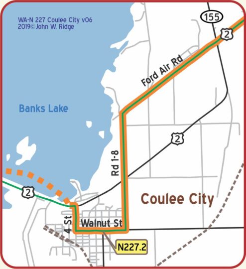
The Yellowstone Trail intersects the Coulee Corridor Scenic Byway in Coulee City, Washington.
pop. 500, is sustained by wheat, apples and stock. Gateway to the Grand Coulee region, one of the six leading geological wonders. Two country hotels, the Coulee leads. Aldrich Motors, Ford, is open late. Young’s Camp, 50c, seven plain, clean cabins, $1 run. water in some. CITY GARAGE is most modern and leads. Labor $1.50. Tire service. Ph. 26 for wrecker until 9 p. m. MH-1928*
Coulee City is one place on the YT where a section of the Trail is now flooded and inaccessible.
Coulee City has modern services and a wonderful City Park Campground to enjoy access to Banks Lake.
 WAYSIDE: HRO Adventures – Rusty and Jacquie Hunt provide unique, private, Rustic Lodging along with Tours, 2,000 acre pheasant shooting preserve, and, 40,000+ acres of fully guided hunting adventure.
Rusty’s Great Grandfather Homesteaded where Banks Lake now resides.
Today, HRO Adventures provides Tours of amazing geological and farming wonders.
♦♦♦♦♦♦♦♦♦
WAYSIDE – At Dry Falls Junction, follow SR 17
four miles southwest from US 2 (the Yellowstone Trail) to Sun Lakes – Dry Falls State Park.
The best place to view Dry Falls is from the Dry Falls Visitor and Vista House.
Rent water-front family friendly cabins in the State Park from Sun Banks Park Resort.
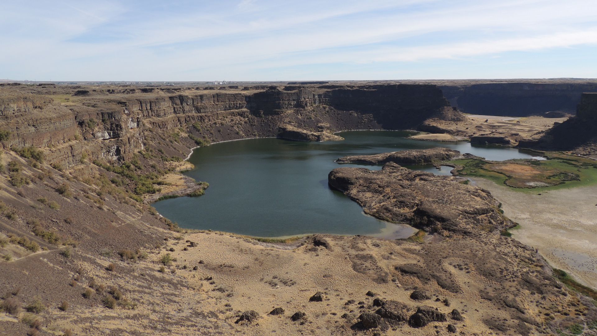
Dry Falls is one of the great geological wonders of North America. Carved by Ice Age floods, the former world’s largest waterfall is now a stark cliff, 400 feet high and 3.5 miles wide.
In its heyday, the waterfall was five times the width of Niagara Falls.
Now, Dry Falls is just a vestige of the humungus, prehistoric (Glacial Lake Missoula) floods that scoured the land several times from western Montana through Idaho, Washington, and Oregon at the end of the last ice age. It carved and moved whole swaths of land and rivers, and formed immense cuts, called coulees. We’re talking about water the size of Lake Ontario rushing over the land, carving the sights in the Channeled Scablands.
The falls began 20 miles to the south but receded upstream through erosion. The retreat of the falls gave birth to the canyon below, the lower Grand Coulee. The flood spewed several cubic miles of rock over vast areas downstream. Today the falls overlook a desert oasis filled with lakes and abundant wildlife. See page <?> for more about the geology.
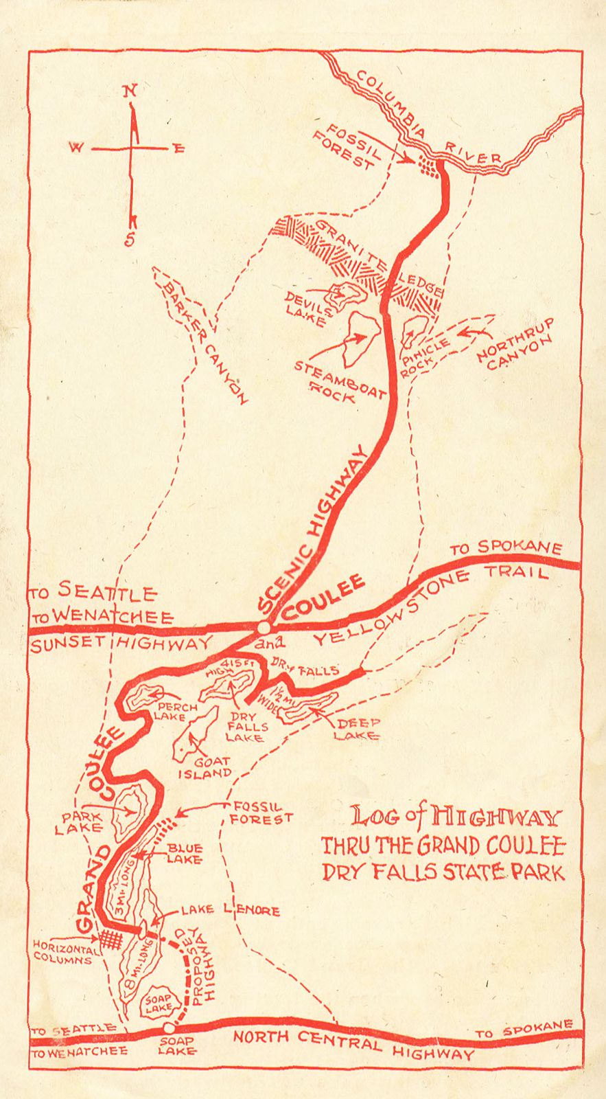 Map (left) in tourist brochure, about 1930.
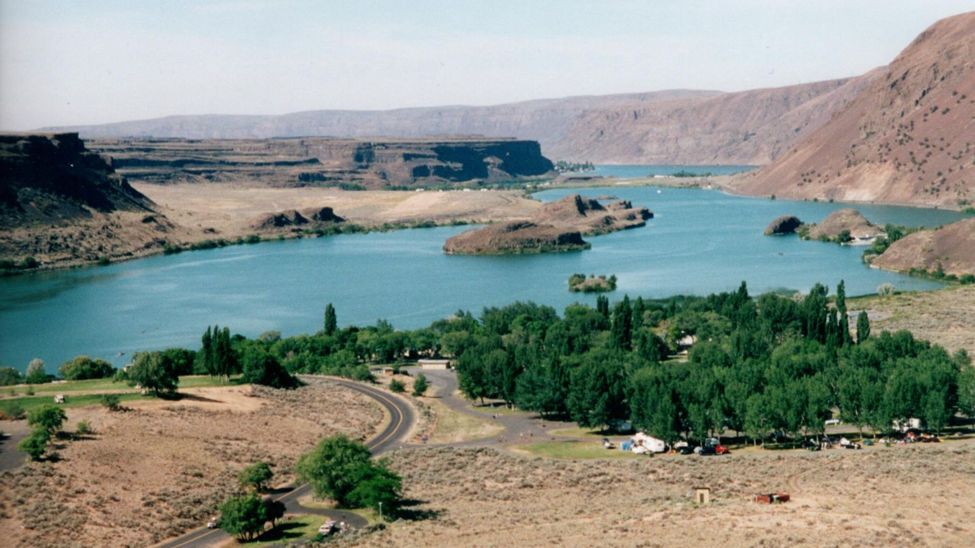
No Grand Coulee Dam and no Banks Lake.
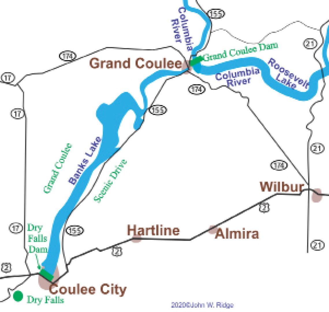
NOTE: The Dry Falls Dam (in Coulee City) flooded the YT alignment just west of Coulee City in the mid-1940s and the highway was rerouted on the dam. The dam created Banks Lake which supplies irrigation water to over 600,000 acres of farm-land through the Columbia Basin Irrigation Project. It also provides a spectacular drive along its east side. Follow it to or from Grand Coulee Dam.
Here’s what the WPA – Works Project Administration* said about Dry Falls at the time (1920s):
DRY FALLS STATE PARK, [Just south] A rustic stone VISTA HOUSE (Visitors register) overlooks the scarred walls of the extinct falls, where a cataract many times greater than Niagara once plunged, a gigantic waterfall with a sheer drop of 417 feet and a width of nearly 3 miles. The dry falls were caused by the erosive glacial waters, the ice cap having changed the course of the Columbia River. Various geologic periods are illustrated in the strata of the walls, and leaves and trees are fossilized in the strata. A trail winds from Vista House down the face of the cliff to the bottom of the falls. At the base of the cliff are Perch and Deep lakes. WPA-WA*
The Coulee Corridor Scenic Byway in Coulee City, goes to Grand Coulee Dam and Dry Falls.
WAYSIDE – Traveling the Yellowstone Trail today you will probably want to take a wayside north to the Grand Coulee Dam.
Continue traveling east past Coulee City for 2 miles.
Then, turn off the Trail (US 2) and follow SR155 north for 28 miles to Grand Coulee Dam, a lovely ride along Banks Lake.
Man-made Banks Lake, created by the Coulee City Dam begun in1933, flooded and sank the road once used by the Yellowstone Trail, so the closest to the Trail that we can now route you is to follow present US 2.
Of course, the old Trail traveler would not have stopped to see the non-existent Grand Coulee Dam. Travelers then were encouraged to visit the Grand Coulee River, thought to be the old bed of the Columbia River.
 All is forgiven for flooding out the original Trail with this man-made, beautiful irrigation reservoir.
You all know about the massive Grand Coulee Dam itself, but seeing it in action is something else!
It is the largest hydroelectric power producer in the U.S., providing electricity to 11 western states, one of the top 10 largest producers in the world. And know that it has many related jobs: flood control, power generation, irrigation, fish migration flows, recreation.
Stay for the evening laser show at the visitors’ center … with sound. We loved it! •
Indeed, the Grand Coulee Dam Laser Light Show is magnificent and something a family can enjoy up close, or from the privacy of your vehicle.
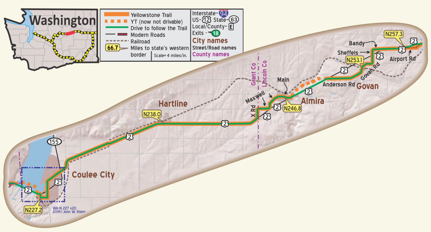
WA-N238.0 Hartline
Hartline has rows of towering wheat elevators along the railroad tracks. West of Hartline is evidence of a large lake that once flooded the area. Dry Alkali Lake has deposits of silt, sand and gravel several hundred feet deep and scab-lands appear again. WPA
WA-N246.8 Almira
Nearly 750,000 bushels of wheat are handled each year through its warehouses. WPA
The landscape alternates between wheat fields and barren rock, called “channeled scablands.”
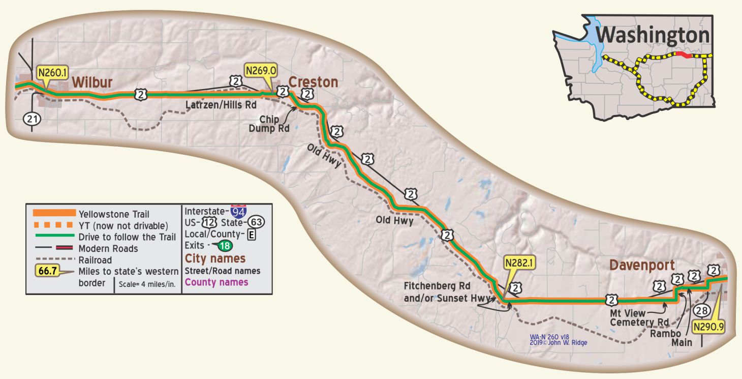
WA-N260.1 Wilbur
Completion of the Grand Coulee Dam will increase Wilbur’s importance as a trading center. A 125-foot municipal swimming pool offers the only facilities for swimming within many miles. WPA-WA*
NOTE: In Wilbur, the YT may have followed Portand St. and Cole St. on the west side of town.
WA-N269.0 Creston
The aforementioned Missoula Floods of the last ice age produced “rushing waters as deep as 200 feet around here, scoured the land across multiple channels miles wide and shaped river valleys and coulees with vertical cliffs on all sides,” wrote Yellowstone Trail researcher Dave Habura. What is left is red soil and flat valley floors.
WA-N290.8 Davenport
pop. 1,350; county seat of dairy, stock raising and wheat farming country. The LINCOLN HOTEL is partly modern. Public swimming pool. Sans Souci Camp, 50c, small but good; 4 small cabins, $1. PIONEER MOTOR CO. Ford is a good agency. MH1928*
Davenport is surrounded by rolling wheat fields and basaltic coulees on the Columbia Plateau.
It still serves as a central collection point for wheat, with most of it shipped out by truck or rail car.
600 Seventh St. Lincoln County History Museum. Through a complete set of programs, the Society collects, preserves, and makes available to all citizens, the heritage of Lincoln County. Visits by school children include a demonstration of pioneer skills and hands-on programs with artifacts from Lincoln County. The Society makes available video presentations on a variety of historical subjects.
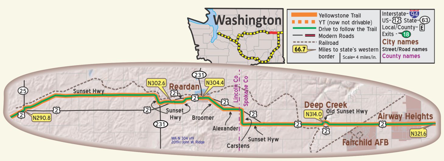
WA-N304.4 Reardan
Red soil, desert, scablands, and rolling, treeless terrain describes the landscape west of Reardan, the result of the great Missoula Ice Age Floods.
Three miles west of the center of Reardan on Sunset Highway/Old State Highway (Yellowstone Trail) at 27300 Sprinkle Rd. N is the Inland Northwest Rail Museum. Their website describes 13 of their 30 different cars and engines in their collection, including a “diner” car that looks just like a real diner with about 14 swivel seats lined up to a long counter. A box car from 1898 is the oldest piece of rolling stock in their collection. Visit the Inland Northwest Rail Museum website here.
 WA-N326.2 and WA-476.6
North YT Route and South YT Route Join.
NOTE: Construction of I-90 removed this intersection.
Location given is on Sunset Boulevard (old Sunset Highway).
North YT Route is 150.6 miles shorter than the South YT Route.
Click Here to continue on to Spokane -OR- Scroll Down for the South YT Route.
YT SOUTH ROUTE TO SPOKANE THROUGH ELLENSBURG – 1915
For Directions, click the WA State YTA Mile Marker Numbers (below) linking you to a real-time map.
Continuing South on the Original 1915 YT from Virden:
WA-107.0 Virden (also known as Lauderdale Junction)
NOTE: WA-107.0: Bettas Rd. is a good “authentic” drive. Although a 1916 BB suggests that WA 97 might have been used. Needs research! The 1924 Automobile Club of Washington called it Horse Canyon Rd. – with a 10% grade.
The original route apparently used Notcho Ln. between WA-114.1 and WA-115.0. It is now private.
NOTE: WA-119.3 to WA 120.1: It is probable that the YT followed Clarke Rd. and a spur of Green Canyon loop to the east in this area but it is not now possible.
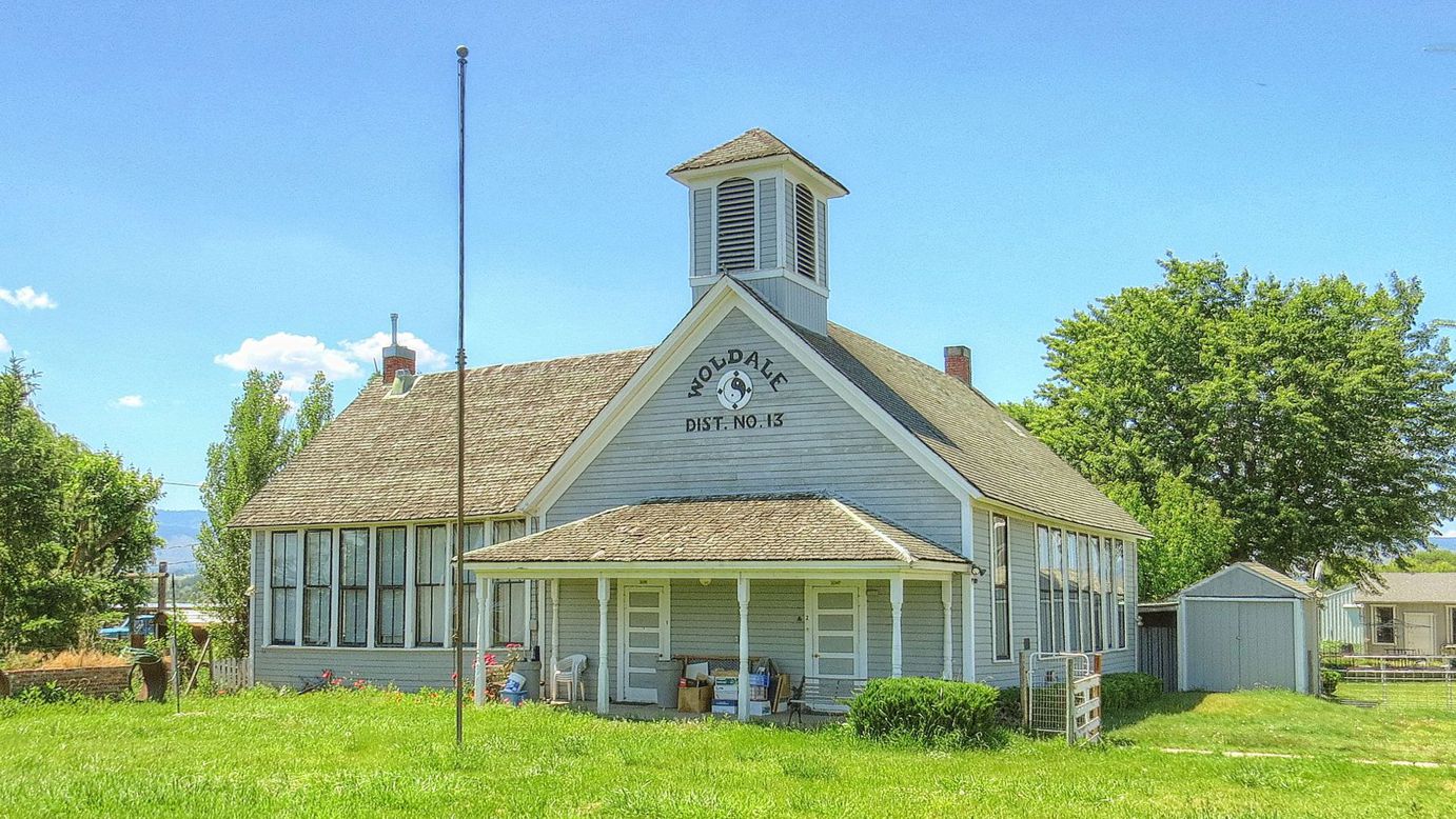
WA-121.8 Woldale School
Woldale School, 1907, at the intersection of Faust and Dry Creek Rds, (GPS: 47.02510, -120.59300) is still there complete with flagpole.
This would definitely have been seen by Yellowstone Trail travelers in 1915.
Note the scenery. If you are traveling east you will ask: Where are the forests of the Cascades? Now the scenery is drier, rolling, small trees only, sagebrush. The wetter weather does not make it over the Cascades. From here east and through the Palouse area be prepared for a different Washington. Ellensburg experiences only about nine inches of precipitation a year and much sunshine. If you are traveling west you will welcome the cool forests of the Cascades.
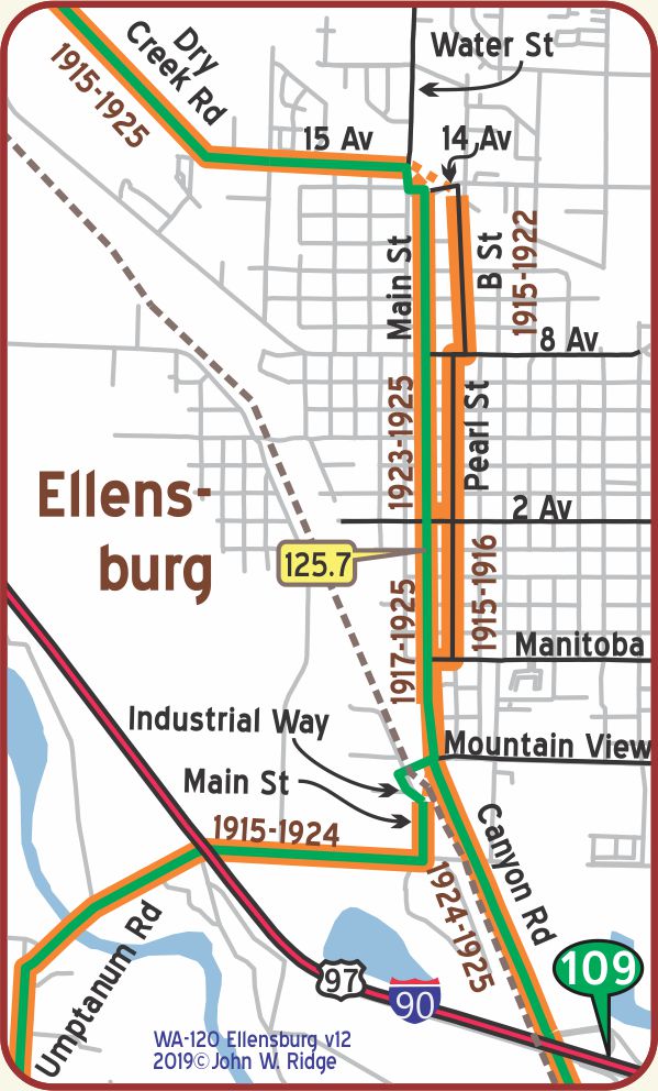 WA-125.7 Ellensburg
(pop. 6,000, alt. 1,510 ft.), is the metropolis of Kittitas valley, of which 60,000 acres are irrigated. Splendid highways lead to and from this city. One of the state normal schools is located here. BB1921-9*
There are at least 31 historic buildings downtown that are still standing and that Yellowstone Trail travelers would probably have seen.
The Downtown Historic District runs from Main St. east to Pine, and 3rd Ave. north to 5th.
Seventeen buildings were built in 1889 after the big fire. We cannot feature all of them.
Local “Walking Tours” guides by the Chamber of Commerce will lead you to them.
Pearl Street was the route of the Yellowstone Trail 1915-1916.
Today, fourteen historic buildings still stand, housing a variety of businesses.
When Main St. was improved, the Association moved its signs there 1917-1925.
Some of the eight historic buildings on Main St. sport cast iron decorations.
In the late 1800s the fashion in architecture was to upgrade your building with cast iron faces and flourishes such as found on the iconic
Davidson Block at Pearl St. and 4th Ave.
111 S Pearl St. The Yellow Church Café. Here is something eye-catching and bright yellow. The church was built in 1923 and could have been visited by early Yellowstone Trail travelers of German Lutheran persuasion.
323 N Main St. The Palace Café has been serving Ellensburg for over 125 years. It was first opened in 1892, moved once, then settled in its present Pearson Building (built 1908) location in the late1940s.
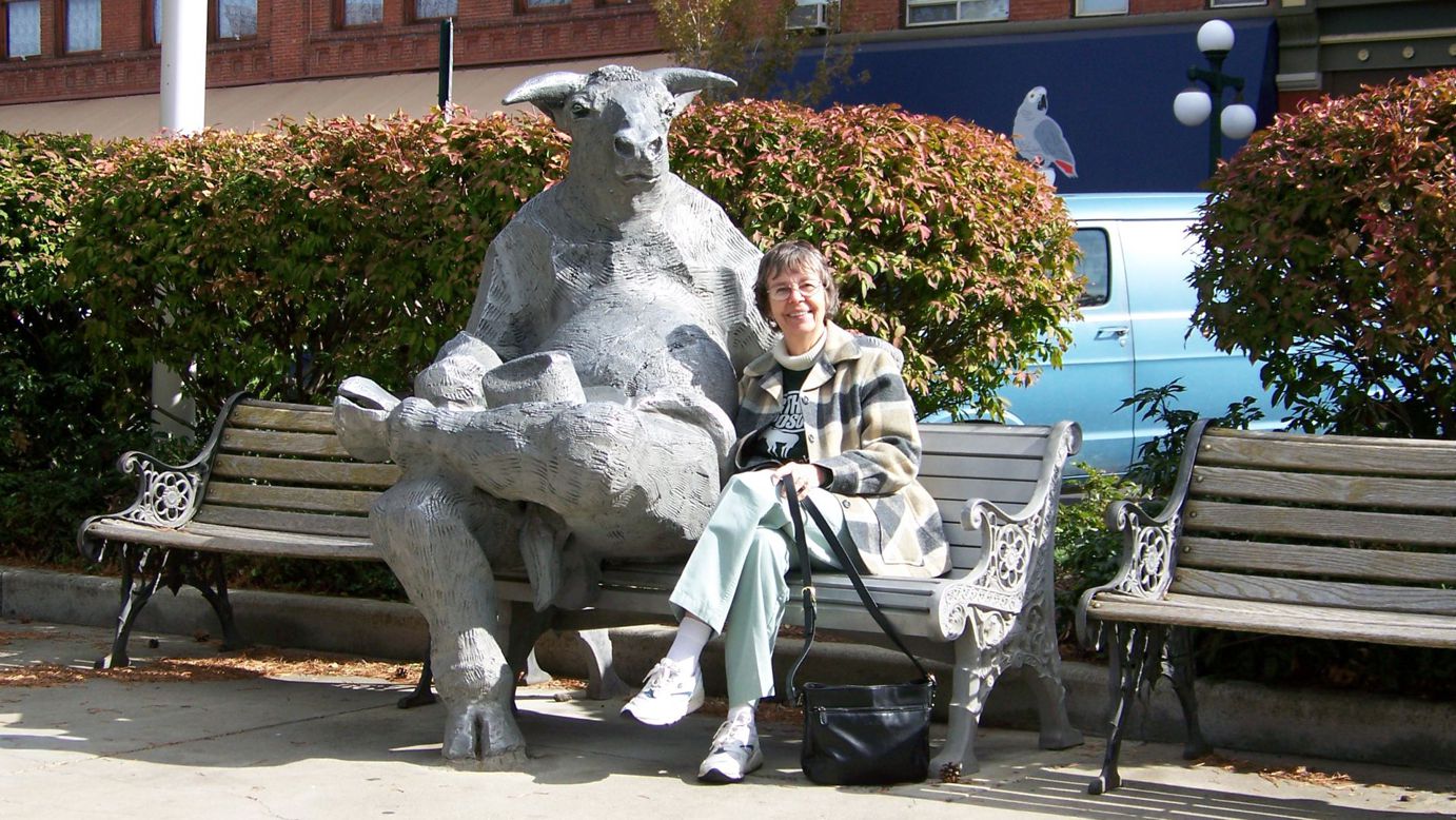
At 4th Ave. and Pearl St., you’ll have to laugh.
A large cast-aluminum sculpture of a bull is seen lounging on a park bench.
We couldn’t resist joining him and neither will you.
Although he appeared years after the Trail went down Pearl St., current travelers will remember this artwork and Ellensburg.
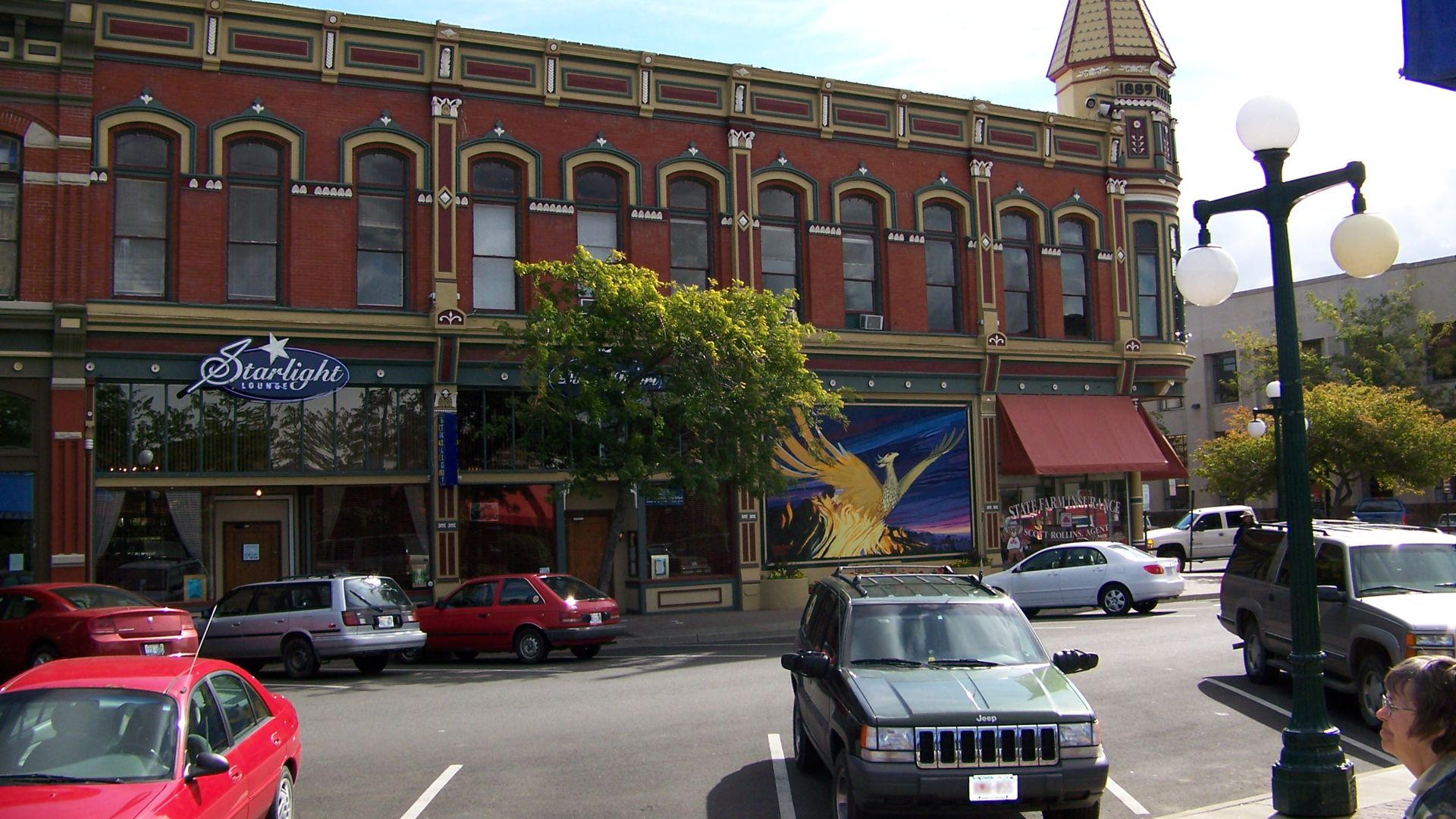
NE corner of 4th Ave. and Pearl is the Davidson Building. This 1889 building is one of the most recognizable landmarks in Ellensburg with its steeple-like turret.
A three-foot high Phoenix graces the south facade, a symbol of the rise of the building which was being constructed when the big 1889 fire took 10 city blocks and 200 homes.
Also notice the cast iron decorations on the whole building, a popular style with late Victorian architects.
114 W 4th Ave. (just off the Yellowstone Trail). Fetterer’s Furniture Store has been there for over 120 years! It might be fun to drop in to see their 120-year-old cash register.
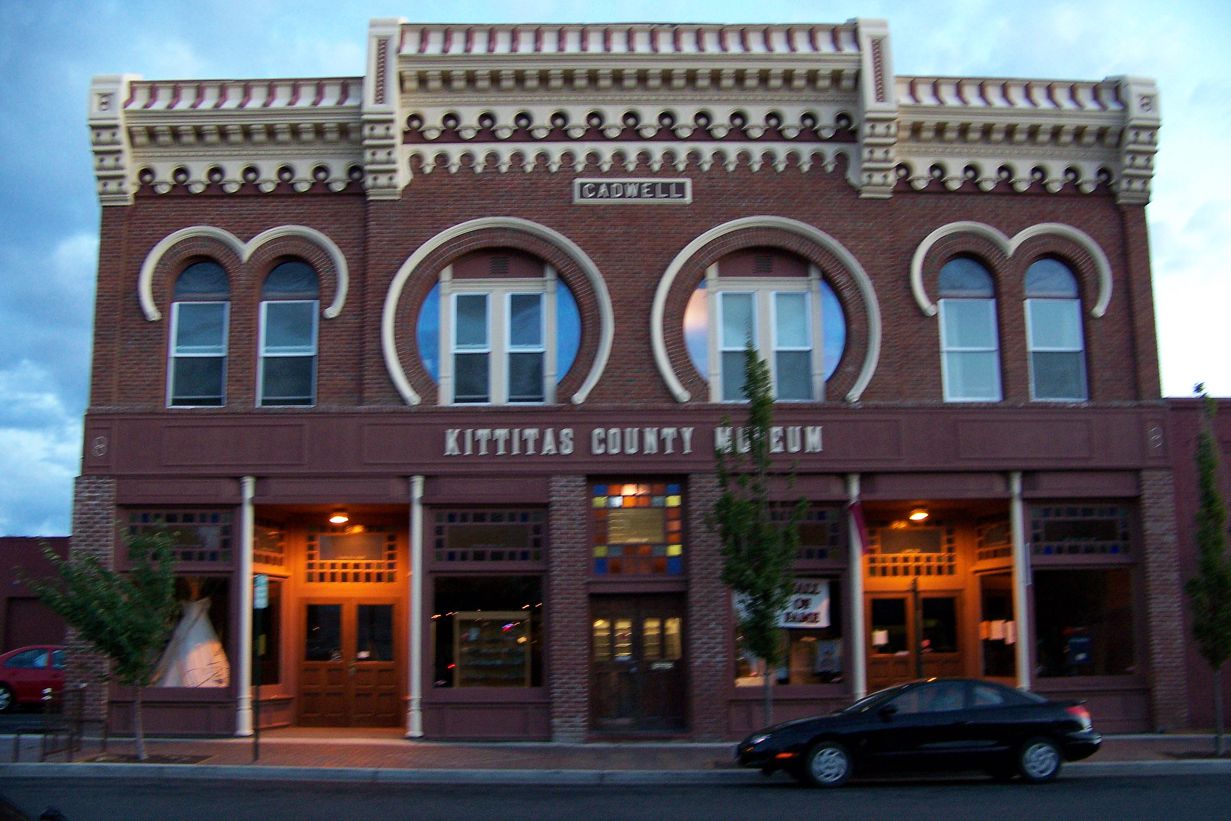
114 E 3rd Ave. Kittitas County Historical Museum.
It collects, preserves and disseminates materials about the history of Kittitas County.
The museum is in the old (1889) Caldwell Block, distinguished by horseshoe-shaped windows.
West end of 3rd Ave. Northern Pacific Historic Train Depot (1910). Friends of the Northern Pacific Depot have been working for years to restore the old station using period replacements which are hard to find. As of this writing, we do not know the status of the project.
Central Washington University
A large swatch of south central Ellensburg is occupied by Central Washington University, begun in 1891 as a Normal School. Today, this place presents most of the facilities and programs associated with much larger universities, including, uniquely, the Chimpanzee and Human Communication Institute at the north end of the campus. There you can observe chimpanzees who speak in sign language. Lab open to the public weekends March to November.
Ellensburg’s State Normal School opened in 1891 (see photos above).
The Normal School became Central Washington College of Education in 1937,
Central Washington State College in 1961,
and Central Washington University in 1977.
NOTE: WA-126.4
1924 Automobile Club of Washington describes the Wenas Rd. (west and south from this point) as “the Old Road to Yakima” and the Canyon Rd. to the south as “the New Road to Yakima.”
Wenas Rd. was the YT until about 1924, then Canyon Rd. was completed and became the YT.
The Wenas Rd. is a more “authentic” driving experience, but the Canyon Rd. is a very scenic route.
It also has the old tunnels from the original 1924 alignment.
Notice that the YT WA State Mile Marker Map shows two green driving lines. This rare instance indicates that either the Wenas or the Yakima Canyon road, both Yellowstone Trail routes at different years, would be driveable today.
The Wenas Rd. was the original Yellowstone Trail southern route from Ellensburg to Yakima which the Trail followed 1915-1924.
Out of Ellensburg, the road goes east through a forest of pine trees and crosses lush creeks and ridges.
A view of Wenas Lake is possible.
The summit of the Wenas is 3,128 feet, about 100 feet higher than Snoqualmie Pass, then the road dips down to farm country.
Today, the summit of the Wenas is known as Ellensburg Pass.
NOTE: If you follow this route, be prepared for rural conditions seasonally.
Recently, mammoth bones were discovered on the Wenas. They are now looking for human bones.
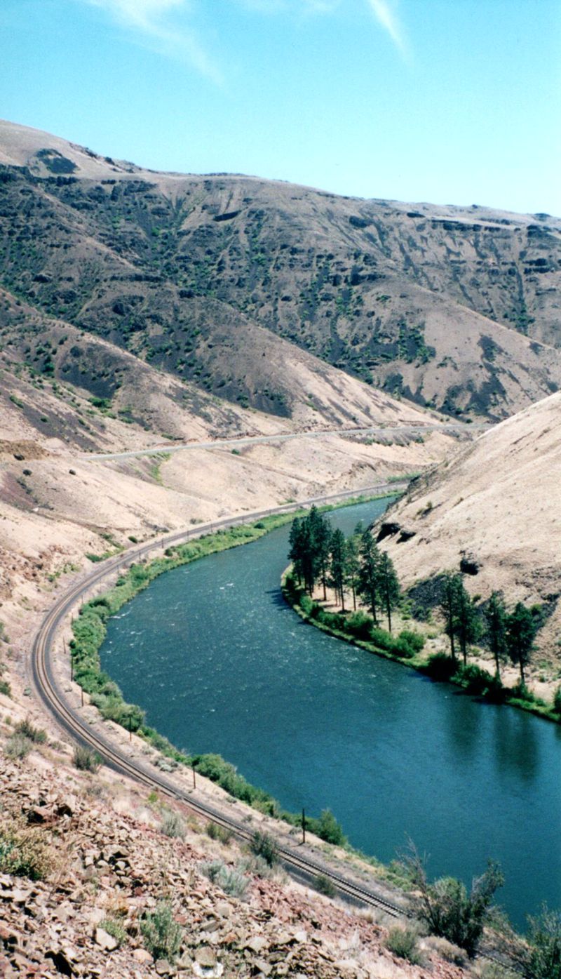
On Sept. 22, 1924, the state engineers completed “the new Yakima Canyon Road that will shorten the distance between Ellensburg and Yakima by approximately 13 miles and will follow practically the water grade” but will also require two tunnels. The road today is very wiggly because it hugs the Yakima River as it wanders through the Yakima Canyon. The two tunnels have long since fallen into disuse. This Canyon route has a landscape of soaring basalt canyon walls at the southern end.
NOTE: WA-165.6: “The Old Yakima Road” (Wenas Rd.) meets “the New Yakima Road”, (Canyon Rd. – 821/823).
The abandoned Twin Tunnels are about five miles north of this point on 823/821. There is a real possibility that coming from the north, the Canyon Rd. route, rather than turning west onto 823, roughly followed 821 into Yakima. Some of the route would then be under I-82. There is a local research opportunity here!
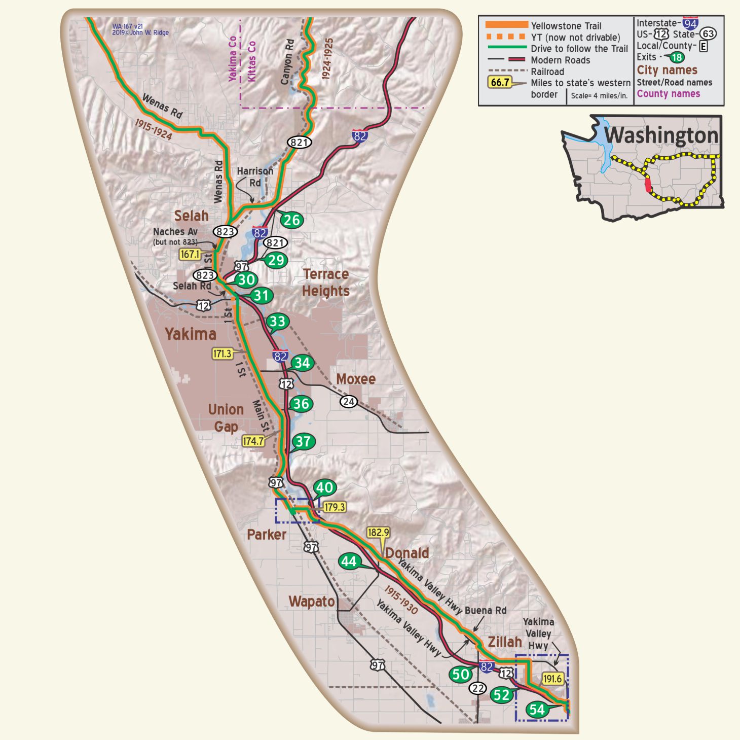
WA-167.1 Selah
The name, Selah, means “calm and peaceful” in the Yakima nation language. From fishing to sheep to pressing apple juice and packing fruit, this town has survived. It affords a great view of Mt. Rainier.
The Yakima Valley, along with other areas of southern Washington, have produced more than half of the apples grown in the U.S. for fresh eating. Before the 1980s, vineyards began replacing apple orchards. Thirty years later there were at least 50 wineries in the Valley. Although they were not there and available to Yellowstone Trail travelers, a trip through wine country today would not be complete without a bit of tasting. The Yakima Valley is approximately 200 miles in length and of great scenic and historic interest throughout.
NOTE: The YT from the north (now along Wenas Ave. and WA 823) apparently turned west at Naches Ave. for one block and then south on 1st St. for two blocks meeting modern WA 823 again to continue south.
Going south on Wenas Ave. (WA 823) at the intersection with I-82 (Exit 30) stay in the left lane, keeping you on WA 823.
Avoid I-82 and continue on 1st through Yakima.
Going north simply follow WA 823.
Just north of Yakima, the Wenas Rd. intersects Dusty Puddle Rd. Hmm.
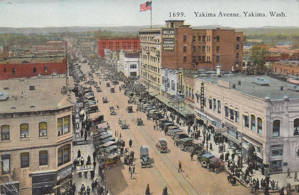
WA-171.2 Yakima
Yakima’s population is 25,000, has an altitude of 1,057 ft., and, is the chief city and trade center of the famous Yakima valley. From an area under cultivation of little less than 300,000 acres, the agricultural and horticultural products last year were $35,000,000. The city has wide, well-shaded streets connecting with hard surfaced roads. It is on the Yellowstone trail and Evergreen highway. The Yakima valley is irrigated practically its entire length. BB1921-9*
As the center of the Yakima Valley apple region, the city gives much publicity to the local apple. Hotels make lobby displays of the fruit, and guests are urged to send boxes of apples to friends. Apple juice cocktails are featured on dinner menus. WA-WPA*
∇
Historic Front St. District hosts a collection of nine buildings constructed between 1889 and 1914.
At 32 N Front St. is a 1912 Northern Pacific Depot. There is also the old Opera House in the District; defunct as an opera house, it now houses gift shops. Wineries, restaurants and a coffeehouse now enliven the District – much better than dereliction.
2105 Tieton Dr. Yakima Valley Museum. A modern, large building houses on two floors the history of the Yakima Valley. It provides new takes on old items. Also, native son Supreme Court Justice William O. Douglas is described as “controversial.” Old and musty it certainly is not. Of course, the orchard industry gets space.
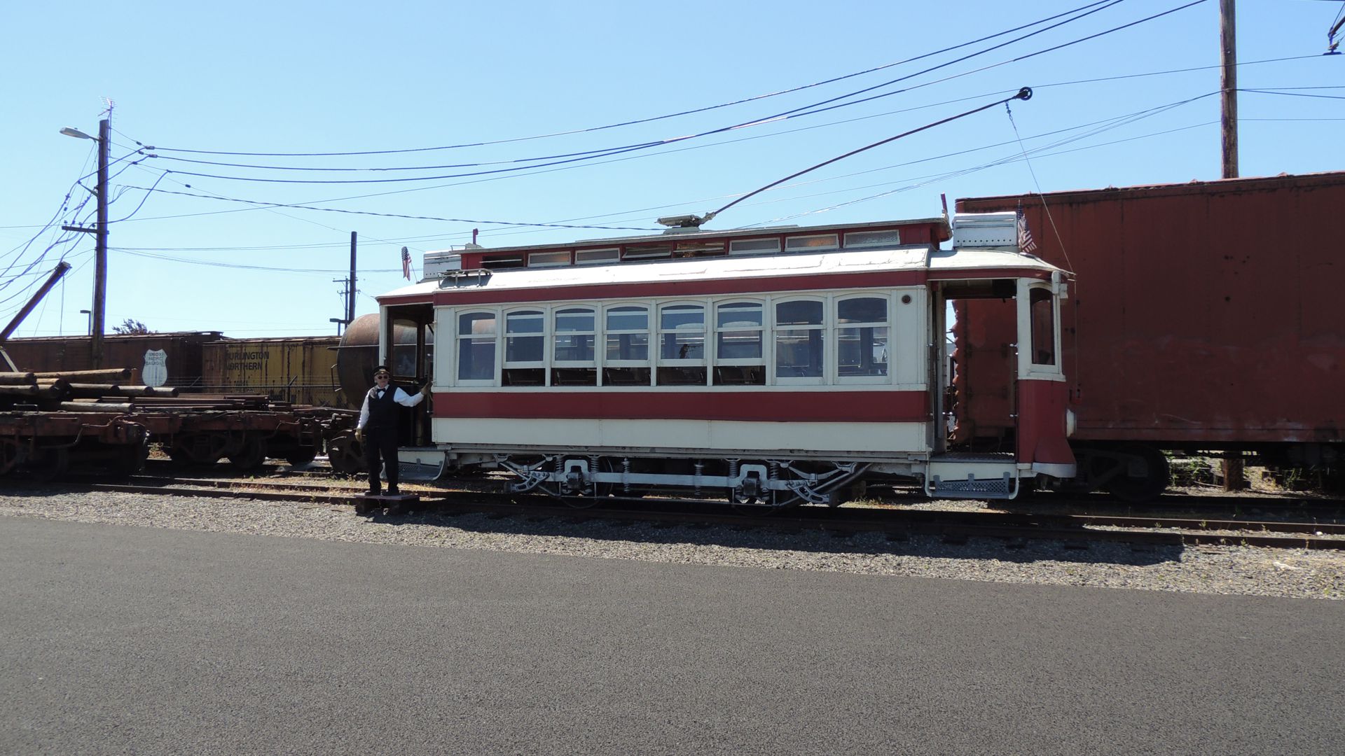
306 W Pine St. Yakima Electric Railway Museum is listed on the National Register of Historic Places because it is the last authentic, all-original, turn-of-the-century interurban electric railroad in the United States.
The Yakima Trolley is the remnant of a once-expansive interurban railway.
Presently, approximately five miles of track remain of the original 44, connecting the cities of Yakima and Selah. Electric trains have operated every year since 1907.
19 S 3rd St. Capitol Theatre. In 1920 the new theatre featured Vaudeville acts. The City of Yakima purchased the theatre in 1975, but a fire burned most of it. By 1978 donated funds restored the building to its original glory. Today the Capitol hosts an average of 175 events annually as a performing arts facility, including the Yakima Symphony Orchestra, Broadway musicals and a Town Hall series. You might meet “Sparky,” the resident ghost.
2008 S 16th Ave. at the airport. McAllister Museum of Aviation. This site is included because it was a school for pilots in the Yellowstone Trail days beginning in 1926, although it was just a pasture then. A woman pilot demonstrated flight there in 1913. Stroll about among the old planes.
308 E Yakima Ave. The Grand Hotel Apartments. Before it was The Grand it was the Commercial Hotel which had advertised widely by 1915. Well preserved today, it may have been a stop for Yellowstone Trail travelers 100 years ago.
4508 Main St. (Yellowstone Trail). Central Washington Agriculture Museum. This is not just a building but is also18 acres of outdoor space to wander among 140 tractors dating from the early 1900s and other old farm pieces. There is also a working windmill, a blacksmith shop and two log cabins. Its goal is to show visitors “what it used to take to feed America.” Go on a nice day. You might see a bit of Mount Adams and the tip of Mount Rainier.
WAYSIDE – At WA-191, turn south on WA 22 for 3 1/2 miles to Toppenish.
Things To Do In Toppenish:
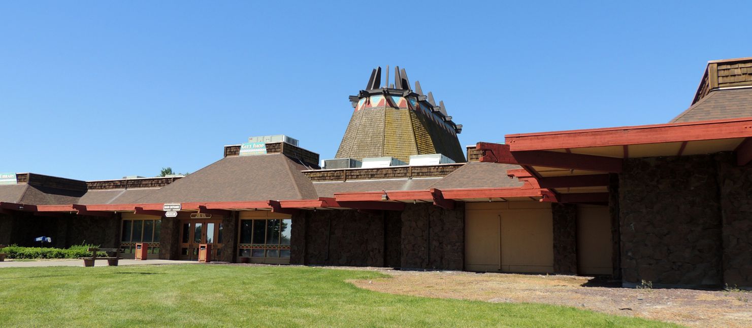
100 Spiel-yay Loop & Buster Rd. Yakima Nation Museum and Cultural Center. The unique building is shaped like a giant Native American winter lodge teepee. It towers and is visible from a long distance. The professionally done displays are very absorbing and sobering. They tell the visitors how they understand their history with focus on their culture and traditions.
22 S B St. Great American Hop Museum (as in the ingredient in beer). This is a small museum but very interesting. It’s all about hops, the history of the industry, and hop memorabilia. It even includes a short informative movie. Did you know that 75% of the hops used in making beer in the U.S. come from this area? We didn’t. We also didn’t know that this was the only hop museum in the U.S.
City of Murals. There are around 76 murals painted on businesses’ walls so far. Plaques tell what the murals represent, all within a time frame of 1850 to 1950. All mural ideas are vetted by a committee for accuracy. Known artists are invited to guarantee quality. They are a combination of cultural expression and history of the area. Be careful! Flat painted surfaces have three-dimensional detail so don’t try walking into them. You can stroll the town or take a horse-drawn carriage ride to see them.
10 Asotin Ave. Yakima Valley Rail & Steam Northern Pacific Railway Museum. This unique museum in a restored 1911 depot has a restored telegraph office and numerous displays about Pacific Northwest railroads and the Yakima Valley. Outside the depot are many pieces of Northern Pacific railroad rolling stock from cabooses to boxcars and a 1902 steam locomotive undergoing restoration.
1 S Elm. Toppenish Museum. Gold panning, wild horses and early day ranch life top the list of exhibits here.
211 S Toppenish Ave. Liberty Theatre. Built in 1915 as the Lois Theatre, it became the Liberty in 1927. Yellowstone Trail travelers would have seen Vaudeville, Chatauqua, and early “talkies” (movies). Note the nice paintings on the exterior. The horses were running freely then. From 1927 to 1984 movies were shown there. At this writing it was undergoing renovation.
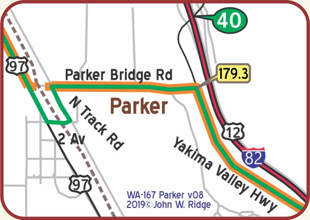
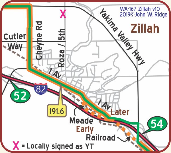 WA-191.6 Zillah
Check for Yellowstone Trail signs throughout the valley: Zillah has four.
1st Ave. GPS: 46.40467, -120.26955. Home of the Teapot Dome Filling Station, (see photos above) named after the historic oil-for-bribes scandal that brought down President Harding in the 1920s. In 1922 the filling station rested on the Yellowstone Trail (Yakima Valley Highway) at the edge of town, was moved once, then rescued from a near death experience and moved into Zillah to its present, pleasant site in 2012 and used as a travel information station. Learn all about it there.
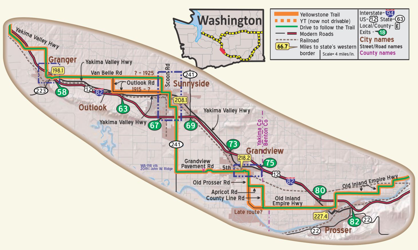
NOTE: In 1925 the Yellowstone Trail picked up its signs from its southern route and placed them on a northern route on “Sunset Highway” through improved Blewett Pass, shortening the route by 133 miles and leaving Grandview, the Zillah Teapot Dome gas station, and all of the southern and eastern towns.
Disappointed were many, including famed photographer Asahel Curtis, Grandview resident. The irony was that he was vice-president of the Yellowstone Trail Association at the time they voted on the move!
204 Cheyne Rd. There is a Christian Worship Center here. They have a large, humorous sign. It reads “Church of GodZillah.”
NOTE: WA-191.6: The YT probably followed Railroad St. in the south part of Zillah rather than 1st all the way (with two more RR crossings!). Follow Yakima Valley Highway out of town to get through the area of Exit 54 of I-82.

WA-198.1 Granger
Granger benefited from the Sunnyside Canal which diverted water from the Yakima River for irrigation to this arid land, turning it into lush agricultural and dairy land.
Granger picked the dinosaur as its “mascot” since mastodon tusks and teeth were found nearby in 1958. There are about 30 of the various fiberglass and cement critters here.
This has nothing to do with the history of the Yellowstone Trail except it explains the appearance of the many signs of creatures along the highway as you entered the town along the Trail.
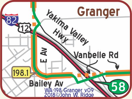 Note the six Yellowstone Trail signs in the community
celebrating the short distance the Trail occupied
in the town due to I-82 cutting it off.
The small community had a great
unveiling of the signs in 2015.
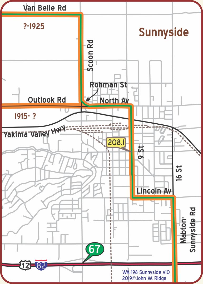
704 S 4th St. Sunnyside Historical Museum. The museum houses a permanent display of Native American artifacts and pioneer life, including an early cattleman’s cabin.
At the junction of Scoon Rd. and North Ave. is small, curved Rohman Dr. All are on the Yellowstone Trail and are marked with Trail signs.
In 1892 Walter Granger dug 25 miles of the Sunnyside Canal that brought water to the north slope and immigrant farmers to the valley and the towns of Sunnyside and Zillah sprang up.
WAYSIDE – 426 6th St., Sunnyside, is a large mural that memorializes the Yellowstone Trail.
After months of effort, a mural depicting the historic Yellowstone Trail has seen its completion. The mural was completed onsite during a celebration on Saturday, August 10.
This mural was hand-painted in 2024 and appeared on Page 14 of the latest Arrow publication.
Click here for a Sunnyside Sun article, with photos and more, about the mural (pictured below).
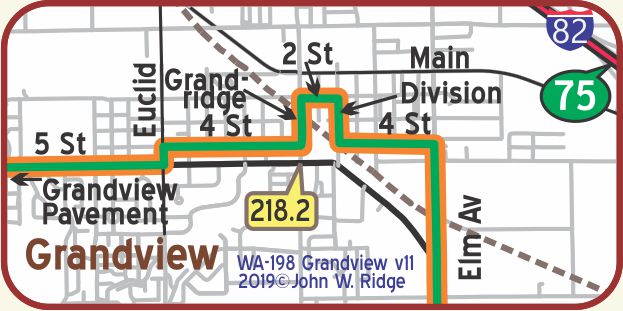
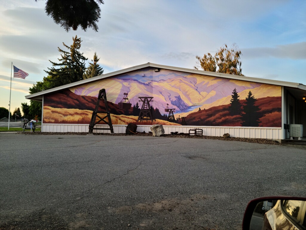
WA-218.2 Grandview
Named for its views of Mts. Rainier and Adams,
especially from the Grandview Pavement Road.
NOTE: WA-218.2: In Grandview,
the route of the YT is somewhat ambiguous, and the exact way the
YT crossed the railroad tracks (Division/4th/Birch) is open to question.
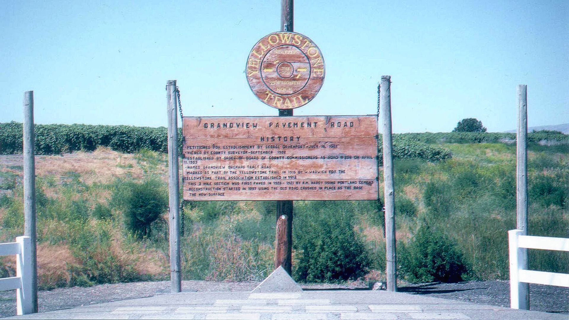
Of most interest to us is the Grandview Pavement Rd./Yellowstone Trail on the west side of town between Mabton-Sunnyside Rd. and Apple Way. This three mile stretch was, until 1997, the original pavement of the Yellowstone Trail with the 1921 stamp of the contractor. The road was narrow and bumpy, but it was on the National Register of Historic Places, the Washington Historical Register, the Washington Trust for Historic Preservation and beloved by the 49 families who lived on it and fought for years to retain the original.
The road passes very near the home of famed photographer Asahel Curtis, whose home is also a declared National Historic Site. In spite of all of its history and adjudged historic value by many groups, the road was not only not repaved, it was obliterated.
One of the original 1921 contractor’s stamps is at the Ray E. Powell Museum in Grandview. An “interpretive center” consisting of two wooden signs was placed along the Grandview Pavement Road. At this writing, a group is improving the marker site.
Pleasant Rd. and Old Prosser Rd. (Old Inland Empire Rd.). Cornell Farmstead round barn, 1916. Watch for signs of hops and apricots growing.
WA-227.4 Prosser
7th St. in Prosser City Park. Benton County Historical Museum. See an old general store, 1867 piano, homesteader’s shack, pictures of wild horses roaming in the pioneer era and other bits of history of the area.
The firmly established apple industry was joined by, and now surpassed by, grape-growing and the wine industry. Around Prosser alone there are upwards of 30 wineries. One hundred years ago Yellowstone Trail travelers would have seen agricultural advances due to irrigation, but no wineries. Prosser is also a cherry-growing district as evidenced by the Chukar Cherries shop.
 NOTE: WA-227.4 – 1916 American Blue Book* lists the non-Prosser route as an alternative to going through town, the northern route.
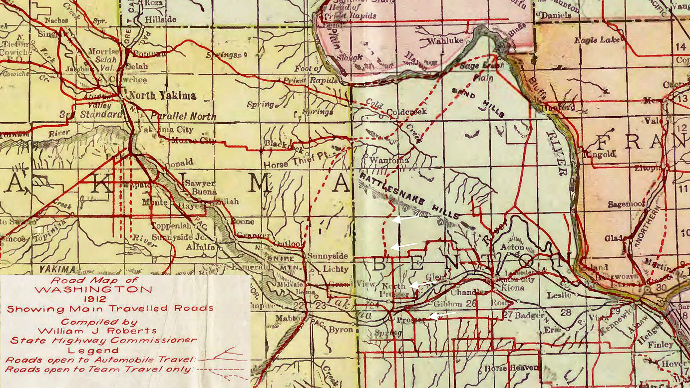
In a 1912 Washington State Map (see map above),
this northern route was listed as a wagon road (Horse Team Only), meaning non-auto.
White arrows on map indicate Prosser north route.
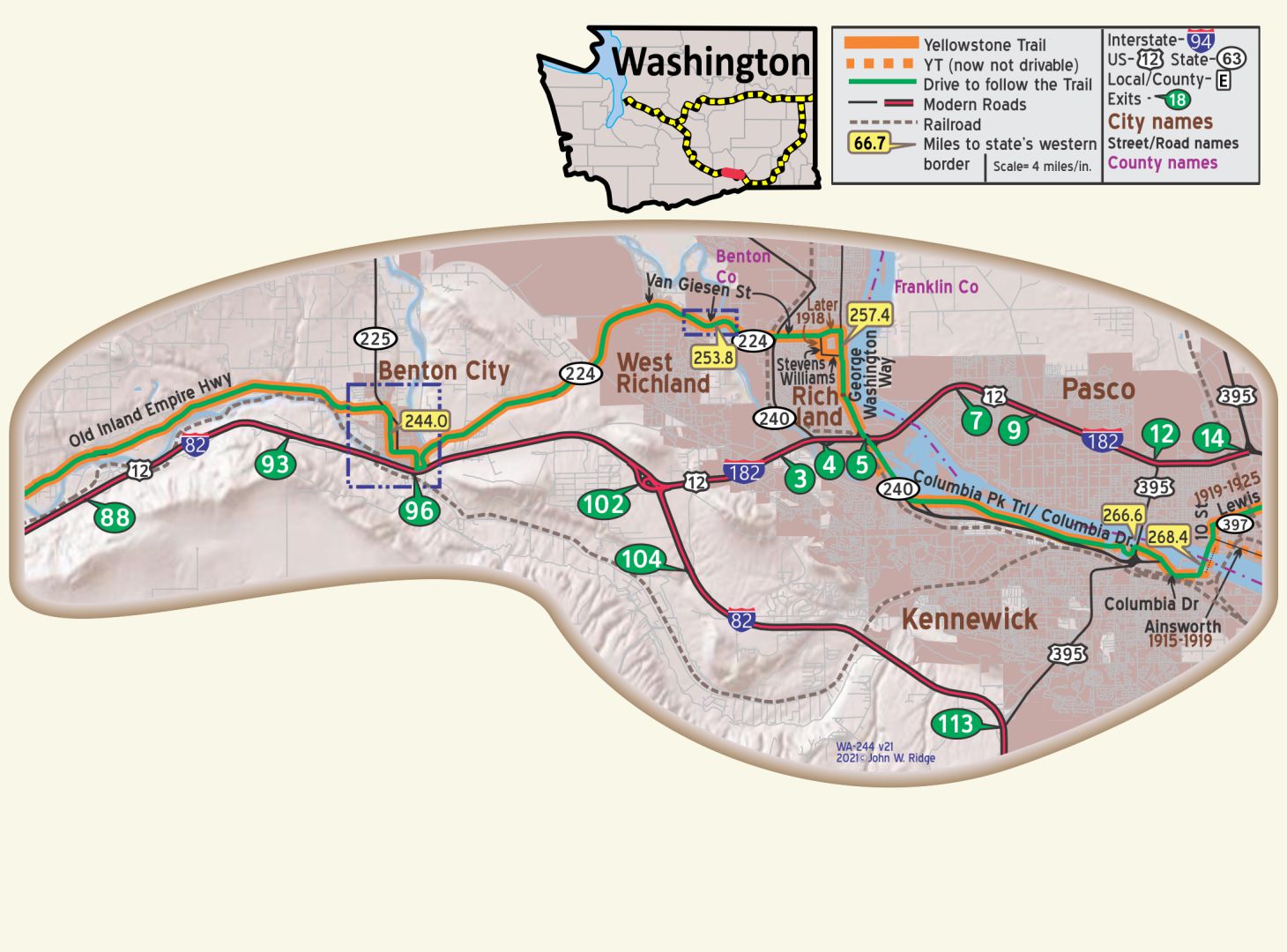
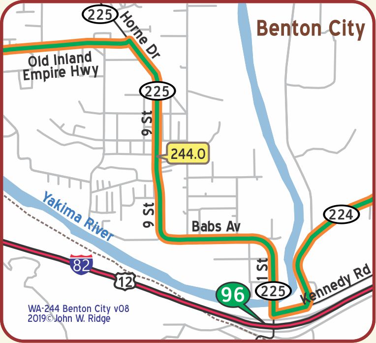 WA-244 Benton City
Benton City became a green spot in this arid area with the arrival of irrigation in the middle of the 20th century.
This, too, is definitely a part of the wine industry that includes other cities in the Yakima Valley, also the Tri-Cities of Pasco, Kennewick and Richland.
NOTE: WA-244.0: There are indications (like the 1924 Automobile Club of Washington strip map #19) that the route through Benton City was more zig-zag. This needs local research.
WA-245.3 Kiona
Kiona was an early Northern Pacific Railway maintenance station which allowed farmers to ship their many dry farming products.
In 1917 the Yellowstone Trail was routed through Kiona. Benton City grew up across the Yakima River and Kiona remains unincorporated.
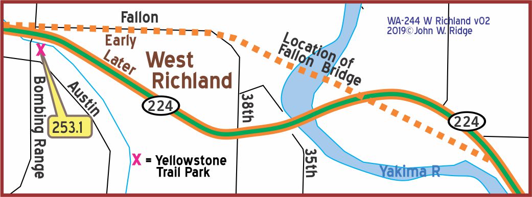 NOTE: WA-252.3 (With the new YT park at WA-253.0): A bridge in West Richland crosses the Yakima River at WA-253.8.
HistoryLink.org Essay 10441 says a bridge was built because school kids need to cross the river. “The bridge, built north of present-day Van Giesen Street, was christened and was used by the YT.”
So the YT probably followed Fallon Dr. from the west, and crossed the river. On the east side, Google Earth shows probable remains of a road south of the loop now made by WA-224. That is just east of the modern bridge.
WA-253.8 West Richland
Austin Rd. & Bombing Range Rd. Yellowstone Trail Park. You’d never know that this lovely community park is really a storm-drainage facility with five underground drainage tanks. It is now a community garden with donated, raised planters available for rent. Who knew that the Trail would one day see a useful, new life as host to colorful flowers and veggies.
WA-257.4 Richland
1943 Columbia Park Trail Hanford Reach Interpretive Center tells a wide ranging story of the Hanford nuclear center and the historical and cultural essence of the region.
It explores the atomic era and the effort behind the massive secret weapons project.
The Manhattan Project (1942-1947), Gallery 2, shows the timeline of the atomic bomb’s development here and the $40 billion environmental cleanup. The museum also features rotating displays of the Grand Coulee River and dam, irrigation projects, and the great Missoula Floods that shaped eastern Washington.
Gold Coast Historic District. Roughly bounded by Willis St., Davison Ave., Hunt Ave., and George Washington Way, this was the area in which scientists lived in government housing while they worked on the Manhattan Project Hanford unit nuclear site.
NOTE: The route through Richland is not well established and needs work; probably the route followed Barth Ave. in the south part of town.
From Richland and into Kennewick the route of the YT is obscured by the construction of modern highways, especially the 240 freeway.
While the Columba Park Trail along the Columbia River is a reasonable candidate for the original YT and seems consistent with several maps and BB* listings,…
Why is there a West Yellowstone Ave. just north of the railroad tracks a few blocks south of Columbia Park Trail? (Needs local research!)
WA-266.6 Kennewick
Kennewick’s population is about 2,700, and it’s altitude above sea level is 365 ft., is the largest town in Benton county, is situated on the Columbia river, and a camp site for tourists is maintained on the banks of this river within the city limits.
In the valleys around Kennewick were the winter camps of the Yakima, Snake and Walla Walla Indians. BB1921-9
Columbia Park Trail/Columbia Drive (Yellowstone Trail) is a lovely drive along the Columbia River.
The Historic Downtown area is between Kennewick Ave. and Canal Dr. and between Washington and Fruitland Sts. Historic buildings have been renovated and restored.
205 W Keewaydin Dr. East Benton County Historical Society Museum. Built in 1982 through local contributions, the museum features a remarkable, beautiful petrified wood floor. Notice the intricate and varied patterns in this astonishing gift. See also “the forces and movements that shaped the eastern part of Benton County: Indians, the Columbia River, transportation and agriculture,” says their exhibit.
The 1978 Ed Hendler Bridge, a beautiful cable bridge across the Columbia River between Kennewick and Pasco, now stands very near the site of the 1922 Yellowstone Trail bridge, or “Green Bridge” as it was affectionately called. It was finally taken down in 1990, much to the despair of the many who had waged a ferocious battle to preserve it for a walking bridge. The bridge you are on, the cable bridge, is lovely, but memories of the Yellowstone Trail Green Bridge near this very spot live on. There is a small display area near the Kennewick approach to the bridge which features an interpretive sign about the old Green Bridge.
Continue scrolling down for the entire story including photos of the river ferry the Green Bridge replaced.
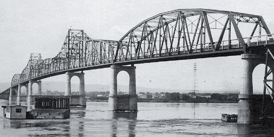
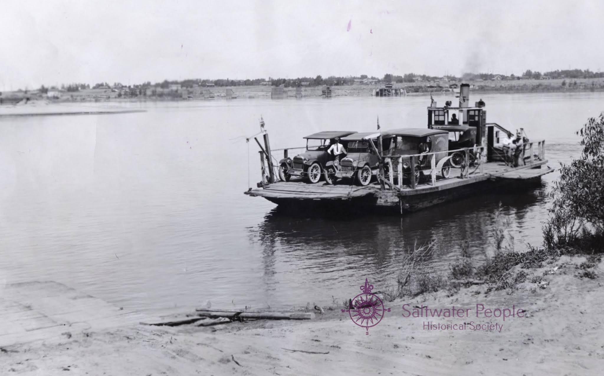
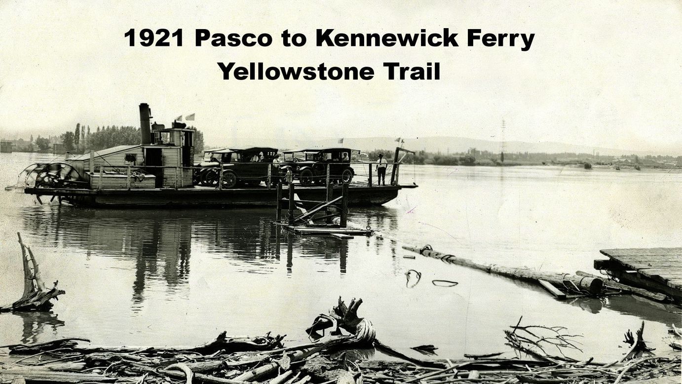
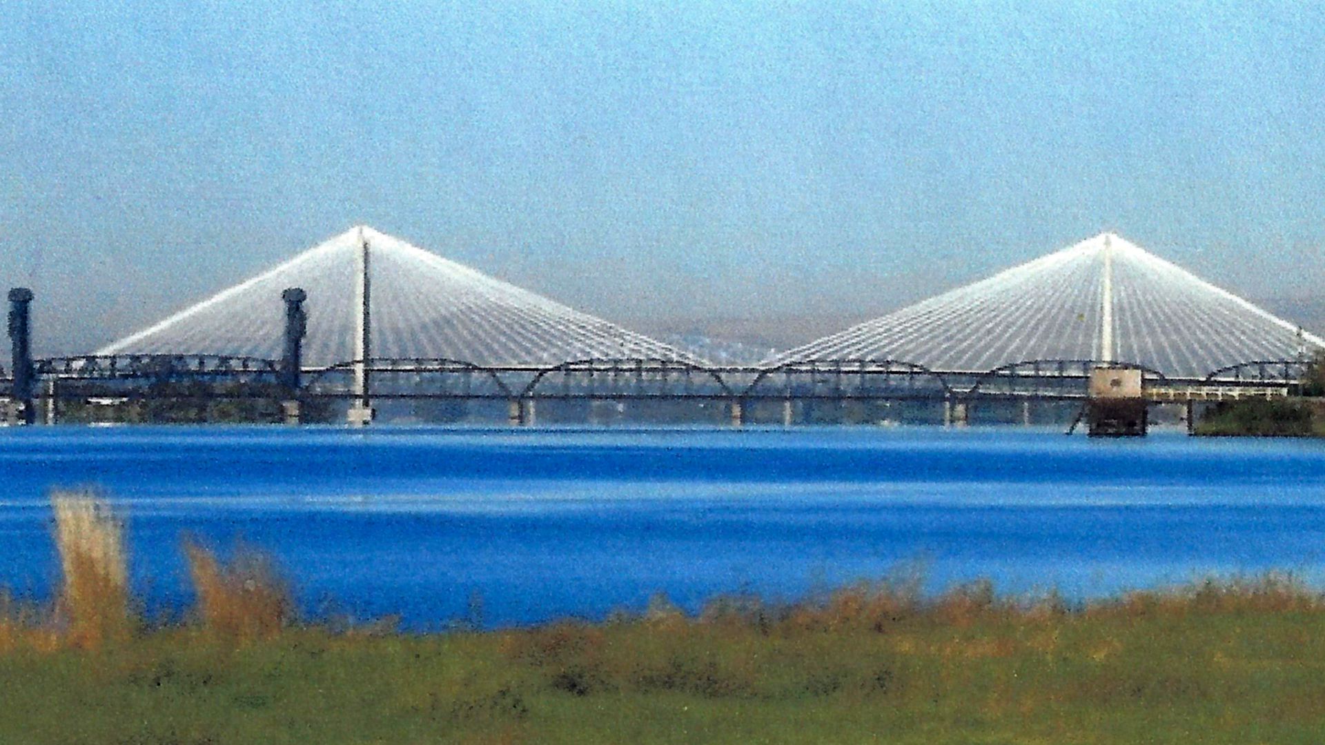
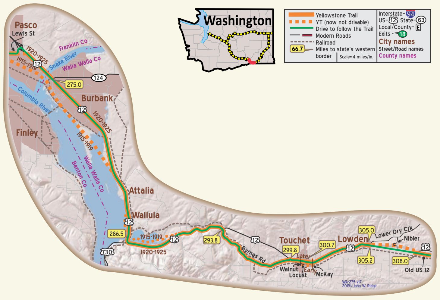
305 N 4th Ave., Franklin County Historical Society and Museum,
tells the story of transportation, agriculture locally, and, the loss of the famous
“Green Bridge” in the 1970s. (see photos right and above)
NOTE: Before the bridge over the Snake at Burbank was built in 1919 to replace the ferry, the YT apparently followed Ainsworth St. through Pasco.
The Historic Downtown District follows Lewis St. and Clark St. between Fourth and Tenth Aves. Pasco was long a transportation hub for railroads, river steamers and auto roads.
2503 Sacajawea Park Rd., Sacajawea State Park & Interpretive Center, is just a little south of the US 12 bridge across the Snake River.
The Yellowstone Trail was routed across the bridge’s predecessor.
Sacajawea Park was not there in Trail days, but you should see it at the confluence of the Snake and Columbia Rivers and refresh your knowledge of Lewis and Clark who camped there.
NOTE: Before the bridge over the Snake at Burbank was built in 1919 to replace the ferry, the YT apparently followed Ainsworth St. through Pasco.
WA-275.0 Burbank
The route of the Yellowstone Trail through Burbank is obscured by the changes made with the building of the 1919 Snake River bridge and the later flooding of the Columbia River because of the building of dams. The route between Burback and Wallula is substantially lost due to that flooding. The replacement route is assumed to be similar to today’s US 12 alignment.
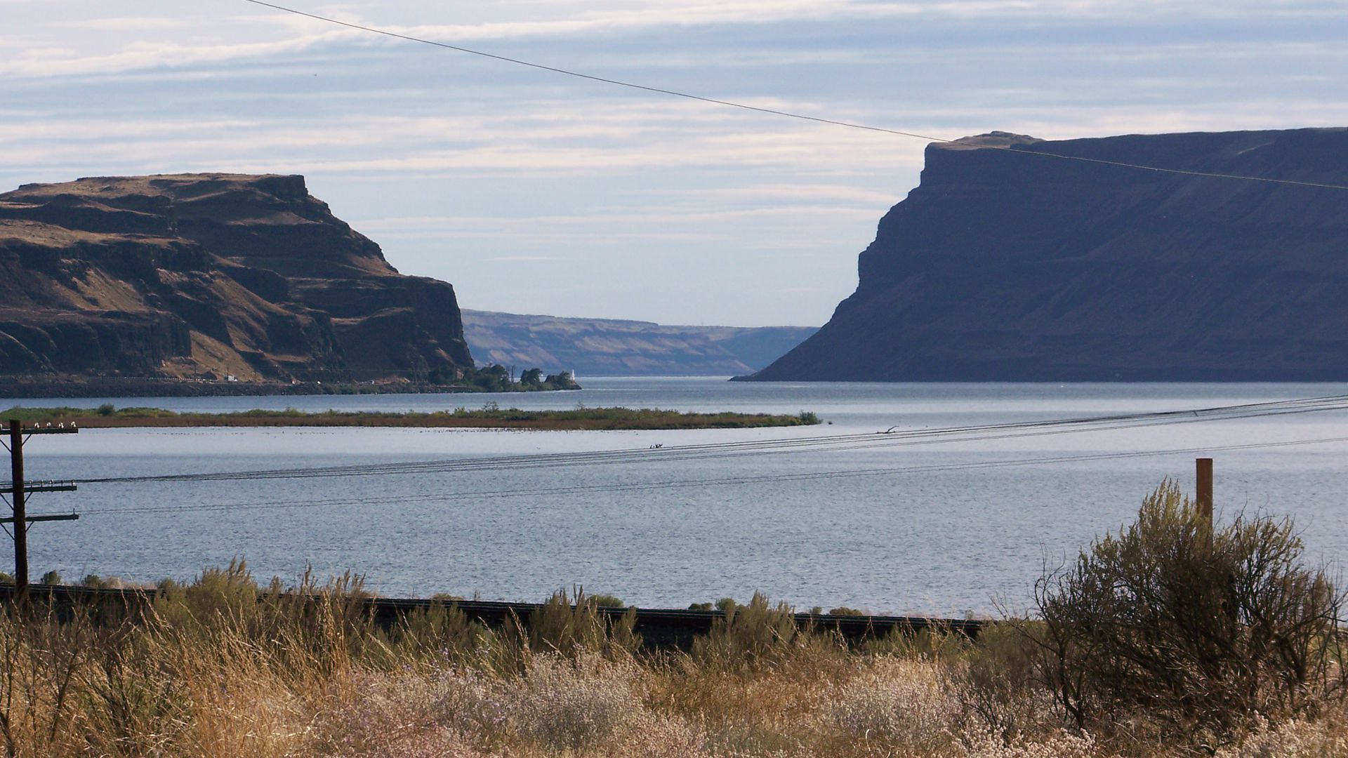
WA-286.5 Wallula
The first railroad to connect Walla Walla with the Columbia River at Wallula was begun in 1871 and it remained a “railroad town” until mid-20th century. The McNarey Dam and resulting Lake Wallula on the Columbia River drowned the town which packed up and moved two miles to higher ground as the dam was completed in 1954.
A later (1931) abandoned partial bridge can be seen, and driven to, about 350 feet east of the present US 12 bridge crossing the Walla Walla River just south of Wallula.
NOTE: A later (1931) abandoned partial bridge can be seen, and driven to, about 350 feet east of the present US 12 bridge crossing the Walla Walla River just south of Wallula.
WA-300.7 Touchet
The land between Pasco and WallaWalla is so much different from western, forested, mountainous Washington. Here we see dry sagebrush, treeless tracts reminiscent of the Palouse area further east. Vineyards and crops do well only because of heavy irrigation. Now one sees huge windmills powering the area, which looks like a 21st century forest.
NOTE: In Touchet [TouChee] apparently the YT crossed the tracks twice, at least in 1918, but many maps seem contradictory and inadequate here. Dams on the Snake River built in 1960s flooded old YT.
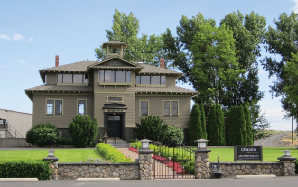
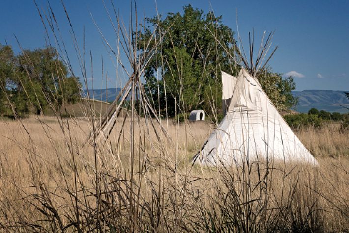 WA-308.6 Frenchtown Historic Site and Monument 8364 Old US 12.
If you want to learn more about Washington early history, keep your eyes open on Old Hwy 12 (Yellowstone Trail) for a series of markers documenting events. The monument is at St. Rose Cemetery and signs tell the story of the Battle of Frenchtown, 1855.
See History Bit “Frenchtown”.
L’Ecole Winery – former Monument site (photo above) – Dave Habura
Teepee at Frenchtown Monument site (photo above) – Dave Habura
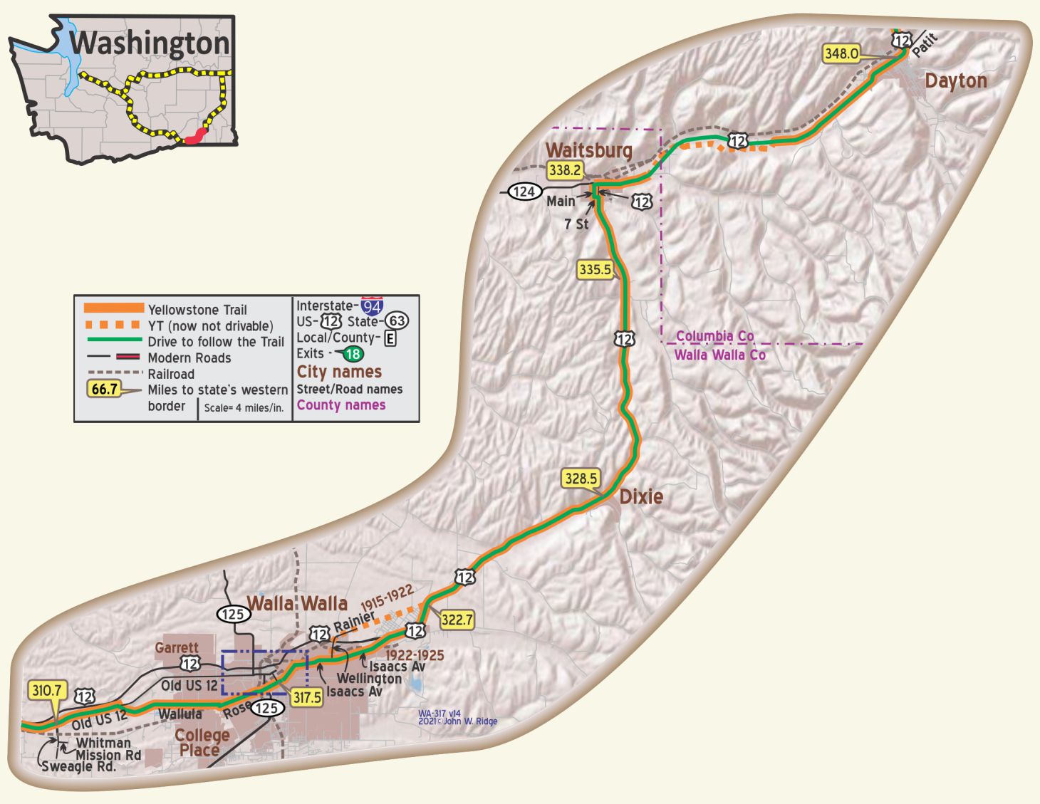
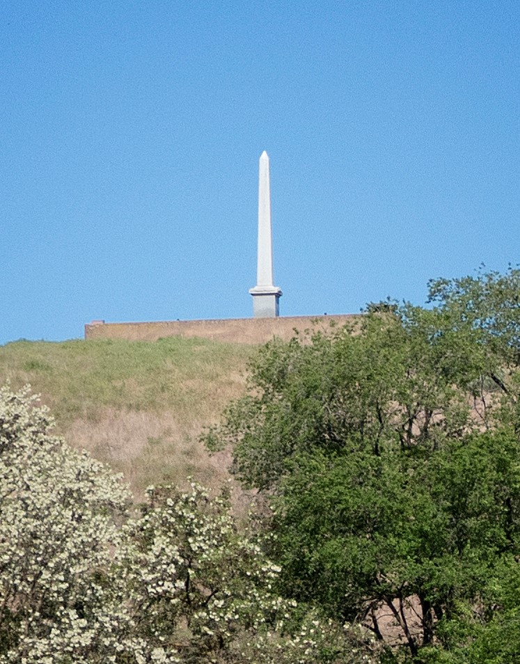
WA-310.7 Whitman Mission National Historic Site and Interpretive Center
328 Whitman Mission Rd. Turn south on Swegel Rd. Site of Dr. Marcus Whitman’s 1836 Methodist Mission and 1847 massacre, with his wife and others, by Cayuse Indians. The massacre was a poignant example of a clash of cultures and mistrust after 11 years of uneasy coexistence.
Traces of the Oregon Trail, which Whitman helped to establish, appear on the property.
The massacre shocked Congress into making Oregon a U.S. territory, an unintended consequence of the tragedy.
A monument marks the massacre site.
WA-311.5 The Oregon Trail and the Whitman Mission off Old US 12 at Sweagle Rd. to Whitman Mission Rd.
The Oregon Trail is a famous 2,170 mile path that emigrant settlers took to the Great West from Independence, Missouri, to Oregon City, Oregon. What may be less well known is that the Oregon Trail also had a spider web of alternative routes. As the trail developed, it became marked by numerous cutoffs and shortcuts.
The basic route follows river valleys as grass and water were absolutely necessary. Later, several feeder trails led across Kansas. Many settlers branched off or stopped short of the Oregon goal with their Prairie Schooners and settled at convenient or promising locations along the trail.
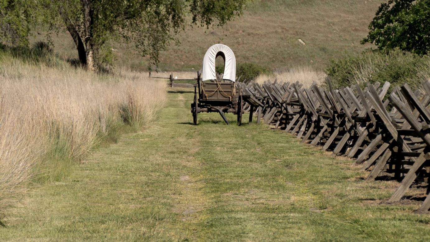
One of these alternate routes led through Dr. Marcus Whitman’s Methodist mission at Waiilatpu two miles east of Frenchtown amid the Cayuse. From Frenchtownwa.org we learn that “emigrants starting in the spring from Independence were able to reach the Whitmans’ mission by fall. After acquiring provisions at the mission, they followed the Walla Walla River to its mouth, then down the south bank of the Columbia River to the Willamette Valley. Many more emigrants followed in succeeding years through the Frenchtown Historic Site in the traditional homeland of the Cayuse Nation.”
The mission was an important stop for settlers, drawing large numbers of them. The Cayuse were suspicious of whites and especially so of their ever-increasing numbers. Dr. Whitman had tried to lessen that suspicion by learning their language, by teaching them to farm and by aiding them during a measles epidemic, fatal to half the local tribe. Sadly, the Whitmans and others were massacred in 1847.
The alternate Oregon Trail runs parallel with and right next to Whitman Mission Rd. as you approach the visitors center. Other remnants of the trail are visible on the property. •
South of WA-315.8 – 755 NE Myra Rd. is Fort Walla Walla, now a fine museum.
It is a terminus of the Mullan Military Road, an important factor in Yellowstone Trail history.
See Trail Tale: Mullan Road.
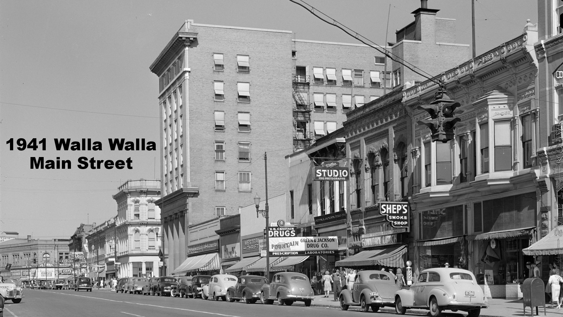
 WA-317.5 Walla Walla
Walla Walla’s population is about 15,000, is the county seat of Walla Walla county, and, is surrounded by one of the richest agricultural and horticultural sections of the northwest.
The old military post, Fort Walla Walla is located here.
Six miles west of town, erected on a spot where Marcus Whitman and his associates were massacred by the Indians in 1847, stands the Whitman Monument. Wildwood park, a camp ground, is located in the heart of the residence district. It offers accommodations for about 100 machines and is equipped with all amenities. BB1921-9*
 Walla Walla served as the regional economic center for several decades, being the major grain producer it continues. Today, it also sports more than 60 wineries, has restored the charming historic buildings on Main St., sports greenery everywhere and hosts a very sophisticated and alive place. Walla Walla also has 24 historic houses of late 1800s and early 1900s.
SW corner of 4th and Main Sts. Dacres Hotel. Opened in 1899, James Dacres erected a “first-class” hotel which was advertised as “one of the most up-to-date and finest hotels in the country.” The Dacres Hotel remained in business until 1963. Currently, the building houses Main Street Studios which features lively musical events. It was added to the National Register of Historic Places.
6 W Rose St. (Yellowstone Trail) Marcus Whitman Hotel & Conference Center. This 1928 hotel has been the pride of Walla Walla since it was built, causing a city ordinance to declare that no building could be built higher than the hotel. The ordinance is still in force today. From the 1970s to 1990s the hotel was used for subsistence housing, thereafter receiving restoration to its former glory. Some pieces of the original hotel are still displayed such as fine wood paneling and trim and the old boxes for room keys, a clock and phone booths (remember those?). The original lobby terrazzo floor has been restored. Just walk in and look around to see what later Yellowstone Trail travelers enjoyed.
755 NE Myra Rd. Fort Walla Walla Museum. The first Fort Walla Walla was operated from 1856 to 1910, comprising 1,280 acres of fort, farm and forest. In 1917, the fort trained men for World War I. In 1921, the fort and property were deeded to the Veterans Administration where 15 original buildings from the military era remain. Today, the complex contains a park, a museum, and a VA Medical Center. The museum offers living history performances each season.
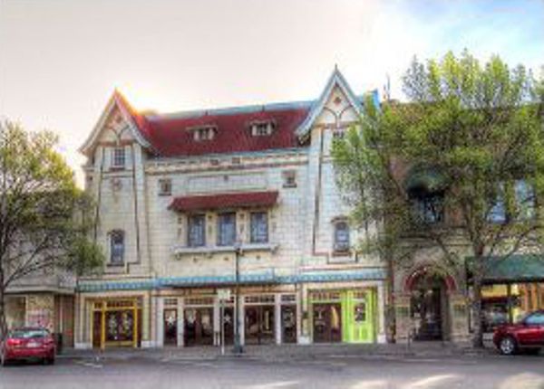
54 E. Main St. (Yellowstone Trail).American Theater 1917-1926 then changed ownership and was called the Liberty. Now it is part of Macy’s store with the inclined theater floor leveled. The theater once boasted a gigantic Wurlitzer organ to accompany the silent films or serve visiting performers with its thunderous power. The decorative Dutch exterior seems somehow out of place.
111 N 6th Ave. The historic Gesa Power House Theatre. The 120-year-old building was once the Walla Walla Gas Plant, built to produce coal gas and pipe it underground to light Walla Walla. The building was converted to generate electricity around 1905. In 2011, the interior of the building was transformed into a state-of-the-art performing arts theater. The interior design was inspired by the intimacy of Shakespear’s Blackfriars Theatre. Plays and musical entertainments are featured now.
416 N 2nd Ave. Northern Pacific Railway Passenger Depot (1914) on the northern edge of the business district. The red brick structure offered the usual services – ticket office, separate men’s and women’s waiting rooms, freight office. The building also featured a dramatic square tower that served as a visual landmark and an observation deck for the rail yards. Remodeled in 1931, the square tower was retained. Passenger service ended in 1956 and freight service was discontinued in the mid-1980s. In 1988, the building was rehabilitated and became The Depot with restaurant and shops. It is on the National Register of Historic Places.
214 N Colville St. Kirkman House Museum. One of Walla Walla’s grandest mansions-turned-museum was saved from further deterioration and destruction in 1974 and was restored to its original 1880 Victorian glory. It reflects the life of a self-made wealthy man who was also civic-minded. The home shares stories of the early days of Walla Walla through exhibits, programs and events. The home, furnished with family and period pieces, illustrates daily Victorian life.
55 W Cherry St. Whitehouse-Crawford Restaurant. Somewhat pricey, but it is housed in a remodeled 1904 sawmill and the food gets rave reviews. Why not go and enjoy the architecture that Yellowstone Trail travelers may have seen?
________________________
NOTE: Entering Walla Walla from the west, the IEH, and thus the YT, followed Wallula Ave. and Rose St. The date of Old US 12 in this area is unknown to the writer but probably after 1925 so the YT never followed it.
NOTE: WA-317.5 – East from Walla Walla, the YT appears to have followed Issacs Ave., to modern US 12 after about 1922.
Before that it used the Wellington/Rainier route extended through the area of the modern airport to WA-322.7 at US 12.
IMPORTANT: Rainier dead-ends at the airport, and you will need to turn around to exit.
Walla Walla Banks at 2nd and Main are listed in 1918 BB*.
NOTE: WA-335.5 – About here the old alignment (1919 USGS) can be seen just west of the modern highway on aerial views.
________________________
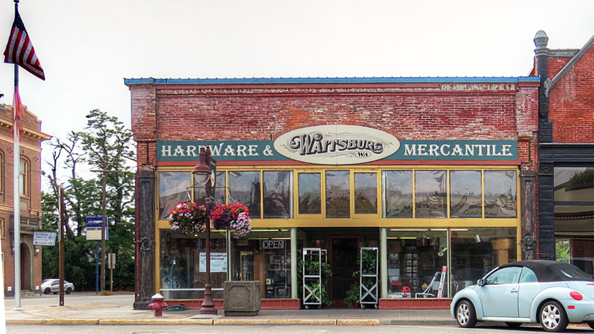
WA-338.2 Waitsburg
(pop. 1,400, alt. 1,268 ft.), is one of the oldest towns in the state of Washington, being founded in 1862. Eighteen miles southeast is the site of old Fort Walla Walla, which was manned by regular troops in the early days and was a source of refuge from the Indians for the pioneers. BB1921-9*
Territorial Charter required an annual Fall Festival to relive historic demonstrations of churning butter, making candles, sewing sacks for wheat. The area is characterized by loess covering lava, low rolling hills and wheat fields.
132-134 Main St. (Yellowstone Trail). J. W. Morgan Bldg. and Waitsburg Hardware and Mercantile seem to be all of a piece, pressed together. However, only the Morgan building is dated – 1892. The adjacent hardware store is going strong. The historic J. W. Morgan building is a primary structure in the Historic District. The trim is cast iron and pressed metal. Yellowstone Trail writer David Habura says that that cast iron store front trim by Mesker Brothers was popular in the late 1800s and early 1900s. There are four such decorated store fronts in Waitsburg.
330 Main St. Bruce Memorial Museum. Built in1883 in the Victorian style, the home was saved in 1971 and completely restored and furnished by the Waitsburg Historical Society.
208 Main St. Plaza Theatre. Although it has been closed for several years, one can drive by this historic 1928 movie theater in the Historic District and appreciate its Moorish style, a two-story structure with gray and red brick trim. By 1928 “talkies” were the thing, but there still was the big Wurlitzer organ there.
WA-348.0 Dayton
Main street in Dayton runs along the line of the old Indian trails leading from the Mexican border to British Columbia. In1806 Lewis and Clark on their return trip passed thru what is now the town of Dayton followed by Capt. Bonneville in 1834, and in 1836 the missionaries, Dr.Whitman and Mr. and Mrs. Spaulding. BB1921-9*
There are many excellent fishing streams and camping sites in this vicinity. The town maintains a tourist park, in which is built a large concrete swimming tank. The widely advertised “Skookum” brand of apples are raised here in abundance. BB1921-9*
The Palouse is a huge area of fertile countryside and ancient silt dunes, one result of the massive, ancient Missoula Floods.
It is mainly wheat-growing today.
Downtown Dayton’s Historic District is roughly along Main St. (Yellowstone Trail) from Front to Third St. In all, there are 117 Dayton buildings on the National Register of Historic Places. Self-guided tour brochures are available at the Depot and the Dayton Chamber of Commerce.
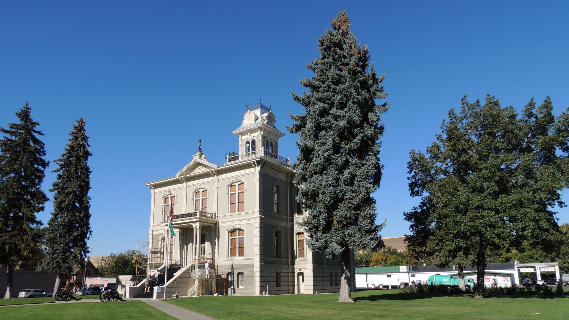
341 E Main St. The Columbia County Courthouse (1887) is the oldest working courthouse in the state. It is a unique building with a large, ornate cupola.
426 E Main St. Palus Artifact Museum. The Palus Artifact Museum offers a collection of locally found artifacts from the Palouse tribe which tells their story. There is also a beautiful collection of native plants.
235 E Main St. Weinhard Hotel. Jacob Weinhard arrived in Dayton in 1880 and began building his local empire of brewery, malt house, beer garden and his Weinhard Hotel building to house the Weinhard Lodge Hall & Saloon. Then, in 1904 came his opera house/movie theater and his large Victorian home. ~ When the Weinhard Hotel was re-created in 1994, the elements of the lodge hall were used throughout, such as wainscoting, doors, moldings and hardware, thus retaining the architectural heritage of the building. Their website says that “Each guest has the comforts of the twenty-first century while at the same time experiencing the flavors of the past.”
344 E Main St. The Liberty Theater. The Dreamland Theater first opened in 1910 and changed its name to the Liberty in 1917. Fire burned the building in 1919, but the theater reopened in 1921. Later, the Liberty brought “talkies” to Dayton where films were shown until the 1970s. For almost 30 years the building was unused, then in 2001 it was renovated and reopened to show first run movies, and host live performances and community events.
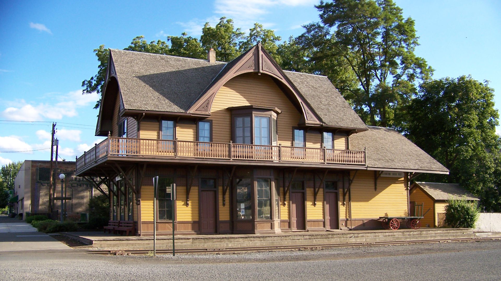
222 E Commercial. Dayton Historic Depot. Built in1882 and used until 1971, it is the oldest Union Pacific Railroad station in Washington. Now an education and interpretation center and museum of local history, it is on the National Register of Historic Places.
410 N 1st St. Boldman House Museum. The house was built in 1883, enlarged in 1891 and again c.1909. It was continuously lived in by its various owners, the last family for 87 years. In 1999 Miss Gladys Boldman’s will directed the Dayton Historical Society to restore her family home to its original (1912) condition, and that it become a community resource and educational “showplace”. The website says that, “Because everything in the house belonged to this one family of savers, these artifacts give us a unique and detailed history of a family and how they lived and interacted with the community and changing times.”
NOTE: WA-338.2 – Just east of Waitsburg WA-339.7 to 340.5, roughly, the original YT (Sunset Highway) alignment was apparently converted to an irrigation ditch. Throughout this area, for which good USGS maps exist, it is apparent that over the years the original alignment was straightened and the curves smoothed, leaving little evidence of the past.
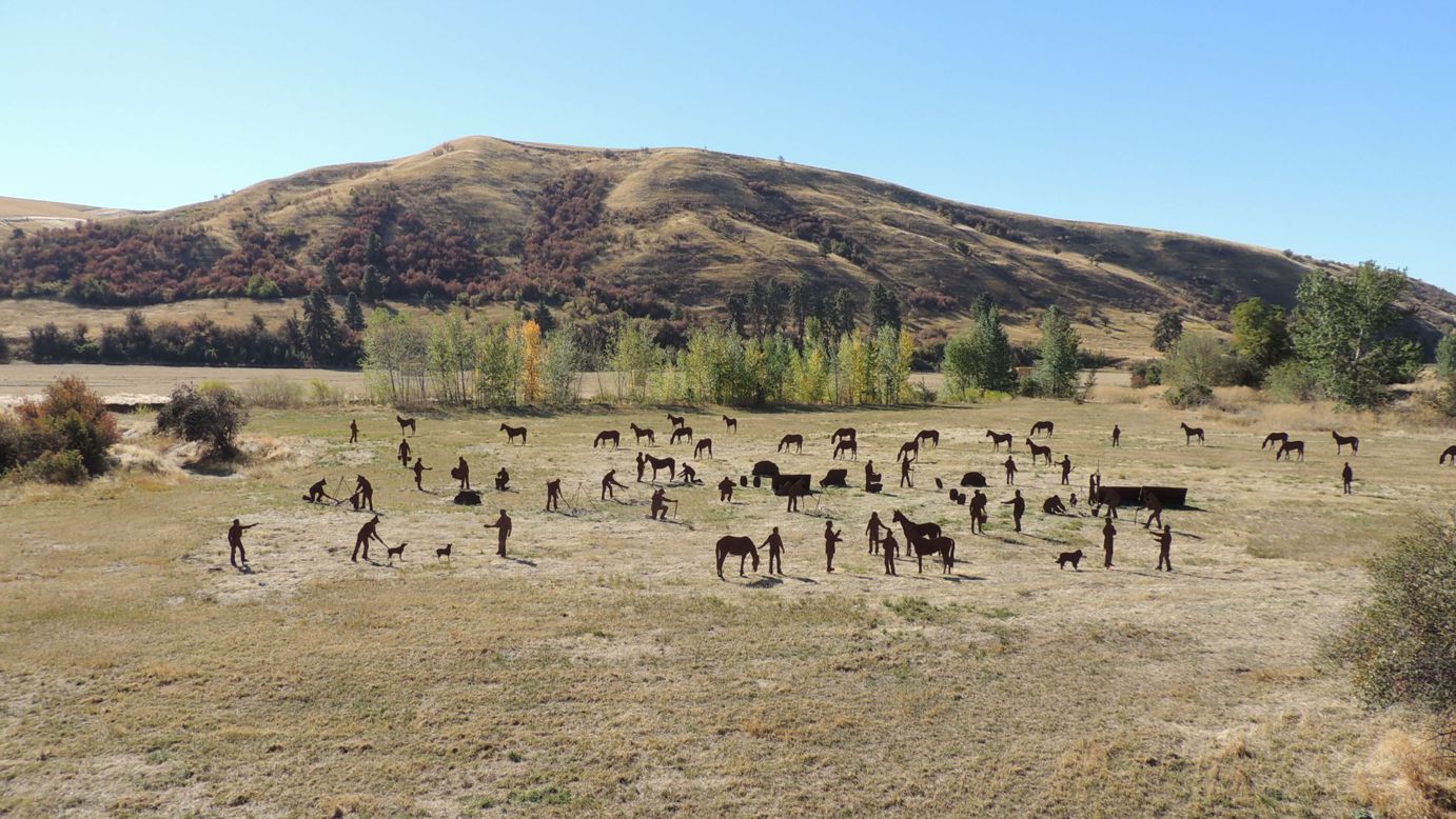
WAYSIDE – 2.5 miles northeast of Dayton on Patit Rd. is a most amazing display. There you will find 80 life-sized steel silhouette sculptures depicting a typical Lewis & Clark encampment.
The citizens of Dayton created this tableau as part of the Lewis and Clark Bicentennial.
In May of 1806 Lewis and Clark passed through what became Dayton. The layout is a re-creation of the camp based partially upon Lewis and Clark journals.
Envisioned by Dayton resident George Touchette, approved by the Washington Lewis and Clark Bicentennial Commission, supported by the Washington State Historical Society, and cast by the Northwest Art Casting in Umapine, OR.
WAYSIDE – Pomeroy has a valid claim to have been on the Yellowstone Trail; the 1917 Yellowstone Trail Association Folder clearly so states. Yet the “official” words, in 1915, from Parmley put the Yellowstone Trail on the IEH which “officially” went through Central Ferry. However, in practice that road through Central Ferry was not usable till later and both practice and Yellowstone Trail Association maps had it using the Penawawa Ferry or the Almota Ferry. A modern denizen of Pomeroy believes the Yellowstone Trail followed the Lower Deadman Rd. to Penawawa Ferry. See the Introduction to this Washington Chapter for more information.
So, explore downtown Pomeroy’s Historic District which is listed on the National Register of Historic Places. Look up and notice the plethora of antique neon signs sprinkled about on buildings, the collection of Dave Webb. The Sacramento (CA) Union-Bulletin reports:
Webb, one of the world’s greatest collectors of chemically-induced commercial lighting, is adding the Fun Center sign to his Pomeroy City Walk in Pomeroy, Washington, a grand concourse of neon signs from around the globe. Webb’s goal is simple, to hang a restored neon sign on every building in town that wants one.
See Webb’s incredible sign museum (if he is home when you visit). Try the Garfield County Museum to find Dave.
708 Columbia St. Garfield County Museum. It was a long time acomin’ from the first idea of 1901 to the 1972 building completion. Historic county and local items are displayed. Ask to see their glass collection.
67 7th St. Seeley Theatre. As is true with many restoration and rejuvenation projects of century-old buildings, finding funds is difficult. That seems to be so with this theatre. However, they are soldiering on, at this writing showing popular films on weekends. The website called her “a lady of distinction.” If you pass through on a weekend, stop and see what’s showing.
WAYSIDE Pomeroy End
________________________
NOTES:
- To add to the confusion, the Almota Ferry route is shown in 1919 BB* Western, including Mayview, as the route of the YT.
Other indications suggest the Penawawa ferry route and the Almota ferry route were equally useful during the years 1915 through 1918. - The Dusty/Central Ferry/Dodge route was designated to be the IHE from 1915, but was not as drivable as either the Penawawa ferry or the Almota ferry routes until probably 1918.
- 1918 American Blue Book (BB)* Vol 9: Via Rosalia, Colfax, Penawawa Ferry and Dayton.
Gravel highway to Colfax; dirt and gravel to Snake River; Poor road to Dayton; balance of the way gravel.
The Central Ferry route [through Dusty] will ultimately become the improved highway, but until completion of same the Penawawa Ferry offers a better way, being about five miles shorter and with equal road conditions. This is a section of the YT which leads through the immense wheat belt of eastern Washington. This section of the Palouse Highway offers a good option between Spokane and Rosalia.
________________________
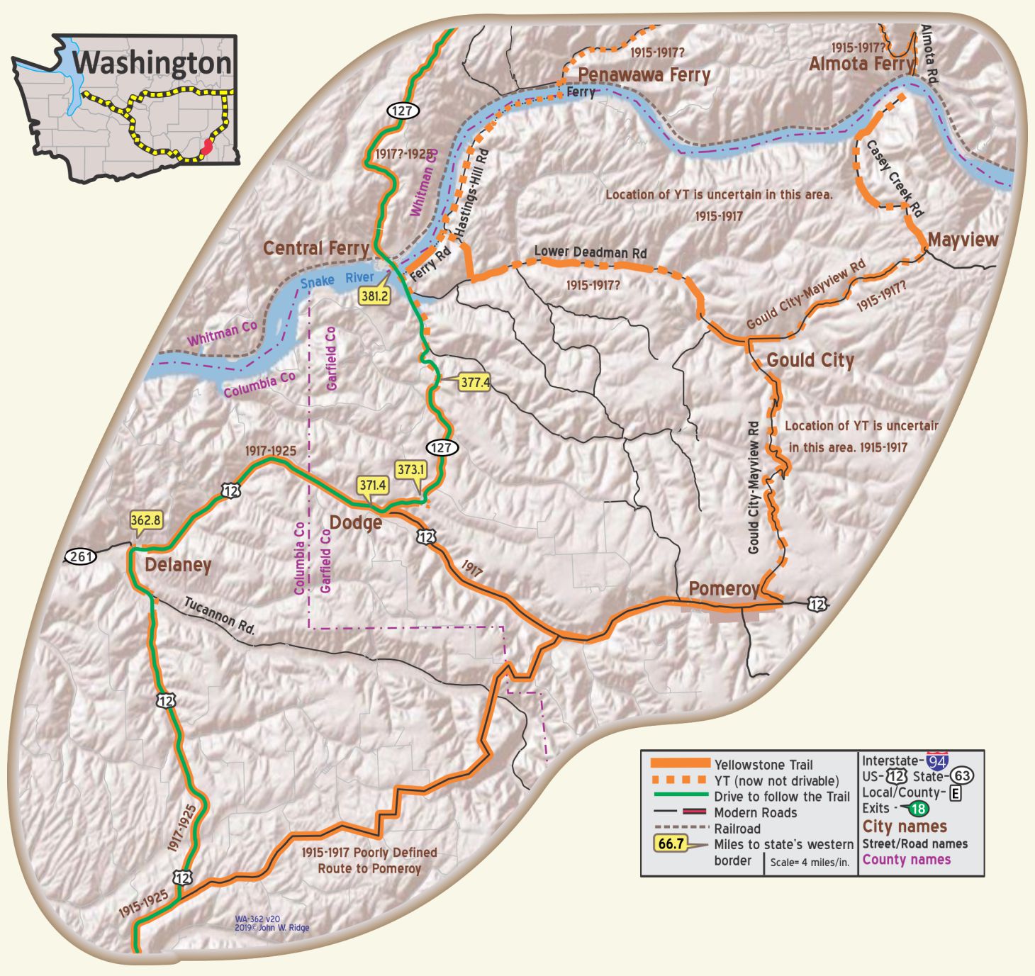
WA-362.8 Delany
East of Delany, the YT was just north of an abandoned railroad just north of modern US 12.
Just south of Delany, an abandoned bridge over Tucannon River can be seen to the east. A new existing one was built in 1967.
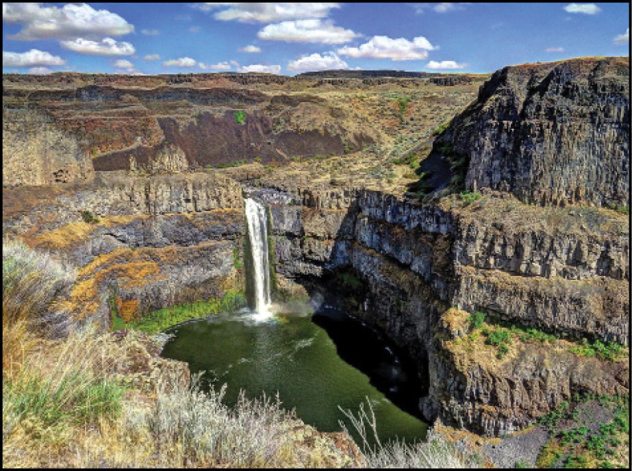 WAYSIDE – Palouse Falls is an incredible sight worth the short side-trip. See picture.
Water emerges from the channeled scablands left by the Missoula Floods at the end of the Ice Age and cascades 198 feet onto a solid basaltic rock canyon.
23 miles from Delany (WA-362.8) follow WA 261 west and north for less than 21 miles to the entrance to Palouse Falls State Park and about two miles into the park.
The scablands themselves were created by an unimaginable force. As Cassandra Tate describes the events in Ice Age Floods in Washington (HistoryLink.org, Essay 8449), “The sound of the great Ice Age Floods would have been terrifying: some 530 cubic miles of water bursting through a wall of ice more than 2,000 feet high; roaring over Eastern Washington with speeds of up to 80 miles an hour; drilling deep crevices into ancient basalt; stripping away topsoil in some areas, piling it up in others; flinging boulders around like ping pong balls. The flood waters pounded down the Columbia Gorge and into the Pacific with enough force to dig channels into the ocean floor.” Gives one a whole new perspective of these windy, almost-lonely scablands.
WA-371.4 Dodge
The modern road is considerably “smoothed” compared to the YT between WA-372-374. At WA-373.1, the original loop south of the modern highway can be seen from several perspectives.
- There existed a road along the Snake River on the south side which carried the traffic from south of Central Ferry to the Penawawa Ferry landing across from Penawawa. It is now under water.
- 1916 BB* v5, Western Edition, has a highway avoiding Penawawa and going to Central Ferry via Dusty. This is the route not listed by the YTA as the YT until 1917.
- Between about WA-377 and the Snake River, (WA-381.2) there are many changes in the alignment of the road in order to smooth curves and to accommodate the higher water level of the now dammed river. Aerial views of the area clearly show some of the old alignments.
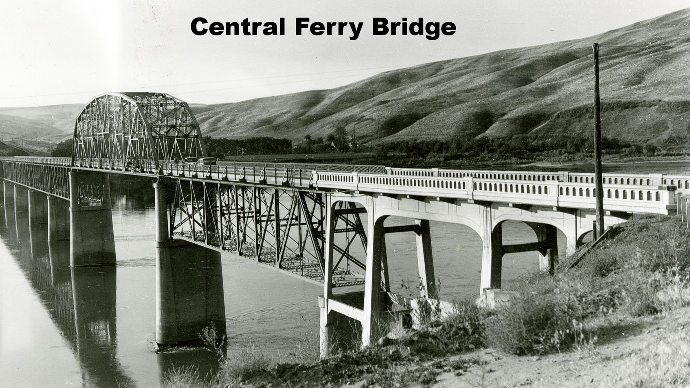
The SNAKE RIVER BRIDGE, a steel span, straddles the river, which is very wide at this point.
For many years prior to the completion of the bridge, a ferry operated by Robert L. Young, connected Whitman and Garfield Counties. WPA-WA*
NOTE: WA-371.4 – The modern road is considerably “smoothed” compared to the YT between WA-372-374. At WA-373.1, the original loop south of the modern highway can be seen from several perspectives.
NOTE: WA-381.2 – There was a bridge built here in 1924 to replace the ferry. Present bridge (longer because of dams) was built in 1969.
- There existed a road along the Snake River on the south side which carried the traffic from south of Central Ferry to the Penawawa Ferry landing across from Penawawa. It is now under water.
- 1916 BB v5, Western Edition, has a highway avoiding Penawawa and going to Central Ferry via Dusty. This is the route not listed by the YTA as the YT until 1917.
- Between about WA-377 and the Snake River, (WA-381.2) there are many changes in the alignment of the road in order to smooth curves and to accommodate the higher water level of the now dammed river. Aerial views of the area clearly show some of the old alignments.
WA-398.2 Dusty
This very small hamlet is located on the Palouse Scenic Byway. Although the Palouse Scenic Byway runs circuitously from near Lewiston in the south to Rockford near Spokane Valley in the north, it also comprises an east-west and parallel leg which includes the Yellowstone Trail towns of Colfax, Steptoe, and Rosalia. “This is a geologically rich area which includes touches of history, tales that have withstood time, and the absolute beauty and bounty of the Palouse” says their website. Undulating hills and sculptured landscapes are scenes for 208 miles of this meandering Byway.
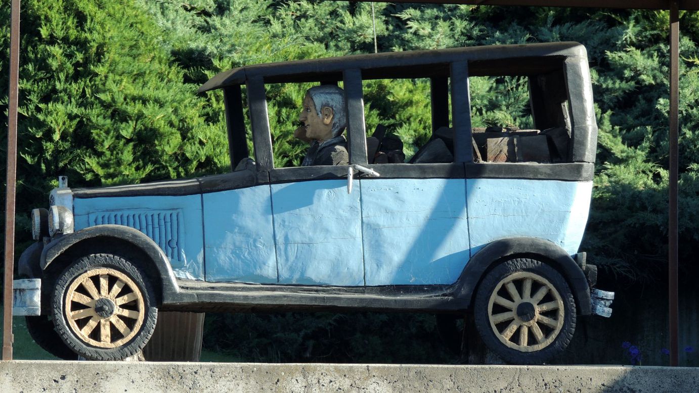
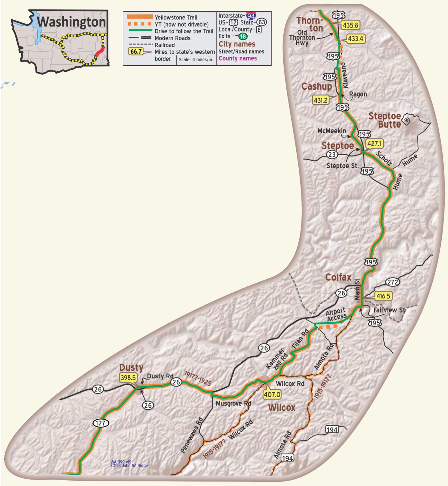 WA-416.5 Colfax
(pop. 3,000, alt. 1,974 ft.), county seat of Whitman county, is a thriving little city situated in one of the richest wheat districts of the U. S. Near Colfax is the historical Steptoe Butte named for Col. Steptoe, who battled with the Indians about 1855. While the battle was not fought just at this point, this treeless butte was named in memory of the hero. It can be seen by the auto tourist for many miles. BB1921-9*
(1,966 alt., 2,853 pop.), seat of Whitman County, spreads along both sides of the Palouse River. Hemming in the town are rounded hills, now largely given over to wheat growing. Main Street, nearly a mile in length, parallels the river, which occasionally goes on a rampage, and floods the lower levels of the town. WPA-WA*
You are in the heart of Palouse country here. The steep, fertile, rolling hills define the unique region known as the Palouse. Steady winds blew sand here eons ago, and still do, leaving the mounds of earth you see around you. The agencies for land formation were wind and waves of the Missoula Floods. Colfax is a nice looking town, hilly, with a “concrete river” for flood control.
Perkins Ave. north end of town. Perkins House, a restored 1884 Victorian house, is named for the town’s founder, James Perkins. His log cabin is on the grounds along with the comical “codger pole” dedicated to old football players in a contested game, but you have to look hard – so much greenery around. It is on the National Register of Historic Places. Other historic buildings line Main St.
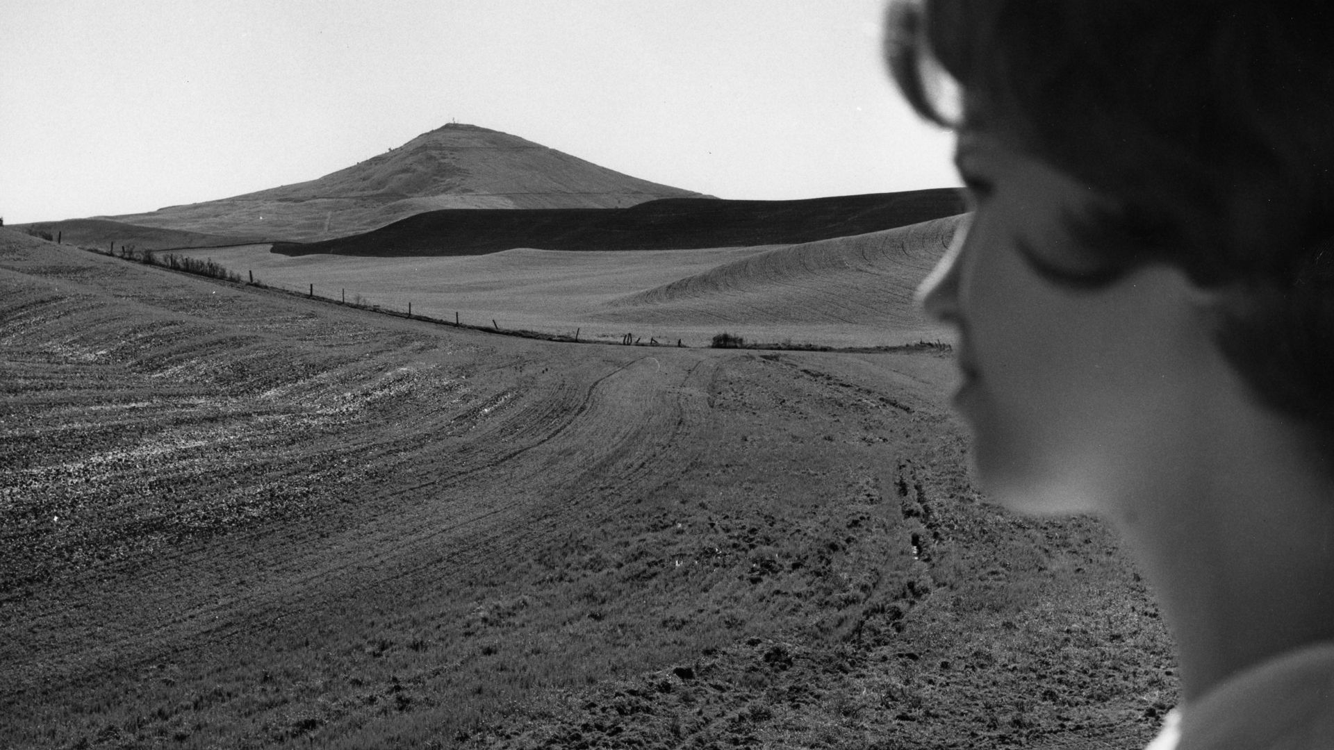 Steptoe Butte is named to honor Colonel Edward Steptoe who led the
U.S. Army in the last U.S. Army/Indian conflict in eastern Washington.
The Butte served as Steptoes’ reconnaissance point.
Steptoe Butte once held a hotel and an observation point built by James S. “Cashup” Davis.
The Cashup Hotel closed after Davis’ death in 1896 and burned down in 1910.1.
That history and the fantastic views of the Palouse warrant a visit but the greatest reason for a visit is to allow your imagination to visualize the impressive geology of eastern Washington from the top of a geological wonder.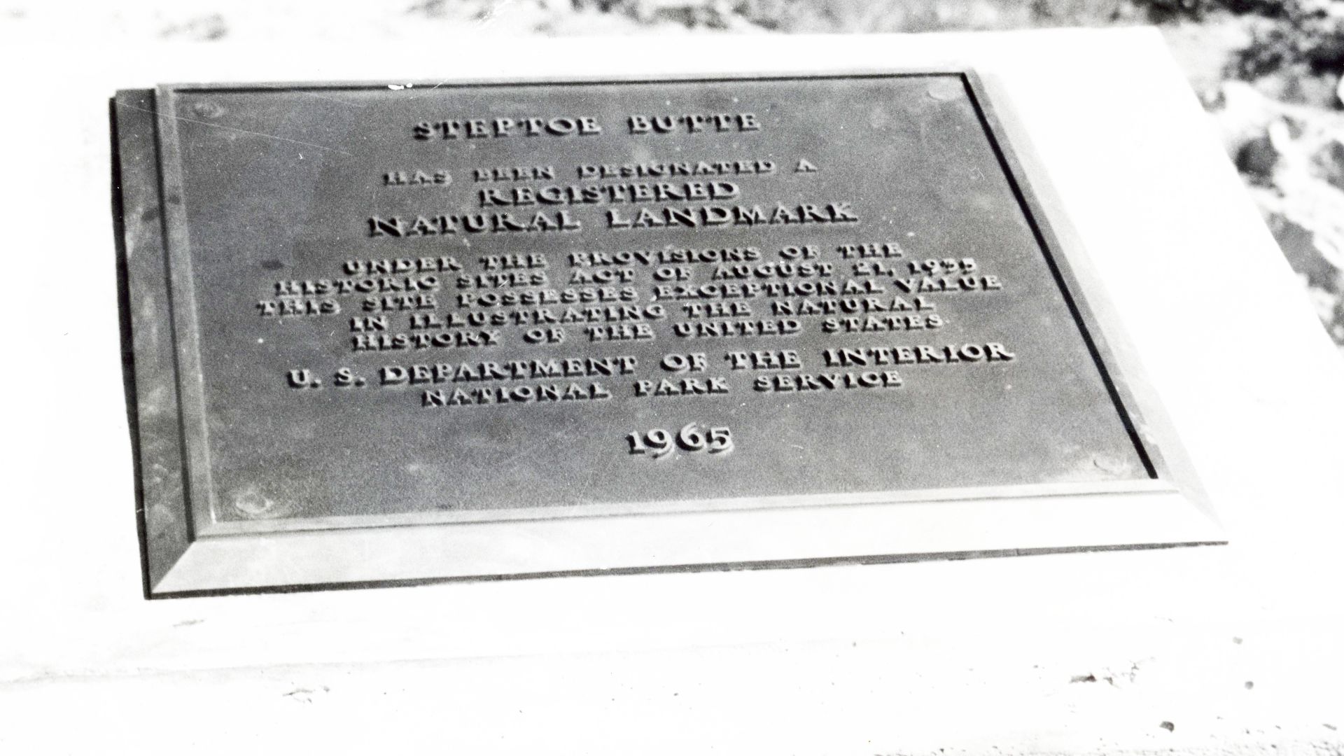 Steptoe Butte is the very top of an ancient mountain composed of billion year old rock which formed part of the western coast of the continent with the view to the west consisting of ocean.
Land to the west rose, mountains and valleys were formed and, in time, about 15 million years ago, basaltic lava filled the area covering the huge area of eastern Washington with an uneven layer of basalt, in some areas thousands of feet deep.
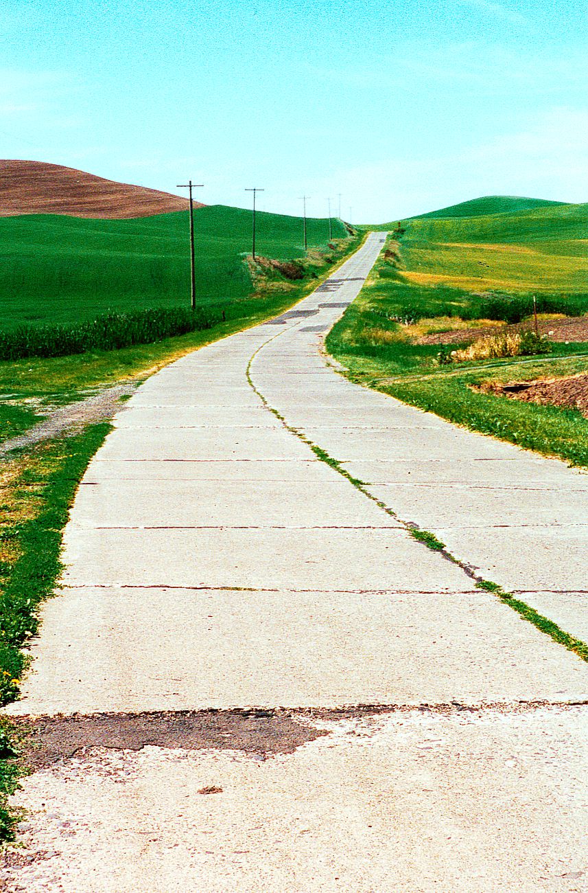
Predecessors of the Columbia River carved channels through the area.
The Missoula Floods raced to Oregon creating the Channeled Scablands of Washington, creating the sights, for instance, near Coulee City (WA-N227.2) and Dry Falls State Park. The glaciers that were instrumental in creating the Missoula Floods also ground down unimaginable amounts of rock to form the dust that then blew out of the Columbia Basin and settled as a thick blanket of silt over the Palouse. That vast loess deposit created the rich farmland of the Palouse, seen today as smooth, round, wheat covered hills.
So the view from 1,100 foot tall Steptoe Butte is of the Palouse, the loess hills, which cover the basaltic rock which in turn covers the ancient mountainous hills and valleys of the land that emerged from the sea. The Butte stood there through the eons, a pink quartzite “island” in a sea of loess-covered Columbia River basalt. Its geology is even more intriguing than Cashup’s remote hotel.
WA-431.2 Cashup
Named after James “Cashup” Davis. He paid only with cash. He built an observatory at Steptoe Butte.
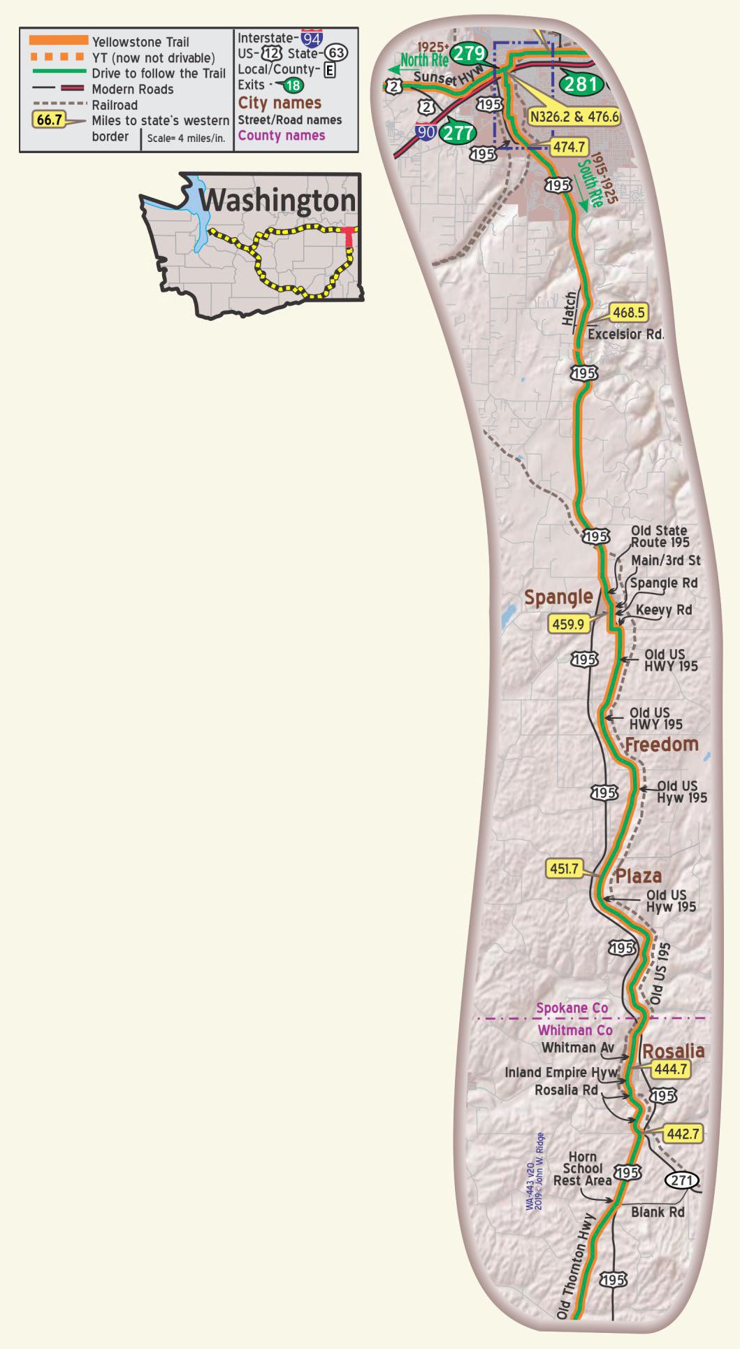
WA-443.6 Milwaukee Road Bridge
The YT followed a Trolley line through the whole area. From the 1916 BB* v5.
WA-444.7 Rosalia
Here you can see great Palouse wheat fields of eastern Washington. Miles of rolling hills with scattered barns. Between Colfax and Rosalia you can easily spot the old road and follow it, if you like, through Thornton and other small settlements.
“Rosalia is a good Yellowstone Trail stop. It is a nice old town with vintage buildings and visible reminders of old Trail days. Trail travelers of 100 years ago would feel comfortable here,” says Washington native and history buff, Dave Habura.
Just at the south edge of town on the Yellowstone Trail you will see a large Milwaukee Road Railroad overpass, begun in 1913. Painted on the inside of the west arch at a low level is a black arrow on yellow background. That remnant of the Yellowstone Trail, although maintained, may have faded so you will have to get out of your car and look sharp to see it.
534 Whitman Ave (Yellowstone Trail). Restored 1923 vintage Texaco Visitor’s Center. You’ll get no gas there, but you will hear lots of history of the area and about this gas station from the friendly volunteer. They even have a 24-hour public rest room. And how’s this for a time warp: outside of the 1923 gas station is an electric car “refueling pump,” a battery charger with four charging stations! Rosalia is certainly looking toward the next 100 years!
Main St. The Model Garage was advertised in the 1919 Automobile Blue Book. Today it is hard to determine what it is used for. It seems maintained. Readers, any thoughts?
110 W 5th St. Battle Days Museum is housed in the city hall and features Rosalia and eastern Washington history.
WAYSIDE: South edge of Rosalia. The Steptoe Battlefield site is a four acre day-use park.
A Memorial marks the 1858 site of the last Native American victory over Col. Steptoe.
Being outnumbered (158 soldiers vs 600-1200 from four tribes), the only thing
the soldiers could do was to slip away to win two battles elsewhere later on.
NOTE: Between Colfax and Rosalia, there is an old road and an old road grader.
WA-451.7 Plaza
Plaza’s population is about 250 at an altitude of 2,353 ft. and boasts a score of frame buildings, straggles along the highway and a railroad track. Dominating the village are several wheat warehouses and a large grain elevator. WPA-WA
WA-453.7 Powers Rd
The original route of the Mullan Military Road crossed the Yellowstone Trail here.
WA-459.9 Spangle
(2,432 alt., 203 pop.), A village of weather stained houses clustered about a few brick buildings, is one of the oldest settlements in the Inland Empire. The first house built in the vicinity was erected in 1862 and for years served as a stopping place on the Mullan Road. WPA-WA
WA-468.5 Mullan Military Road Monument, at intersection of Excelsior Rd.
NOTE: Mullan Military Road Monuments near Spokane Valley.
WA-476.6 and WA-N326.2
North YT Route and South YT Route Join Together at Spokane.
NOTE: Construction of I-90 removed this part of the Yellowstone Trail.
Location provided is on Sunset Boulevard (old Sunset Highway / YT).
North YT Route is 150.6 miles shorter than the South YT Route.
Click Here to continue on to Spokane -OR- Scroll Down
YT SPOKANE TO COEUR D’ALENE
For Directions, click the WA State YTA Mile Marker Numbers (below) linking you to a real-time map.
Continuing East on the YT from Spokane:
WA-476.6 or N326.2 Spokane
Spokane (pop. 104,437, alt. 1,891 ft.), situated on the Spokane river, is the commercial and financial center of a large agricultural area. Spokane stands unique where downtown the river plunges over rocky leaps in a cascade of foam. Spokane has a well-equipped motor tourists’ camp located on the banks of Hangman creek. *BB1921-9
J. R. RICHARDS TIRE CO., East 313 Sprague Ave. on Yellowstone Trail, is convenient for tourists; expert repair work. *MH-1928. [Note: Today it is a Karate Center.]
DAVENPORT HOTEL is one of the finest in the West. World famed for its appointments, service and luxurious lobby. Single $2.25-$3.25; dbl. $4, with bath $5-$8; Formal dining to coffee shop; exceptional food and service. MH-1928*
The Davenport Hotel
10 S Post St. (corner of Post and Sprague Ave., the Yellowstone Trail)Davenport Hotel.
Louis Davenport saw opportunity in the ashes of the 1889 Spokane fire.
The elegant Davenport Hotel really taxes expression and is a “must see” for YT Travelers today.
Called a “beacon of culture and refinement.”
Go in and stroll about.
See historic pictures in the mezzanine and look down upon the glittering lobby.
For more on the Davenport Hotel, visit Trail Tales.
♥
Riverside Park in north central Spokane is a “must see.” It is along the Spokane River as it winds through some of the town with four beautiful waterfalls.
W 1005 First Ave. Historic Montvale Hotel. Opened in 1899, with street-level commercial space (first in Spokane) and two upper-level floors with 60 residential rooms. All for $1 or $2 per week. In 1914 each room had wash basins! After a period of neglect, a full renovation was completed in 2015, restoring the hotel to its original luster, now a true historic boutique hotel.
901 W Sprague. Bing Crosby Theater, so named because he attended local Gonzaga University and supposedly got his start at this theater and at local radio station KHQ, which signed on the air in 1922 from its tower on the roof of the Davenport Hotel.
KHQ featured many local bands, including The Musicaladers. That group’s drummer, Bing Crosby, dropped out of Gonzaga University and became world-famous for his singing voice. The theater features live music and film festivals.
159 S Lincoln. Steam Plant. On March 5, 1916, operations started, beginning the important role the Steam Plant played in downtown Spokane. The over 100 year old property now hosts a brewery, restaurant, and retail shops under catwalks open to 80 foot high ceiling skylights. Or look straight up the inside of one of the 225 foot smokestacks.
507 N Howard. Riverfront Park Clocktower is all that remains of the 1902 Great Northern Depot.
By 1921 a 200-acre site was up and running at Riverside Ave. and A Street. High Bridge Park.
Latah Creek had been called Hangman Creek after the hanging of Native Americans there in retaliation of Col. Steptoe’s defeat by four Native American tribes in the Indian War of 1858. Today it is a large green space for Frisbee golf, but no camping.
2316 W 1st Ave. The Campbell House (c.1910) and Northwest Museum of Arts and Culture. The Campbells moved from Coeur d’Alene’s raucous mining community to refined Spokane and the Tudor home reveals what life was like for the Western wealthy in the early 1900s.
20th Ave.& Chestnut St. Seven blocks further from 13th Ave. we happened on to a great old concrete spring/watering trough we had not seen before. There were pipes but no water. Was it for man or beast or a radiator fill-up? Do you know? Tell us.
This area from 13th to 20th Avenues and beyond is called “Vinegar Flats,” apparently named in memory of the nearby Keller-Lorenze 1890 vinegar company. Vinegar was used as a food preservative, or pickling. The Yellowstone Trail went through the Flats on Chestnut St.
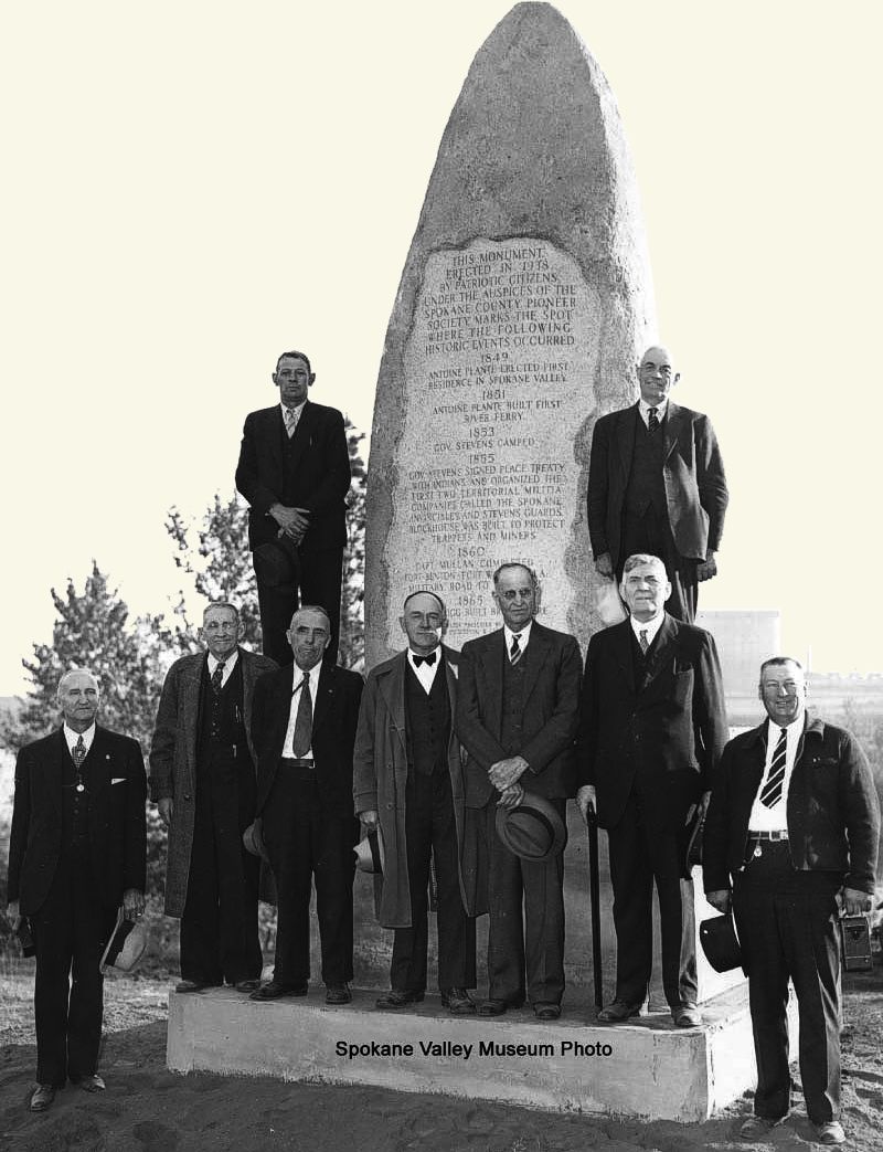
WA-484.9 or N334.3 Dishman
Crossed by the Mullan Military Road.
See Idaho Trail Tale: Mullan Road (you will leave the Washington State page).
WAYSIDE: Just 2.5 miles north of WA-486.9 on Sprague Ave. is the location of Plante’s Ferry, used on the Spokane River by the Mullan Road.
Mullan Military Road Monuments near Spokane Valley.
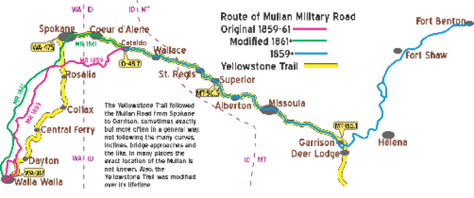


From its beginnings in South Dakota in 1912, the Yellowstone Trail had progressed west through North Dakota and Montana and by 1914 it was going through the Idaho panhandle and knocking on Washington’s door (Spokane) for the 1915 travel season.
Good timing!
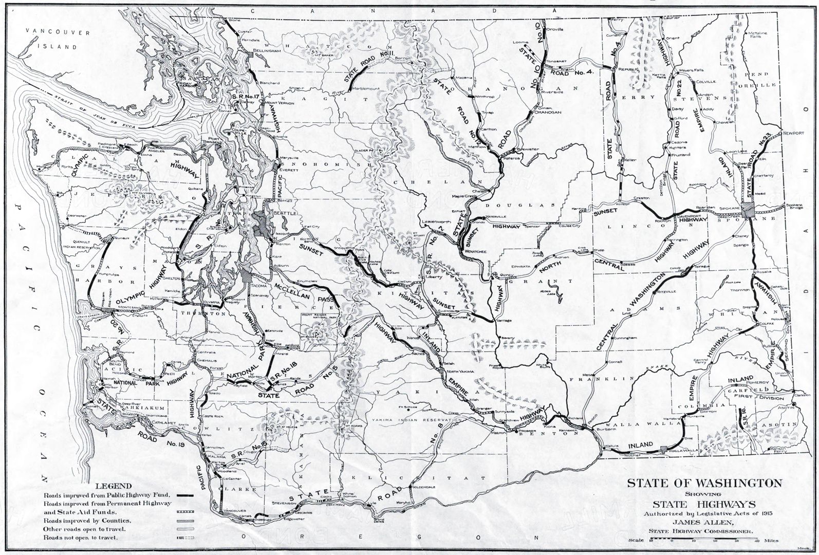 The 1915 state map of Washington’s State Highway Commission (above)
shows the recently refined routing of two great Washington highways of interest
to the Yellowstone Trail: the Sunset Highway, 1915, and the Inland Empire Highway (IEH), 1913.
But they were hardly great highways…
Major sections were identified as “improved,” meaning something between smooth gravel roads and, well, dirt wagon roads that had been dragged, sometimes.
But long sections of each are identified as “Other roads open to travel,” that is, dirt wagon roads that maybe you can get through.
Maybe…
Marked so you could find your way?
Nah.
Nevertheless, no other “highways” connected Spokane with Seattle.
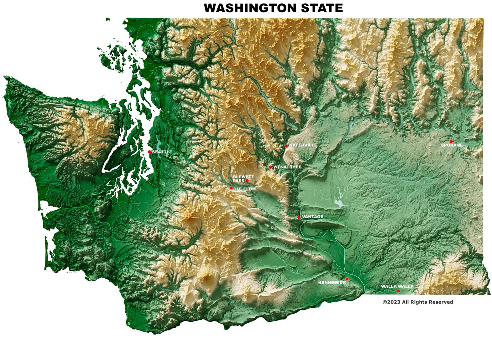
Put three things in mind to avoid being overly ungenerous in your judgment of Washington’s lack of long-distance auto roads.
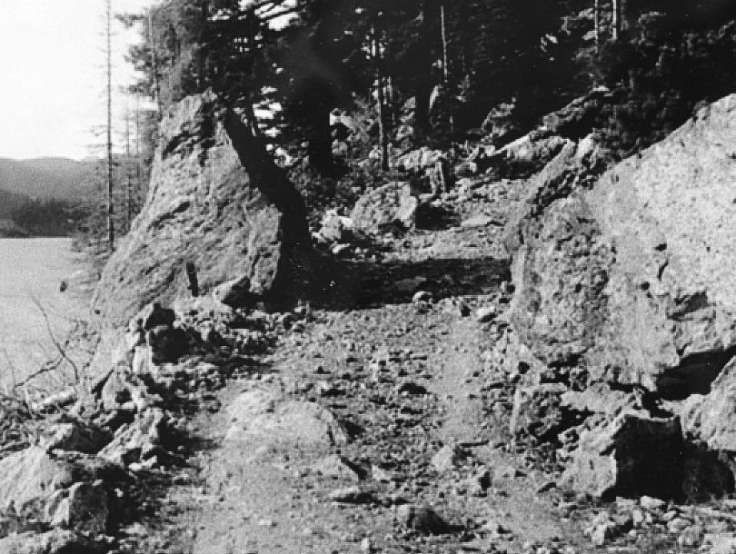
First. If you are not familiar with Washington’s geography, take a minute to review the fact that the beautiful Cascade mountains from Canada to Oregon divide the state with a north/south transportation barrier (see map above). Note the lack of cross-state highways in the 21st century and note further that in the winter, snow still closes some of those east-west highways for the season. And then there is the meagerly populated eastern half of the state, especially the Palouse area. Not a prime territory for an extensive road system.
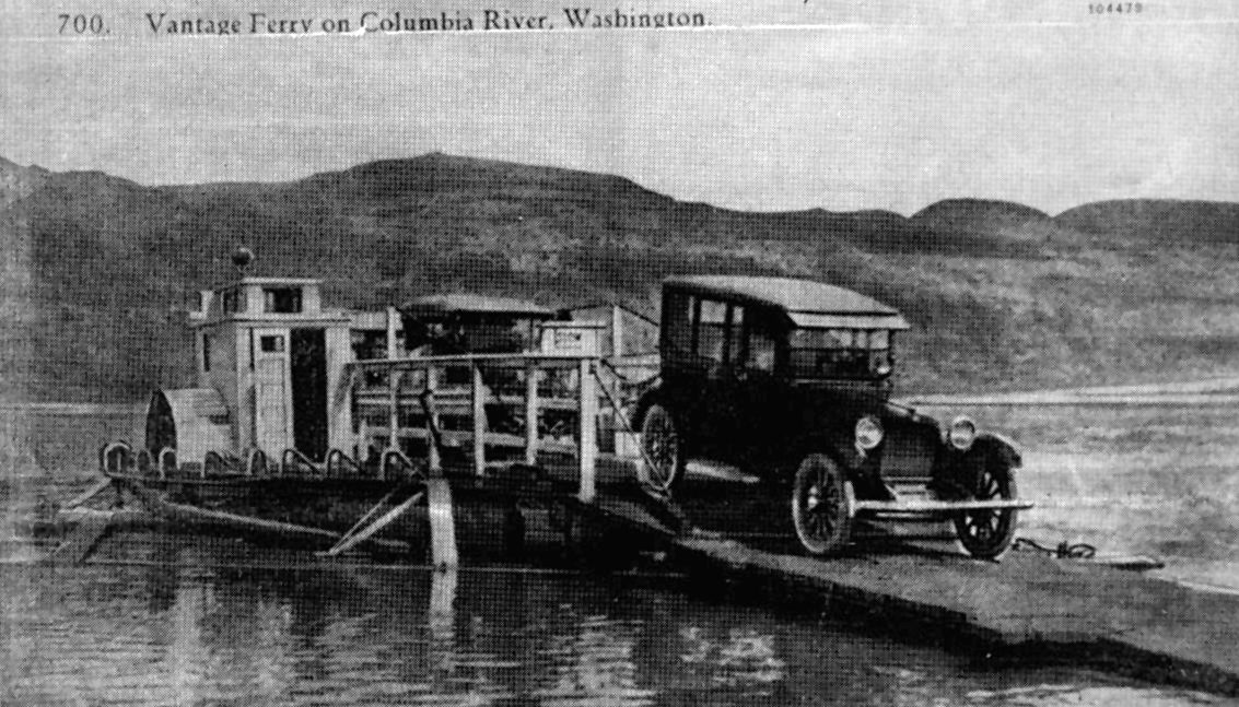 Second. Yes, the auto had made its appearance in Washington. By 1912 autos appeared in great numbers. A handful was produced locally but most arrived to Washington’s scattered towns and cities by railroad. Except for a few ambitious path finders, drivers didn’t drive cross-country because, for the most part, only the roads in or near cities were reasonably passable for autos. Other roads were rough wagon roads created by use; they were not engineered. That is, they were not designed with the necessary drainage, durable surfaces, or acceptable gradients needed for auto travel. And those sharp rocks killed a rubber tire in short order.
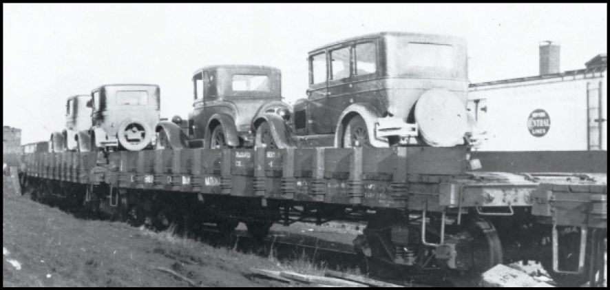
Third. Even though Washington was way ahead of many other states in thinking about highways, not all of the necessary political decisions had been made and implemented to establish responsibility for funding, building, and fixing them. State funding for scattered roads first occurred in 1893. However, the Washington State Highway Department was not created by the legislature until 1905. That same year 12 scattered roads were designated as state roads and received funds. The state spent some money on those scattered roads, but improvement was minimal.
That lack of long-distance roads had been noted by Washington’s long standing Good Roads Association which was the major “shaker and mover” in road matters.
By 1912 it had proposed three long-distance auto roads:
1.) The Pacific Highway to run north/south across the state between the ocean and the Cascades;
2.) The great curving Inland Empire Highway (IEH) from Ellensburg to Spokane via Yakima and Walla Walla;
3.) The Sunset Highway from Spokane to Seattle through Wenatchee and Ellensburg.
The names stuck and the State Highway Department began implementing the plan.

Why Did the Yellowstone Trail
Go Where it Went in Washington?
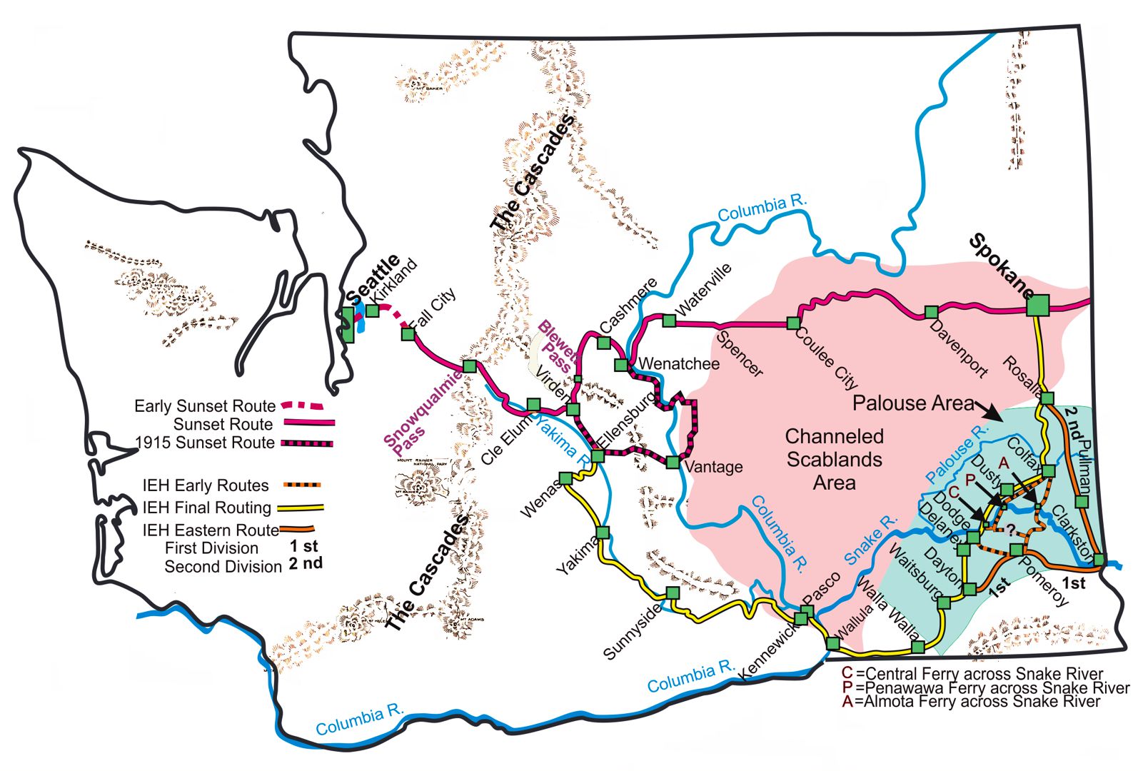
Today’s driver of the Yellowstone Trail has to choose between two routes in Washington, the southern route through Walla Walla or the northern route over Blewett Pass. This is the same choice of routes available to the Yellowstone Trail Association when it first entered the state in 1915.
Should the Yellowstone Trail follow the northern Sunset Highway or the southern IEH? That was the only choice to be made. There were no other realistic possibilities.

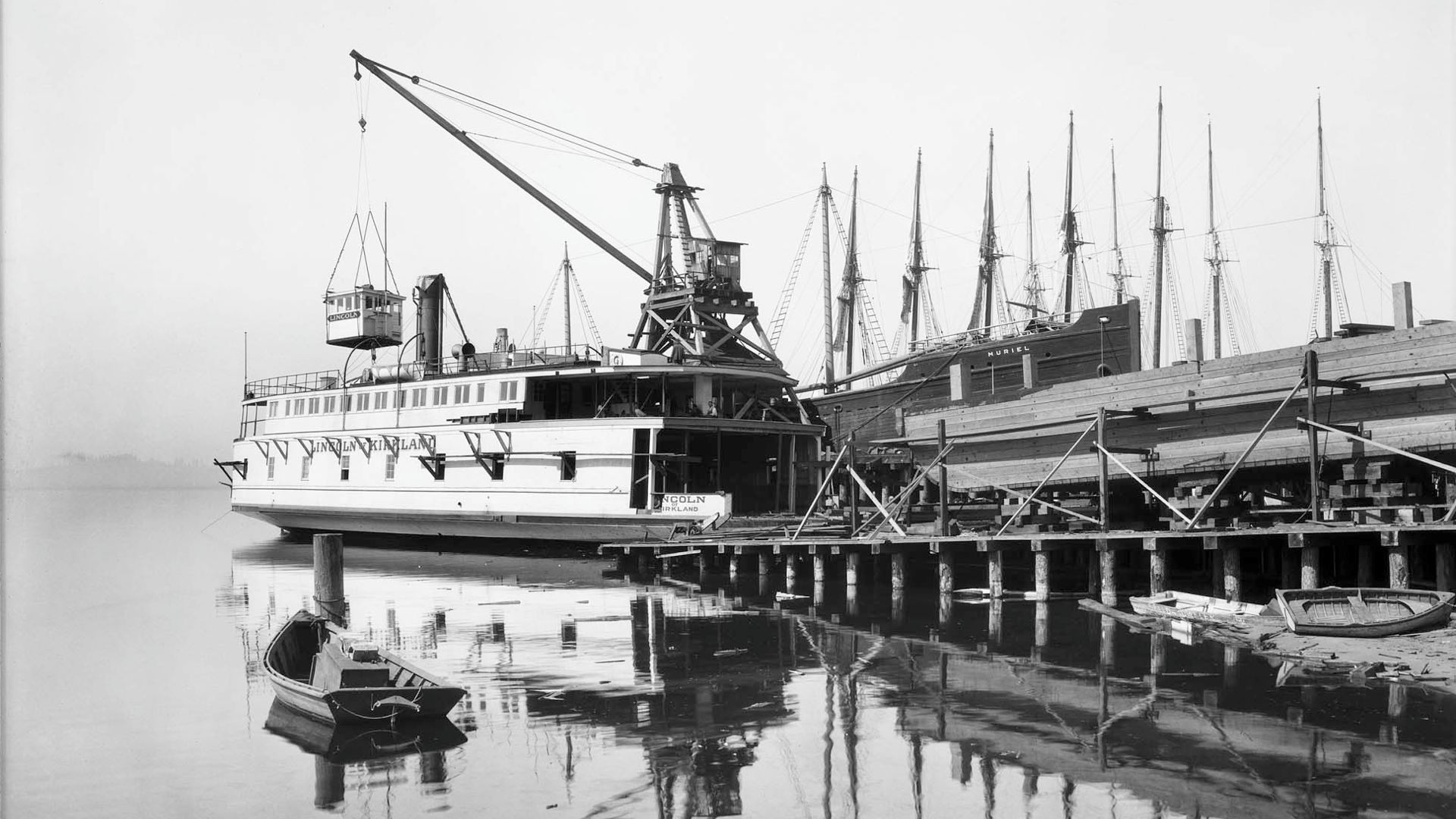
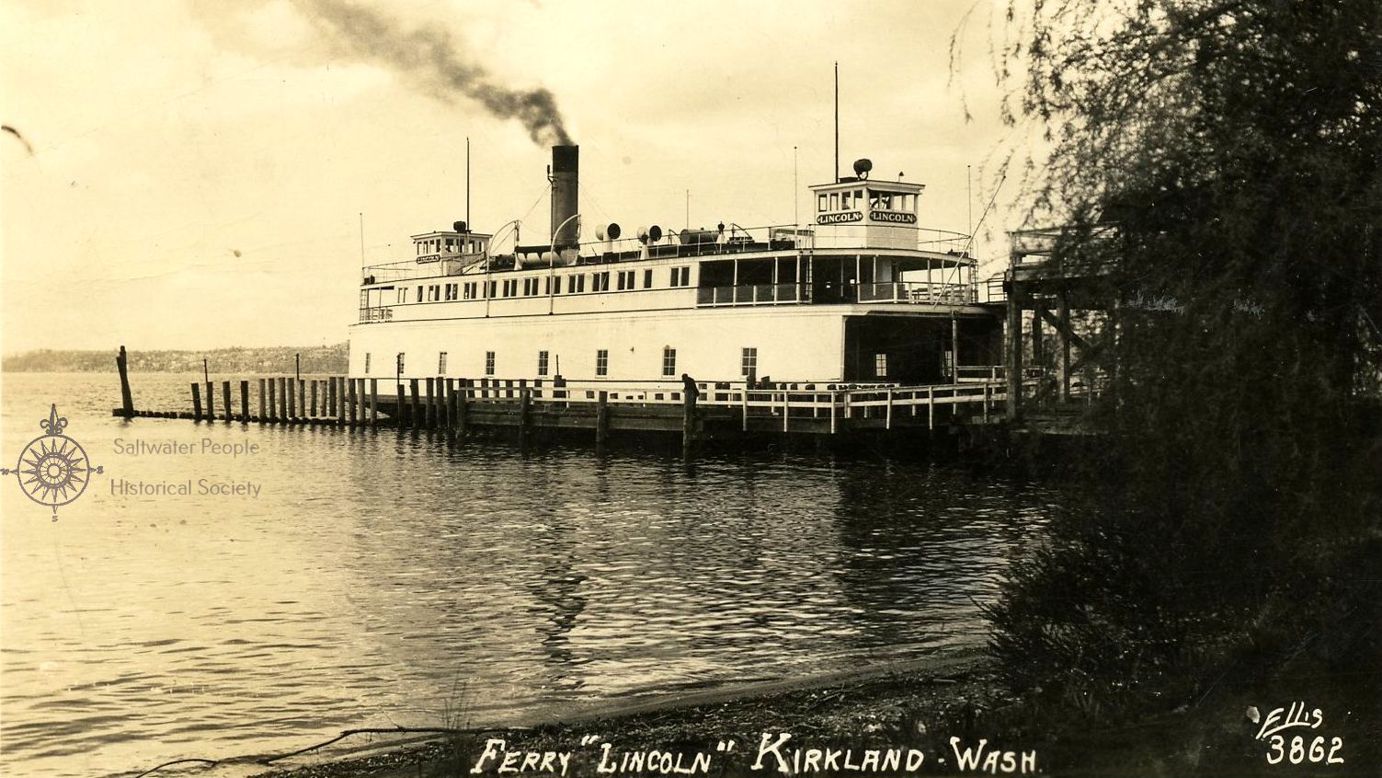
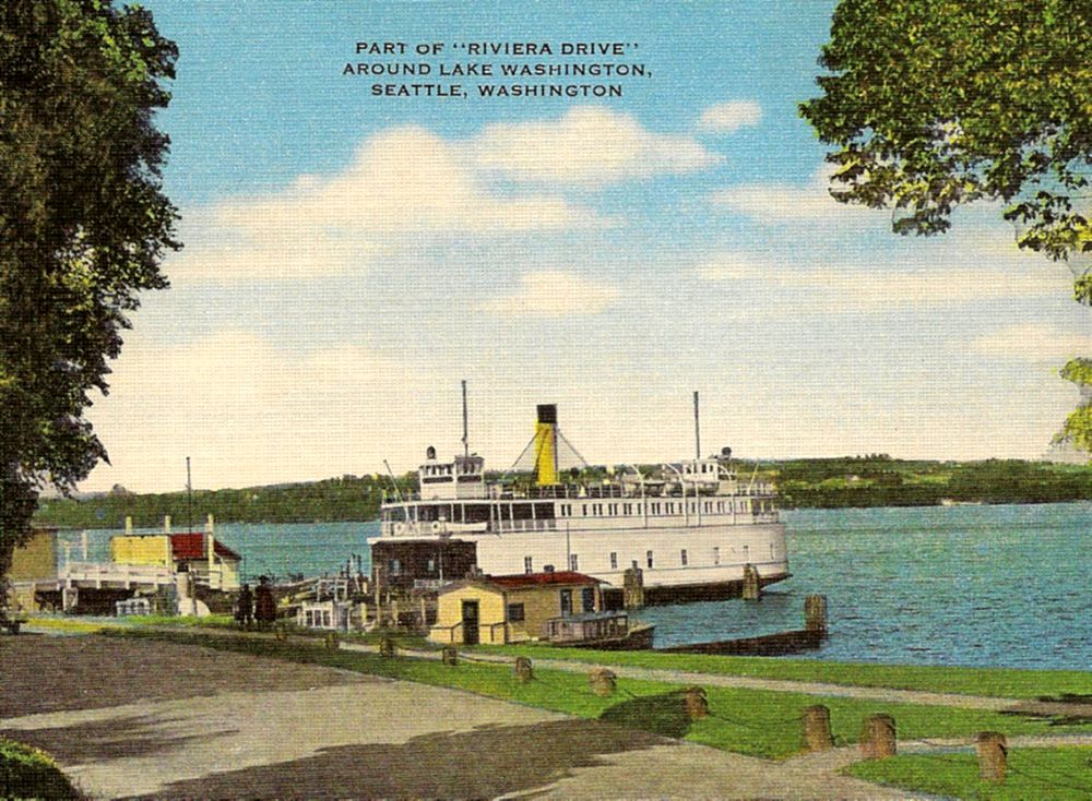
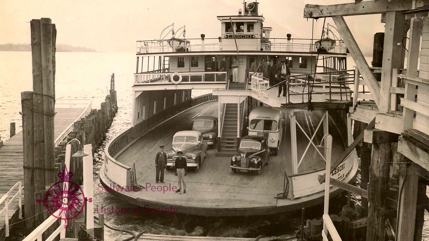
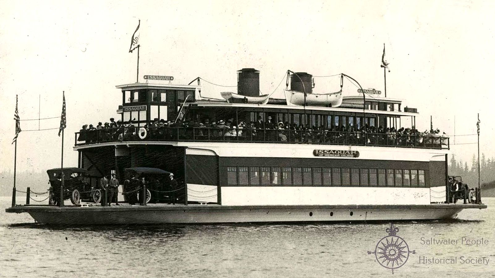
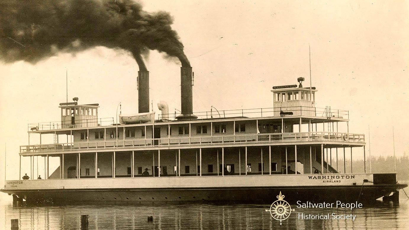
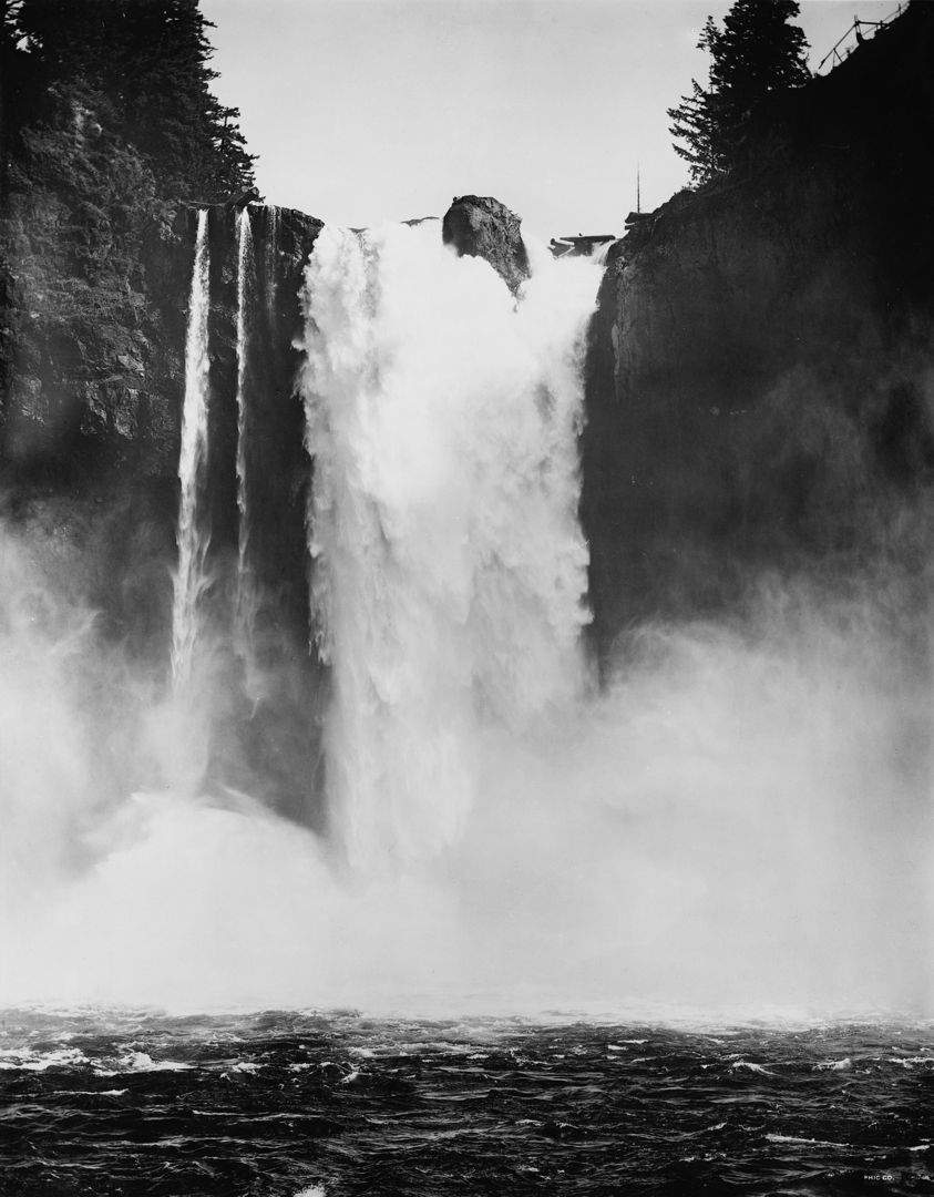
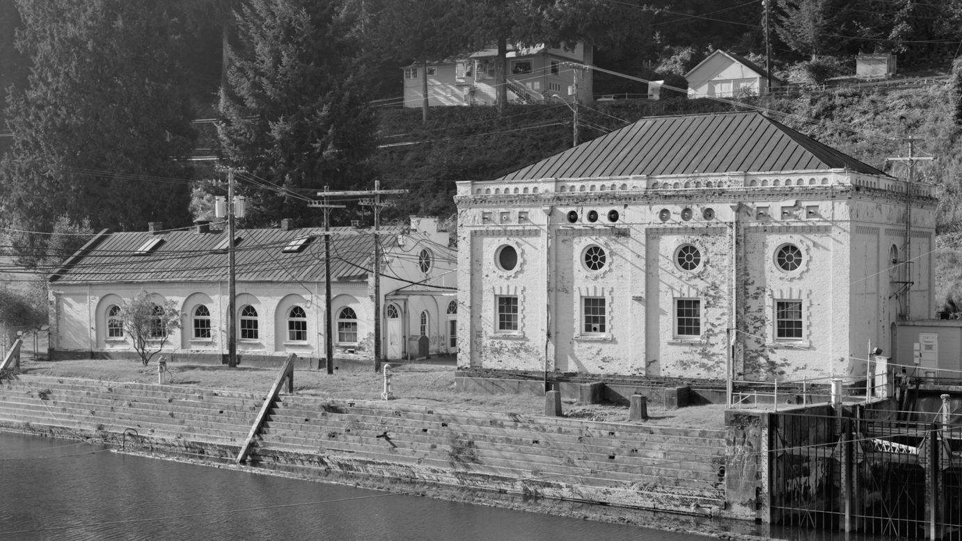
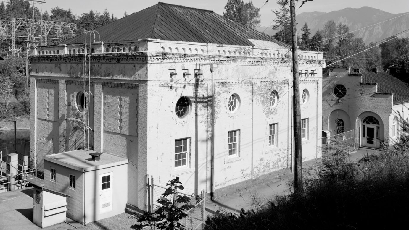
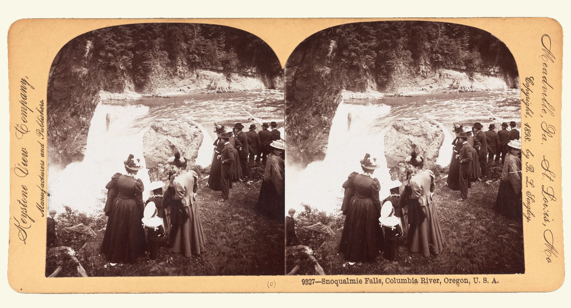
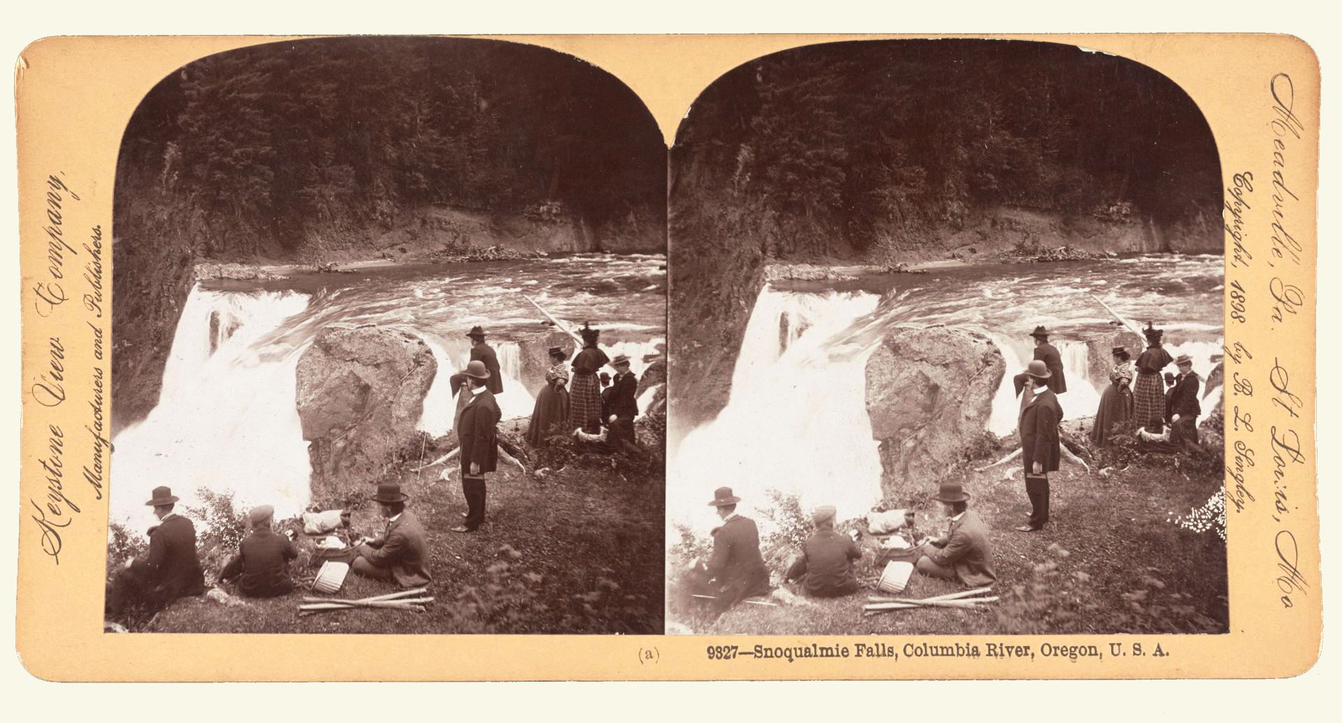
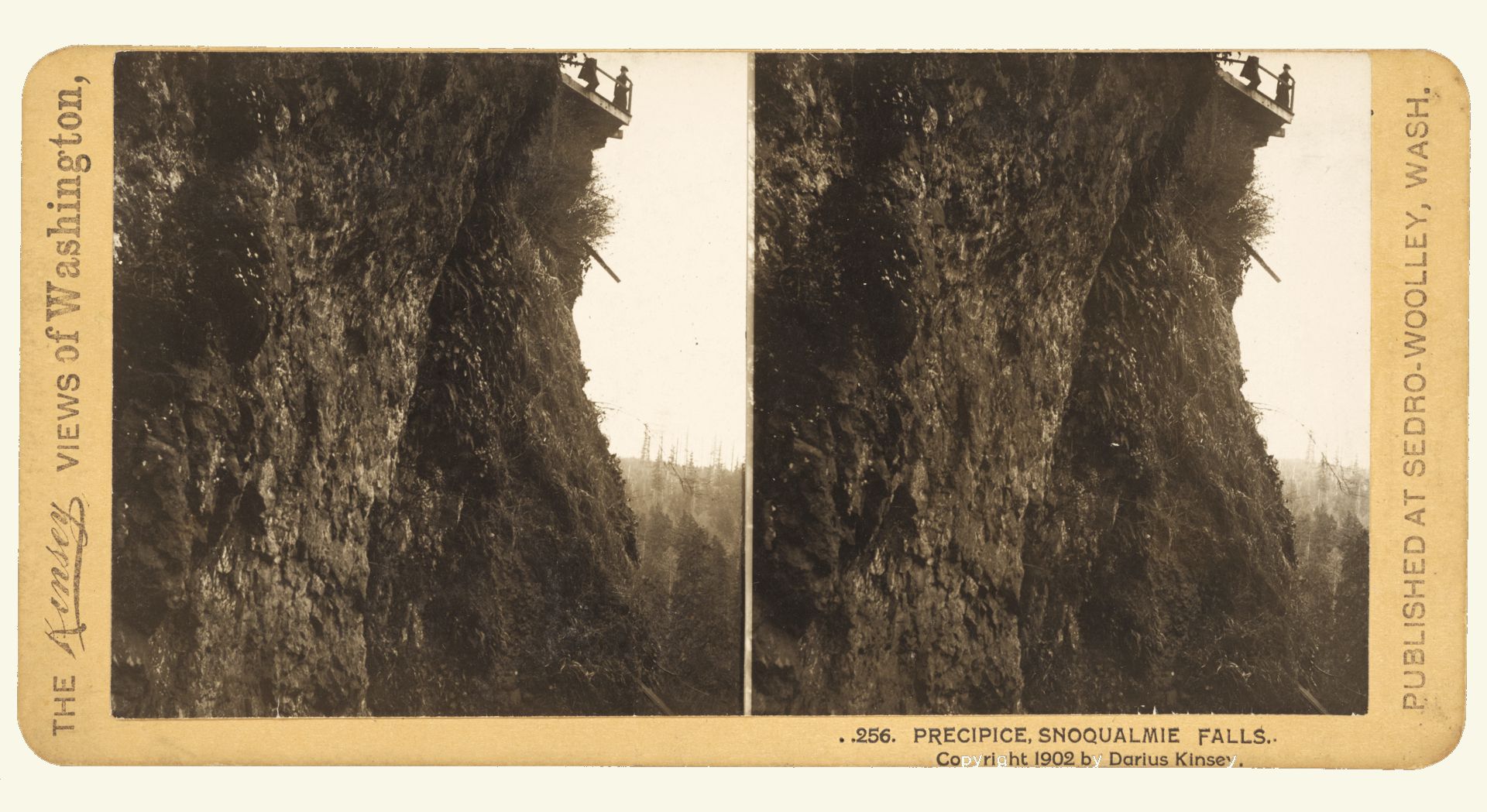
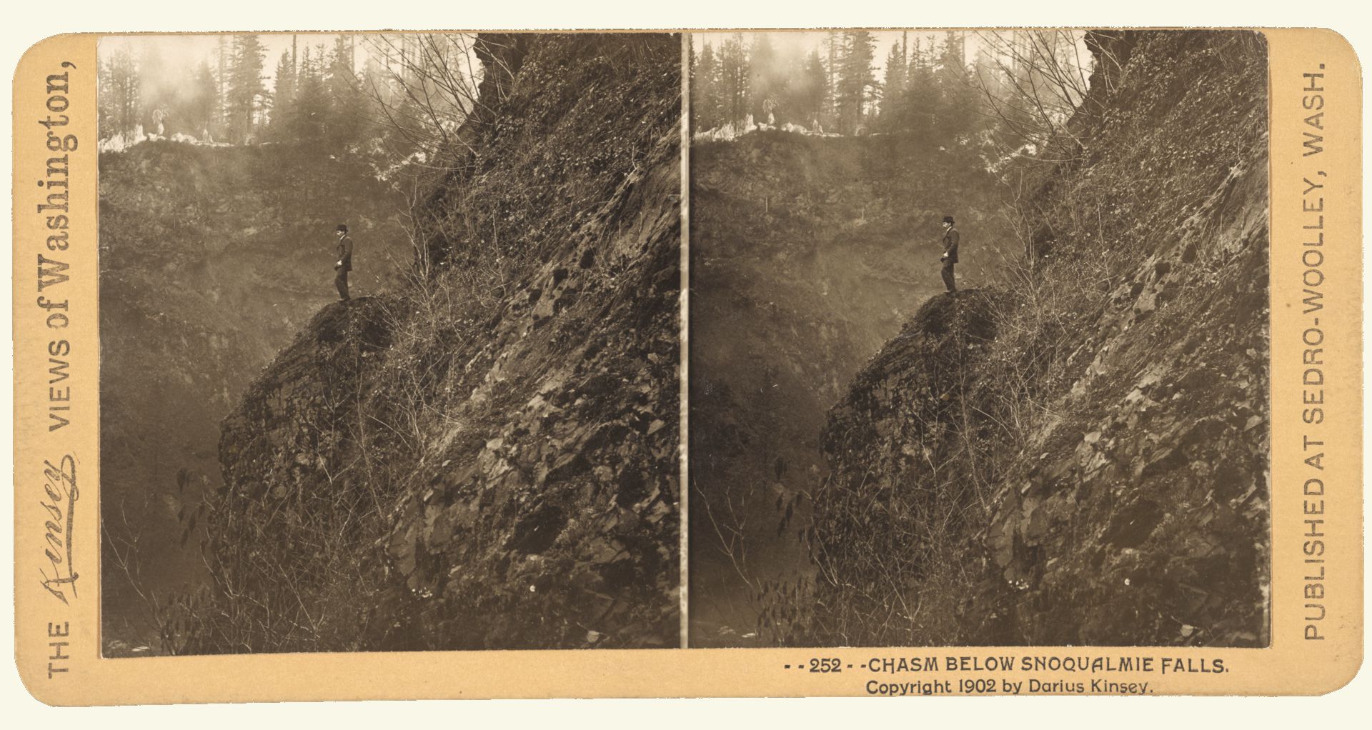
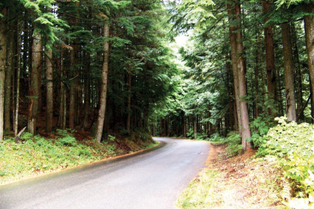
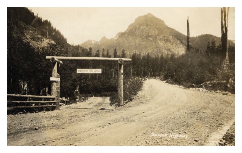
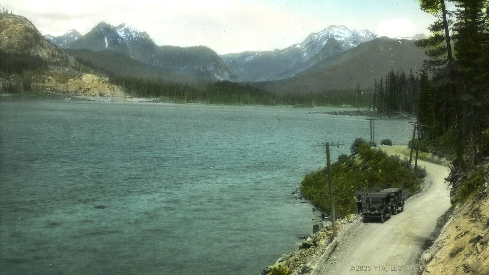
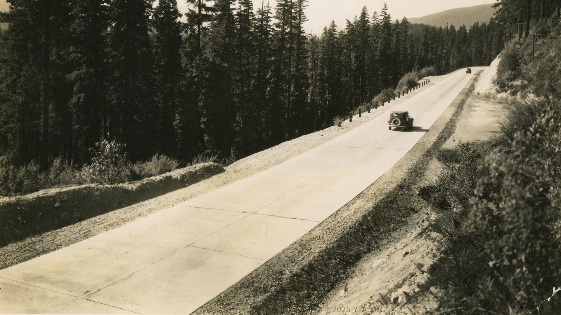
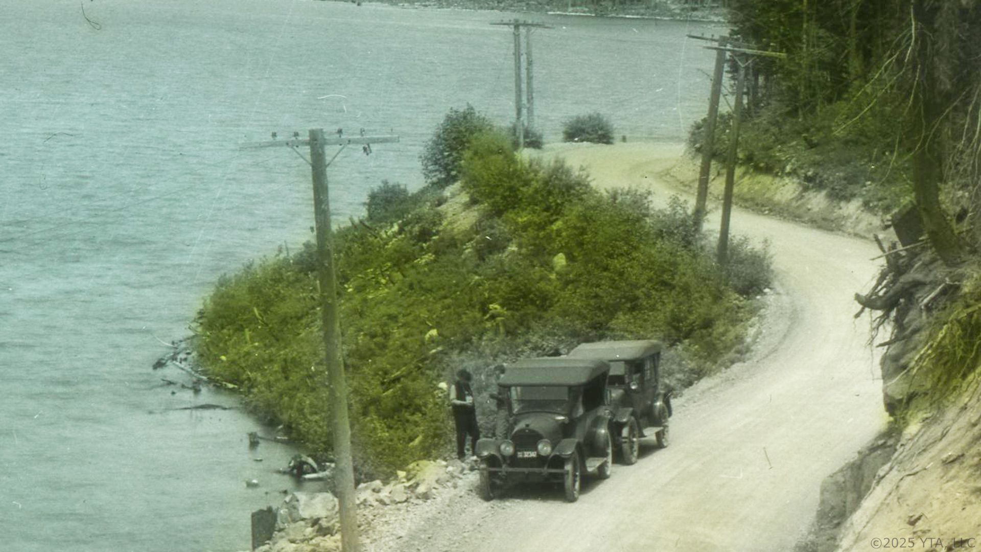
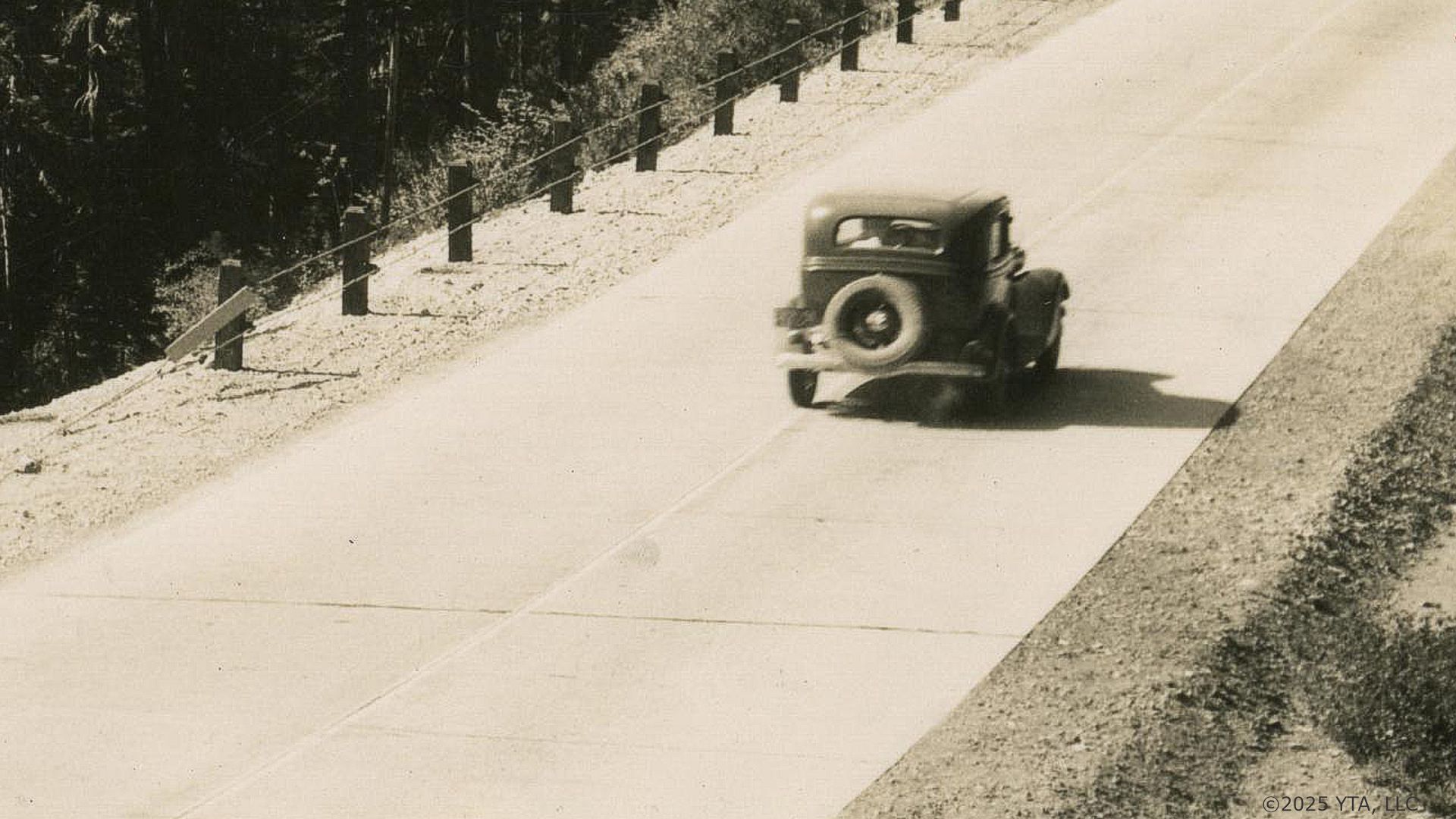
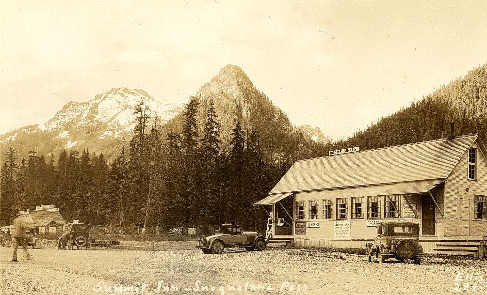
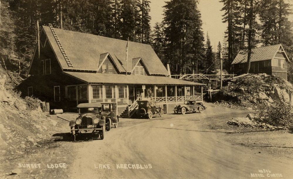
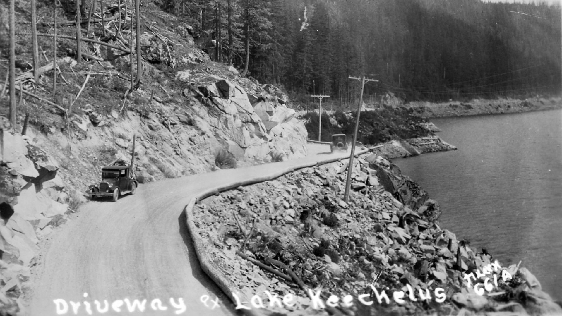
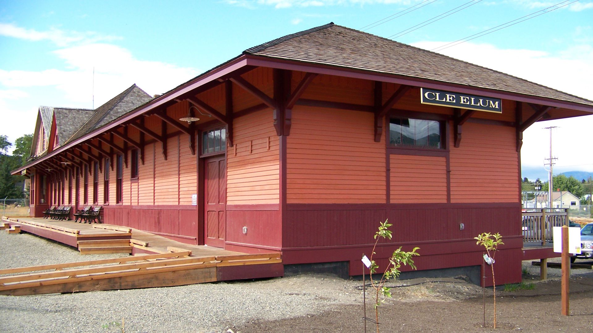
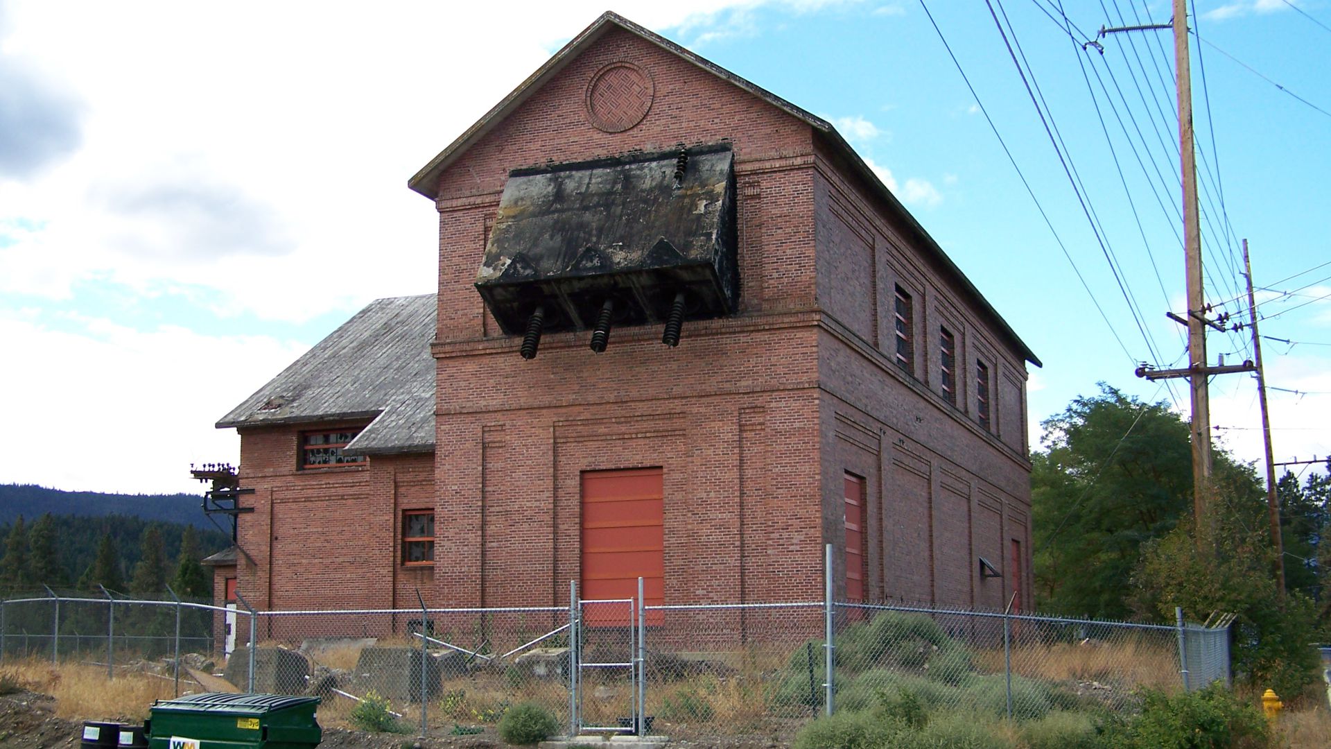
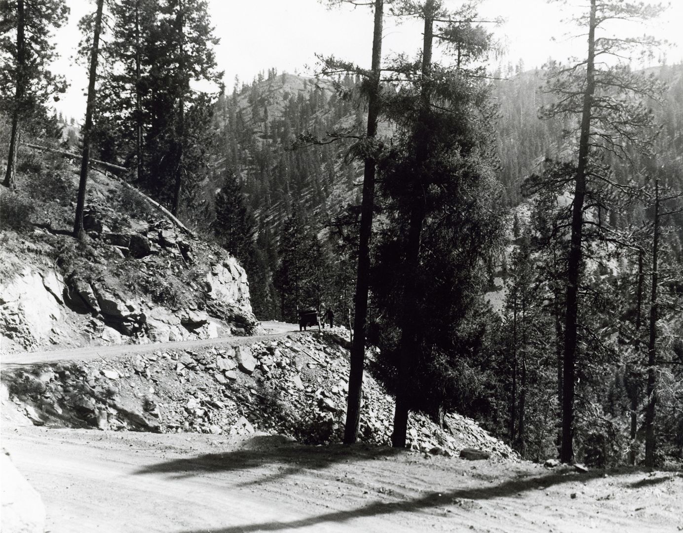
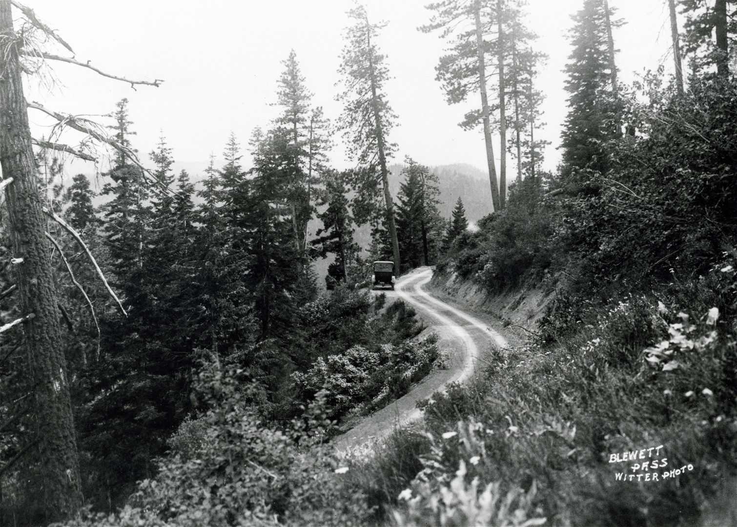
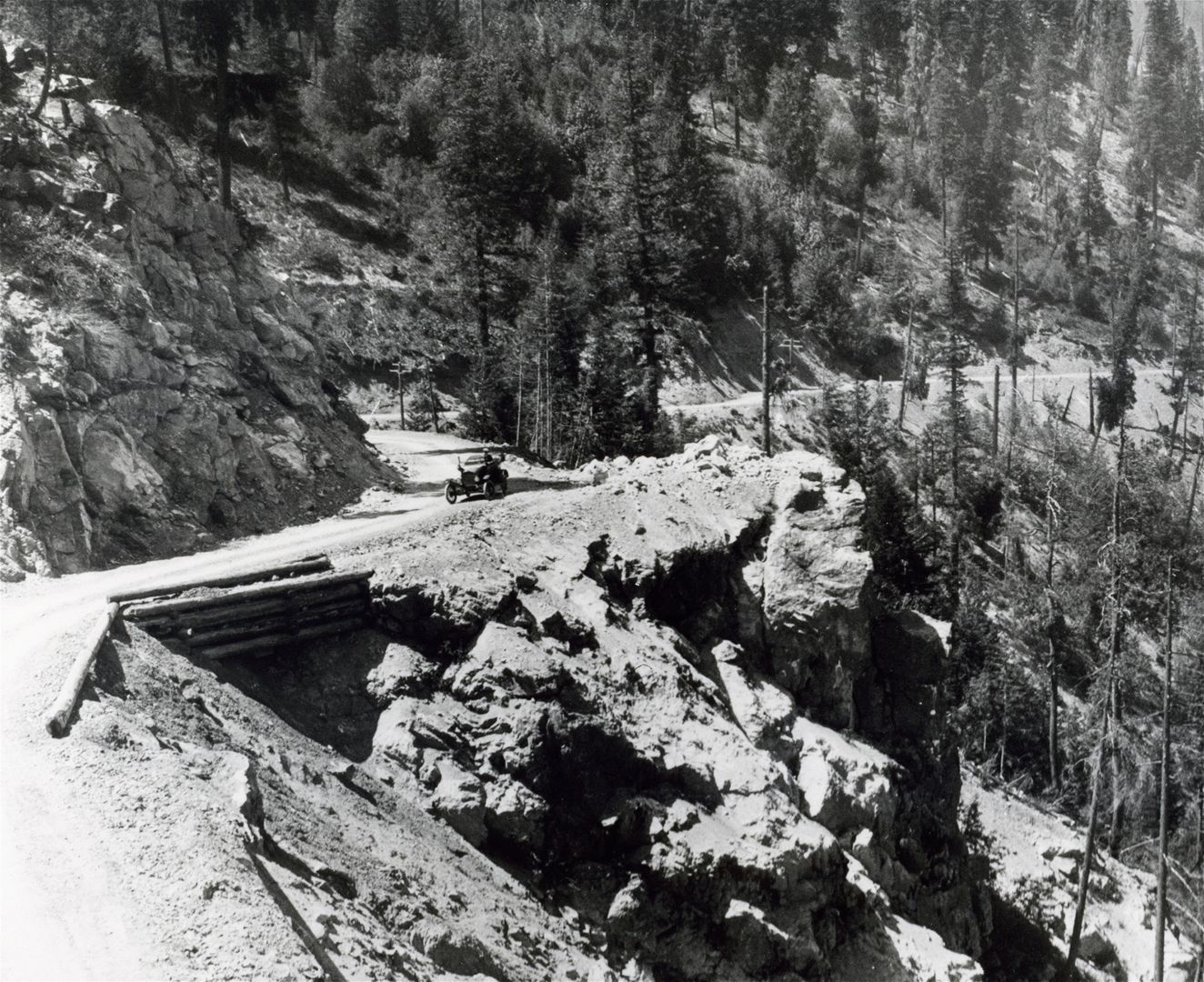
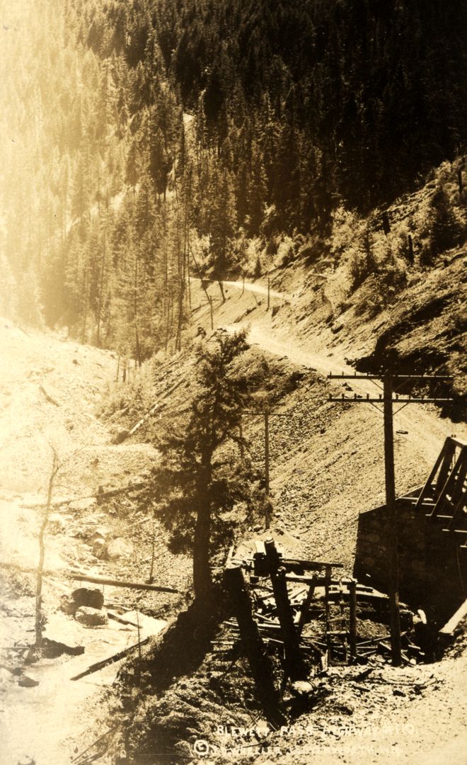
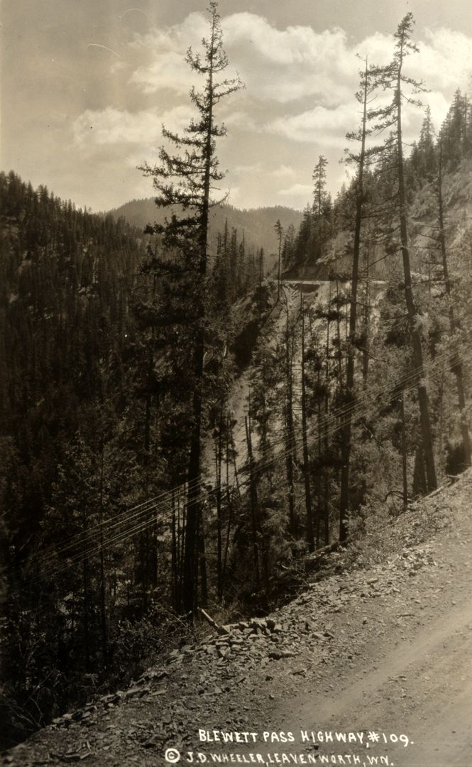
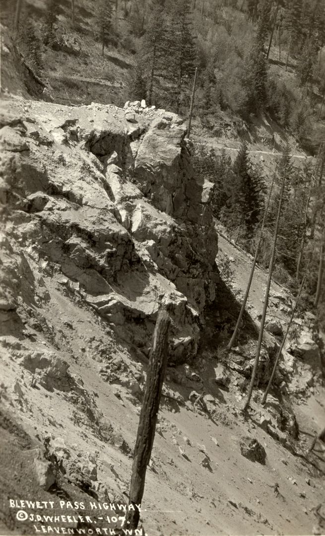
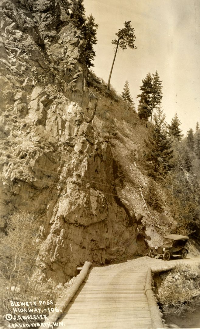
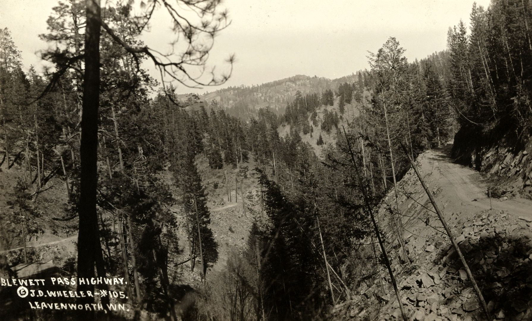
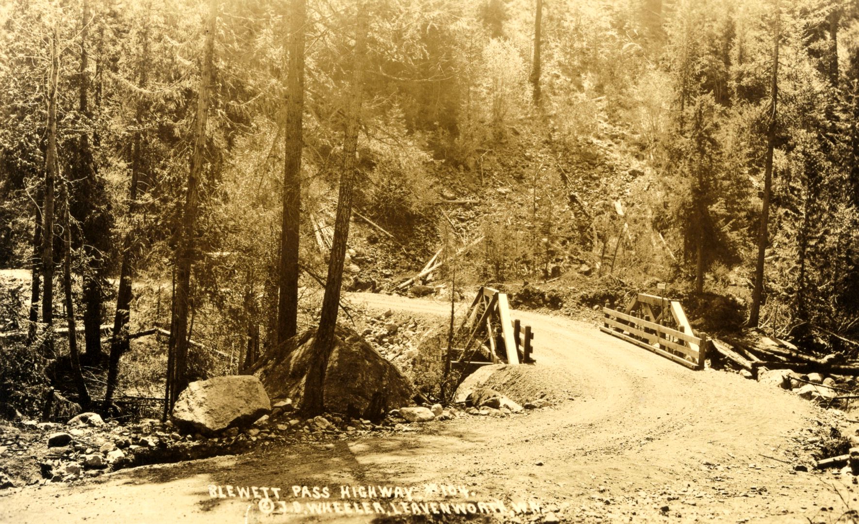
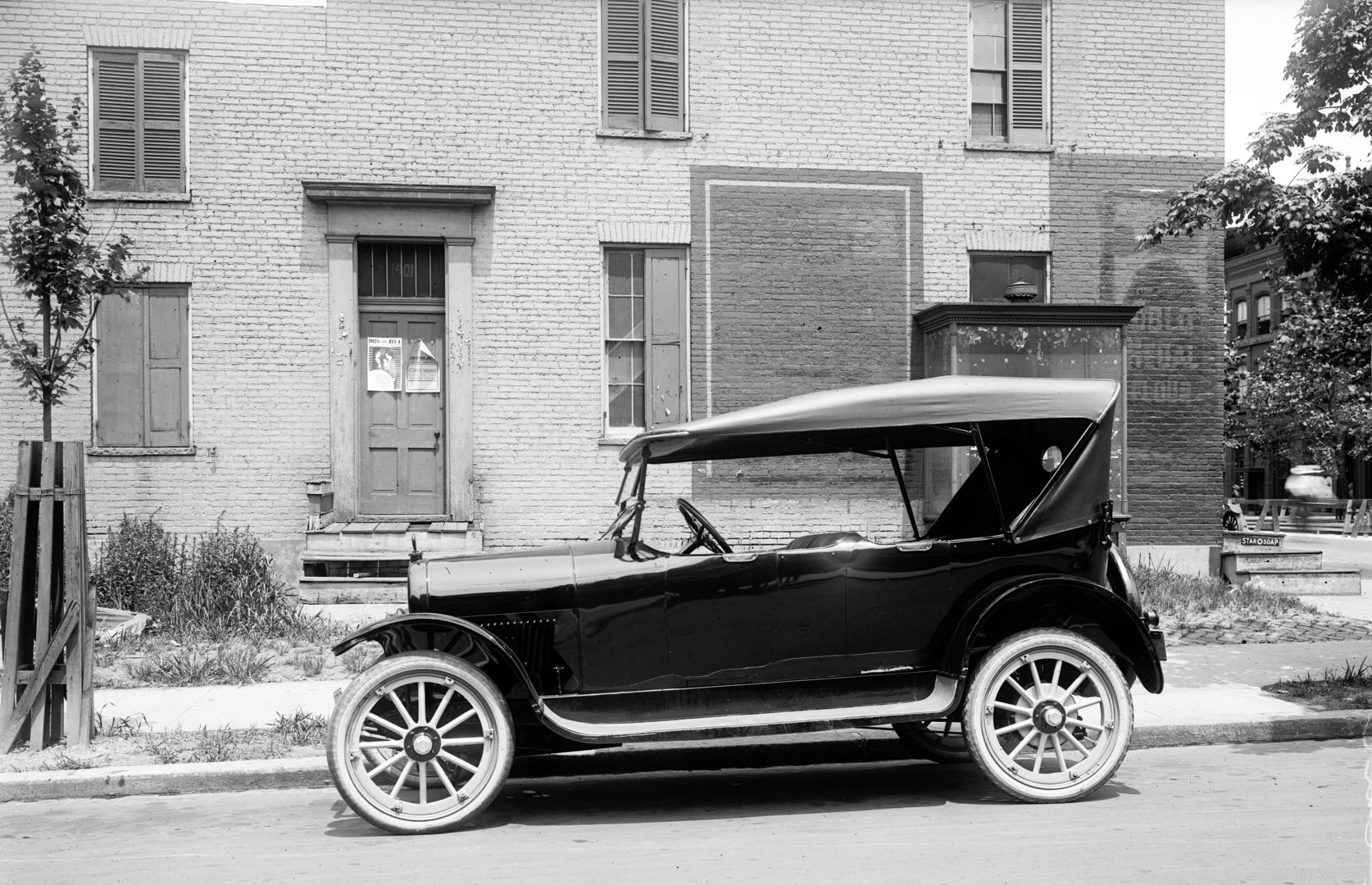
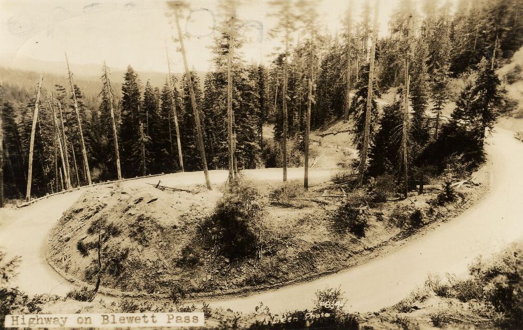
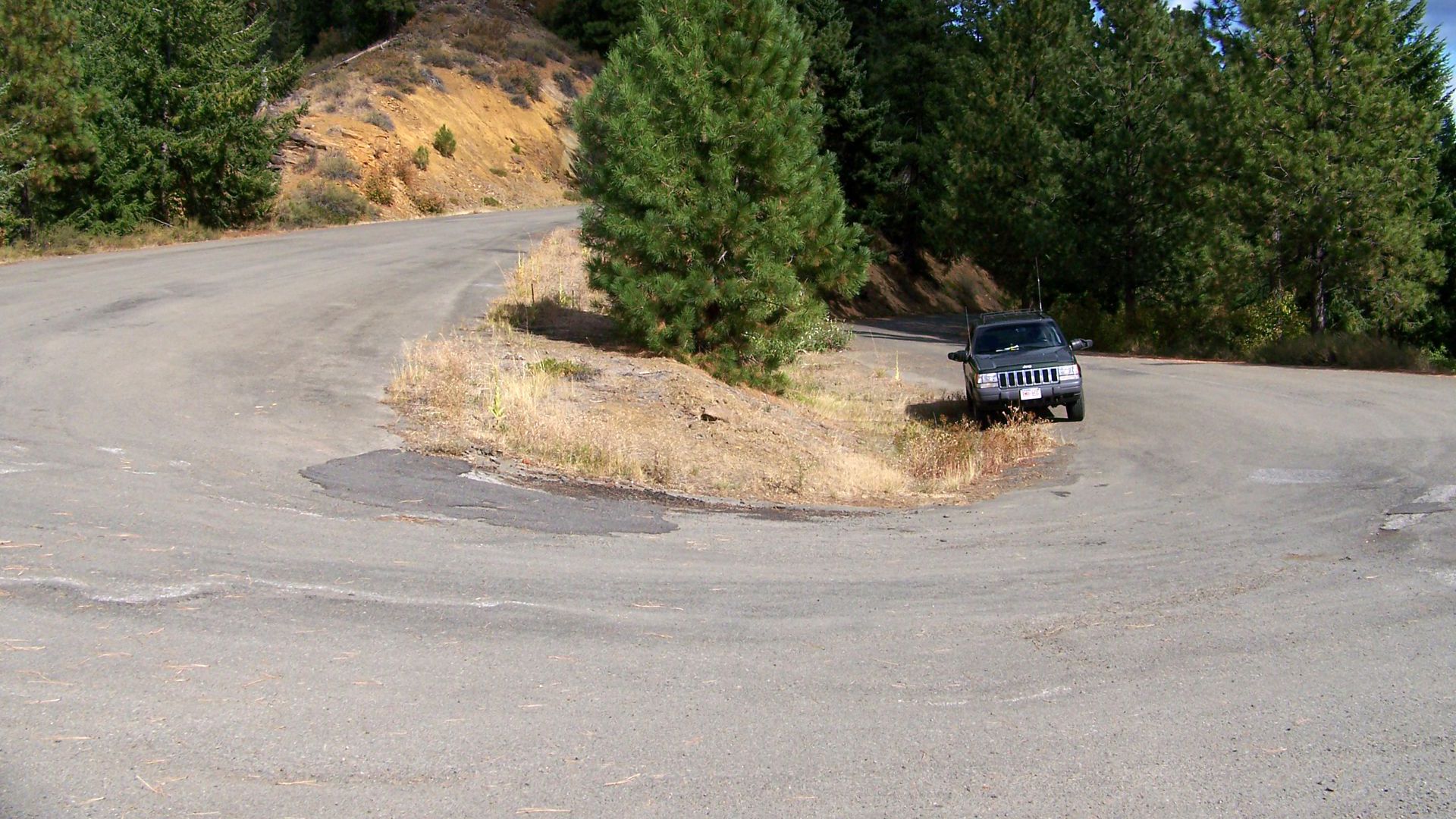
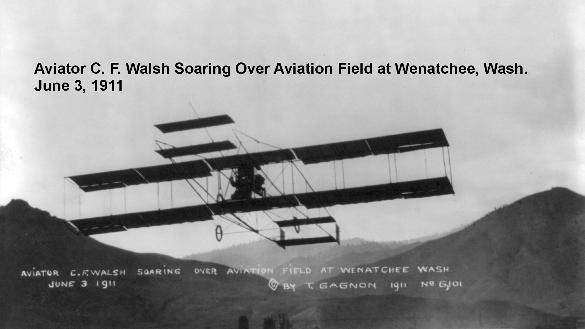
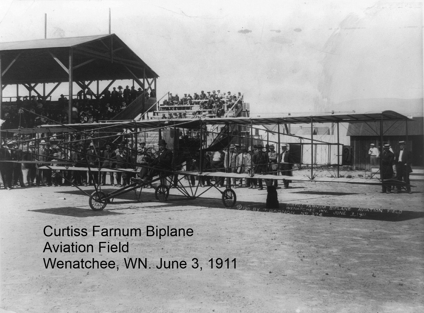
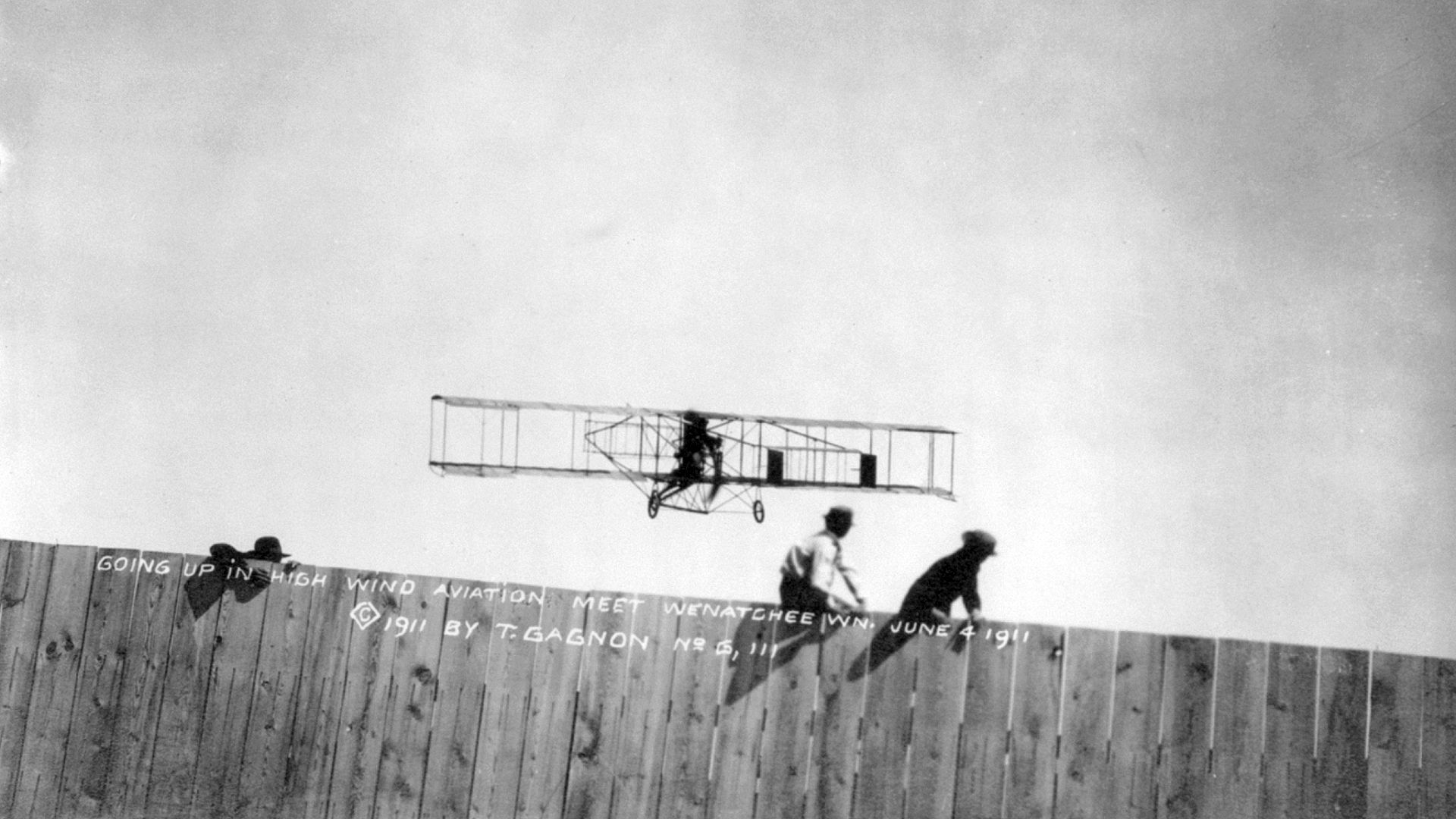
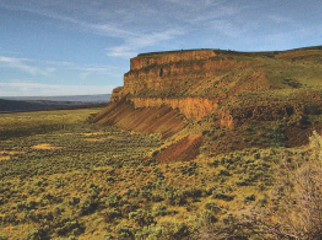
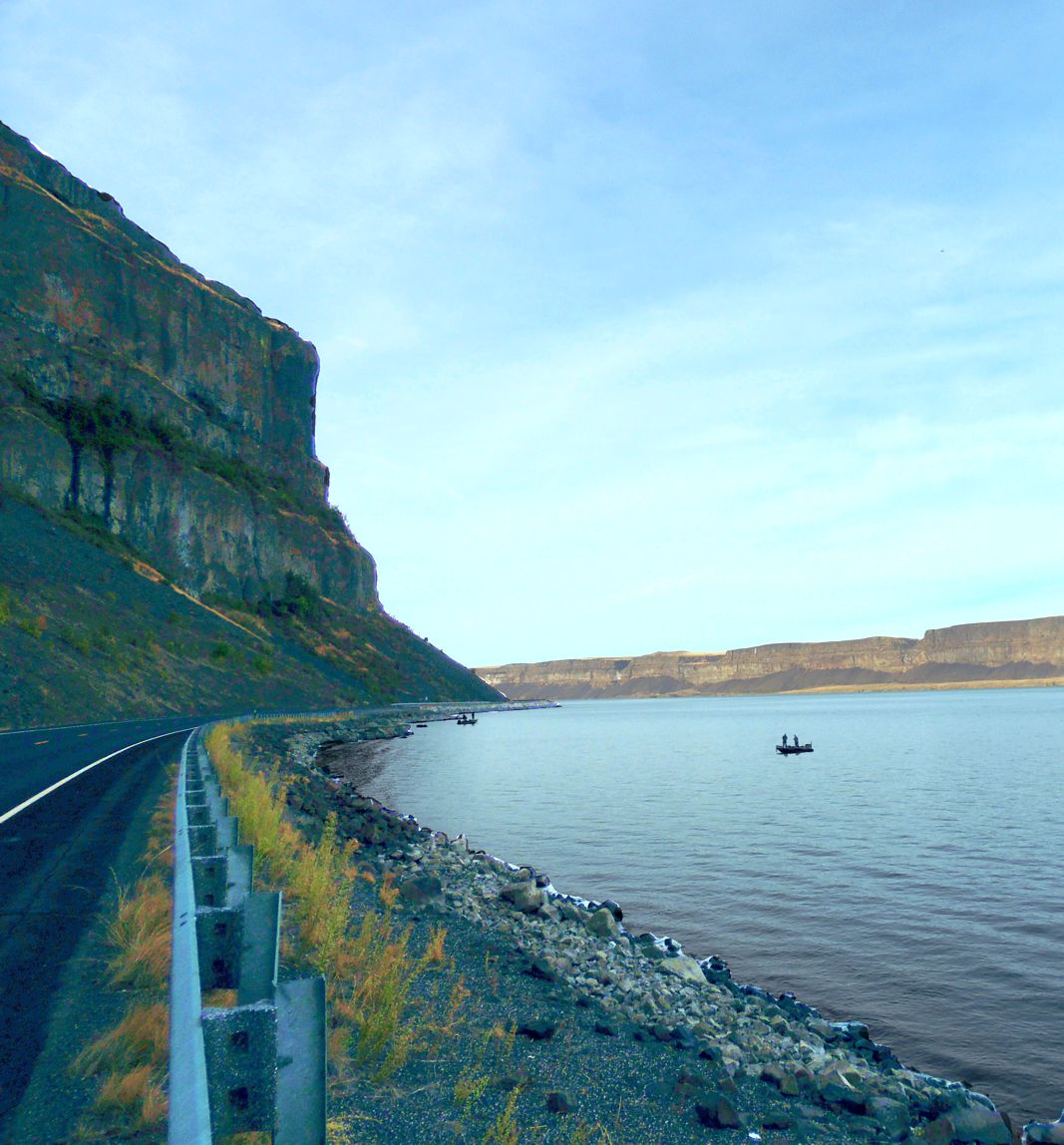
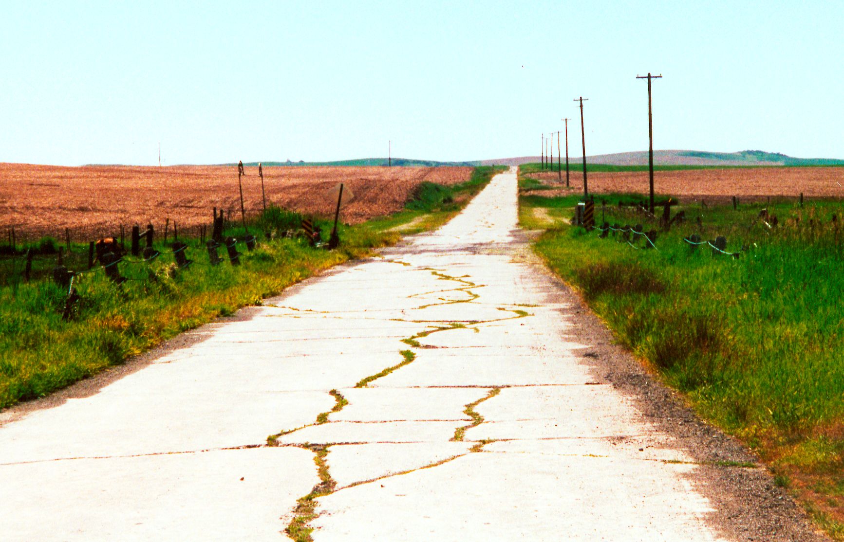
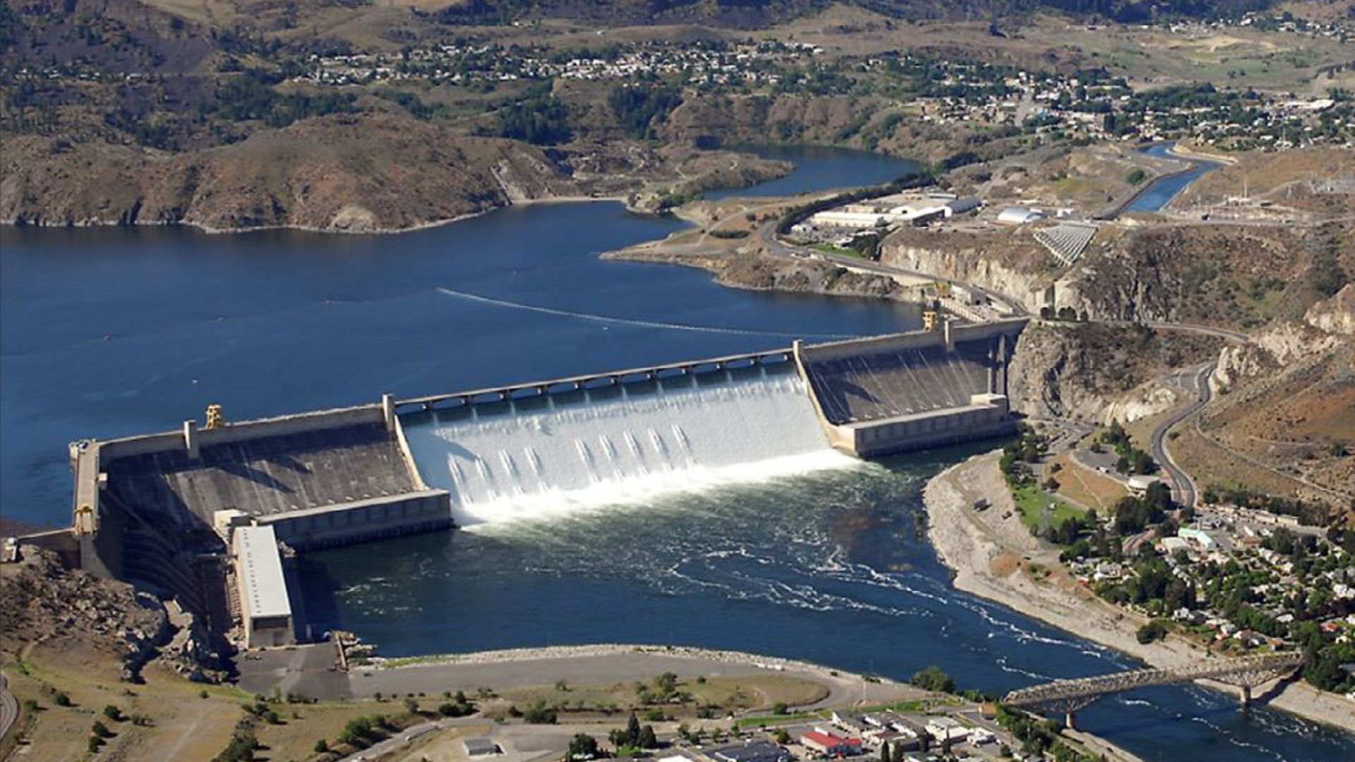
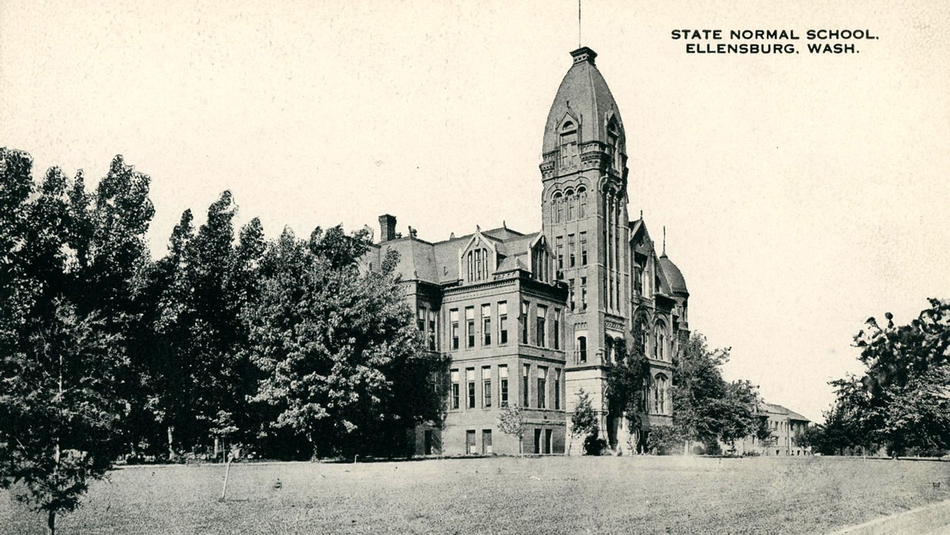
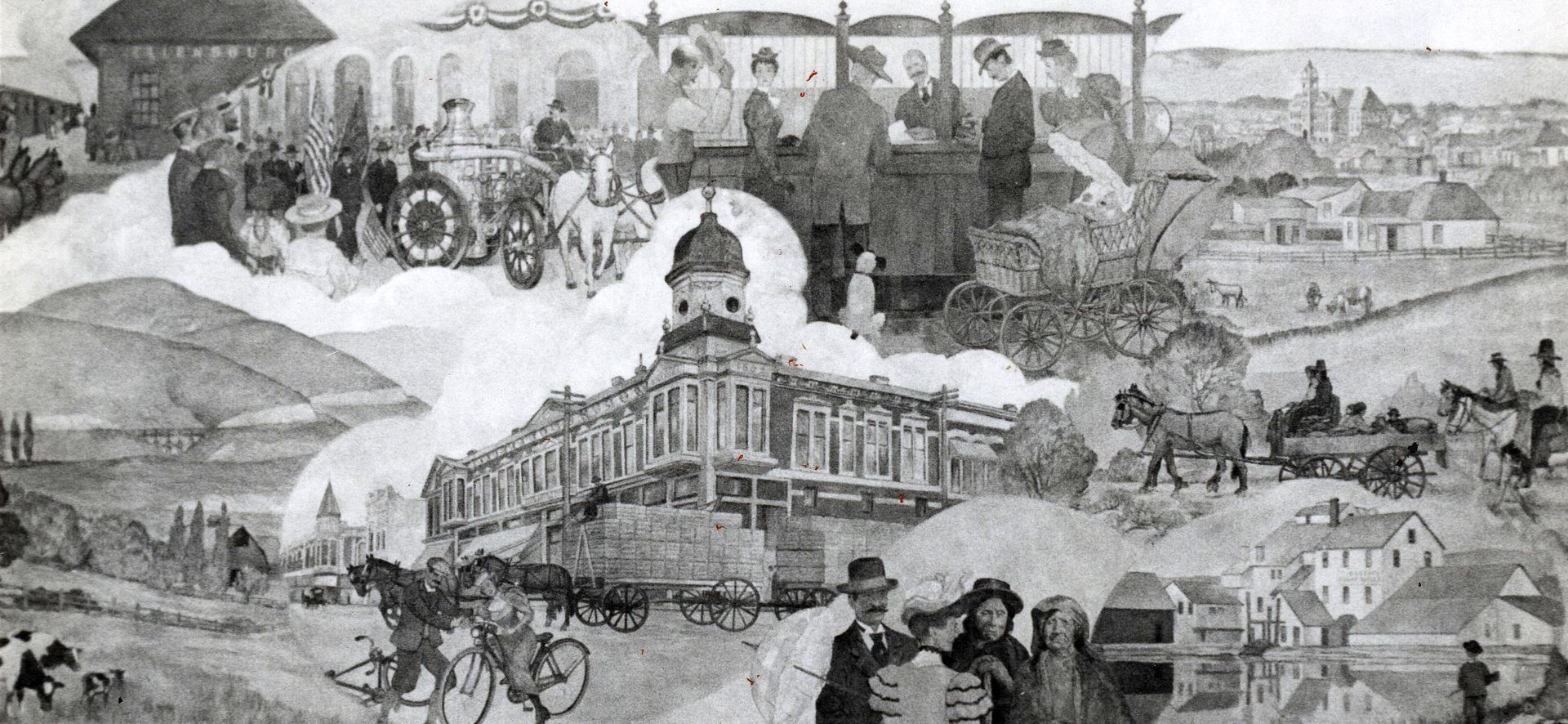
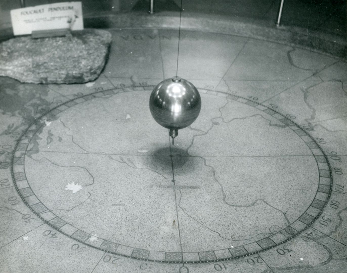
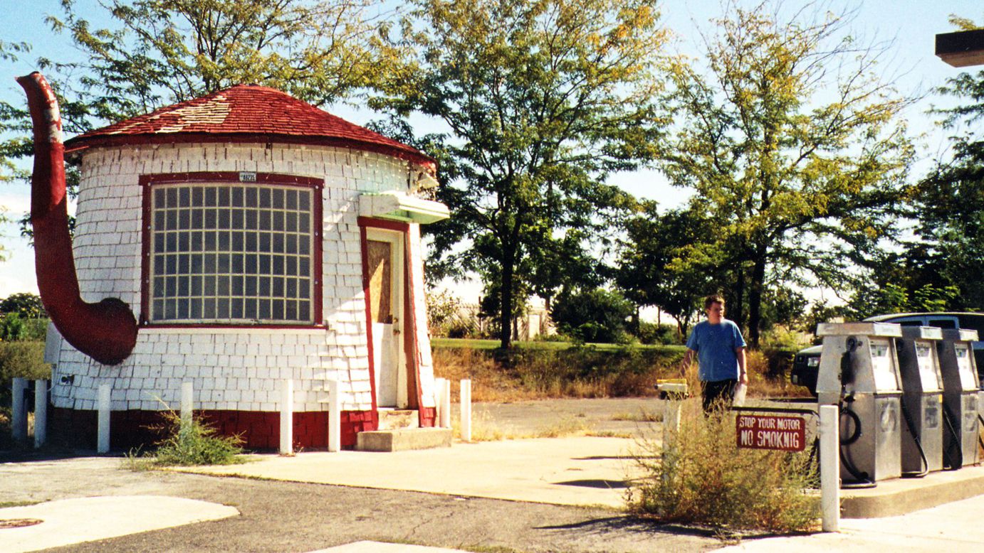
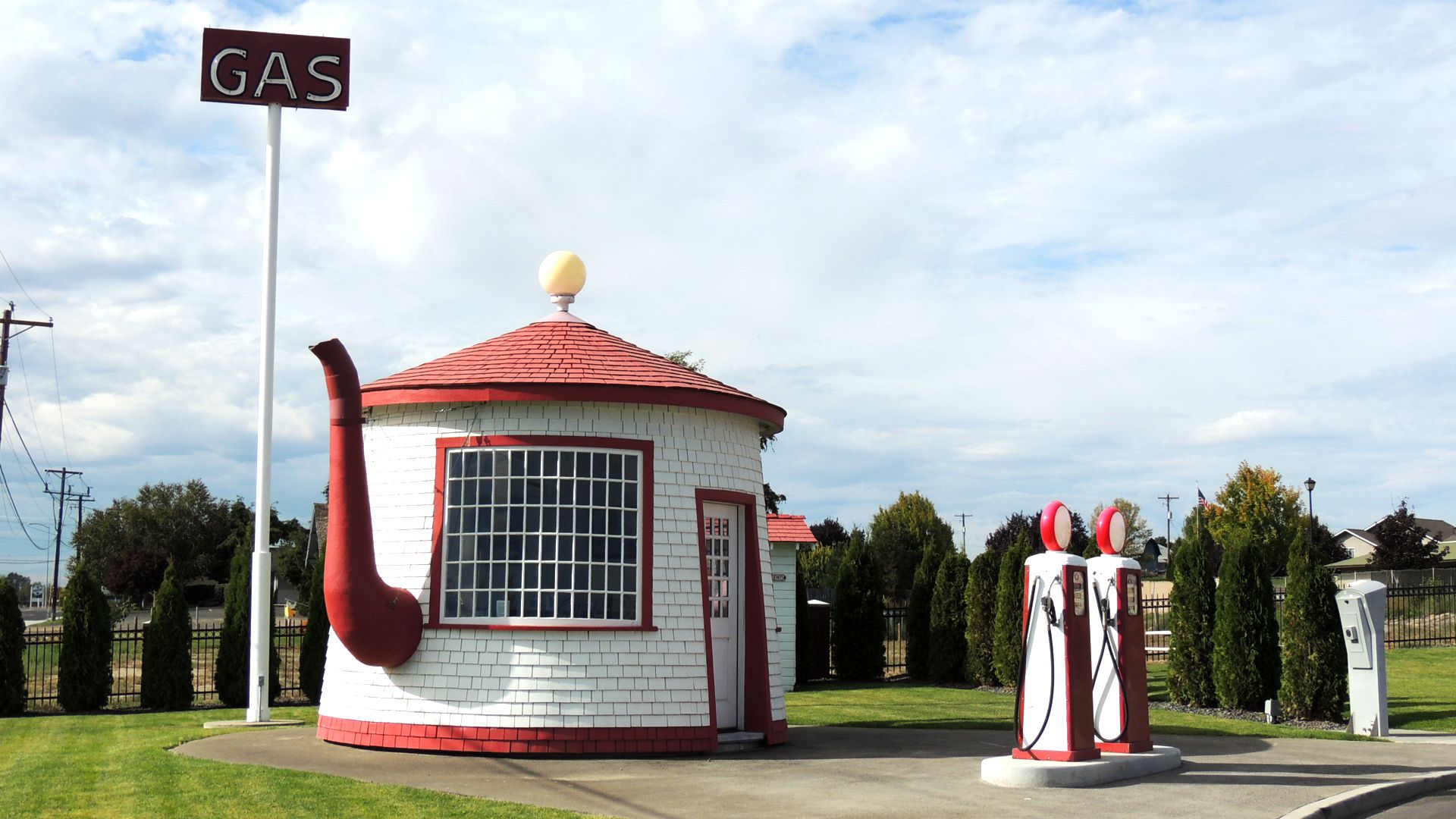
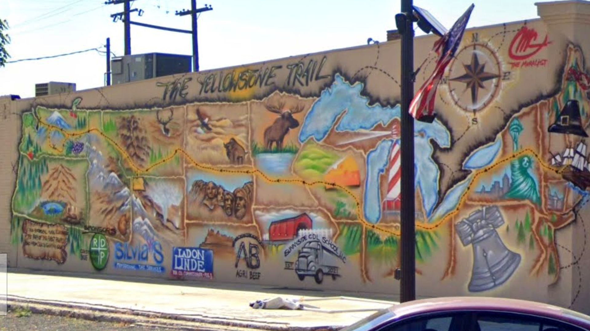
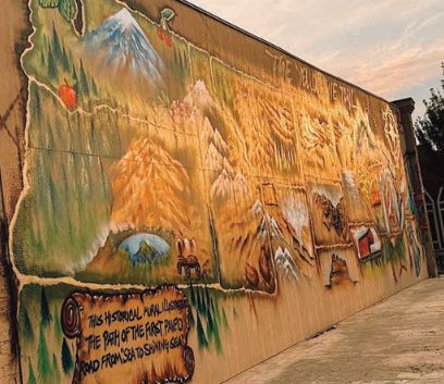
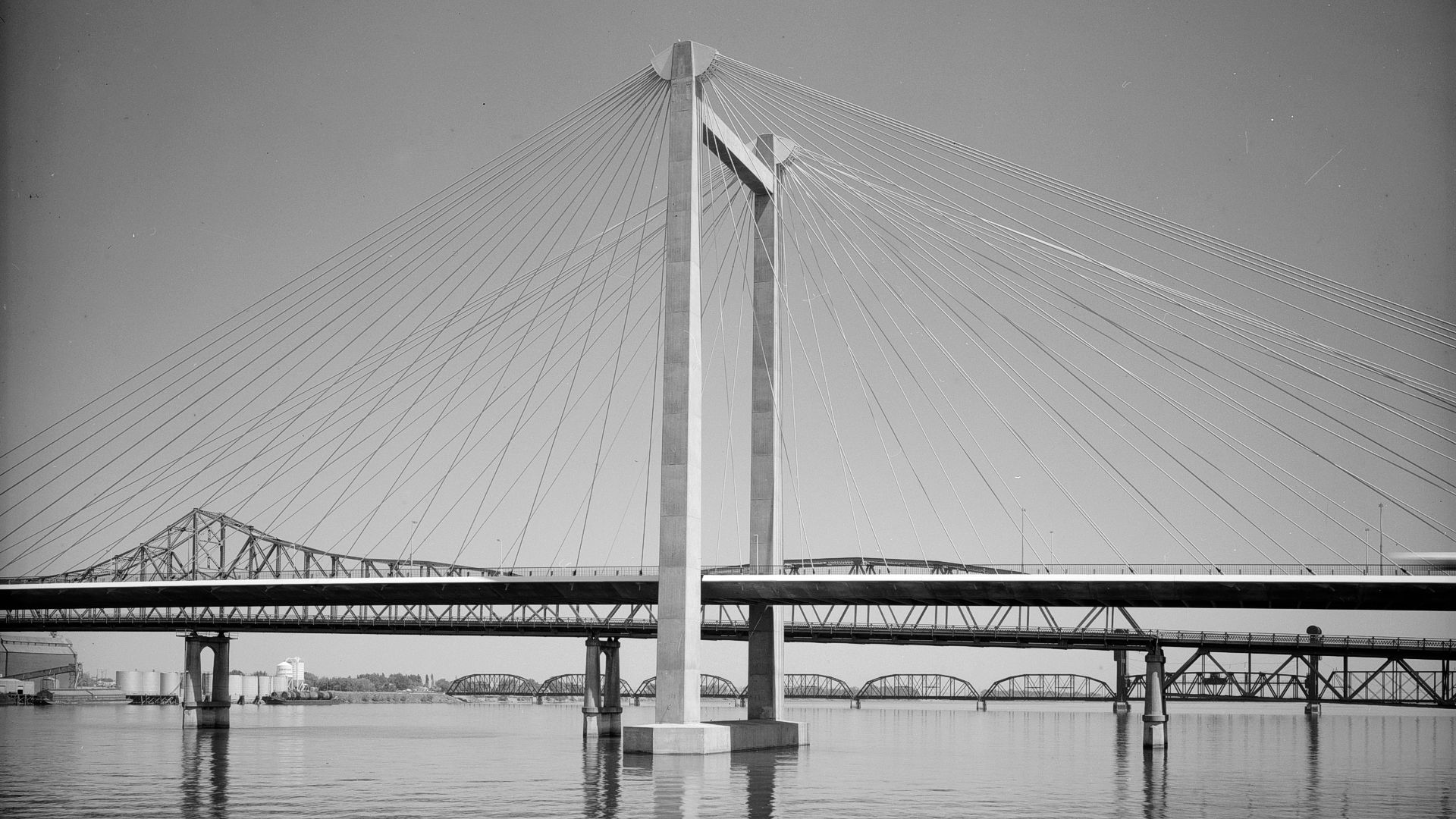
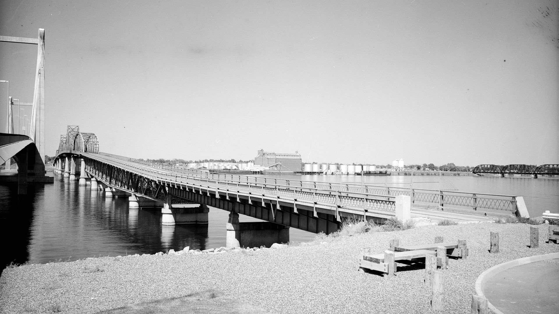
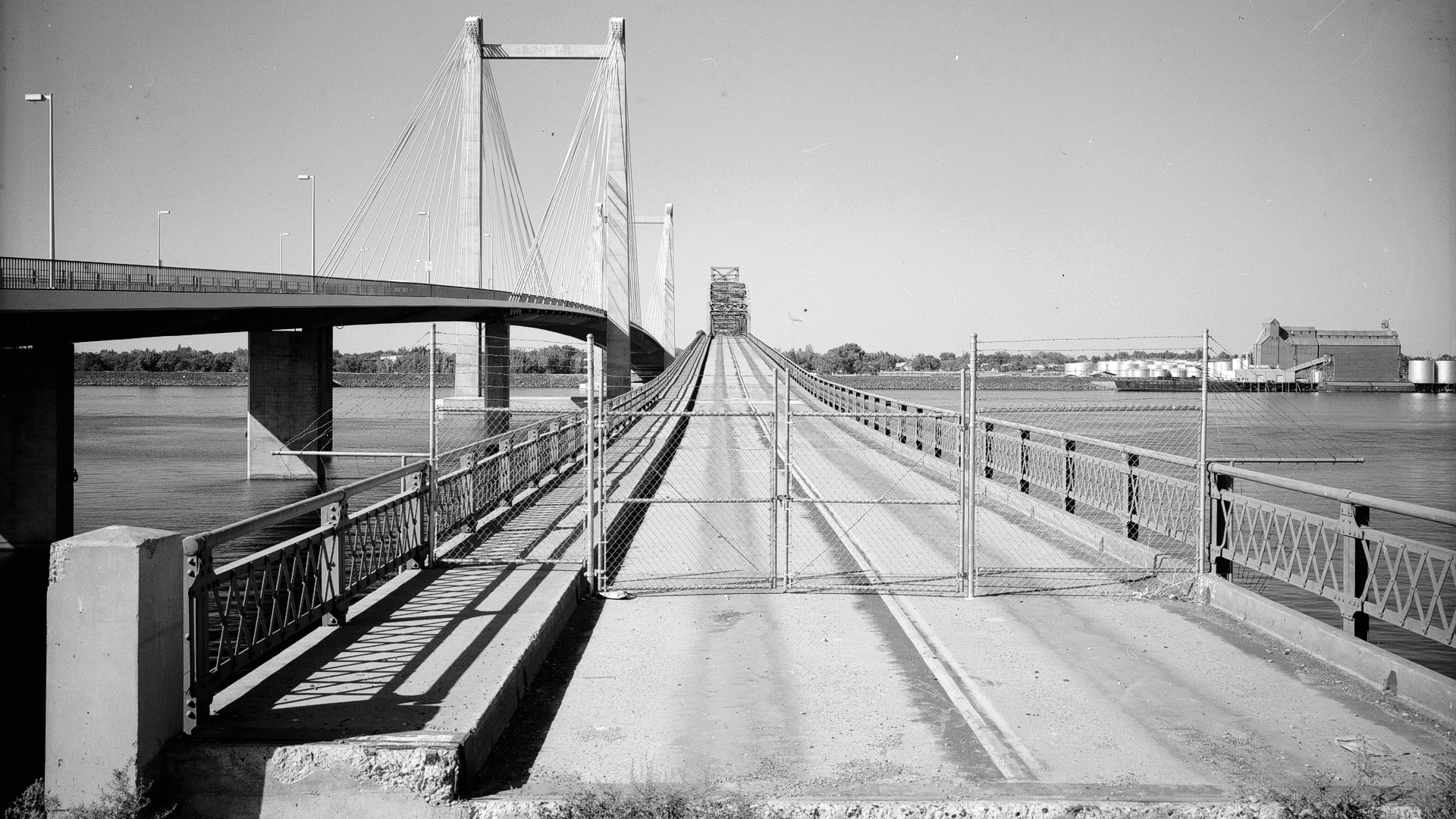
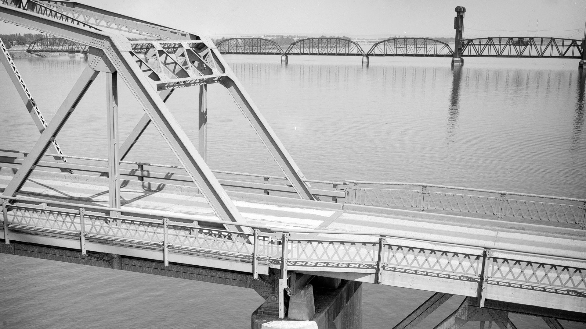
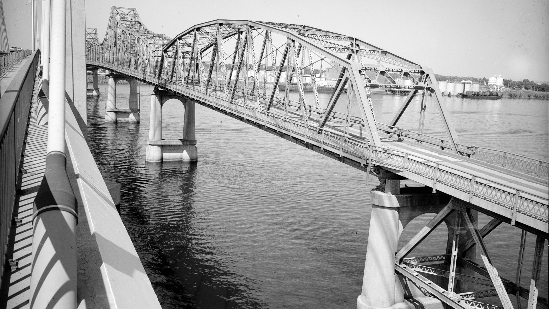
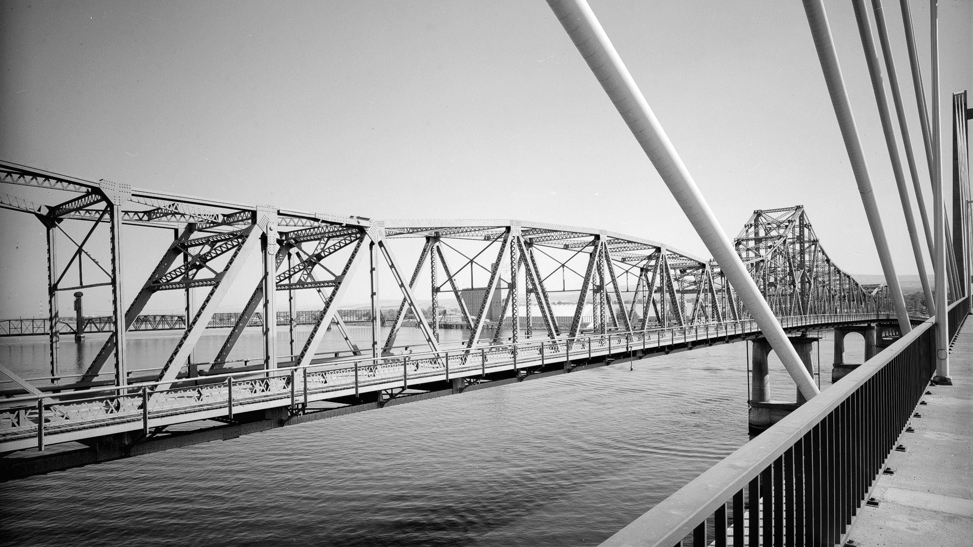
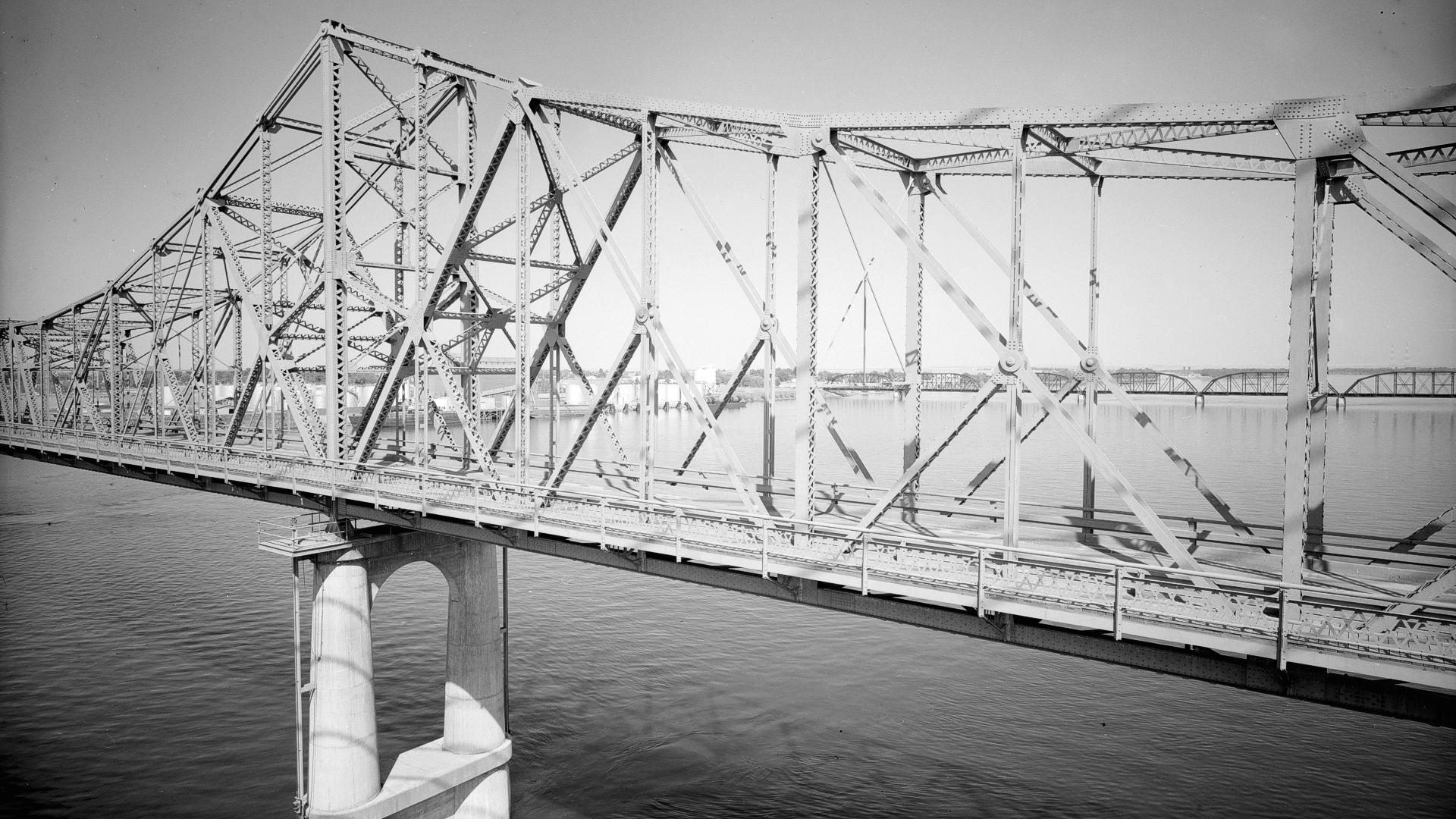
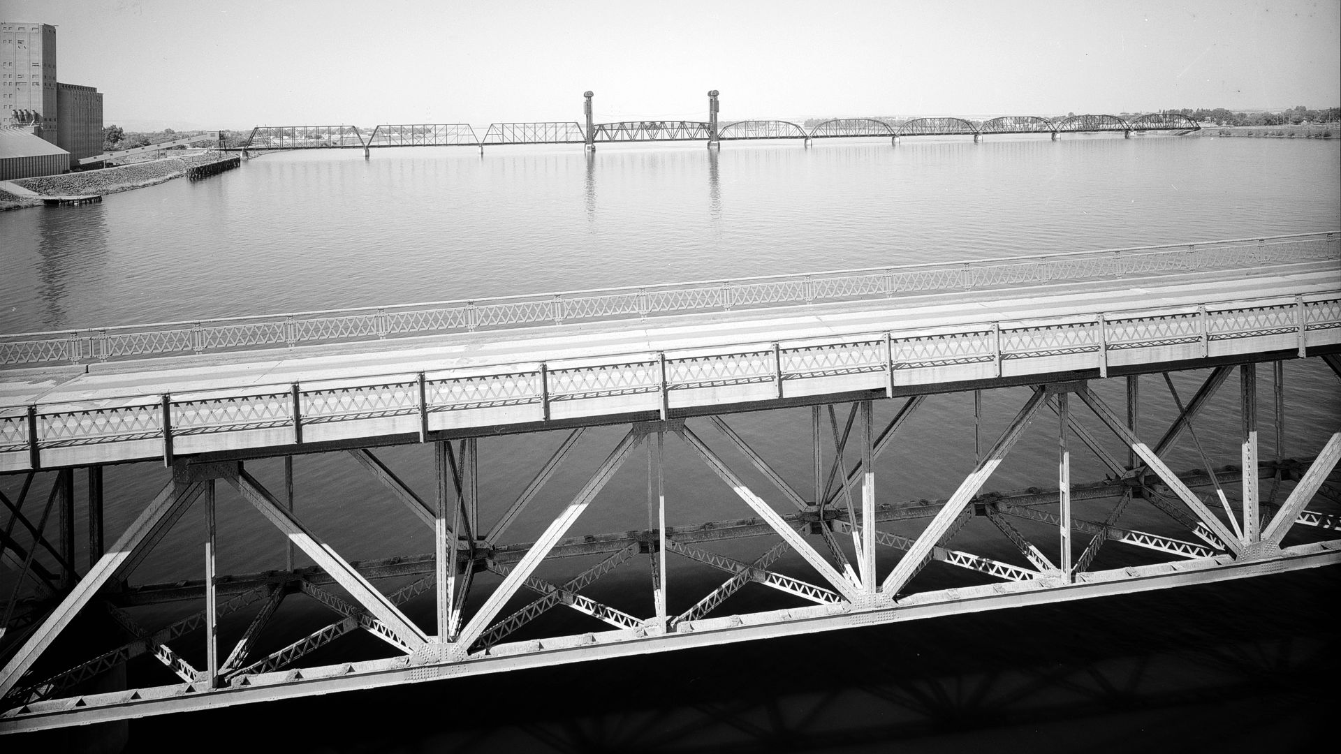
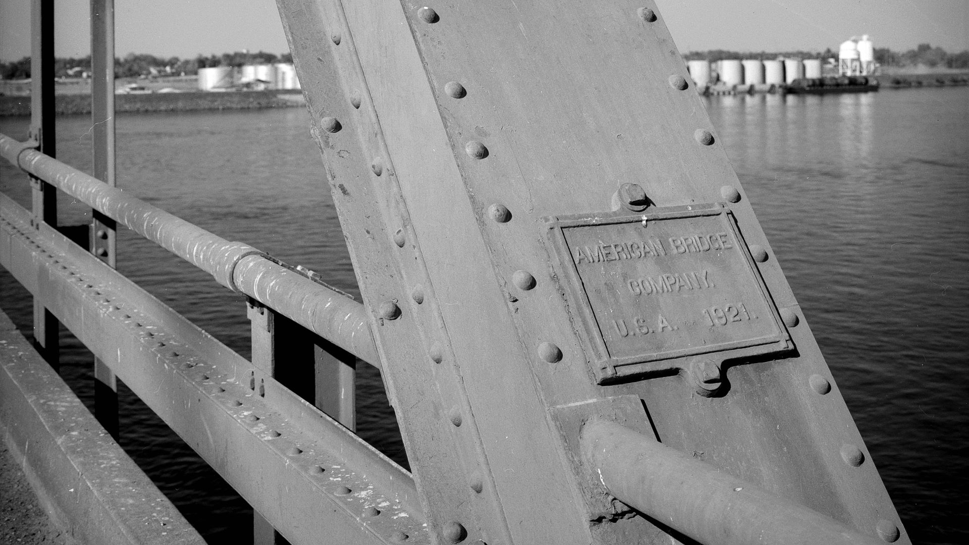
The difficulties of establishing a Yellowstone Trail route through western Montana, Idaho, and Washington had been brought to the attention of J. W. Parmley (founder of the Yellowstone Trail) so, true to his nature, he took a train from South Dakota to Butte, Montana, and then a car to Washington, in early 1915 to inspect the route alternatives.
After considerable consultation,
Parmley personally picked the southern IEH.
The more direct Sunset Highway would have been the obvious choice
had it not been for worries about the condition of the road through Blewett Pass.
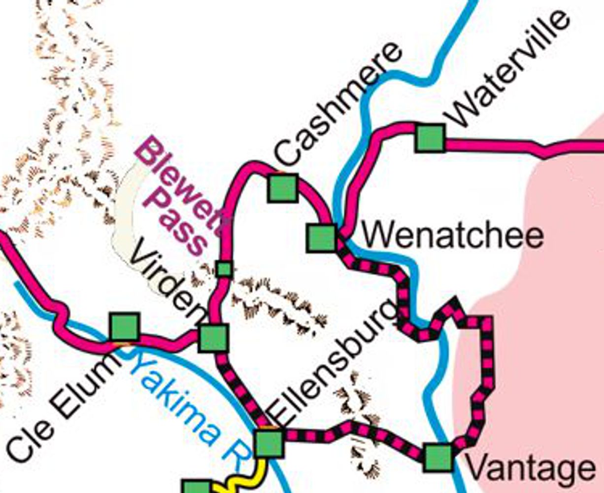 If Parmley was shown a copy of the 1915 State Highways map, his worries would have been compounded by a weird “reverse curve” that routed the Sunset Highway through Vantage apparently to avoid Blewett Pass (shown as a dotted black and red line on the accompanying map left).
That routing is strange in many ways: It crosses the Columbia River in three places, only one of which had a bridge, and it follows seeming non-existent roads.
Apparently, someone in the State Highway Commission determined that the condition of the Blewett Pass route was just too formidable!
In spite of that perverse map and Parmley’s decision to use the IEH, the local managers and drivers in the Yellowstone Trail 1915 Chicago to Seattle Relay Race chose to follow the route over Blewett Pass.
Confusing. But that is the way it was. See Trail Tale: 1915 Race (coming soon!).
The southern Yellowstone Trail route on the IEH was made irrevocable by its documentation in the popular Automobile Blue Book in the 1916 edition, and the 1916 Plymouth to Seattle Relay Race did follow the IEH route.
The Yellowstone Trail Association 1916 Route Folder was almost apologetic in describing the “scenic” route through the southeast Palouse district of Washington.
Promises of future connections to the Columbia River Road, Tacoma, and connections to California filled more space than discussion of the actual road in Washington.
“You can ship your machine [car] from Seattle to San Francisco for $50” sounds like an invitation to skip Washington entirely.
However, the 1917 Route Folder, much more assured, listed 25 Trailmen or supporting organizations from 25 cities on the Trail from Seattle through the southern Pasco and Walla Walla area and north through the Palouse to Spokane.
Descriptions of the Palouse praised it as “one of the most famous wheat countries of the world,” and, “fruit, nuts, and agriculture abound.” To offset the added distance, the Folder lamely offered, “the tourist has the advantage of a much better road.”
The Association went full throttle in the 1919 Route Folder, waxing poetic about the scenery of Idaho and Washington and devoting a whole page to the wonders of 15 towns on the route.
And Then There Was the
Banker in Pomeroy
Well, maybe it was the orchardist at Penawawa. They were both Yellowstone Trail Trailmen listed on one or more of the annual Yellowstone Trail Association Folders. One of them was apparently in charge of keeping the home office of the Yellowstone Trail Association informed of the location of the Yellowstone Trail in Southeastern Washington. And, we think, he communicated to keep Pomeroy, his home town, on the Trail a bit longer than was strictly fact. You judge.
Here’s the story as we can reconstruct it:
As you might recall, early in 1915 Parmley chose the Inland Empire Highway (IEH) route for the Yellowstone Trail over the shorter Sunset Highway because of the apparent poor condition of Blewett Pass. What Parmley might not have been fully informed of was the condition of the IEH.
First, a bit of background:
1911. The idea for the IEH route as a state highway was proposed by the Washington State Good Roads Association in response to the growing cadre´ of automobilists.
1912. An April 30, 1912 letter from Governor Hay stated that a state highway is being contemplated, the Inland Empire Road, to begin in Aberdeen (on the Pacific coast), and run a great circle through Seattle, Ellensburg, Wenatchee, Spokane, Colfax, Pomeroy, Walla Walla, Pasco, and back to Ellensburg. It is, however, “mere talk and its construction is many years in the future,” wrote Hay.
1913. The folks in southeastern Washington assumed the IEH was coming “now!” According to the online encyclopedia of Washington state history (www.historylink.org/File/10644).
The route of the Inland Empire Highway was also a matter of spirited contention in Whitman County. On January 7, 1913, a public meeting of the Good Roads Association of Whitman County in Colfax attracted so many people that the meeting had to be switched from a hotel meeting room to a much larger space at the Whitman County Courthouse.
The Pullman/Clarkston people promoted an eastern route and Colfax area folks promoted a western route. The association eventually agreed on nothing, except to formally endorse no particular route.
1914. The state began improvements (probably graded and added some bridges) on the IEH. The plan for the IEH called for it to go between Colfax and Pomeroy on the “most feasible route, crossing the Snake River on either the Penawawa ferry or the Almota ferry.” This certainly had pleased the Banker in Pomeroy.
1915. As reported on the 1915 State Highways map, something less than half that IEH route had been “improved” by state administered funds, and the Seattle/Spokane route (with that “reverse curve” through Vantage) was renamed the Sunset Highway.
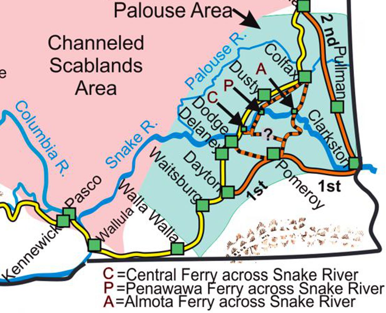 More important to our story is that after boisterous public meetings, many meetings of the state highway commission, and grousing on all sides, the IEH was given two routes between Walla Walla and Spokane!
One, the western route, ran through Central Ferry between Dayton and Rosalia on the yellow line on the map on the previous page. The other, the eastern route, had two parts: the 1st Division and the 2nd Division, shown in orange.
The Yellowstone Trail by default would follow the more direct Central Ferry route and avoid Pomeroy.
That certainly did not please the Banker in Pomeroy.
But, in fact, the Dusty/Central Ferry road was barely a road.
The 1915 state map labeled it as an “Other road open to travel.” Neither county nor state had touched it.
Apparently, the Trailmen from Pomeroy and Penawawa were slow to communicate the news of the change to the Central Ferry route back to Yellowstone Trail Association headquarters and Pomeroy was shown to be on the Trail maps in 1915 and 1916. Travelers were expected to ask directions locally and cross the Snake River at either Penawawa or Almota and wander south through Pomeroy.
See map left.
However, by 1917 the Central Ferry/Yellowstone Trail route was well established in fact and in the 1917 Folder.
And all was well… unless you lived in Pomeroy…until 1925.
1925 – The Route Reconsidered
In 1925, Blewett Pass, west of Wenatchee, was improved enough to more easily carry autos, and the Wenatchee city fathers strongly argued for the Trail to move north – through their town. We do not know what Wenatchee offered or if they offered anything besides argument, but whatever it was, it persuaded the Yellowstone Trail Association to abandon the Palouse and move north to the Sunset Highway for the entire distance between Seattle and Spokane.
In 1925 the Yellowstone Trail Association picked up its signs from the southern route which it had spent years installing and put them down on the northern route, on the Sunset Highway.
We do not possess a 1925 or 1926 Route Folder and would really like to have seen their explanation for the move north. The 1927 Folder spends time explaining about coulees as it described the sites along the northern route.
Why Did the Trail Go Where it Went?
A Different Perspective
Yes, the Trail was routed by J. W. Parmley and others of the Yellowstone Trail Association but their efforts were built on the work of many men before them.
Others developed the mail routes, built some of the necessary bridges, built the towns, and laid the railroad track, all of which determined the location of the road.
But,… the route was ultimately affected by something we seldom name: geology.
Traveling from Seattle to Boston the Trail went through Chicago and Cleveland because Lakes Michigan and Erie forced it south of what would have been the shortest possible route. Going west from Montana, the road had to squeeze between hills, around the lakes, and over the rivers of the Bitterroots, part of the great Rocky Mountains.
So,…?
Well, in Washington the “troublesome” geology is spectacularly on display along and near the Yellowstone Trail in Washington. And much of that is compelling because it is new to most of us.
We’ll consider three (3) “bits” of geology that profoundly affected the route of the Trail in eastern Washington that you can see and enjoy.
It is just more of the history of the Trail, but a few thousand or even a million years earlier.

Bit #1:
As you follow much of the Trail east of Ellensburg, either the north or south route, you have a whole lot of basaltic rock under (and sometimes around) you. Between six and 17 million years ago, most of it about 15.6 million years ago, lava welled up in many places (not volcanoes) in the neighborhood and filled in the entire area of eastern Washington (and into Idaho and Oregon). Actually, it covered up then-existing mountains and valleys, leaving them now, in places, up to 3,000 feet below the new surface. So much lava that the whole area sank so that the surface was at about the same elevation as before the magma came. A lot of that basaltic rock is now seen in layers in erosion cuts in many, many places, such as at Palouse Falls, Dry Falls south of Coulee City and the east shore of Banks Lake in Grand Coulee on your way to Grand Coulee Dam.
Bit #2:
A long time later, in the last ice age, 150,000 to 12,000 years ago, glaciers repeatedly cut across the Clark Fork river valley near Sandpoint, Idaho, and formed a dam backing up drainage to southeast of Missoula, a couple of Great Lakes’ volume of water. Enough water collected to float part of the ice dam, or at least the dam failed, and released the whole lake in a gigantic “Missoula Flood” over eastern Washington, Idaho, and Oregon, creating the Channelled Scablands. The water scoured the land, cut waterfalls bigger than Niagara, eroded out valleys and left some areas undisturbed. After each dam failure, the southward moving ice sheet then created a new lake, and the cycle repeated itself. (See the Mile-by-Mile for WA-N227.2 and related Waysides)
Bit #3:
With the ice age glaciers grinding up rock, lots of fine dust and sand was created and washed over the land to the southwest by the melting glaciers or one of the Missoula Floods. During the periods between the Floods, the dust and sand (now called loess) was blown (actually just dropped from the air) into the Palouse where it formed dune-like hills. Well, that is a current thought; geologists are still trying to figure it all out. Nevertheless, the Palouse is an incredible area visually and agriculturally.
See the map left.
Much of the countryside from Spokane to Walla Walla is in the Palouse.
Put all three geology bits together and visit Palouse Falls (photo right).
Now that you are off the Interstate, look left and right, stop to really explore something, learn and enjoy.
Consider the constant, pervasive effect that geology placed on routing the Yellowstone Trail.
If you have the slightest tickle of interest, very understandable and interesting videos and references are easy to find: Search online for 1) Central Washington University’s online presentations by Nick Zentner, 2) “Washington’s Ice Age Floods” and 3) “Flood Basalts of the Pacific Northwest”.
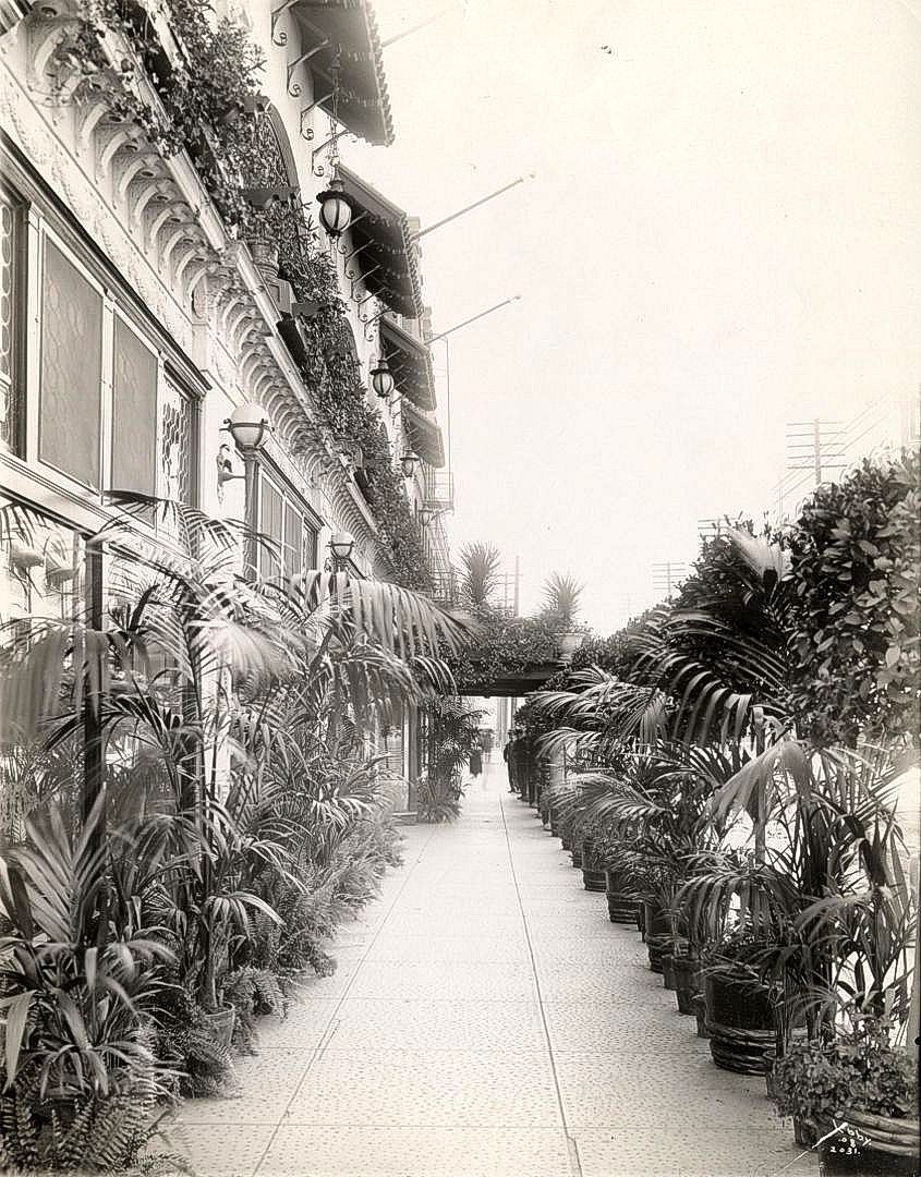
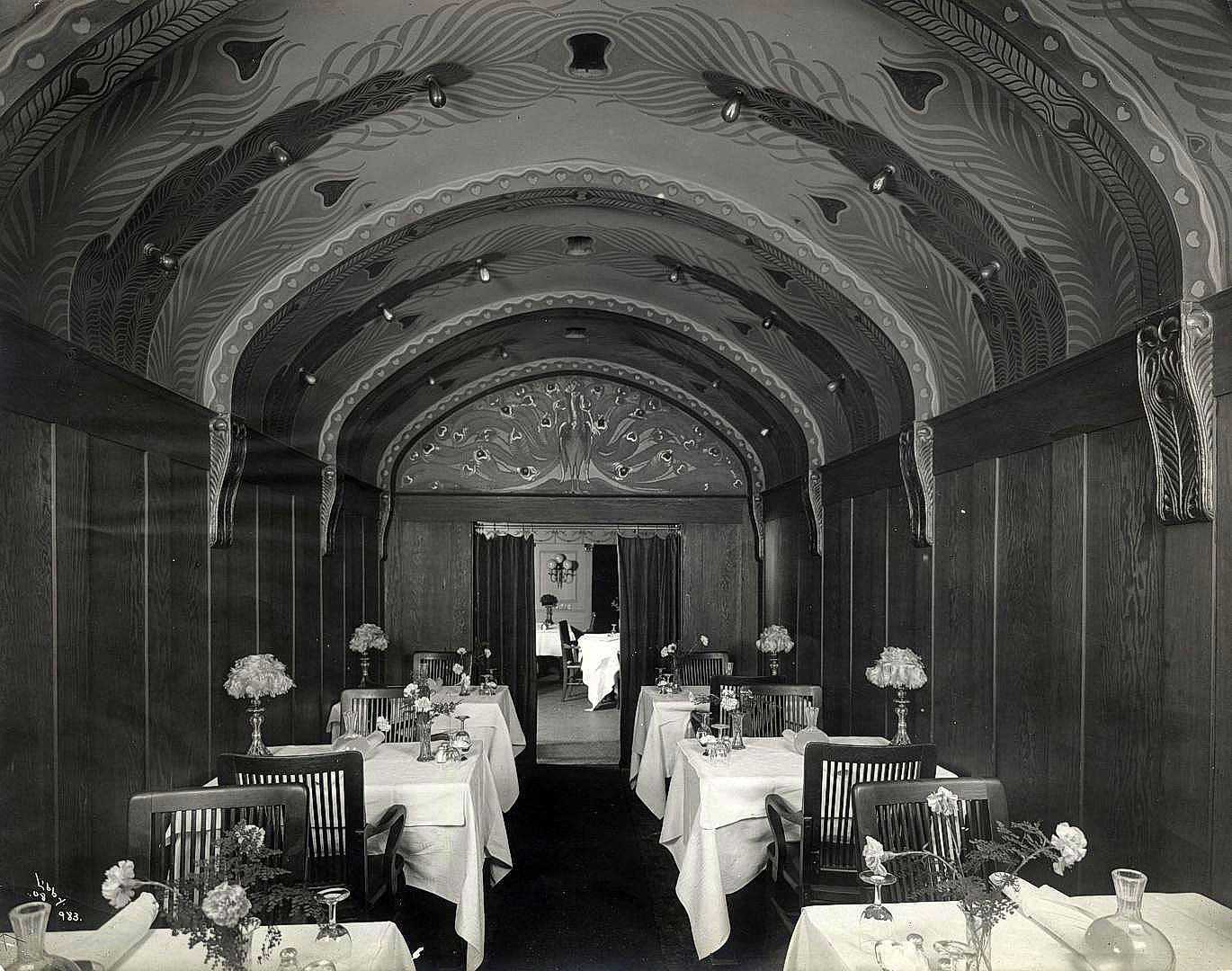
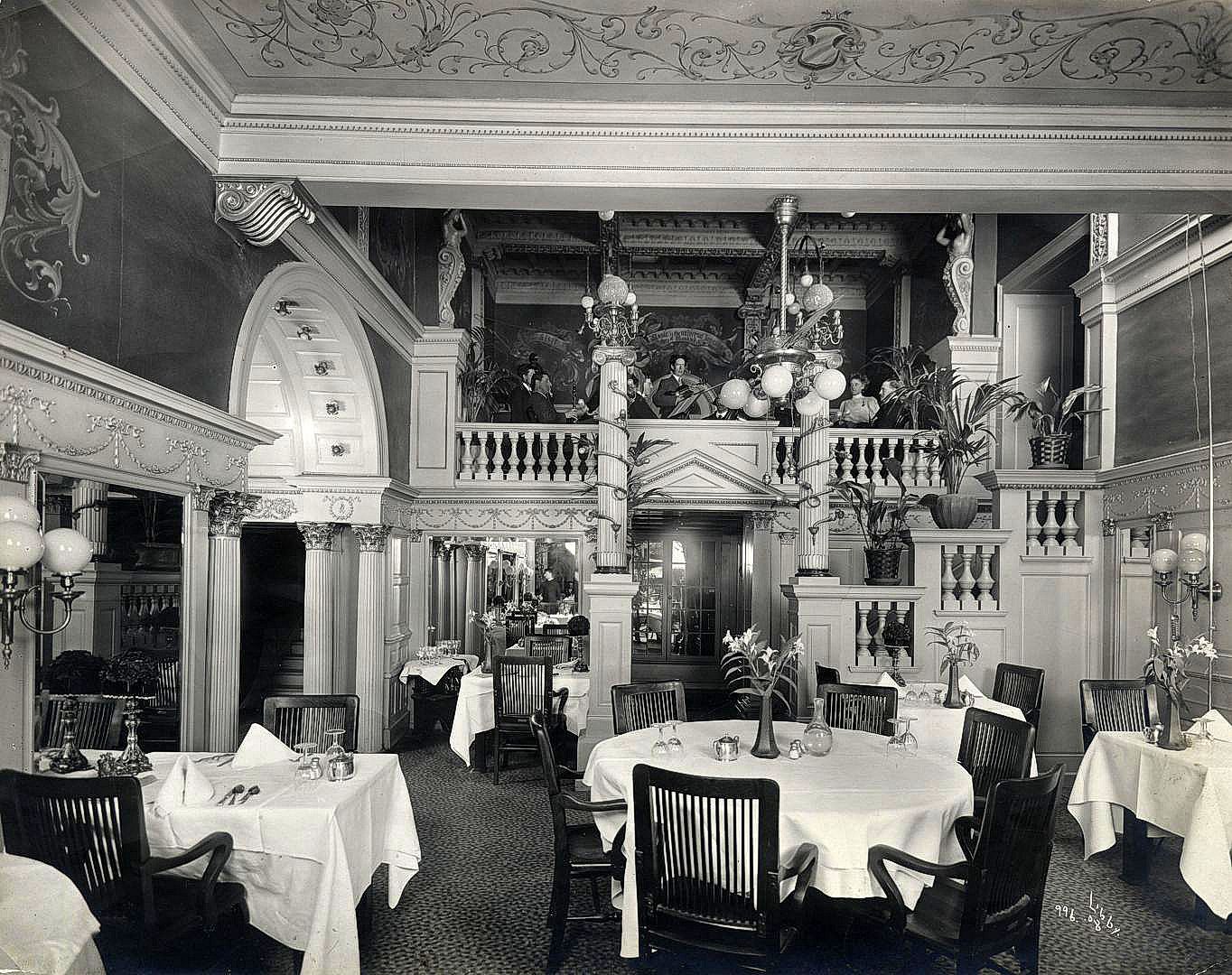
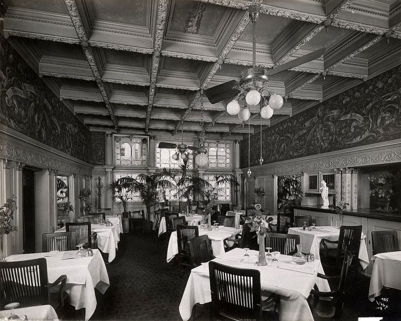
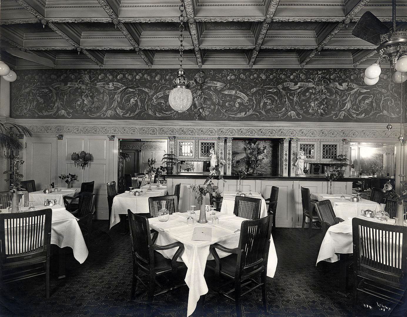
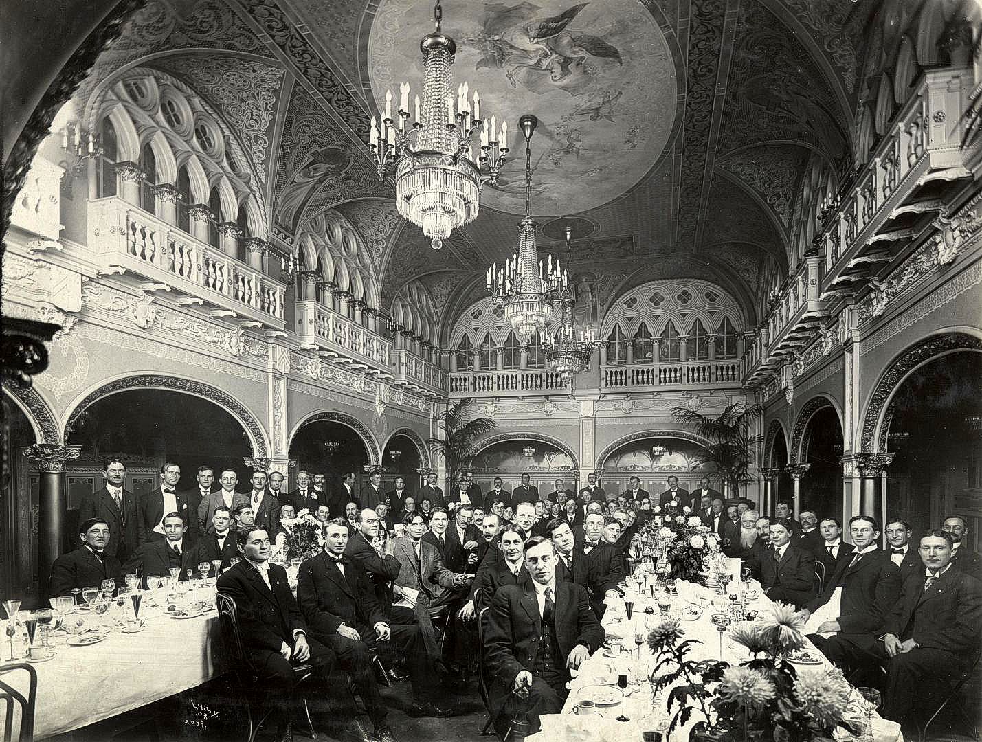
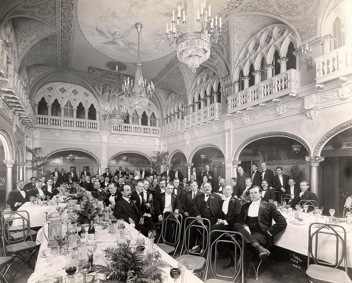
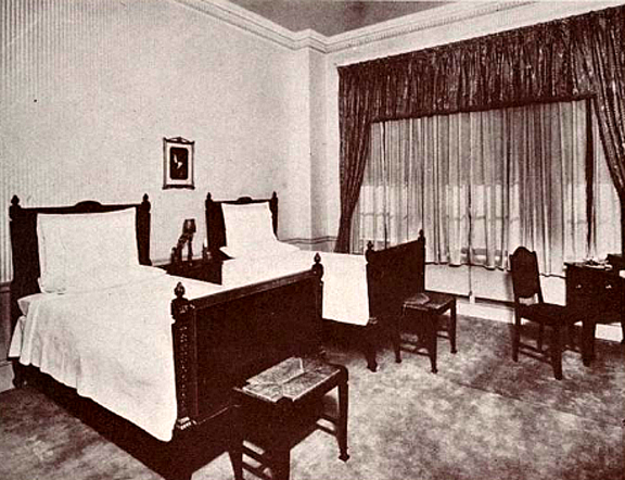
The Corbaley – Pine Canyon Road
The Pine Canyon Road is a most interesting part of the 1925-1930 Yellowstone Trail, in addition to being a part of the National Parks Highway and Washington’s Sunset Highway. Lori Ludeman, Director of the Douglas County Historical Museum, contributed much to this essay, but questions still remain; we hope some reader can find answers to them.
NOTE: The new Director of the Douglas County Museum, Dr. E. F. Cater, has for the most part, solved this mystery.
Click Here to see the results on the museum’s website.
During 1925, the Yellowstone Trail between Spokane and Cle Elum in Washington was rerouted from the southern Walla Walla through Yakima route to the northern Waterville, Wenatchee, Blewett Pass route after the Blewett Pass had been sufficiently upgraded.
The northern route includes Pine Canyon, between Waterville and the Columbia River. There the road drops 2,000 feet and includes some dramatic scenery. The road was a challenge to build and is a delightful area to explore in the 21st century.
That area is marked by several canyons formed as the Columbia cut 2,000 feet down below the altitude of Waterville.
In addition to the major Columbia River canyon there are two tributary canyons of interest.
The larger, Corbaley Canyon, is marked on the map (below) in orange.
The other, Pine Canyon, is marked in purple.
Pine Canyon meets Corbaley Canyon at the point marked “B”.
There appears to be continuing ambiguity about those names; some commentators include the canyon marked in orange as part of Pine Canyon.
The USGS does not help the ambiguity by recording the name Pine Canyon only at the coordinates of the canyons’ intersection at “B”.
Transportation around Waterville developed from the immigrant routes from the east and the extension of railroads from the midwest. The 2,000 foot drop to the Columbia River had to be faced to develop transportation to the west toward the Pacific Ocean.
One of the early attempts resulted in a tramway described in an article in www.historylink.org (June 8, 2010) by Laura Arksey, late of the Northwest Museum of Arts and Culture in Spokane.
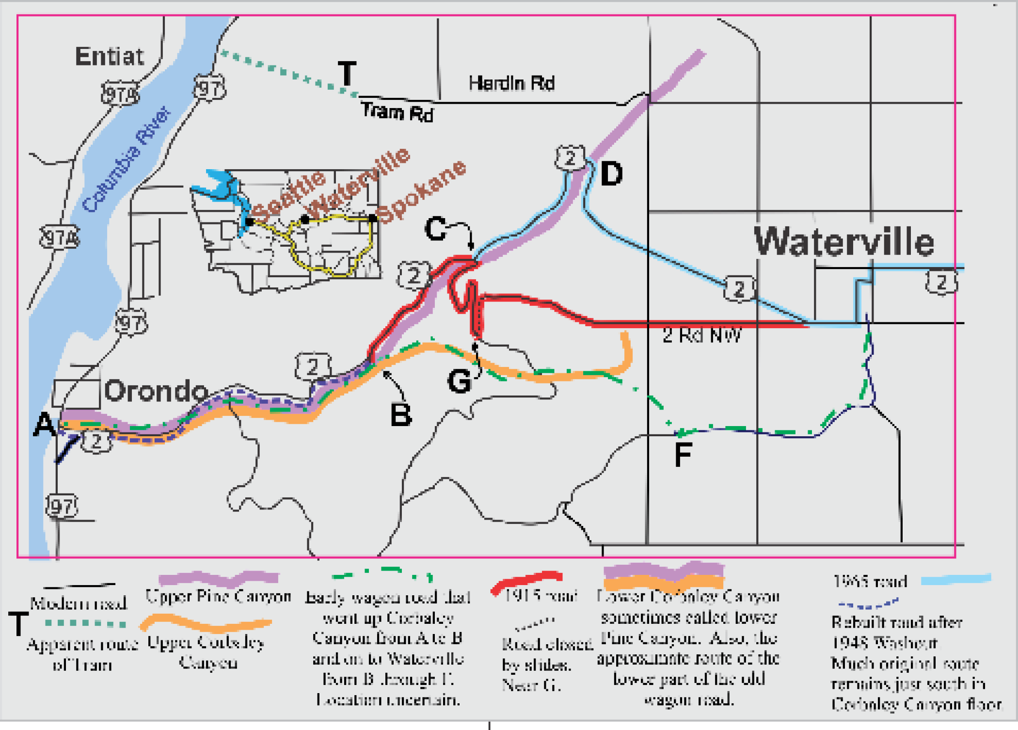 Arksey wrote:
Wheat farming was not without some continuing problems, transportation being a major one. Waterville’s position high on the plateau above the Columbia made access to the river ports barely possible for heavily-loaded wagons.
A solution was found in 1902 when the Columbia River Tramway Company began operating trams from the edge of the bluff down the breaks to a steamboat landing three miles north of Orondo.
Large steel buckets on cables supported by wooden towers carried wheat sacks the two miles down and returned laden with freight and merchandise for Waterville stores. At first gravity operated, it soon became obvious that the tram needed a steam engine as well. There are local tales of a few intrepid souls riding the giant buckets, on one occasion being stranded for many hours because of a mechanical malfunction. The tram operated until 1910. One of the buckets salvaged by helicopter in 1973 is on display outside the Douglas County Historical Museum at Waterville next to murals depicting the tramway era.
The probable route of the tram is marked with a T and a dotted line on the map. The “Tram Road” name appears on some maps instead of the modern Hardin Road, indicating that was the location of the road from the tram to Waterville.
Douglas County Museum has the complete history of the Tramway along with a new outside mural of the Tramway painted on the outside of their building!
For more information about the “Tramway”, please visit Douglas County Museum.
Arksey also reports that beginning around 1885 a wagon road was created running from Waterville through Corbaley Canyon to the Columbia River. (The dot-dash green line.)
On a difficult old Indian trail George W. Blair and C. C. Rickman established a stage and mail service in 1886, linking Waterville with Ellensburg. It was ‘a nightmare for men and horses alike, going and coming, steep and treacherous, and winters turned the route into an icy bobsled run. They had to wrap chains around the runners of the loaded sled to prevent it from shooting downhill out of control.’ During the 1890s another company operated a road from the east, roughly following present US 2, which was only marginally better, involving steep grades at Moses Coulee and Douglas Creek Canyon.
Although a few intrepid early motorists did traverse Corbaley Canyon, and as early as 1914 an automobile “stage line” was transporting passengers and parcels in a Maxwell and a Buick, it was obvious that a new route was needed.
And the new route (pink shaded line on the map) was created. As reported by Lori Ludeman:
A major improvement came in 1915-16 from a road gang of state prison convicts from the penitentiary at Walla Walla who were used as a cost-cutting means; $59,036 had been appropriated from the legislature for construction of five miles of road from a point two miles west of Waterville down Pine Canyon to a point where it runs into Corbaley Canyon.
The road was 30 feet wide, with a maximum grade of five percent. Hillside material was the base. Work began in June 1915. The convicts worked both summer and winter months and were, with the exception of some blasting powder, equipped with only hand tools.
Completion of the road was greeted enthusiastically both by travelers and commercial interests. The route was said to not have a “single turn around which cars cannot be seen.”
The original wagon road was in the canyon bottom and two years later spring runoff water from Pine Canyon Creek wiped out two miles of the road’s lower section. Repair work was completed soon after. In 1930, the first “bituminous coating” was laid on the road.
Apparently, the 1915 five-mile road together with the existing lower Corbaley Canyon road became known as the Pine Canyon Rd.
Ludeman continued:
The early route had a roadside attraction in Beaver Den Springs. Developed in the early 1920s, there was a tent area, ice cream and fresh fruits. A telephone was also available.
In 1948, a flash flood hit the canyon, destroying the original Pine Canyon highway. State highway officials surveyed and rebuilt the road on a higher level. The new highway is 10 to 150 feet above the old flood washed road.
Much of the earlier lower road can still be seen from the existing road, now known a US 2. Turn offs along US 2 are available to provide a view of that earlier road.
Some of those early sections can be seen from the parking area at GPS: 47.63166, -120.18614 and from others nearby.
Zoom in along US 2 in Satellite view and inspect just south of the road. See the Corbaley Canyon picture, page <?>.
Ludeman concluded:
Later, a new upper portion of the canyon road and a new approach to Waterville were made.
The first section of the new road was completed during the summer of 1950, the second section 1965.
That modern alignment of the road, US 2, runs from C on the map to Waterville.
Because of washouts and debris on the road, the upper horseshoe of the 1915 road (dotted black line on map, near G) was closed at a fairly recent, but unknown, date. It can be seen at: GPS: 47.64371, -120.14724.
The reader is invited to provide clarifications, corrections, additional information, travel diaries, and stories to help document this section of the Yellowstone Trail.
Also see WA-N180 Pine Canyon, page <?>.