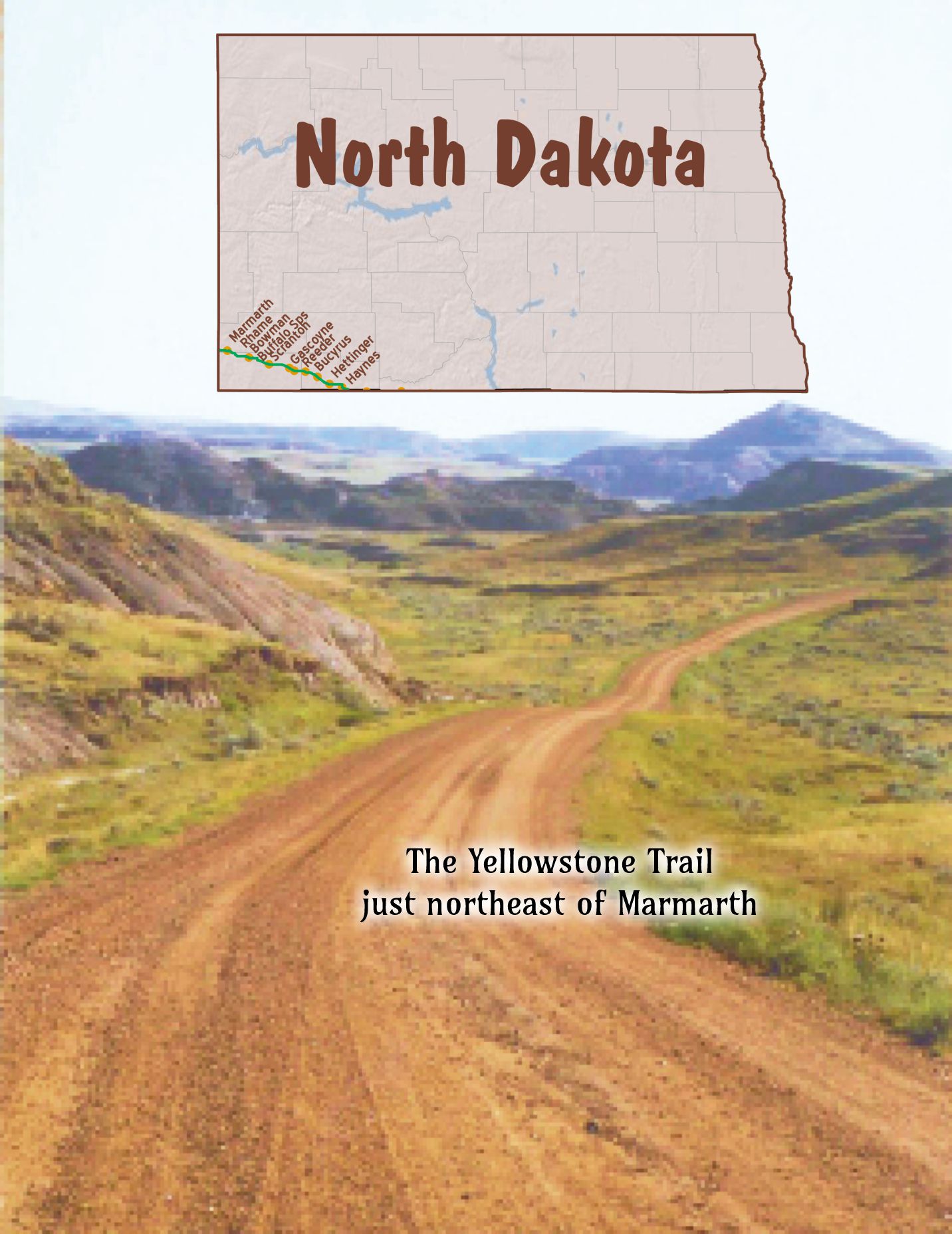


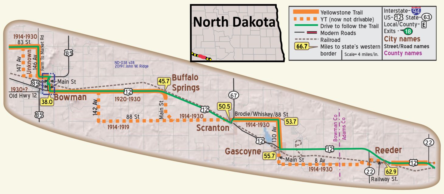
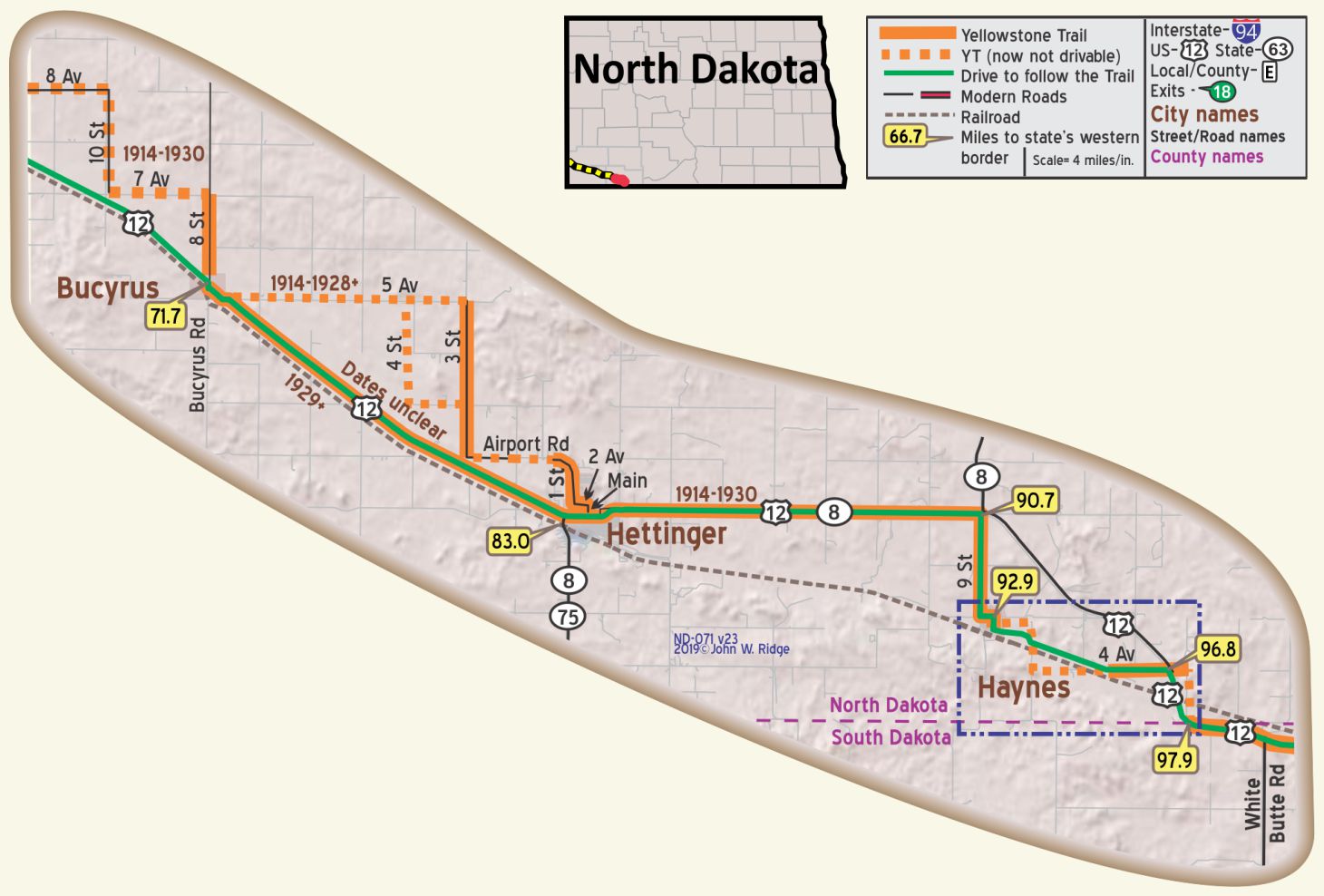
 The map’s green circle markers
are modern highway exit numbers used for current location reference.
 The map’s yellow rectangle mile markers show path of YT and distance from state’s west border.
While following the Travel Guide’s details below, click the corresponding text for Google Maps link.

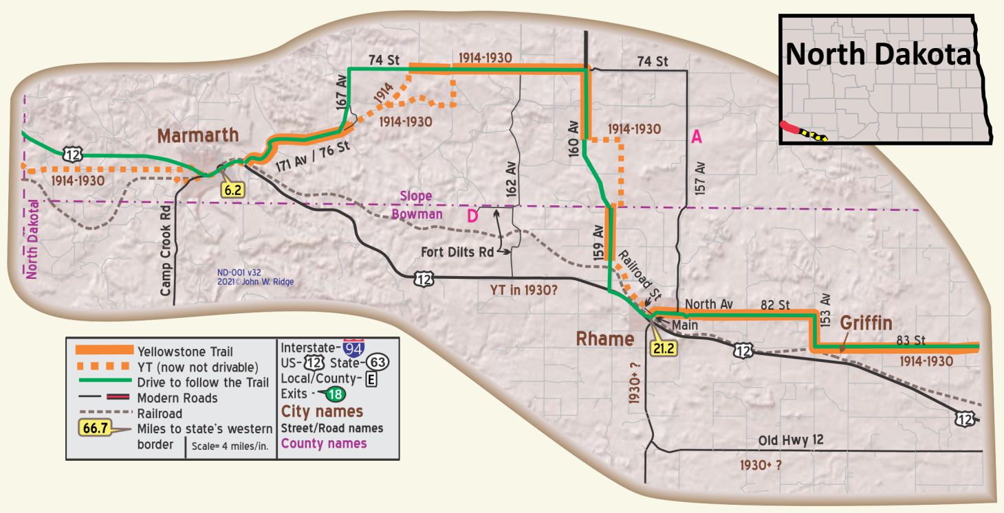 For Directions, click the North Dakota State (ND-) YTA Mile Marker Numbers below linking you to a real-time map.
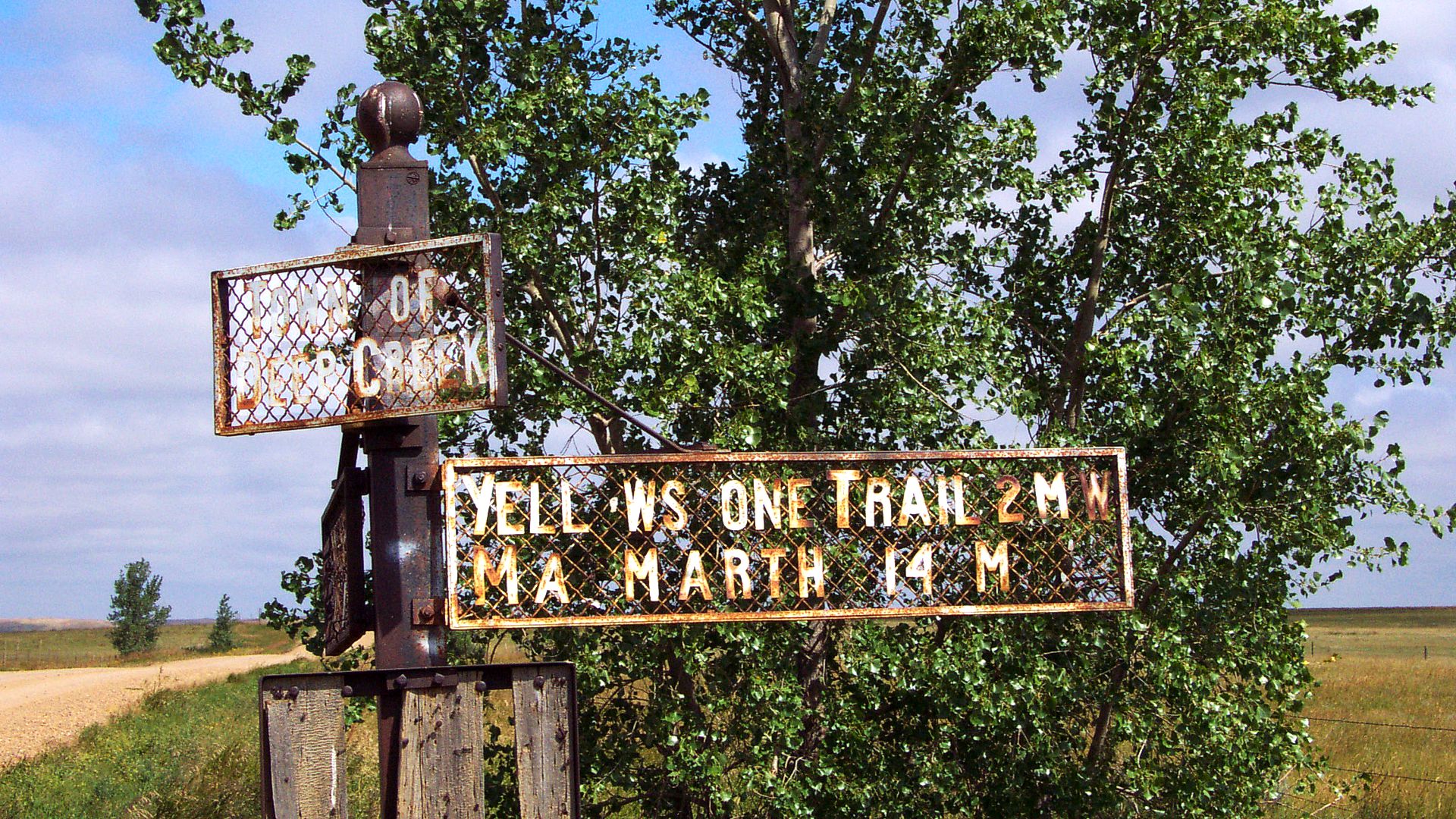
 ND-006.2 Marmarth
(pop. 1,500, alt. 1,800 ft.), is a modern little city located in the most picturesque part of the famous Little Missouri river badlands. A drive of about six miles north of town takes one to the foot of Pretty butte, one of the most fantastic badland formations. There are extensive camping grounds in Marmarth. BB1921-9*
As the tourist nears Marmarth the Badlands of North Dakota are reached, these being one of the most curious natural formations; very interesting and picturesque. WPA-ND*
Marmarth is at the confluence of Little Beaver Creek, Hay Creek, and the Little Missouri River. Known as the “city of trees,” Marmarth is almost an oasis in the treeless Badlands country. The town had its inception in 1902, and grew rapidly following the advent of the Milwaukee R. R. in 1907. Proximity to the Little Missouri and its tributaries has not always been advantageous; the town has been flooded five times. Dikes have been put up around the town adjacent to the streams. WPA-ND*
Marmarth is a shipping point for cattle brought overland from range grounds in this State, Montana, and South Dakota. The stockyards, which cover an area of 45 acres, and contain 86 pens and 15 loading chutes, are built on the site of the old O-X (0 Bar X) ranch. Nearby, on Hay Creek, still stands the squat old ranch house in which Theodore Roosevelt was once a guest. WPA-ND*
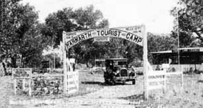 It is a freight division of the C. M. & St. Paul R. R. Cozy Cafe is well liked. Marmarth Camp, 50c, wood stoves; a nice site on river.
ST. CHARLES HOTEL is best; 30 rooms, 6 with r. w., 3 with bath; sgl. $l-$2; dbl. $1.50-$2.50; with bath $3.
PHILIPS MOTOR CO., Ford, owner is master mechanic. Fine for all cars. Labor $1.50; phone 42 until 10 p. m. MH-1928*.
In 1911 Marmarth was the largest city in North Dakota on the Milwaukee Road. By 1917 it was the only town in North Dakota to have natural gas piped in for both commercial and domestic use.
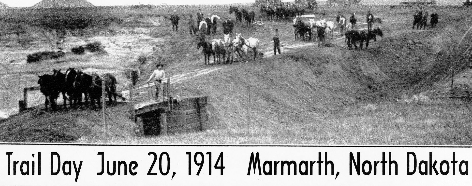
The problem of crossing the Little Missouri River at Marmarth yielded many a story including the fording of the river in 1913 by Michael Dowling and the fund-raising efforts of the Yellowstone Trail Association. For the stories and pictures of the crossing, see Trail Tale: Marmarth Bridge, page <?>.
After a long period of stagnation, Marmarth, just south of the Little Missouri National Grassland, seems to be enjoying a renaissance of sorts.
The Bismarck Tribune says,
Population is 136 as of the 2010 census, but that doesn’t take into account the folks who drive through on Highway 12, the oil workers who drift into town and the paleontology scholars and volunteers who participate in summer dinosaur projects.
305 First St. W (US 12/Yellowstone Trail). Unique Antique Auto Museum. The Unique Antique Car Museum showcases its 50 refurbished antique vehicles, a miniature car collection and a vast collection of old license plates from1916, and a 1920s die cast toy collection.
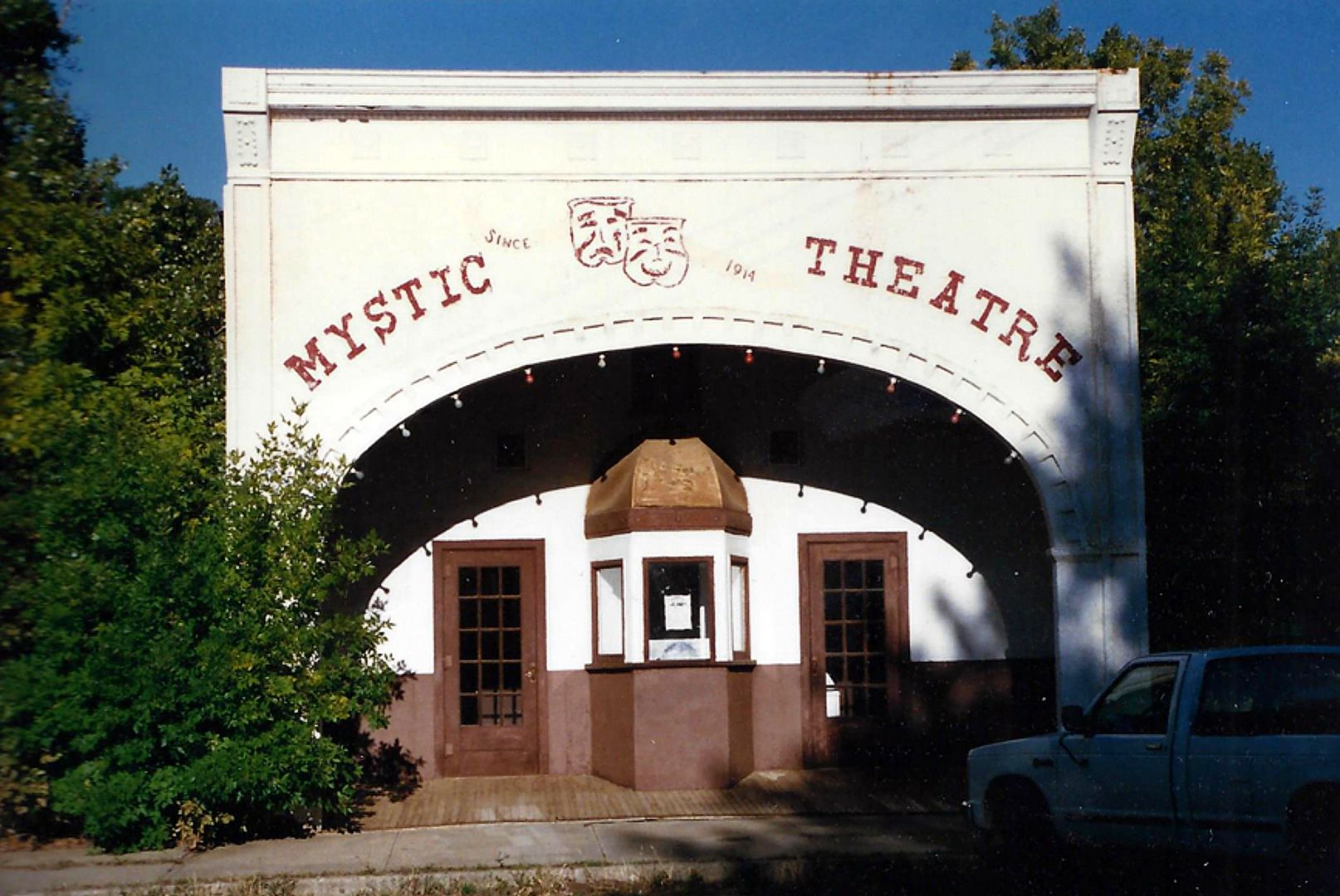 51 Main St. The Mystic Theatre was built in 1914, and is now owned by the Marmarth Historical Society. It has a stuccoed exterior and seats 187 (another source says 109 seats). It was unusual for its time, as it was specifically designed for showing “motion pictures” 13 years before “talkies” happened. It opened April 22, 1914, and was packed.
It is listed on the National Registry of Historic Places. The Society still operates the theatre and hosts a cowboy poetry gathering in September of every year, along with local talent and visiting entertainers. In 2014 there was a big 100th birthday bash for the edifice.
118 N Main St. Pastime Bar (one block north of US 12/Yellowstone Trail) or, more formally, Pastime Club and Steak House. Don’t be scared off by the name. It’s just a cowboy bar that serves great food and has creative participatory entertainment. We ate there a few years ago and had the best, largest hamburgers we ever ate.
WAYSIDE – Marmarth Research Foundation in the Hell Creek Formation near Marmarth. Dr. Tyler Lyson of the Smithsonian has been digging for dinosaur bones and fossils in this Badlands area his entire life. His 501(c)(3) Foundation has attracted other professional university paleontologists. It is entirely private, but amateurs are invited to dig, for a fee, and careful attention is made to maintain scientific integrity. The site includes tents, a lecture hall/dining facility and a lab. There is an office in Marmarth.
 ND-021.2 Rhame
(3,184 alt., 356 pop.), named for M. D. Rhame, district engineer of the Milwaukee R. R. when it was established in 1907, has the highest elevation of any town in the State. It is in a high valley between two large, flat, scoria-capped buttes. WPA-ND*
A 1924 Bulletin lists the Buttes Hotel and the Yellowstone Trail Garage.
Rhame’s first post office (1908) was a derailed boxcar. Before this, the mail was brought by stage and placed under the rock ledges of Post Office Butte for people to pick up their mail. The townsfolk celebrated their 100th anniversary in 2008.
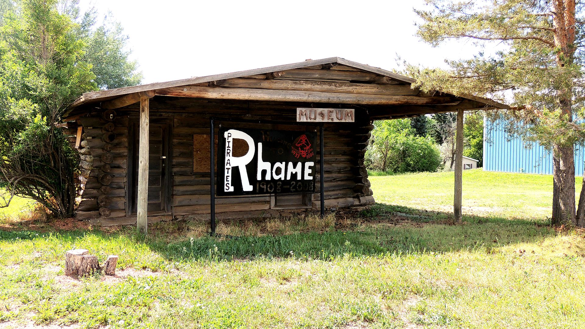
SE corner of Main & 2nd Sts. is a log cabin built in 1912 as a whimsical-style gas station. It was most recently used as a community museum. The walls were made of logs from a camp at Ekalaka where they were assembled before moving to Rhame. The roof is covered with scoria rock and extended on the west side so as to cover the service area. Note the height of the trees in that area in this picture. No car has approached the building in many decades (see picture below).
As you travel east from Rhame you will notice less of a “badlands” scene, fewer volcano-like buttes and more rolling hills and cattle. You might even see a few oil pumps.
ND-038.0 Bowman
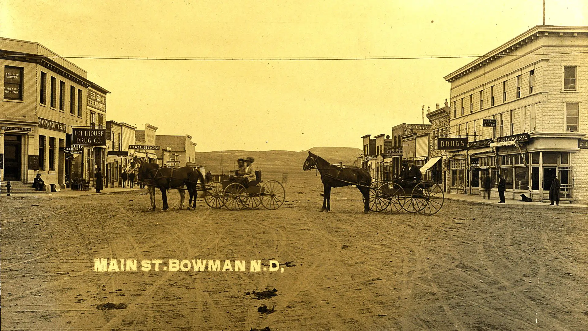
A live town in a grain and cattle raising area. Meals at Rudolph Hotel. Bowman Motor Co. is modern Ford Agency.
Free camp site, no shade. Good new pay camp to be built.
RUDOLPH HOTEL is partly modern; 3 rooms with bath, dbl. $2.75; dbl. without r. w. $1.75. MH-1928*
A 1924 Bulletin lists two more garages.
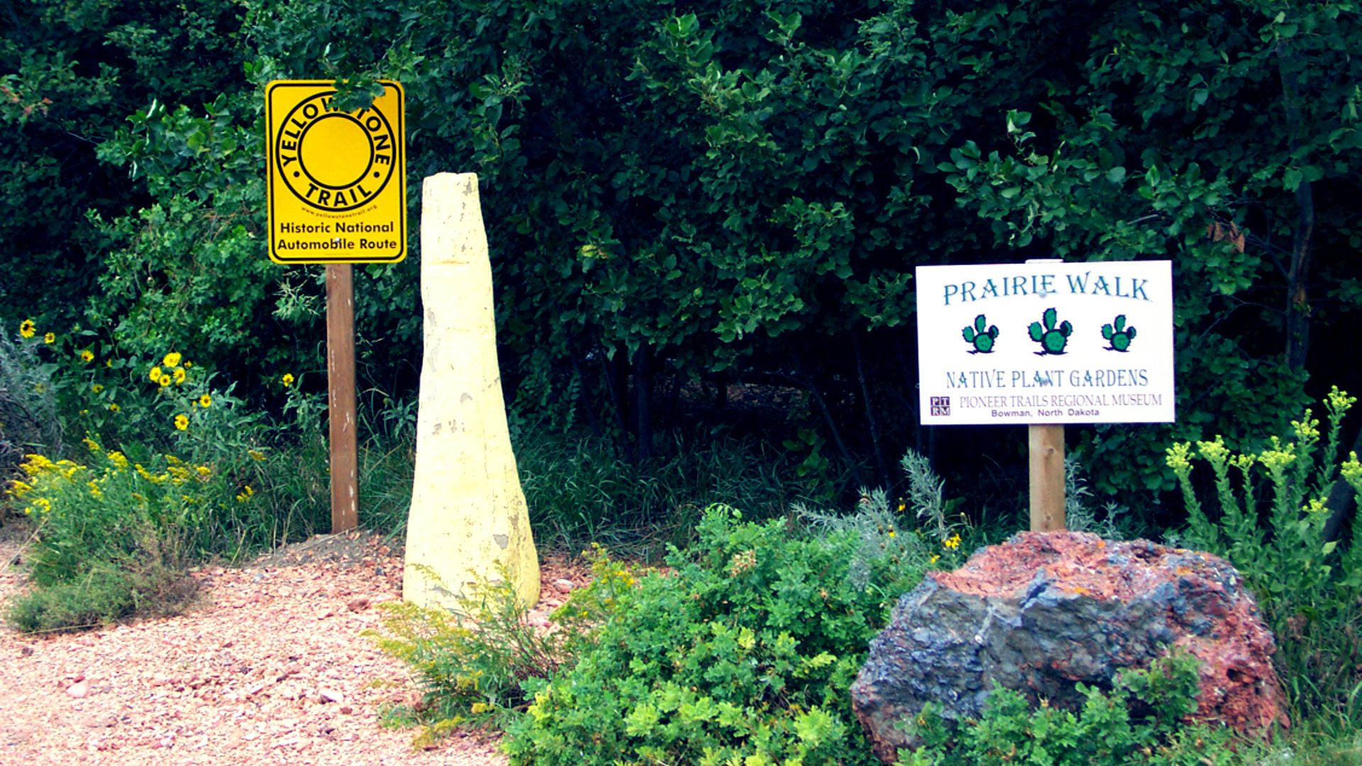
12 First Ave. NE. The Pioneer Trails Regional Museum is a regional research and repository museum reaching from within 100 miles of Bowman to include parts of Montana and South Dakota.
As such, it has programs available on anthropology, archaeology, paleontology, botany, and others.
Part of their mission is to conserve local historical artifacts and fossils.
Note: Western South Dakota and Western North Dakota are prime areas for organized dinosaur digging.
Guided tours of fossil sites are available as well as “hands on” digging. It is a sharp, energetic museum with a broad vision, a sod house, and a good book selection in its small shop. We stop in whenever we are in the area to view changing displays and their list of scientific guest speakers. Step into their small back yard and you will see a Yellowstone Trail sign.
If you are in Bowman in early September, you might see their annual Threshing Bee and display of 100-year-old farm equipment such as the huge Reeves Steam Tractor. Actual threshing happens and you can volunteer to experience what farming was like in Yellowstone Trail days.
WAYSIDE – About 30 miles north of Bowman is an oddity of nature. The Burning Coal Vein is a badlands landscape still in the making. For at least 200 years and until very recently a fire was smoldering in the coal layer several feet underground. As the burning turned the soil above it to ash, it collapsed, leaving large cracks in the surface of the badlands. The phenomenon still occurs on occasion, but the U.S. Forest Service has a policy of mechanically extinguishing the coal veins where they’re burning on the Little Missouri National Grasslands in order to prevent grass fires. A visitor might still see escaping gasses and slumping soil.
ND-045.7 Buffalo Springs
(2,850 alt., 75 pop.), was known briefly as Ingomar, but in 1907 received its present name, suggested by the nearby springs which once served as a watering place for the bison that roamed the plains. WPA-ND*
Gas, supplies and repair shop. Small free camp. MH-1928*
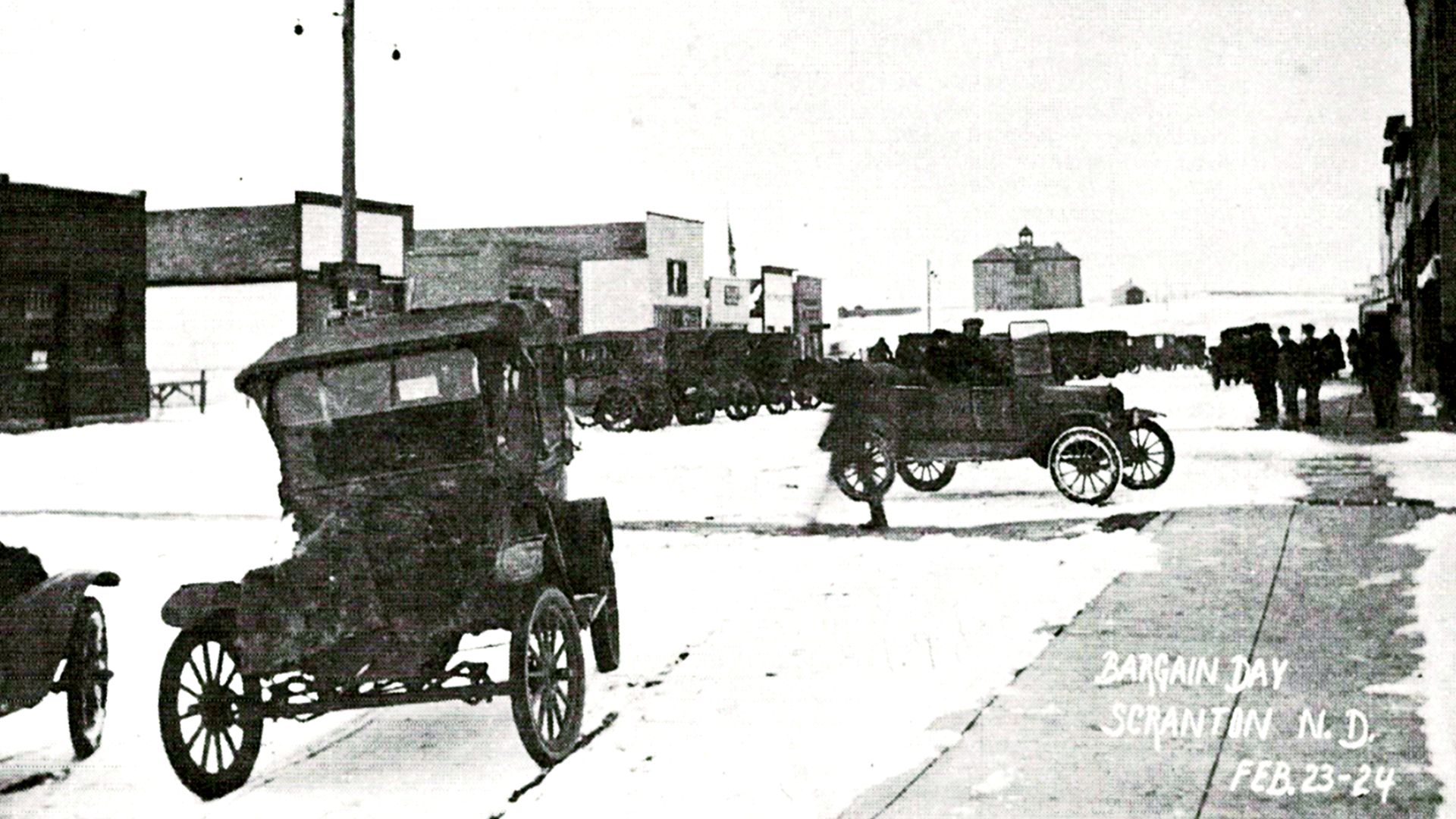
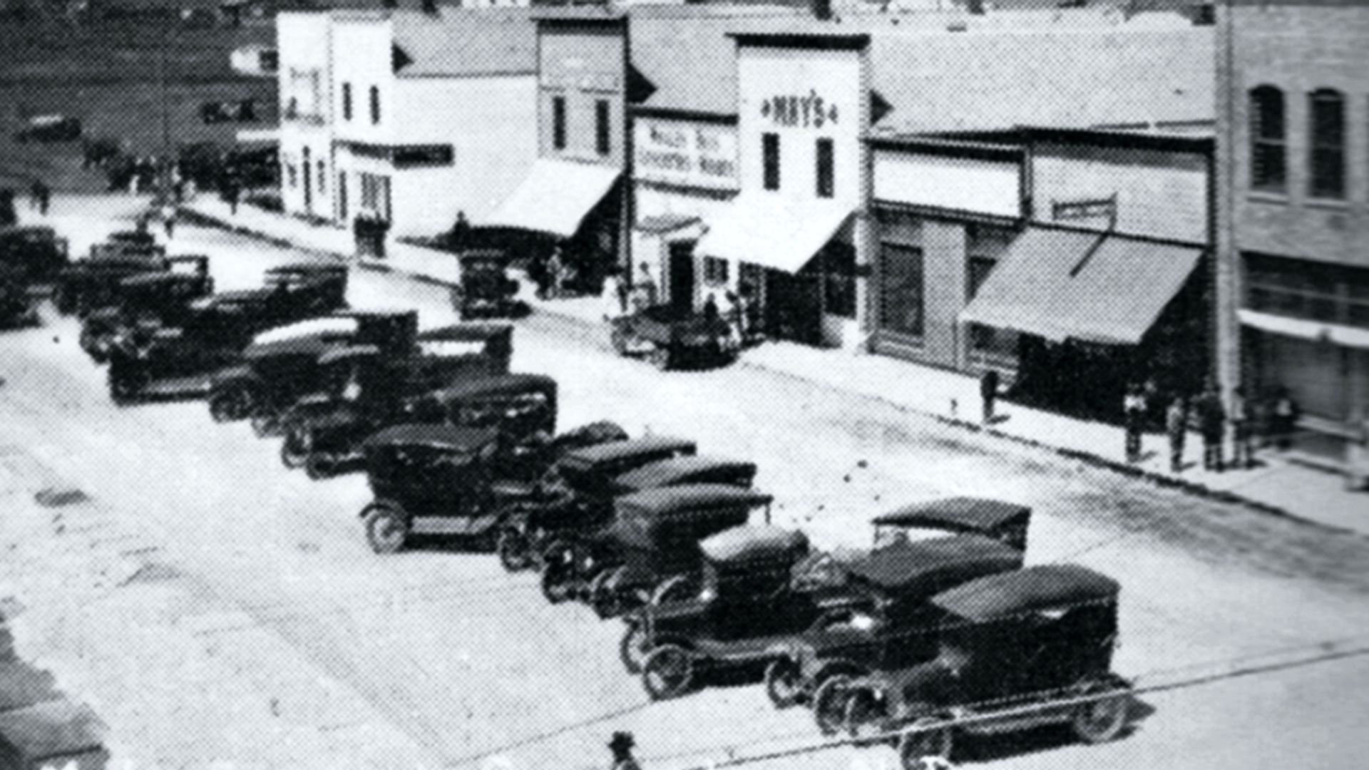
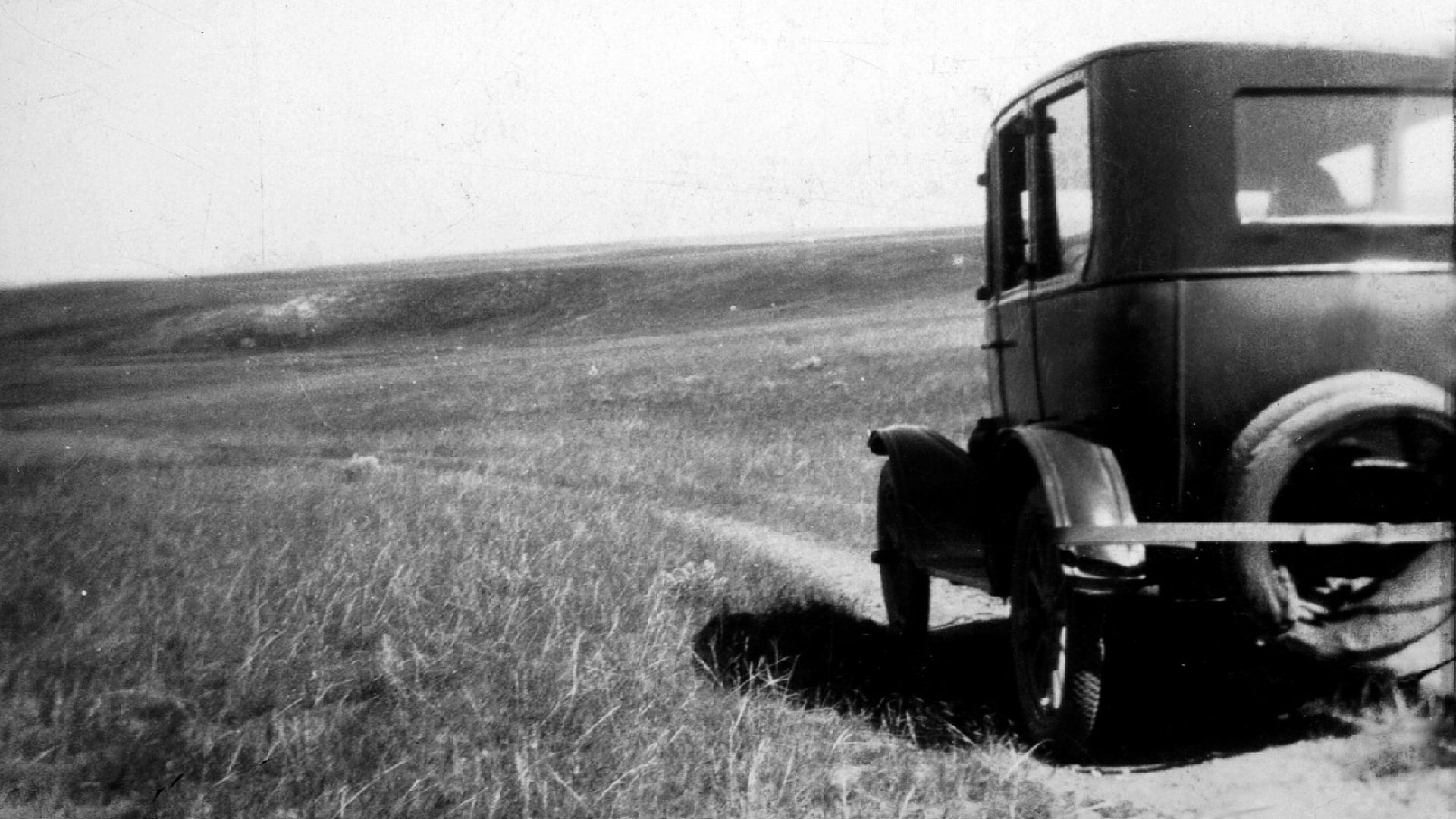
ND-050.5 Scranton
pop. 450; in a grain district; has several active coal mines. Scranton Garage is best; open until 10 p. m. ALBION HOTEL not modern, but clean rooms; dbl. $1.50; water and bath in halls. Good meals 50c MH-1928*
Named in 1907 for Scranton, Pennsylvania, because both were coal mining towns. Clay suitable for brick manufacture was discovered and today’s Yellowstone Trail traveler may see remnants of 1907 brick work on downtown buildings. Briquetting lignite coal was a big operation.
Many grain elevators today suggest a major grain shipping center.
ND-055.7 Gascoyne
(2,759 alt., 97 pop.), Northwest of town is a railroad Reservoir (swimming and picnicking facilities). WPA-ND*
pop. 90. Gas and small garage. MH-1928*
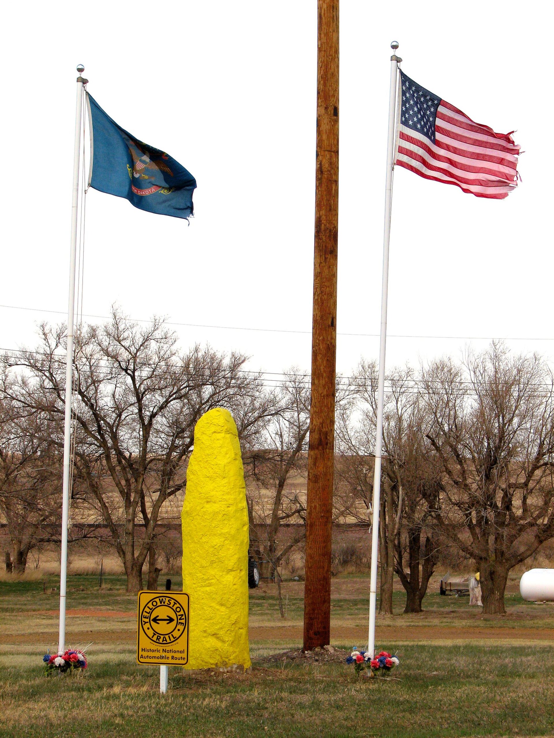
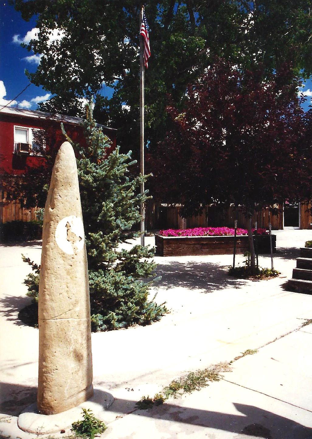
Pause as you travel the Trail. Look at Gascoyne, population 12. They have erected a small memorial to the Trail. It is a limestone hoodoo, found easily in these parts, painted yellow with a new Yellowstone Trail sign attached, flanked by two flags. Not bad for a very small village!
The name of the town in 1907 was Fischbein, a hamlet founder, but was changed to Gascoyne, a railroad foreman, in 1909 because “Fischbein” was too difficult for Morse Code spelling.
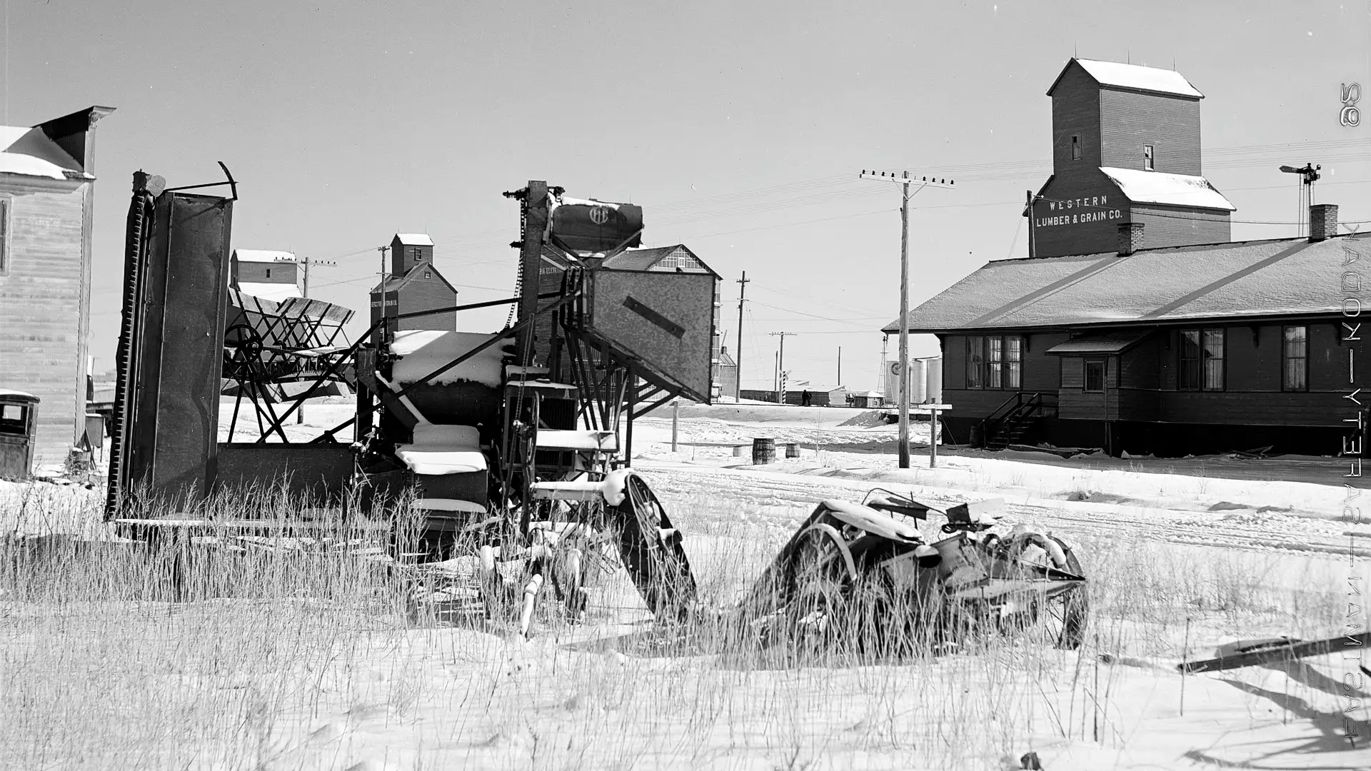
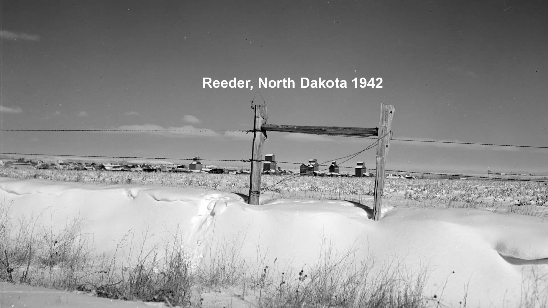
ND-062.9 Reeder
A typical farm center. Oelker’s Hotel is best; not modern. Free camp with stoves and tables. OELKER’S GARAGE, Ford, and good on all cars. MH-1928*
Reeder had a population if 181 in the 2000 census. It, like many other towns, got its name from a Milwaukee Road railroad employee. A strain of wheat has been named after the town.
Reeder citizens have repurposed their old school, which they say has retained its integrity from the first graduating class, 1916, to the last, 1993. It has retained the gym for physical workouts and transformed 12 rooms into motel-type rooms for hunting parties, wedding parties and any other overnight groups. Space is also available for quilting retreats, auction sales, etc. And what does this do for today’s Yellowstone Trail traveler? You could stop in, shoot some pool, exercise a little and see what’s cookin’. Quite a creative idea for a small town to stay vibrant. It includes the Dakota Prairie Enrichment Center, a 501(c)(3) organization.
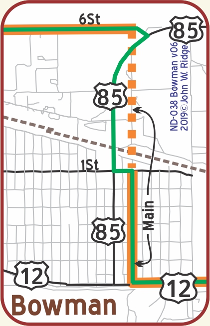
Just to the west of Bowman 83 St. and 146 Ave. were, together, named “Farm to Market Rd.” a general name given to early regional roads.
The 1921 ND maps seem to indicate that the main route (and thus the YT) followed 147 Ave., now not usable.
It is no longer possible to travel between 6th St. and the railroad on the Main St. route of the YT. So just south of the railroad, use 1st St. between Main St. and 1st Ave.
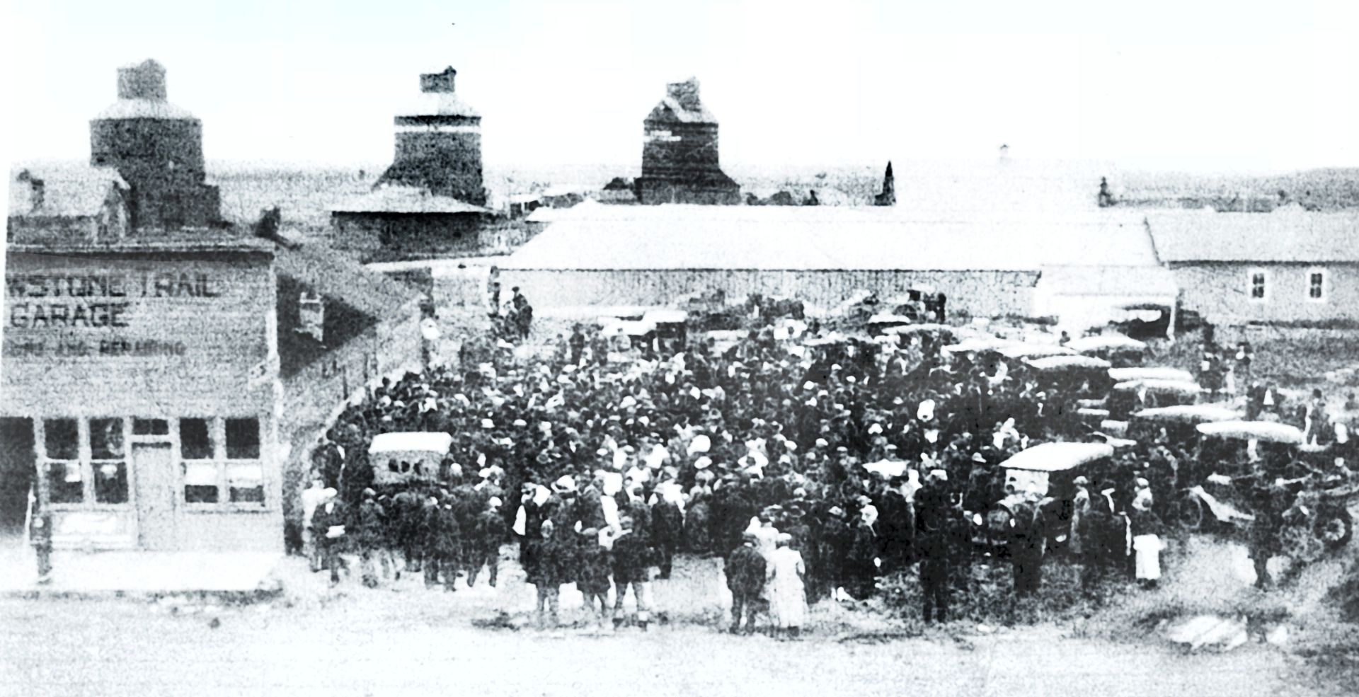
ND-071.7 Bucyrus
Bucyrus was first known as Dolan, in honor of the contractor for the Milwaukee Road Railway grading. During the grading for the tracks a new name was sought for the town, and Bucyrus, the trade name of one of the huge steam shovels in use, was suggested. Bucyrus once had a Yellowstone Trail Garage.
NOTE: The Bucyrus steam shovel and other large, early road building equipment were manufactured in another Yellowstone Trail town, South Milwaukee, Wisconsin.
The population of Bucyrus was 27 in the 2010 census. The town was struck by a wind-fueled wildfire on October 18, 2012. Thankfully two dozen residents of Bucyrus were evacuated before the fire and there were no injuries. However, much of Bucyrus was lost in the fire.
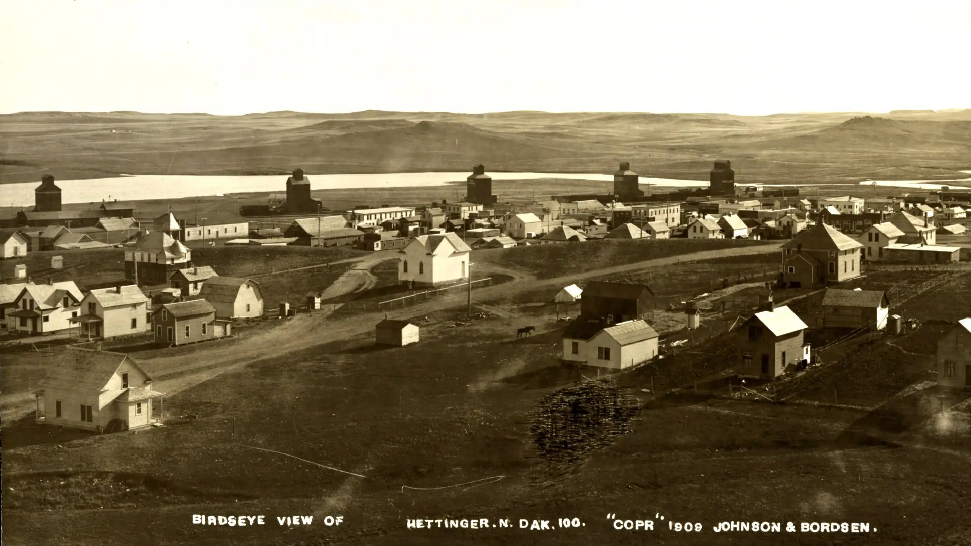
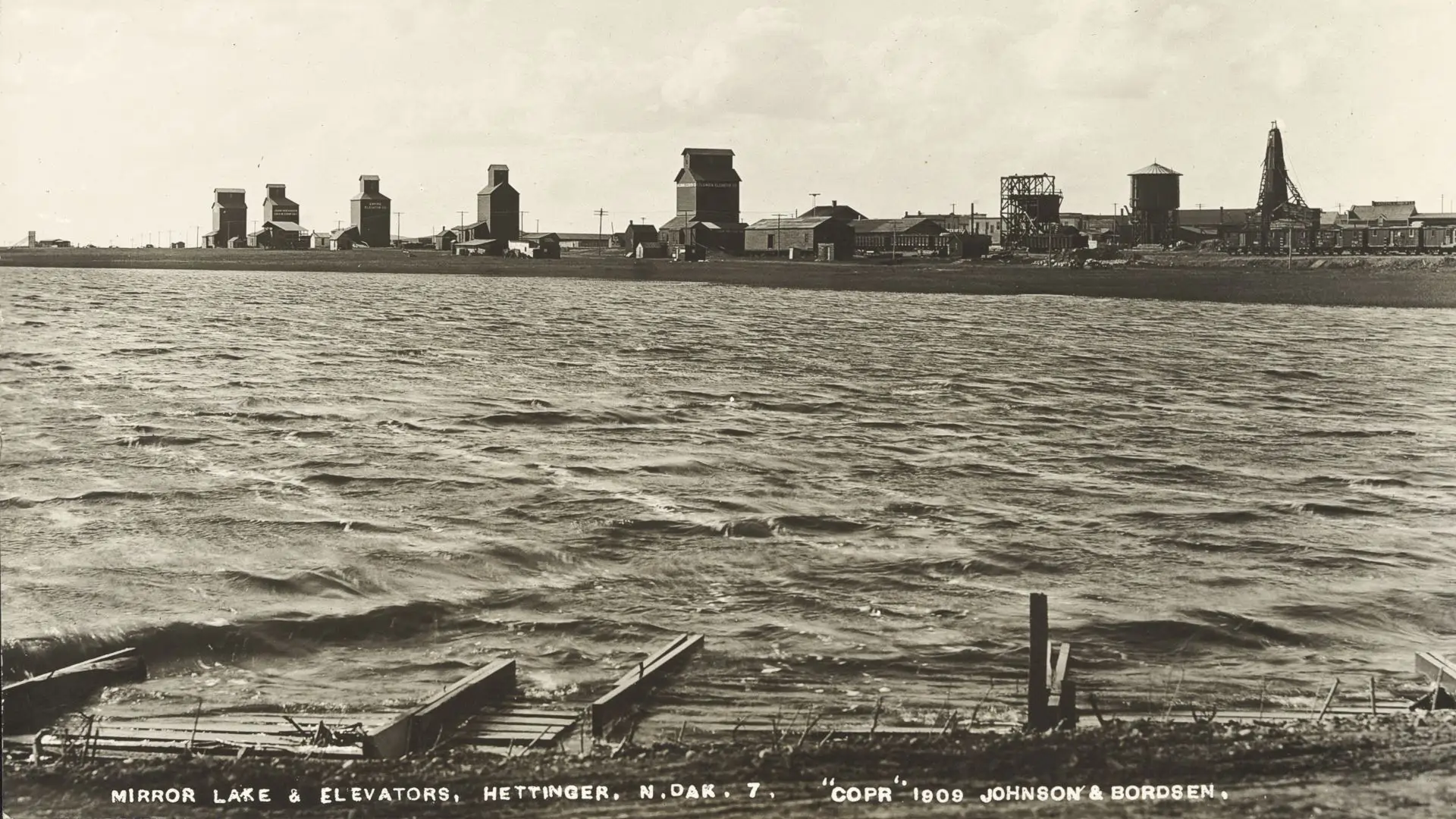
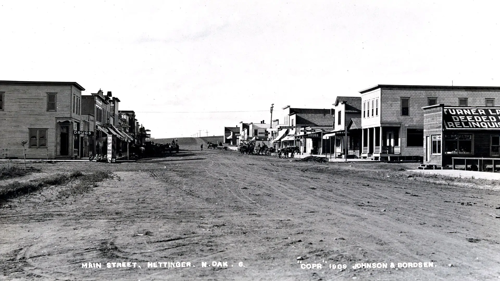
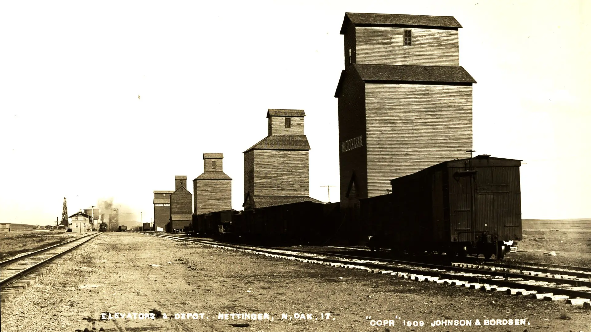
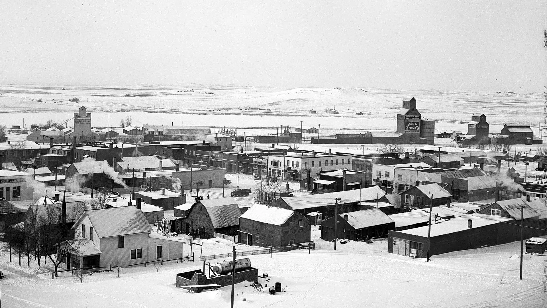
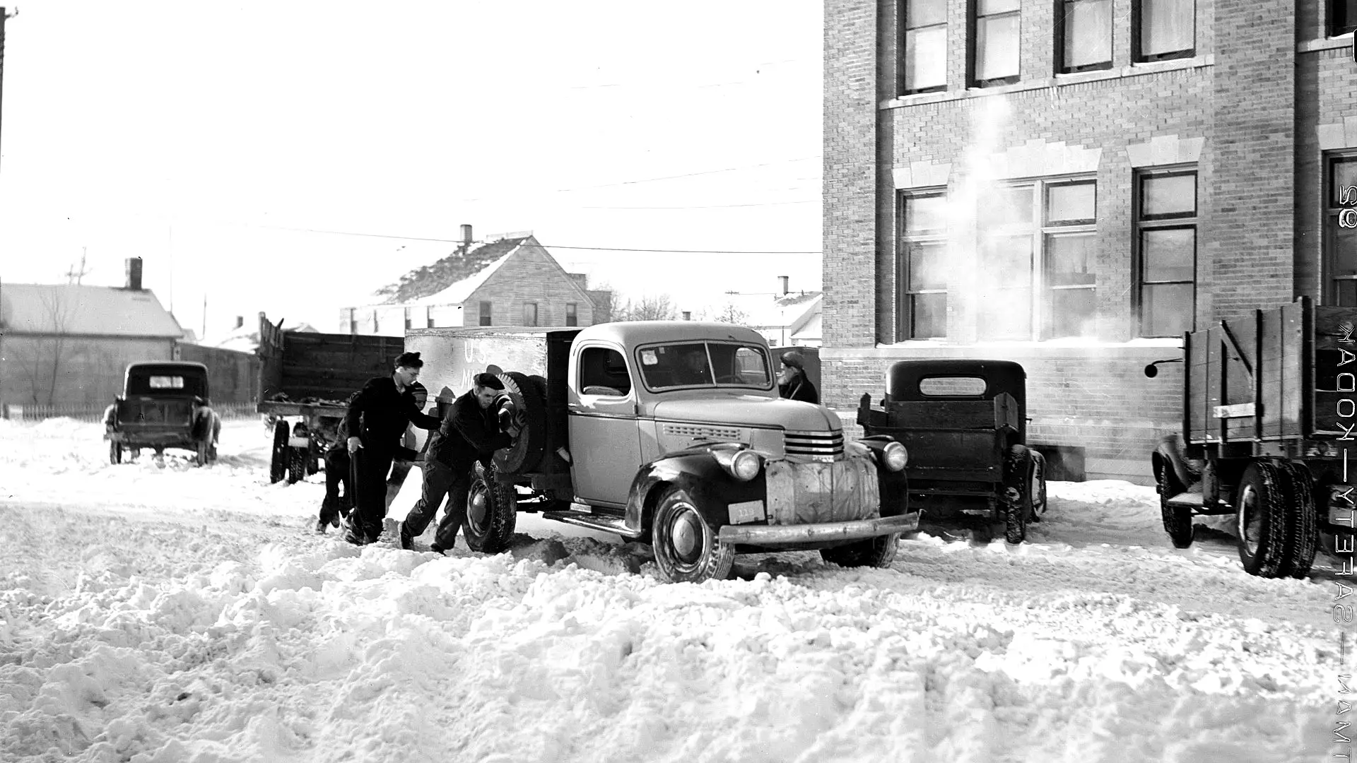
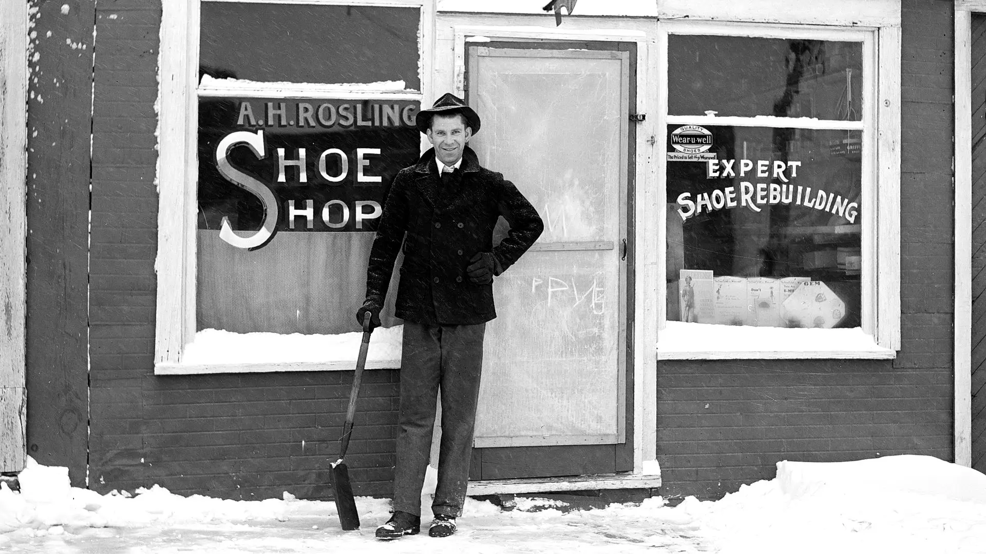
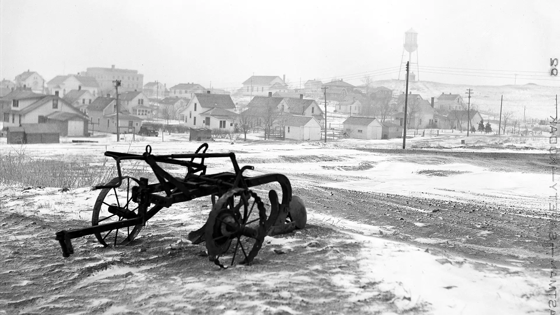
ND-083.0 Hettinger
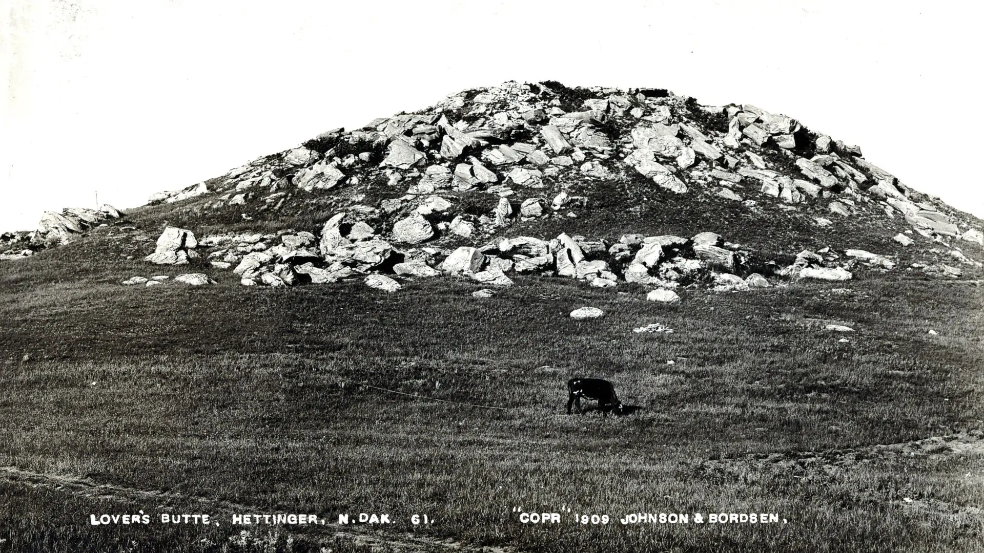
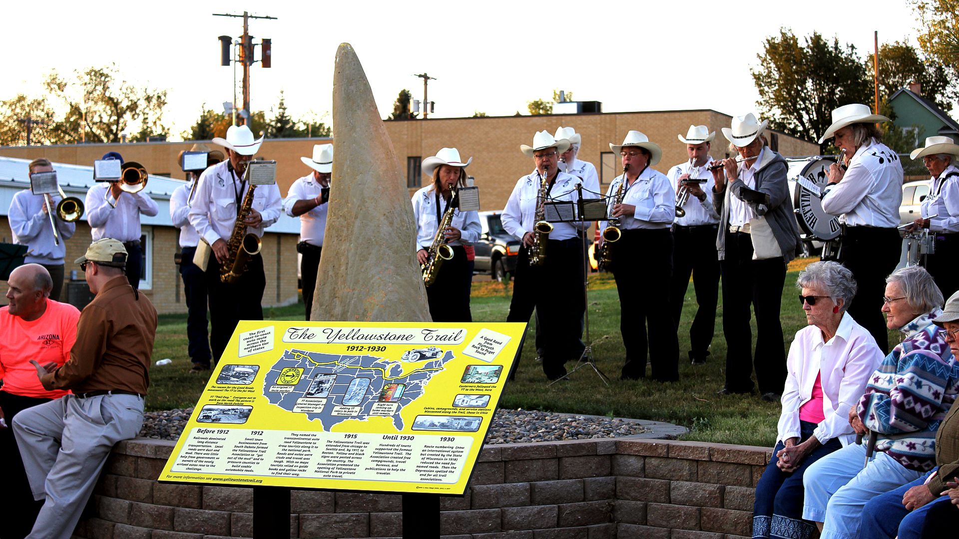
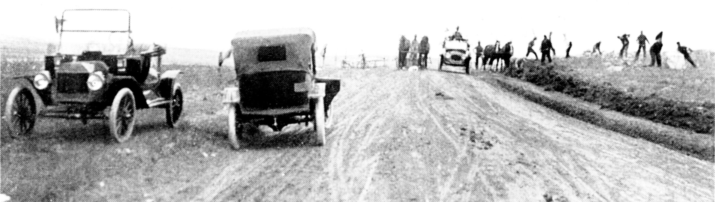
(pop. 1,000, alt. 2,400 ft.). There are a great many interesting rock formations in this section worthy of note. On the north side of town are some high buttes capped with rock containing fossils of imprints of leaves, as perfect in outline as the day they were deposited there. There is a lake at the edge of town where a swim may be enjoyed. BB1921-9*
THE YELLOWSTONE HOTEL steam heat and r. w. in all rooms; sgl. $1.50-$2; dbl. $2; 3 rooms with bath $3
NOTE: There was also a Yellowstone Garage listed in 1924.
THOMPSON AUTO CO. is best for heavy cars; skilled men and modern bldg. Labor $1; ph. 17 until 10:30.
HETTINGER AUTO CO., Ford; large and modern. Ph. 24 until 10 p. m. MH-1928*
At Hettinger, one can get from the rocks on the buttes numerous beautiful imprints of leaves, also some fossils.
On the side of the road east of Hettinger lie several petrified stumps. Sections of petrified trees can be found in abundance in this neighborhood.
As in the Yellowstone Trail days, the scenery here still offers the traveler broad plateaus, majestic buttes, rolling prairie and wide, windswept vistas.
This book encourages the reader to experience the Yellowstone Trail as much as possible.
Appreciating scenery is part of that experience.
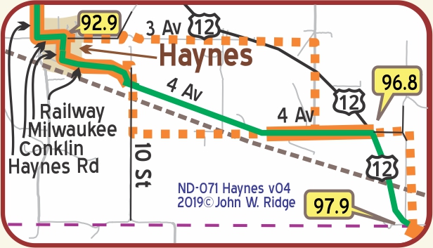
During the years that the YT passed through and near Haynes before the routing of modern US 12, the local roads were crude and ill-marked. Maps produced by national companies had little definitive information about the alignment of the YT which apparently was defined by which roads were driveable that week. Most of the sources we located show the use of approximately the routes shown on the map.
In 2013 Hettinger folks were instrumental in getting state representatives to officially recognize the whole of US 12 in North Dakota (100 miles) as a “Memorable Highway in the State of North Dakota” The route is now marked with Yellowstone Trail signs. In the fall of 2016 the Adams County Record featured five articles which traced in depth the emergence of the Yellowstone Trail through Adams County and Hettinger “in an effort to increase awareness of this historical roadway.”
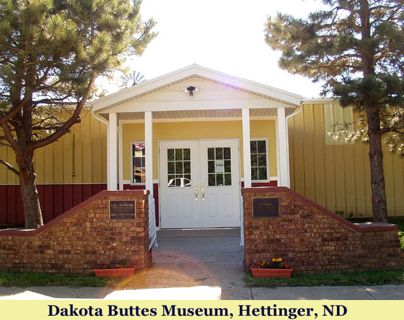 400 11th St. S. Dakota Buttes Museum is a complex of four redesigned buildings and outdoor exhibits displaying more than a century of life and times in Adams County.
While you are there, look at the Yellowstone Trail kiosk and ask about Mr. O. T. Peterson and Rev. George Kenniston, two very early officers of the Trail Association.
Also, ask about the self-guided tour brochure called Buffalo Trails in the Dakota Buttes which takes in 10 historic buffalo sites as well as current buffalo ranches.
ND-092.9 Haynes
Nearing the status of a ghost town, Haynes is a pleasant place to explore a bit and see a well maintained Yellowstone Trail hoodoo marker in the center of town (below). A “hoodoo” is a wind-formed obelisk of sandstone. The community keeps it painted yellow.
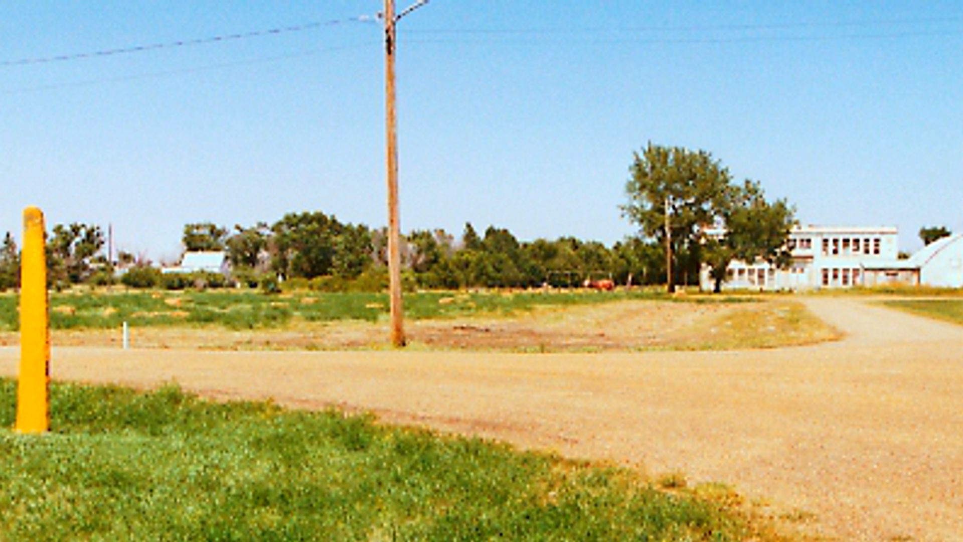
ND-097.9 N. Dakota/S. Dakota Line
Marmarth Bridge
The saga of the Marmarth bridge construction over the Little Missouri River is proof of the value of persistence.
Marmarth, North Dakota, on the Little Missouri River, had become a major cattle shipping point as the plains were settled, but its development was hindered by a lack of a wagon or auto bridge.
In 1913, the Yellowstone Trail was pushing westward toward Montana, and the lack of this North Dakota bridge created a gap that threatened the integrity of the whole trail. Fording across streams was a way of life. In dry times an experienced driver could ford easily. But this Little Missouri River was different. It was described as “rampaging in spring, unpredictable, turbulent, hiding a strong current” and capable of rising several feet in moments.
There were tales of horses getting spooked while fording, throwing riders. Then there was a crossing attempted on a raft; twelve miles downstream it finally hit the bank.
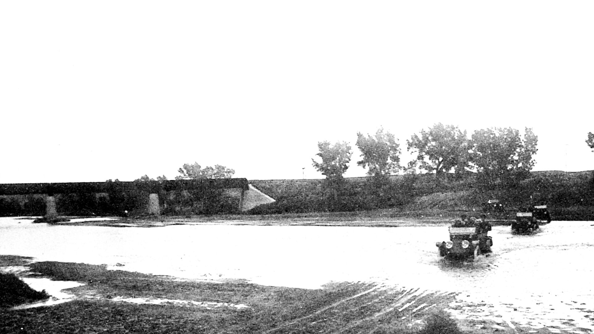
“Marmarth needs a bridge” was the chant in the western side of the city from early 1909.
A county bond issue was voted down in the autumn of 1912. It seems the “east enders” of the city were not buying the idea.
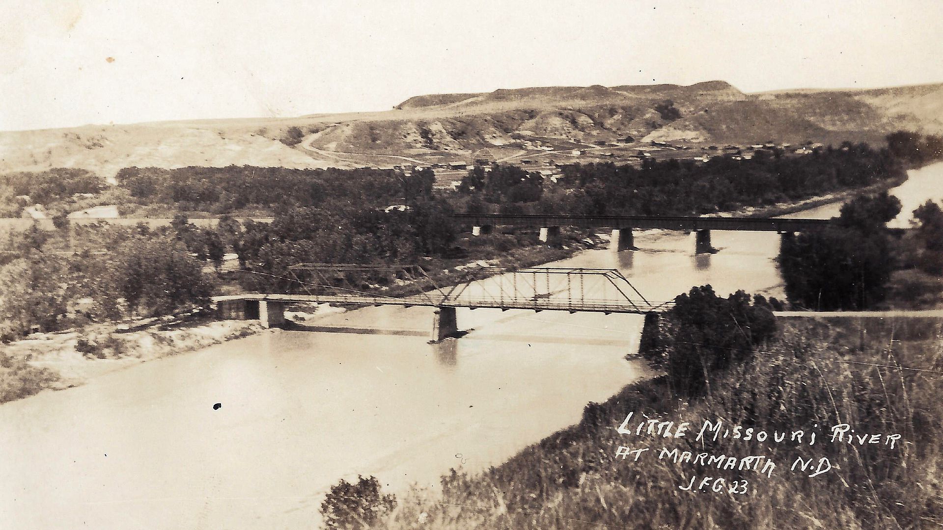
Some disgusted Marmarthians built a “low water” plank bridge just 12 inches above the low water level. It was designed to be “temporary” and it was. It floated away with the first high water.
The Yellowstone Trail Association weighed in to close this gap in the Trail in early 1913 offering to raise $10,000. They would do this by laying a special assessment on member towns in the area. Newspapers along the trail in three western states carried frequent articles about the bridge crisis. Trail literature took up the cry. Trail members hosted “benefit balls” and “socials” to raise more money. But by June 1913 only $4,000 had been raised.
Rev. George Keniston, a charismatic Chatauqua speaker, was dispatched in 1914 by the Trail Association to raise the rest of their promised $10,000. He reportedly had raised $28,000 in pledges in short order for this project and the road project through the Standing Rock Reservation, just west of Mobridge, South Dakota.
Now here’s the puzzle…
In September, 1914, the Yellowstone Trail Association reneged on its promise. What happened? Were pledges not honored? “Doomed to failure” declared one reporter of the Trail offer. There was some grumbling in the Marmarth Mail, saying that the Association “fluked out,” but that was all that was said. The project proceeded anyway. Bids were lower than expected, coming in at $13,000. But there was only the $5000 pledged from Billings County in the pot now since the Trail Association backed out.
In April 1915, a request for a referendum about the bridge was declined by the county board. All progress stopped. A ferry functioned for a brief period. It was a plank box with sloping ramps for cars to enter and exit. It was fastened to a steel cable stretched across the river and was propelled by the current. When it dropped a car into the river the ferry fell into disfavor.
The large Billings County divided and the newly formed Slope County board passed a tax levy for the bridge. “East-enders” brought an injunction against the bridge that was soon dissolved, but a new injunction tied up the tax levy for a year. The Little Missouri River physically divided the town but the differences between the “west-enders” and the “east-enders” may also have been cultural. To the east lay flat farm land. To the west lay the “city” and the badlands. Apparently the eastern farmers saw no future in dealing with city folk nor need to cross the river.
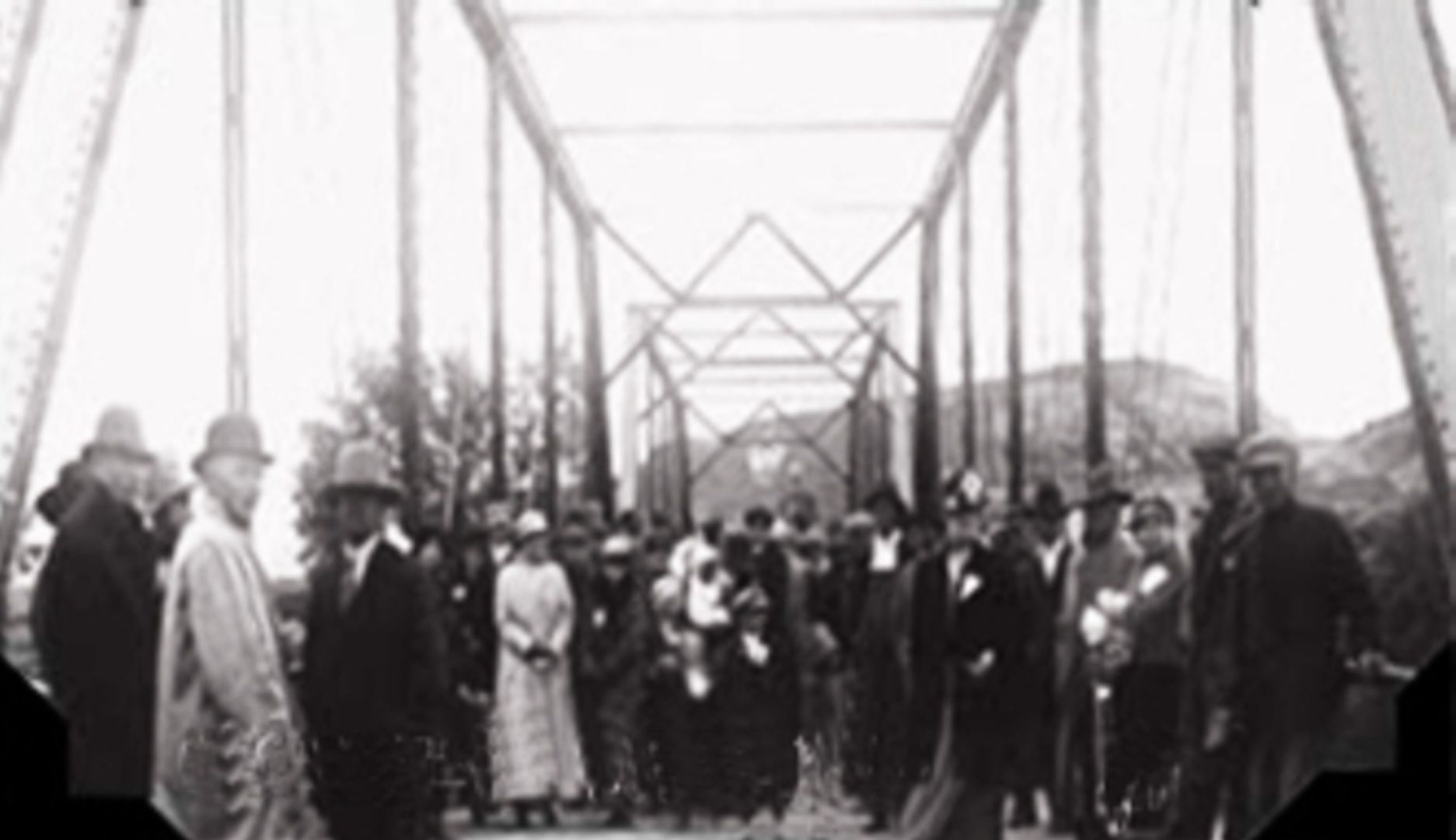
But somehow, a steel and concrete bridge was built. On June 20, 1916, a big dedicatory celebration was held featuring a dance on the bridge, free barbeque dinner, electric lights everywhere and great hoopla. J. W. Parmley and J. Prindle, present and past presidents of the Trail Association, were featured speakers, so the $10,000 debacle was apparently forgiven.
How dedicated, yet how foreign to us was this nickel-and-dime attempt to close the gap. Personal involvement can be seen at every step. This was true of the Trail west of Minneapolis. The Trail to the east used bridges already built. •
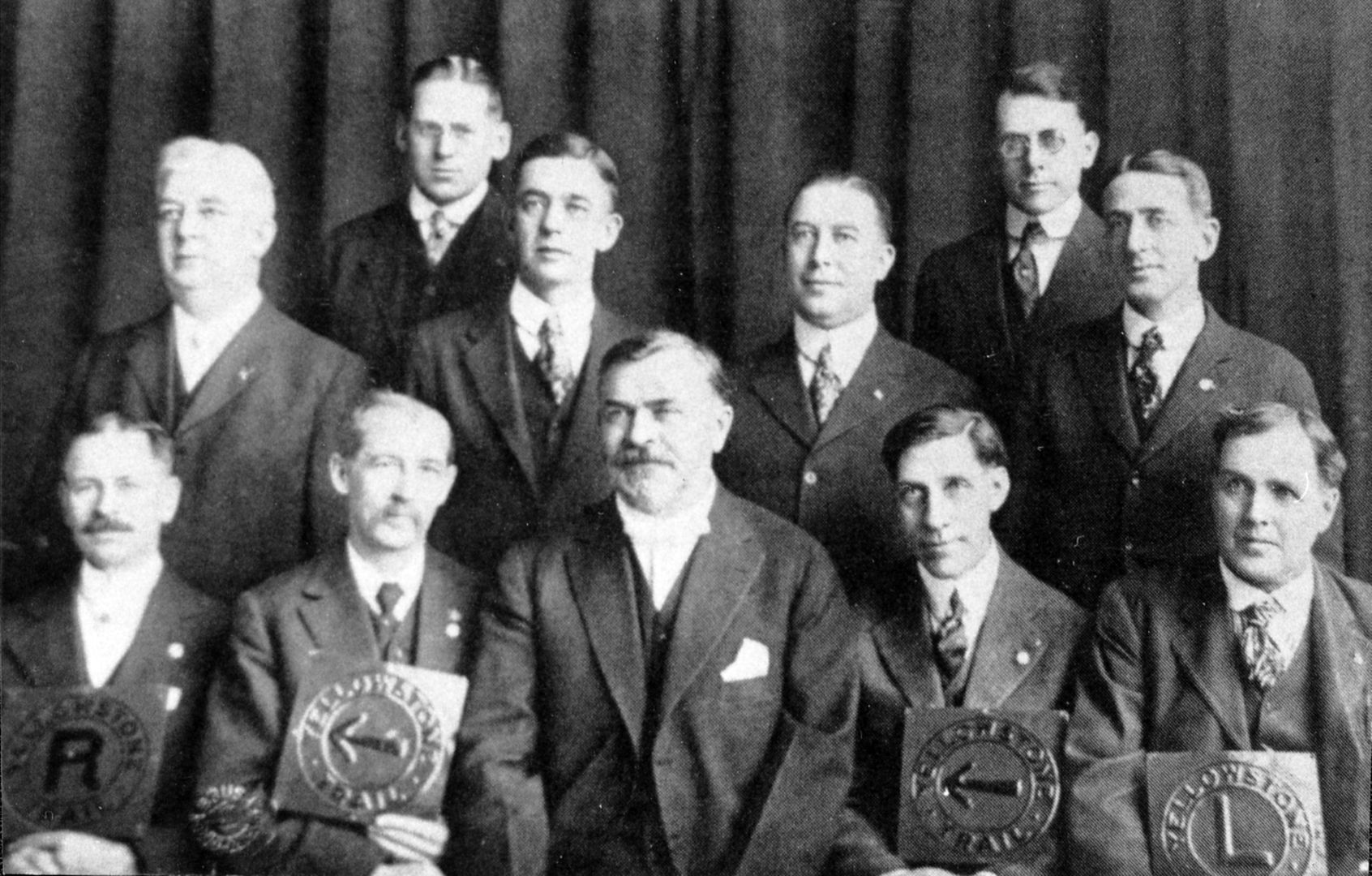
The “Boys” of the Yellowstone Trail Association
As the founder, lead spokesperson, and tireless organizer of the Yellowstone Trail Association, Joe Parmley got most of the notoriety, but there was a plethora of people in the Association as dedicated as he.
Space allows only for mention of a few of the many stellar gentlemen who cast their lot with this great road experiment. There was no expectation of payment. Getting a transcontinental highway through their town was payment enough.
Establishing a trail, these men worked with no computers, no cell phones, no television, no auto pay, no internet, no Google maps, no apps. Rural telephones had to be cranked and long- distance calls were pretty alien. Crystal radio sets were only on the horizon for rural folk. The telegraph was their fastest line of distant communication, although the U.S. postal service (RFD) seemed speedier than today. Few connected roads existed to get these automobilists to Association national or even state meetings. Although passenger train service was good, it was vexing to have to take a train to a good roads meeting.
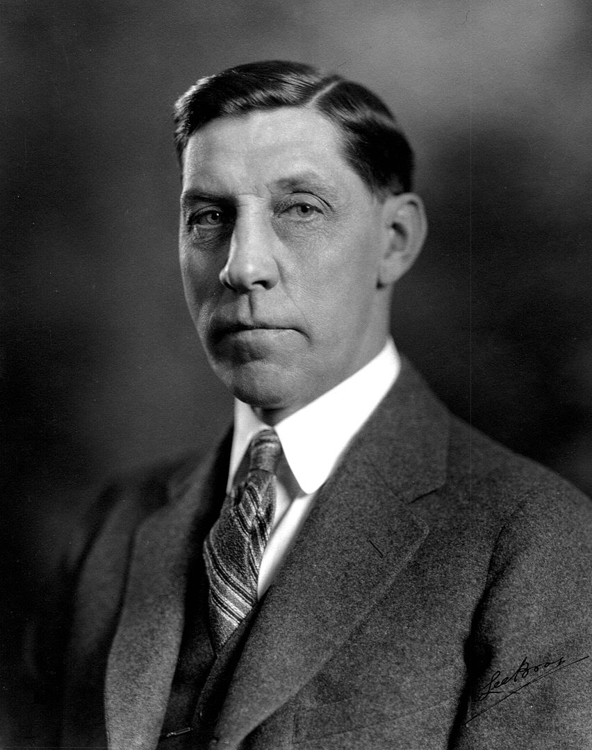
Hal Cooley
Besides Joe Parmley and Michael Dowling (See Trail Tale: Parmley, and Trail Tale: Dowling, the most physically and intellectually engaged in the Association was Harold (Hal) Cooley, certainly a public relations expert way before the PR term was invented.
He spent his whole career in civic, political, and road promotions, jobs seemingly intertwined with the warp and woof of his Type-A personality. His was the public face of the Yellowstone Trail Association for 15 of the Association’s 18 years.
Some years ago we interviewed Cooley’s granddaughter and elderly son-in-law and we drew a picture of Hal consistent with newspaper accounts of his day. He was everywhere on the Trail speaking at all of the state and national Association meetings.
He appeared regularly in most of the Trail towns from Ohio to Washington to speak, but more importantly, to beat the drum for dues payments. It was a Sisyphean task. Son-in-law, Julius Maland, remarked that “Hal was never home.” This popular speaker was also sought by civic organizations unrelated to the Trail.
Maland related a tale that Cooley liked to tell: Cooley and a line of cars got stuck in the mud. He worried that the Yellowstone Trail would get a bad name from this occurrence so he went from car to car to get people out, formed a big circle and led them in singing to raise their spirits until they all got pulled out. His favorite song was “There’s a Long, Long Trail Awinding.”
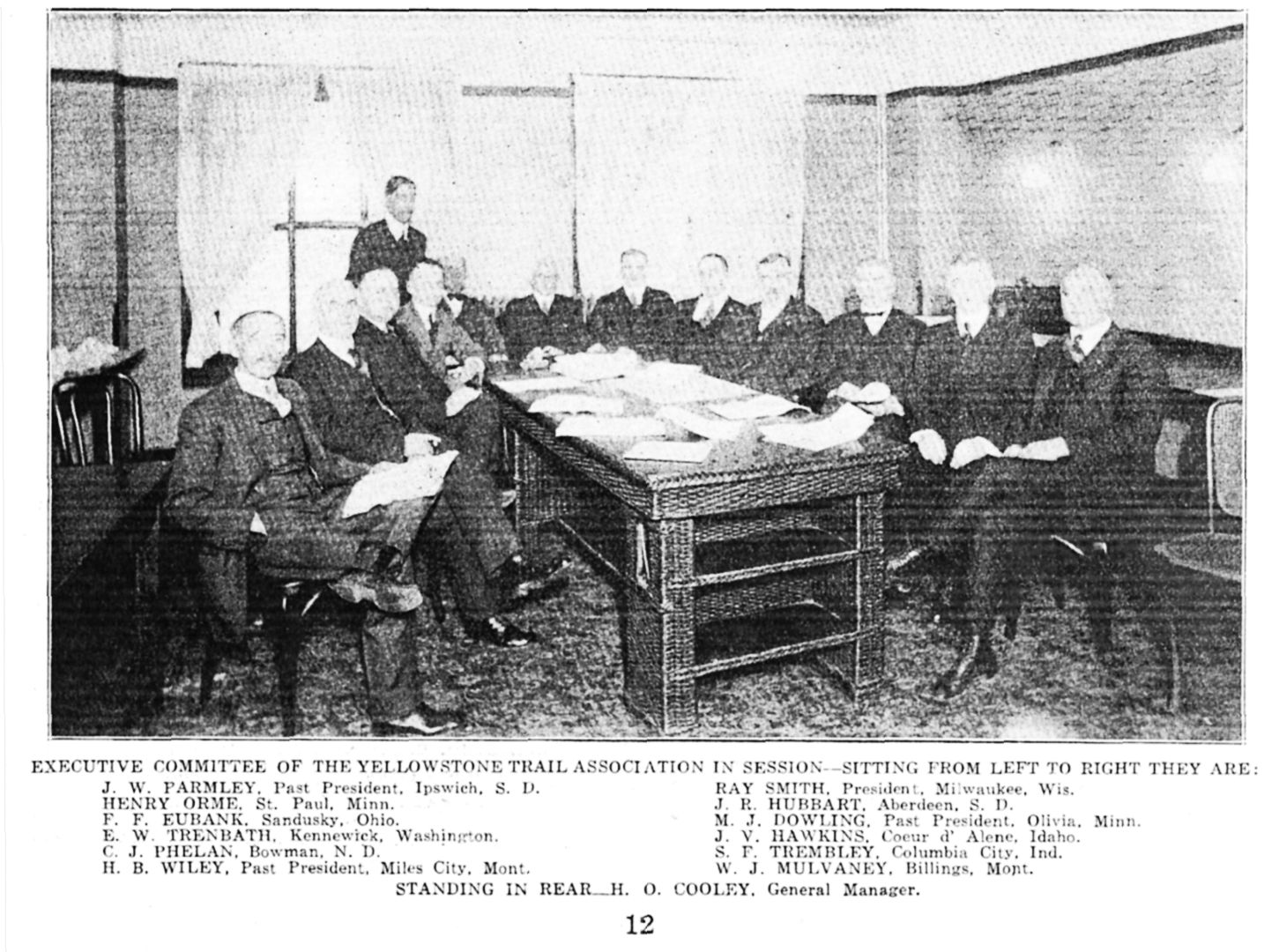
Dozens and dozens of newspaper clippings described a very entertaining speaker who was humorous, yet mesmerizing, with his almost eidetic memory of Trail facts, delivered rapidly because he usually had a limited time allotted to him on the program. This rapid-fire delivery of sometimes startling road or Trail facts, all laced with humor, kept his audiences awake and kept the ever-present press on their toes.
Cooley wore several hats with the Trail Association as his position evolved, but it all boiled down to General Manager.
It was he who managed the Aberdeen, then Minneapolis, then, briefly, Fort Wayne, Indiana, and Cleveland offices while writing the Arrow newsletter, building a budget, handling correspondence, supervising the 15 Trail Bureaus, and supervising weather/road condition regional reports.
It was Cooley who let loose over one million pieces of Trail literature in one year with a small staff, and it was Hal Cooley who wrote many articles for road magazines and newspapers.
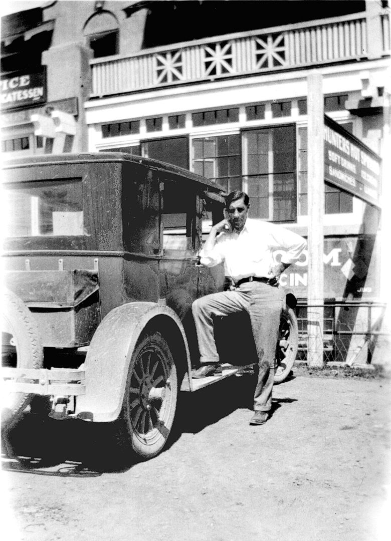
It was Hal Cooley who, in 1926, braved the unthinkable. He published the names of people and organizations in South Dakota with the amounts of their pledged dues that were in arrears!
He wrote that “Since this is a public business operating without a profit, in each bulletin we will designate one or more towns along the Trail which owes the most.” There followed a list of South Dakota “welchers.”
By May of 1927 he was able to report in the Aberdeen American News that “The Association is out of debt for the first time since 1920.” The embarrassing ploy must have worked.
This heavy-handed approach was frequently garbed with the threat of pulling the signs off of a town’s Trail and moving them away if dues were not forthcoming. That approach apparently worked.
Yes, the Trail was moved in areas as new and better roads were built, but never was it removed for lack of payment.
And it was Hal Cooley who crossed swords with Trail founder, Joe Parmley. Beginning around 1927 Parmley began to disparage Cooley in speech and writings. We can only guess that it was a difference in management style that drove them apart at the end. Joe favored honoring old route commitments; Cooley favored moving to new, better routes. Cooley kept up his busy regimen even as late as December of 1929, three months before the collapse of the organization.
Rev. George R. Keniston
George Keniston had a much shorter career with the Yellowstone Trail Association, only a few months, but it was colorful. He, too, wore two hats: one hat as the financial agent for the Association in 1914, and one as the preacher for the Congregational Church at Hettinger, North Dakota, which he had served since 1907.
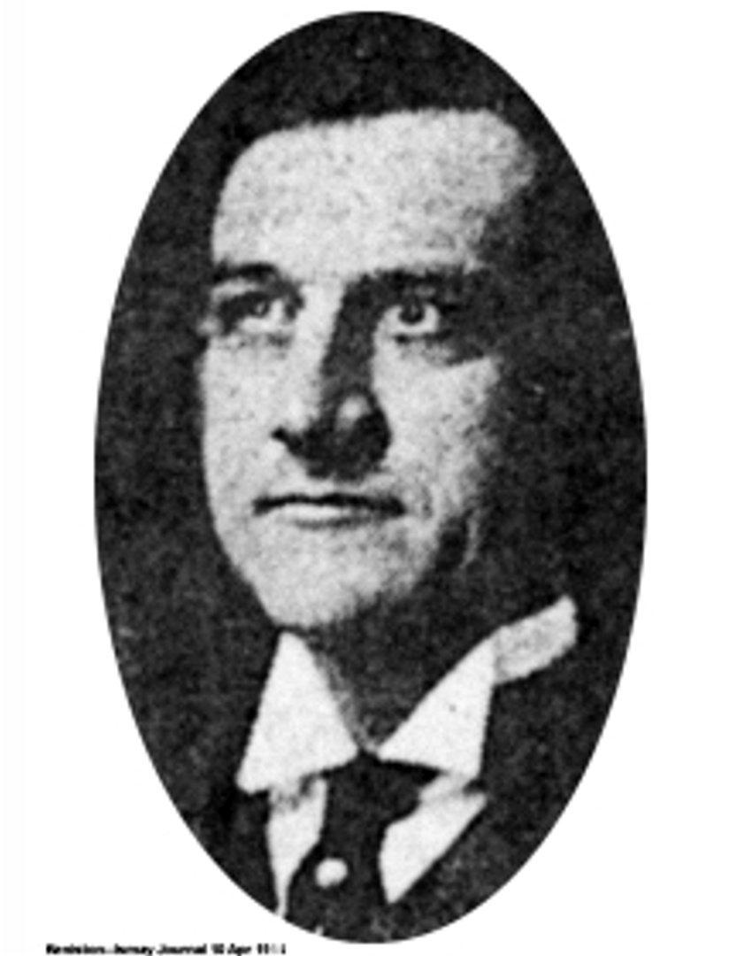
Like Hal Cooley, George Keniston was apparently a mesmerizing speaker, but with an entirely different style. Handsome Keniston depended upon “friendly persuasion” with a sincerely happy persona as he more gently prodded his audiences. He was a very popular preacher and Chatauqua speaker, possibly due to his sunny disposition and richly textured reasonings.
Keniston’s job for the Trail Association was to raise funds for the badly needed bridge over the Little Missouri River at Marmarth, North Dakota, and to buy the rights-of-way for the road through the Standing Rock Reservation in South Dakota. These were the two weakest links in the Trail. In March of 1914 it was thought that $50,000 was needed, $15,000 for the bridge and $35,000 for Corson County and the Reservation.
Keniston hit the road running. Quickly he raised $28,000 in pledges and was soon off to Washington D.C. to confer with congressmen. A bill was written for $50,000 for the Indians, but only $5,000 of it was eventually passed. In late March, the necessary funds had dropped to $40,000 with $10,000 promised to Marmarth. Billings County, North Dakota, sold $5,000 worth of bonds at 4.9% for the bridge. The Association reported in June that “the remainder of the funds will be raised by contributions guaranteed by different communities along the Trail.” But next thing we read was that in September the Trail Association reneged on it’s promise of bridge help. Nothing was said about the Reservation.
We are puzzled. George Keniston was so charismatic and so quickly raised a good share of the funds. Let’s see. $40,000 minus $28,000 raised, minus $5,000 from Billings County leaves $7,000. Washington D.C. apparently would not come through with $5,000 for awhile yet. But success was on the horizon. What happened? Did people not honor their pledges? Was the saga of the Marmarth bridge repeated injunctions off-putting to the pledgers? We read nothing about him after June. Keniston’s honesty was never in question. For more about the saga, see Trail Tale: Marmarth Bridge.
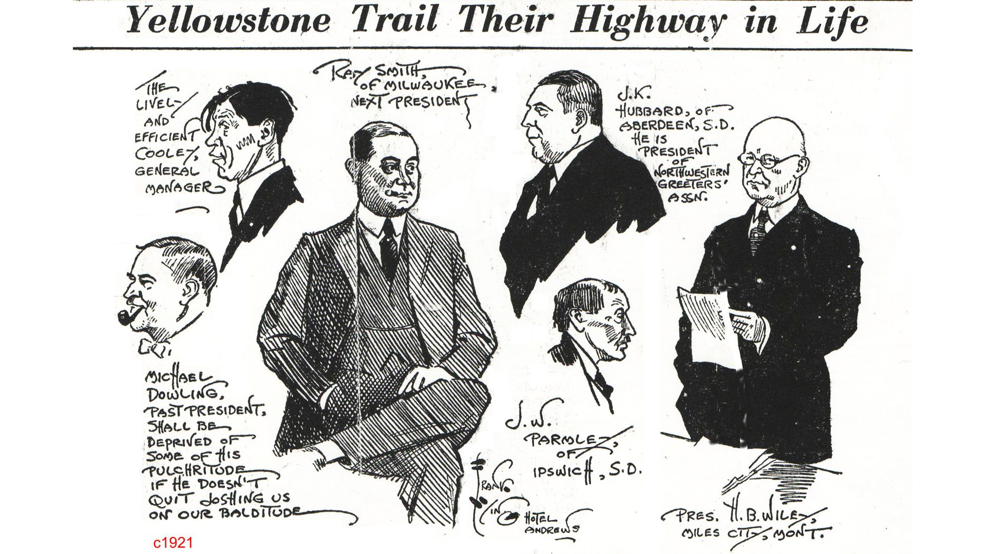
By spring of 1915 Keniston was reported “helping the Bismarck Commercial Club in its fundraising efforts for a bridge over the Little Missouri River at Medora.”
And, simultaneously, he left Hettinger and became the preacher for the Congregational Church at Beach, North Dakota.
We can only guess that he was offered a better deal from Bismarck and their road project with the National Parks Highway (Red Trail) than the $300 a month from the Yellowstone Trail Association.
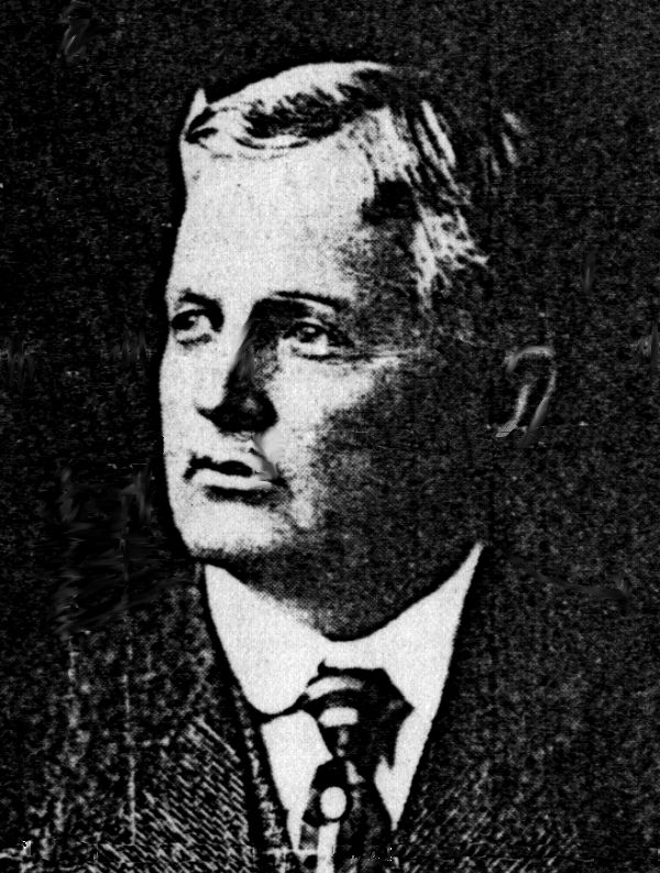
Other Trail-ers of Note
Most Trail members received less notoriety, but were nonetheless tireless volunteers without whom the Association would not have thrived. Due to space limitation, we only mention three here who really deserve a longer personal narrative.
Marcus Beebe, founder of Beebe, South Dakota, was a friend of Joe Parmley’s in Ipswich.
Marcus served as interim president of the Association, October 1912 to February 1913, until the first national meeting was held.
He was a quiet philanthropist and on the Board of Regents of the South Dakota University.
The most memorable tale about him was his impatience with the Edmunds county board’s slow action about road funding. That resulted in his marching in and plunking down $500 in cash with a promise of another $500 to come! It shamed the Board into action.
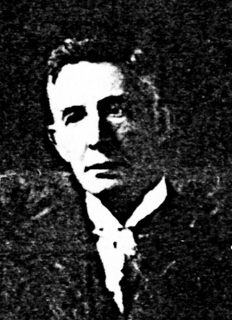
Judge (Magistrate) J. E. Prindle of Ismay, Montana, was the first elected president of the Yellowstone Trail Association, serving 1913-1914.
He, like Joe Parmley, was a land dealer.
This first year of the Association presented many problems faced by entrepreneurs today – deciding on a business plan, budget, and organizational structure in addition to creating marking symbols and dues structures.
He also had to shoulder the burden, along with other founders, of persuading folks to accept the new idea of a national highway, and to look beyond their local RFD route.
R. B. Anderson was the father of the idea of Trail Day. That idea was not necessarily original, but it was new to the Trail Association in 1914 when it was first decreed. All citizens in towns along the Trail from Minneapolis through Montana were to get out and work on bettering the Trail on the same day with members of the press on hand. It worked! Newspapers along the Trail loved it.
Two members’ names may ring a bell with modern readers: Asahel Curtis, famous Washington photographer, and vice-president from 1925 to 1928, and John Willys of Willys Overland autos in Toledo, member of the Executive Committee.
It would be easy to assume that these and other Trailmen portrayed a picture of self-importance and posturing, what with their “smokers” after each meeting and their many pronouncements to an accommodating press and eager townsfolk. Actually, they seemed like sincere guys who wanted the best for their communities and wanted to be part of something that they recognized as historic. They may have seen the scope of this project as requiring boldness, and a certain foolhardiness.
Perhaps it was a combination of Mary and Oscar Handlin’s observation that, “Voluntary associations proved essential to give the individual a place in a fluid society” and architect Daniel Burnham’s 1900 admonition: “Make no little plans; they have no magic to stir men’s souls” that also moved these men. They were characters with character. •
Where is that Road? Oh, for a Map!
Railroads were beginning to deliver automobiles to nearly every nook and cranny of America at the time the Yellowstone Trail was founded. New auto owners wanted to “drive somewhere.” Big problems became apparent. Roads reasonably suitable for driving from one town to another were rare. There were no maps to consult, few guidebooks to buy, no helpful directional signs, and no established and marked routes. And nothing to tell the driver if the road ahead was even passable.
In practical terms, to make the Yellowstone Trail succeed, the Association had not only to motivate the construction and maintenance of the roads used for the route but it also had to motivate (or create) some way for people to know it existed and know where it was and where it went. In modern times, road maps with US, state, and local roads carefully shown, either paper or digital, inform about where a route travels and where it is.
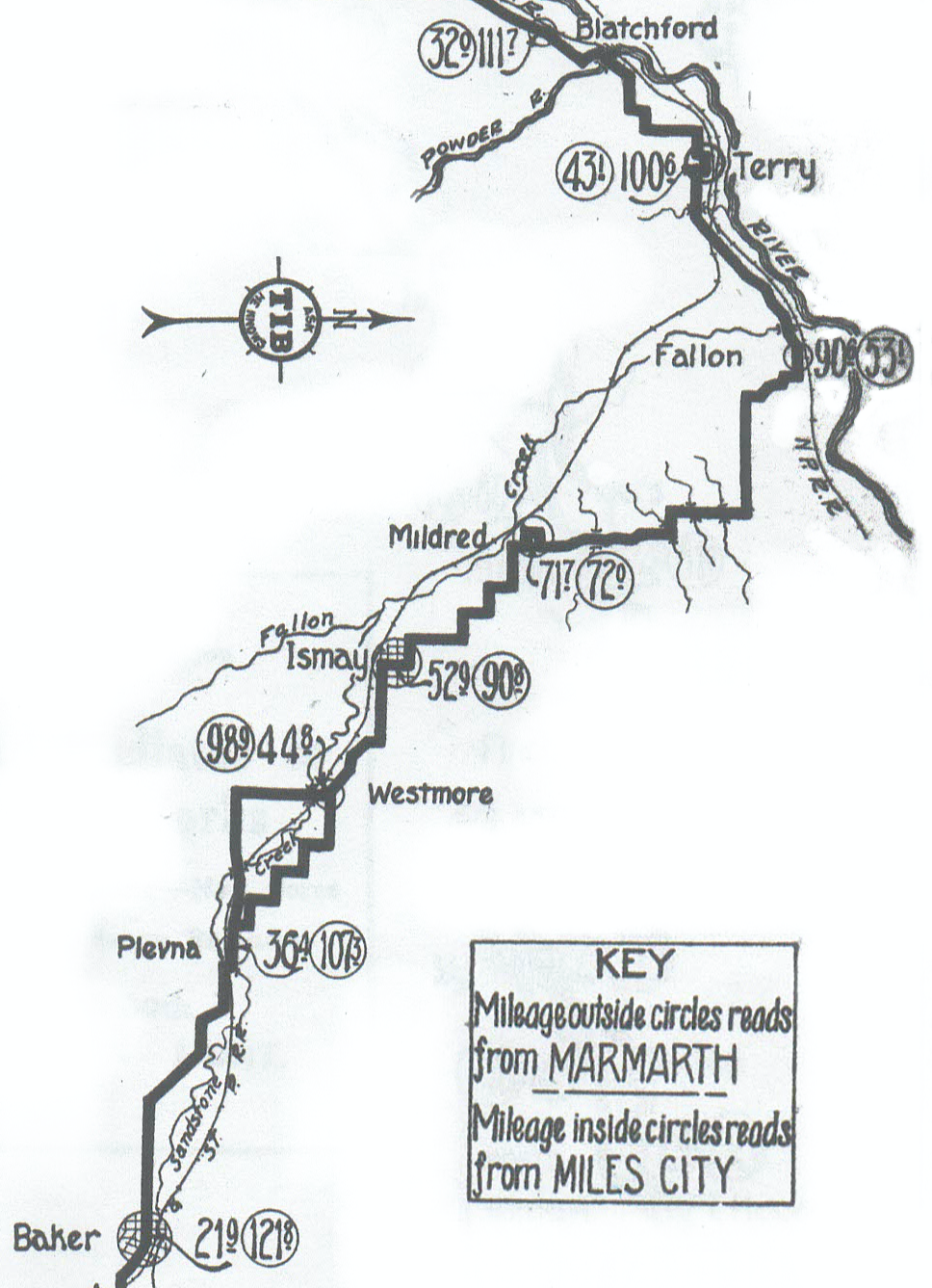
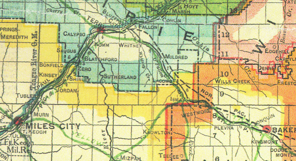
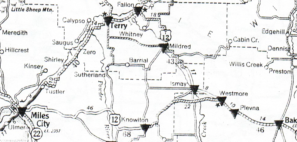
To show the progression of road map-making, MAP 1 through MAP 5 show the area near Ismay (Is) and Baker (Ba), Montana.
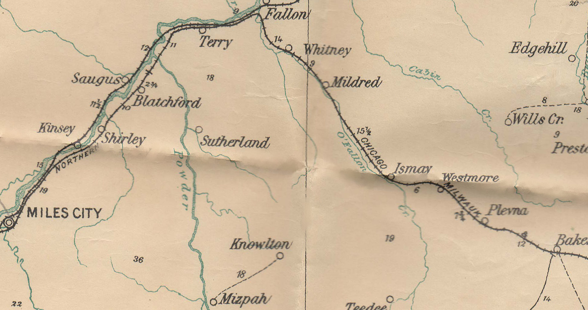 MAP 1
MAP 1
There were early maps, of course.
Counties of the period created maps showing roads (but not routes) for their own official uses.
There were plentiful railroad maps for rail travel planning but they were of no help to the auto driver.
And there were US Post Office maps like that above from 1911.
The mail routes were mostly railroads and local wagon roads as rural free delivery spread across the county.
♦
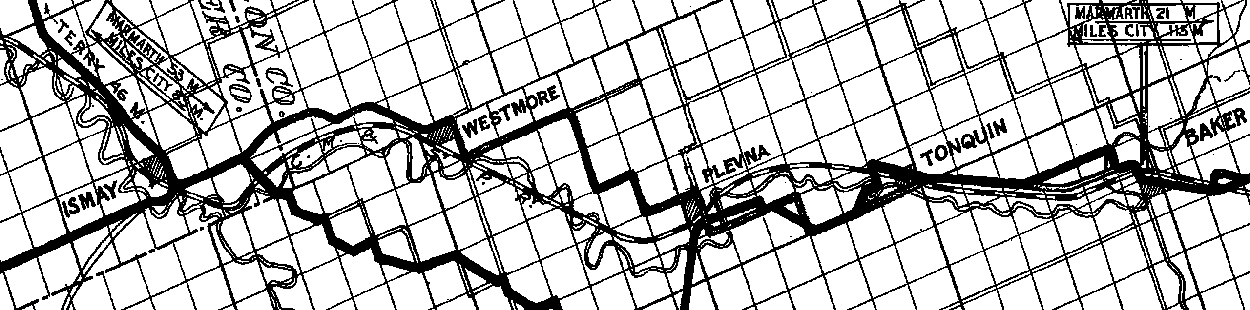 MAP 2
MAP 2
The Association published their first major publication in 1914, the First Year Book.
In addition to an historical record of some interesting aspects of the Trail’s first years, the First Year Book included maps of the Trail covering the then active section from St. Paul, Minnesota, to near Three Forks, Montana. Apparently it was based on county maps from along the route. Today those maps remain the best available of the early route.
♦
 MAP 3
MAP 3
Probably the most helpful early guides
to finding one’s way were the voluminous books
containing mile-by-mile documentation of roads
using turn left/turn right instructions.
For a few of the major long-distance auto routes,
“strip maps” were published by auto clubs or commercial services.
One of the later is shown above.
♦
 MAP 4
MAP 4
Before the era of named auto Trails, several major, nationally based map companies
were making, printing, and distributing railroad maps showing the cities and the rail lines connecting them.
As named auto trails made their appearance, some map companies attempted to
meet the need for an auto route map by adding free-hand drawn major auto routes on their railroad maps.
They were often drawn crudely and with errors and great ambiguities.
On the example shown here, the locally promoted version of the Yellowstone Trail
is marked “Yellow” and just to the west of Baker it is marked “Trail”.
With imagination, the user could see those obscure green words that
indicated the Yellowstone Trail.
The maps were of little help for mile-by-mile travel.
♦
 MAP 5
MAP 5
After Wisconsin’s idea of state-specified route numbers and matching state road maps
it was adopted across the country, and usable road maps became ubiquitous.
They rather quickly supplanted the dominant guidebooks because of their
cheapness and ease of use without a navigator in a passenger seat.
But those numbered routes were designed to replace named highways,
so fewer and fewer maps showed named routes.
The free service station state maps were introduced to motivate autoists
to buy the advertised brand of gasoline in exchange for the map service.
Not until the widespread use of GPS gadgets did the free service station map disappear.