


 Home
Home
Advance to the next map to the west.
Advance to the next map to the east.
Return to state map. map.
Advance to the next map to the north.
Advance to the next map to the south.
All maps and text on this website are copyright by John W. Ridge or YT Publishers and permission must be given for their reproduction.
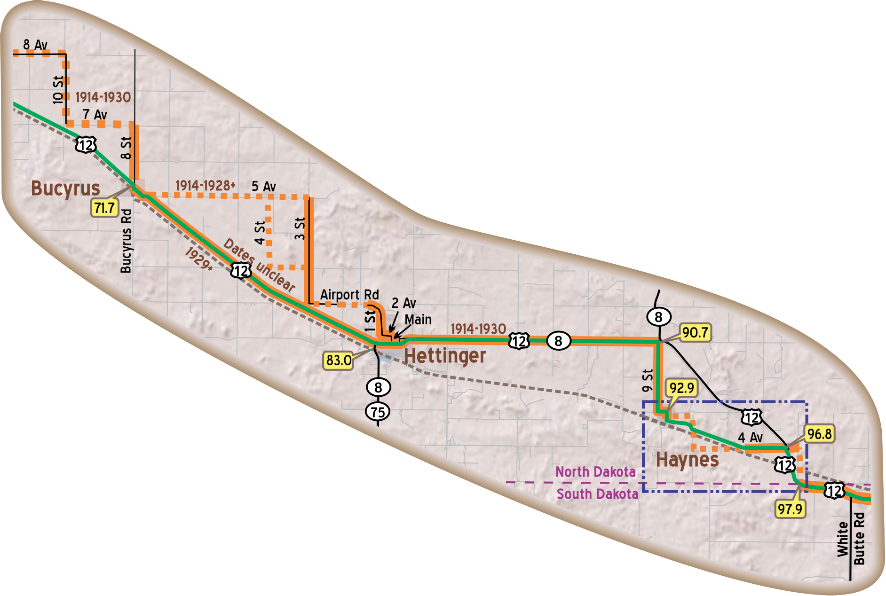
The beginning date "1914" given for any part of the Trail represents the first documented alignment of the Trail in that area. While the Trail was established, and used, in areas from the Twin Cities to Yellowstone National Park before that date we do not have documentation for the exact alignment.
Additional information, suggestion, or corrections should be sent to ytp@yellowstonetrail.org All are welcome!
Advance to the next map to the west.
Advance to the next map to the east.